The Lick and Beyond
Prev
Next
|
Day 3: May 27, 2007 The Lick and Beyond |
Prev Next |
|
|

 I had half planned on getting to the actual Boone's Lick yesterday but
once I reached New Franklin I figured that was enough. No big deal. It just meant that
I needed to head back to New Franklin to pick up MO-97. But, as I passed through
Boonville, something caught my eye. Then something else caught my eye as I turned to
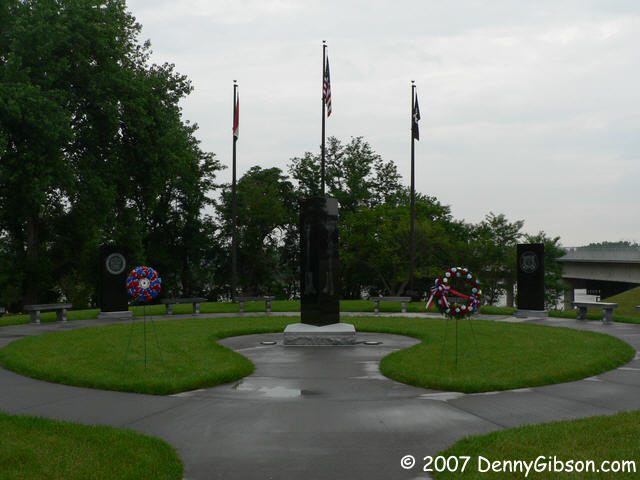
get back to the first eye catcher. I pulled into a space at the memorial
park and took a few pictures there before walking closer to the river for a couple of shots.
While walking back from the river, I noticed a banner on a building across
the street with the phrase "Opening May, 15th, 2007".
I had half planned on getting to the actual Boone's Lick yesterday but
once I reached New Franklin I figured that was enough. No big deal. It just meant that
I needed to head back to New Franklin to pick up MO-97. But, as I passed through
Boonville, something caught my eye. Then something else caught my eye as I turned to
get back to the first eye catcher. I pulled into a space at the memorial
park and took a few pictures there before walking closer to the river for a couple of shots.
While walking back from the river, I noticed a banner on a building across
the street with the phrase "Opening May, 15th, 2007".
|
|
|
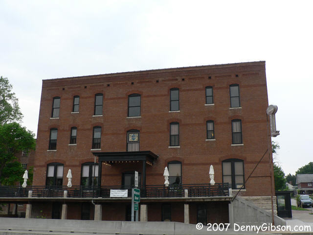
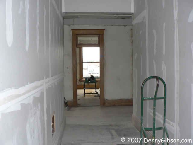


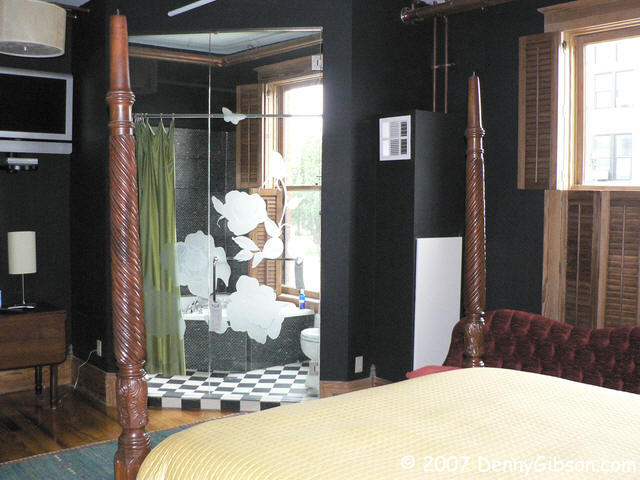
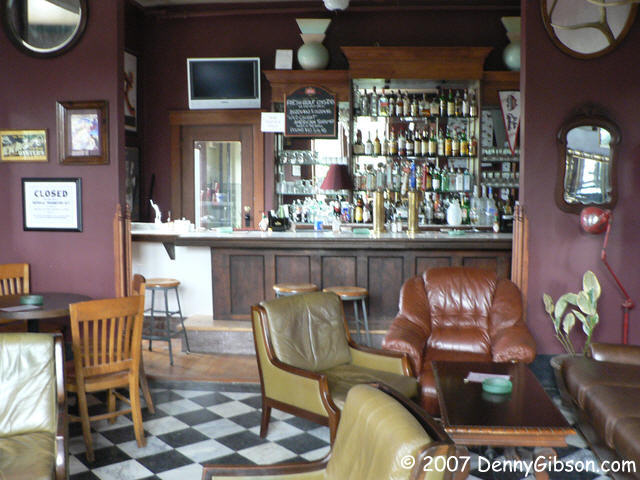 That building was the Frederick Hotel and, since I was heading in that
general direction, I decided to get a closer look. I was peering through
the front door when someone walked up behind me and said, "Go on in if you want."
Not only did I go in, I got the grand tour of the newest hotel in town. It
was new the first time in 1905 and has been a variety of things, including a nursing home,
since then. Now a fellow named Bill Hall owns it and has put some serious money into
refurbishing the place. The top floor isn't quite done yet but should be in
a couple of weeks. Today I could get a sort of "before and after" view. I could
also get a good view of the park I had just visited from a third floor window.
Each room is different but all are classy. Prices start just a bit over a hundred a
night and where they end I do not know. The last shot is of the comfy looking
bar on the first floor and that floor also holds the restaurant. This is
a really cool addition to Boonville.
That building was the Frederick Hotel and, since I was heading in that
general direction, I decided to get a closer look. I was peering through
the front door when someone walked up behind me and said, "Go on in if you want."
Not only did I go in, I got the grand tour of the newest hotel in town. It
was new the first time in 1905 and has been a variety of things, including a nursing home,
since then. Now a fellow named Bill Hall owns it and has put some serious money into
refurbishing the place. The top floor isn't quite done yet but should be in
a couple of weeks. Today I could get a sort of "before and after" view. I could
also get a good view of the park I had just visited from a third floor window.
Each room is different but all are classy. Prices start just a bit over a hundred a
night and where they end I do not know. The last shot is of the comfy looking
bar on the first floor and that floor also holds the restaurant. This is
a really cool addition to Boonville.
|
|
|
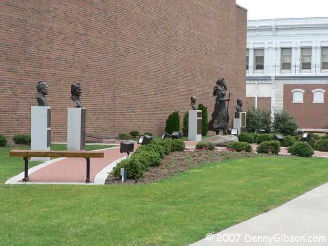
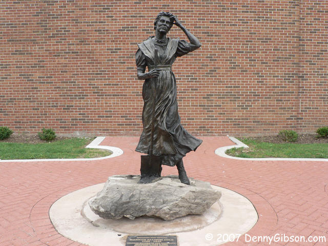
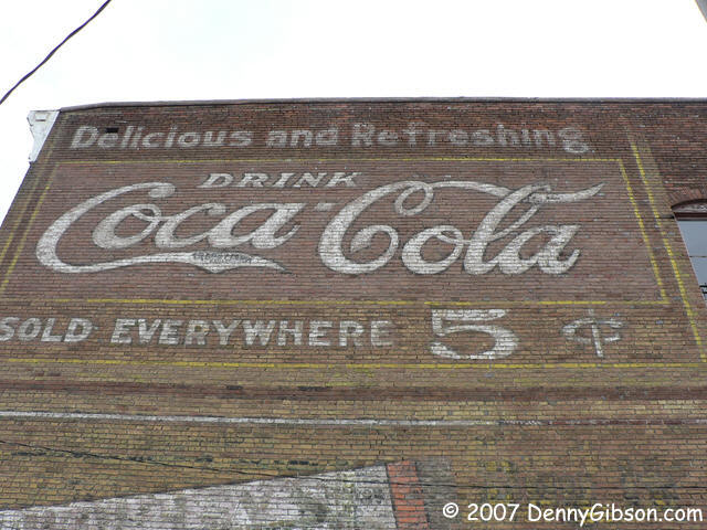
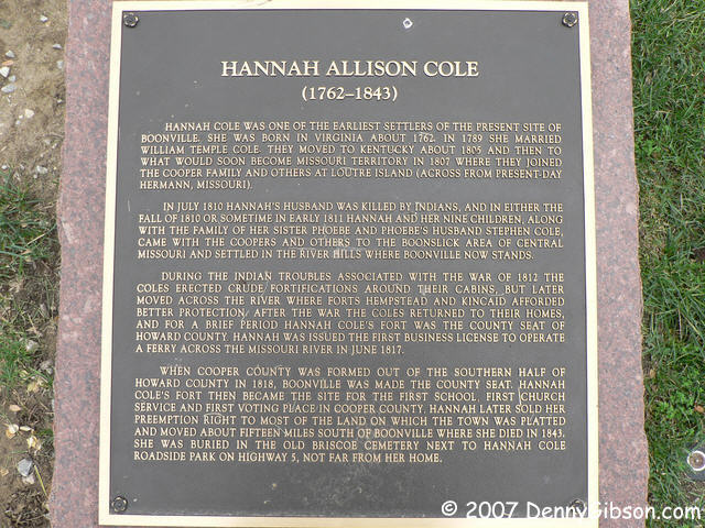
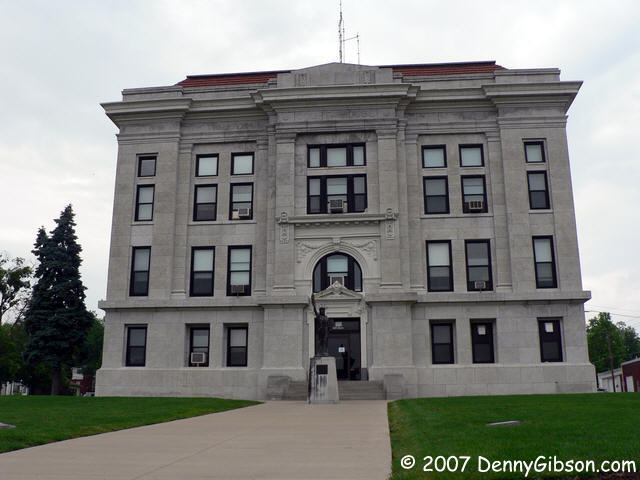 From the hotel I walked over to the court house and then to a large Coca-Cola
ghost sign I had spotted yesterday. Finally I made it to the little park that
had caught my eye originally. The central figure is Boonville founder
Hannah Allison Cole. Beside her are the busts of four
men prominent in Boonville's history.
From the hotel I walked over to the court house and then to a large Coca-Cola
ghost sign I had spotted yesterday. Finally I made it to the little park that
had caught my eye originally. The central figure is Boonville founder
Hannah Allison Cole. Beside her are the busts of four
men prominent in Boonville's history.
|
|
|
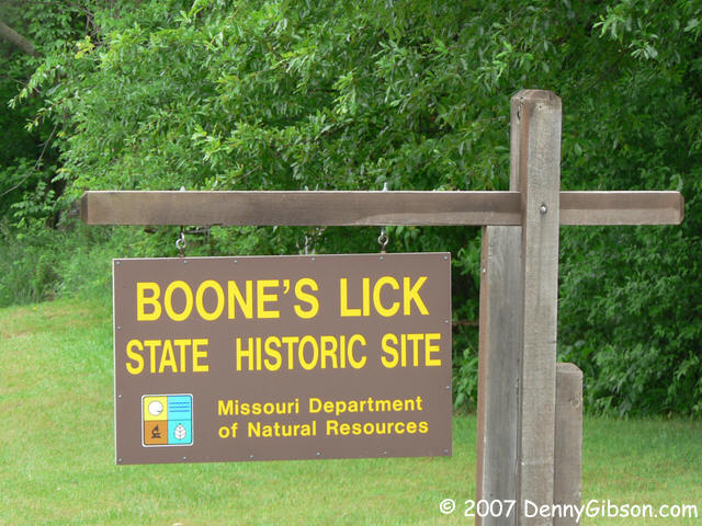

 When I finally did pull out of town I headed to the site of the salt
spring that gives the area its name. This is where various combinations of Boones and
Morrisons ran a salt extracting operation, with varying degrees of success,
from 1805 to about 1833. That DAR marker says Daniel Boone discovered the
salt lick but that is certainly not true. If any Boone "discovered"
it, it was Nathan. It might have been Jesse Morrison. In interviews, both men claimed
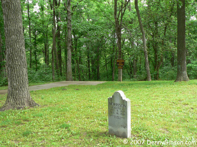
credit for the find. The tombstone is for James Morrison's son, Joseph, who
died in an accident at the salt works. The stone gives the date of death as
August 16, 1828, but every other source, including an information panel
at this site, says 1833.
When I finally did pull out of town I headed to the site of the salt
spring that gives the area its name. This is where various combinations of Boones and
Morrisons ran a salt extracting operation, with varying degrees of success,
from 1805 to about 1833. That DAR marker says Daniel Boone discovered the
salt lick but that is certainly not true. If any Boone "discovered"
it, it was Nathan. It might have been Jesse Morrison. In interviews, both men claimed
credit for the find. The tombstone is for James Morrison's son, Joseph, who
died in an accident at the salt works. The stone gives the date of death as
August 16, 1828, but every other source, including an information panel
at this site, says 1833.
The picture of the tombstone could be the last one ever taken by my Panasonic. After taking it, I headed down the trail to the spring. The trail is fairly steep and at one point is graded into steps. As is common, the front of each step is a wooden cross piece that holds the step in place. Everything was pretty wet and the wooden portions of those steps were pretty slick. My foot slipped on one and I halfway fell to the ground. I caught myself with the hand holding the camera and I banged it rather hard. The electronics work fine but the zoom lens is jammed in its extended position and cycling power yields only a tiny whir and a "Remove lens cap" message. From this point on, all pictures are taken with my backup pocket camera. Not too bad a camera but less pixels, less zoom, etc. |
|
|

 I had thought this might be yesterday's last stop so the planned route had
me heading to Boonville from here and taking the Santa Fe Trail and MO-41
from there. Instead, I headed north on MO-87 and crossed the Missouri at Glasgow.
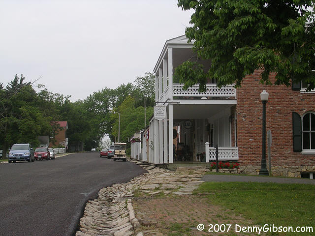
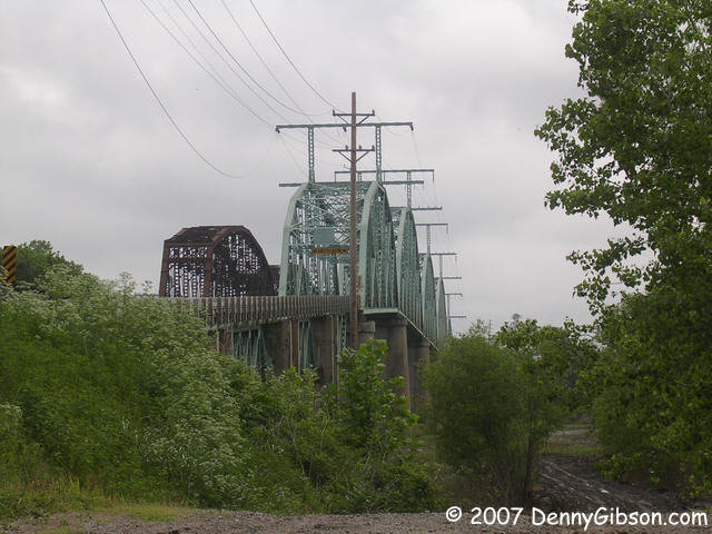
that first picture is of the bridges at Glasgow taken from the west side
of the river. The other two pictures are in the historic town of Arrow Rock.
The town contains many preserved and restored buildings. The pictures are
of a group of shops fronted by a board walk and the court house. Note the
rock lined gutter in the picture of the shops.
I had thought this might be yesterday's last stop so the planned route had
me heading to Boonville from here and taking the Santa Fe Trail and MO-41
from there. Instead, I headed north on MO-87 and crossed the Missouri at Glasgow.
that first picture is of the bridges at Glasgow taken from the west side
of the river. The other two pictures are in the historic town of Arrow Rock.
The town contains many preserved and restored buildings. The pictures are
of a group of shops fronted by a board walk and the court house. Note the
rock lined gutter in the picture of the shops.
|
|
|
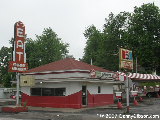 This Maid Rite Drive-In is in Lexington, MO, and, much to my disappointment,
does not open on Sundays. I don't have the full story but Maid Rites have a
history that is an odd mix of franchises and independent stores. There is
a Maid Rite in my home county that is a local icon and has cars lined up at the drive-through
window at all hours, including some on Sunday. This location offers car-side
speaker service and a much wider menu than the one I'm familiar with. Rolla.
MO, also has a Maid Rite but I've never seen it open, either.
This Maid Rite Drive-In is in Lexington, MO, and, much to my disappointment,
does not open on Sundays. I don't have the full story but Maid Rites have a
history that is an odd mix of franchises and independent stores. There is
a Maid Rite in my home county that is a local icon and has cars lined up at the drive-through
window at all hours, including some on Sunday. This location offers car-side
speaker service and a much wider menu than the one I'm familiar with. Rolla.
MO, also has a Maid Rite but I've never seen it open, either.
|
|
|
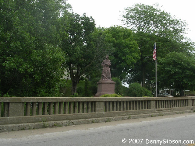
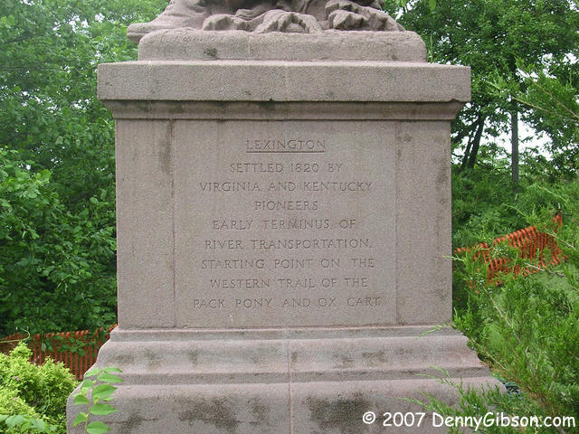
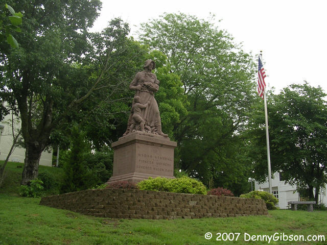
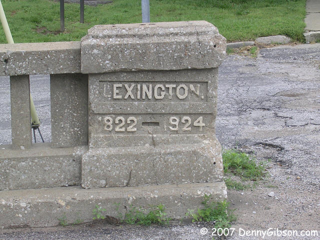
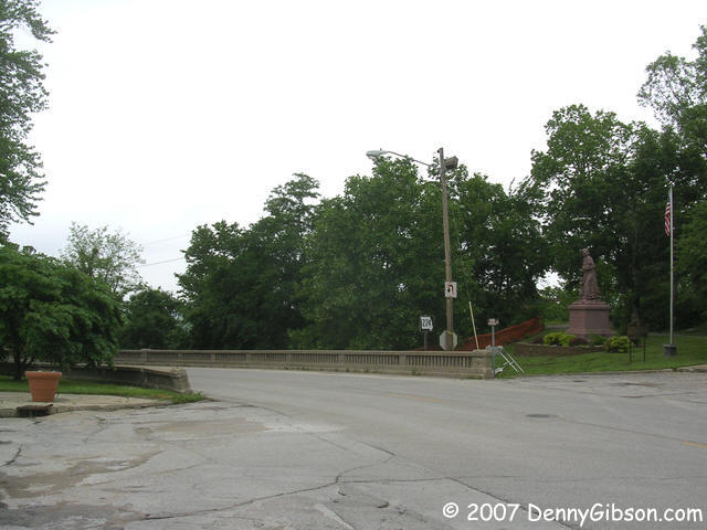 Missouri's Madonna of the Trail sits, as it always has, beside a viaduct at
the west edge of Lexington. The viaduct is dated 1924 - four years before
the Madonna arrived. The last picture shows the view that east bound travelers get.
Missouri's Madonna of the Trail sits, as it always has, beside a viaduct at
the west edge of Lexington. The viaduct is dated 1924 - four years before
the Madonna arrived. The last picture shows the view that east bound travelers get.
|
|
|
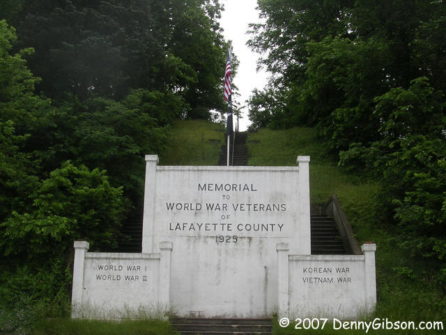
 On the west end of that viaduct, MO-224 descends to riverside level and
this 1925 memorial is about where it levels out. Those front panels have
obviously been updated. We've been doing a lot of fighting since 1925.
On the west end of that viaduct, MO-224 descends to riverside level and
this 1925 memorial is about where it levels out. Those front panels have
obviously been updated. We've been doing a lot of fighting since 1925.
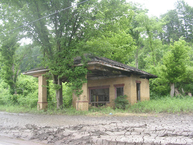
There are railroad tracks between MO-224 and the river but that certainly won't always keep them apart. The deep mud in front of this long closed gas station proves that. |
|
|

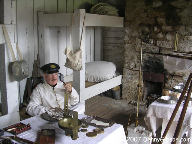
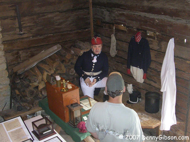
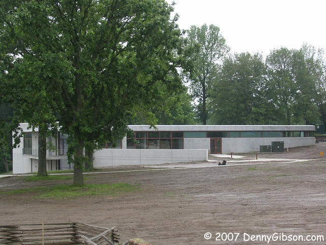
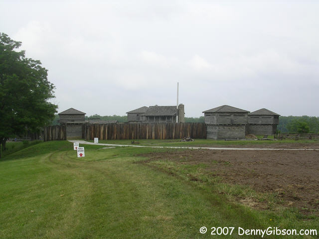 The western end of my drive was at Fort Osage. In 1808, Nathan Boone
guided William Clark's troops here to establish the fort giving it a
slight claim to being the original terminus of the Boone's Lick Road.
Visitors currently reach the fort on a grass path while new walkways and a
new visitor center near completion. "A couple of weeks" is what the women
at the ticket counter had been told. She did smile when she said that. Not
quite all of the original fort has been reconstructed but what has been is
quite accurate. And the docents/reenactors are quite accurate, too. Some
of the most knowledgeable I've seen anywhere.
The western end of my drive was at Fort Osage. In 1808, Nathan Boone
guided William Clark's troops here to establish the fort giving it a
slight claim to being the original terminus of the Boone's Lick Road.
Visitors currently reach the fort on a grass path while new walkways and a
new visitor center near completion. "A couple of weeks" is what the women
at the ticket counter had been told. She did smile when she said that. Not
quite all of the original fort has been reconstructed but what has been is
quite accurate. And the docents/reenactors are quite accurate, too. Some
of the most knowledgeable I've seen anywhere.
This was a combination trading post and fort and the name "factory" was often used. Trading with the Osage usually meant pelts and the factory prepared those pelts for shipment back east. |
|
|
| [Prev] [Site Home] [Trip Home] [Contact] [Next] |