On Boone's Lick Road
Prev
Next
|
Day 2: May 26, 2007 On Boone's Lick Road |
Prev Next |
|
|

 Last night at the brewery I heard someone giving directions that included
"...just past Noah's Ark...". I spent the night west of St Charles and on
my way back to start my drive at the beginning of Boone's Lick Road, the
meaning of that snippet became crystal clear. Can there be any doubt that
this structure was once a restaurant called Noah's Ark? Both it and the
gas station it appears to have crashed into have obviously been closed for
some time.
Last night at the brewery I heard someone giving directions that included
"...just past Noah's Ark...". I spent the night west of St Charles and on
my way back to start my drive at the beginning of Boone's Lick Road, the
meaning of that snippet became crystal clear. Can there be any doubt that
this structure was once a restaurant called Noah's Ark? Both it and the
gas station it appears to have crashed into have obviously been closed for
some time.
|
|
|
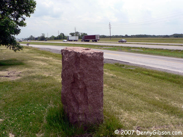
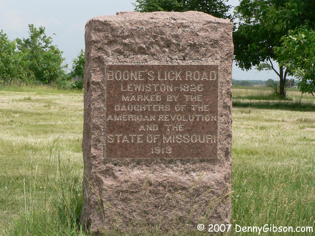
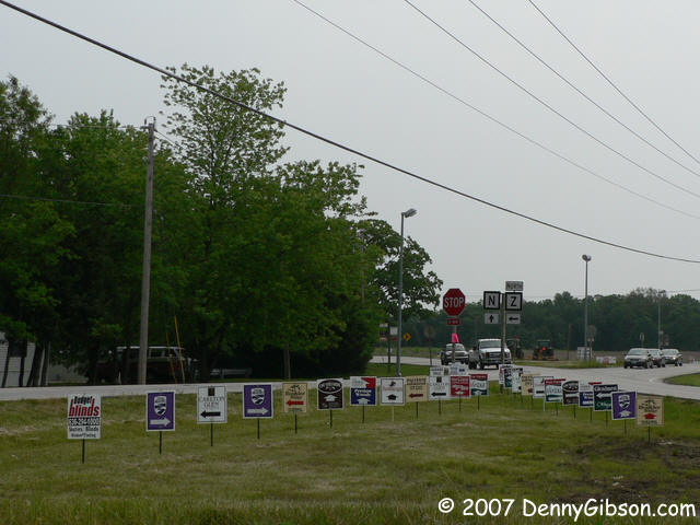 In St Charles, Boone's Lick Road is slightly winding and rather pleasant
until it hits MO-94. Once that happens, it becomes immersed in what Kip
called "the pox of suburbia". In addition to the normal mix of gas
stations and shopping malls, there are numerous new housing developments.
They fill a whole lot of the space between and behind the stations and
malls and blanket every intersection with signs. It all combines to make
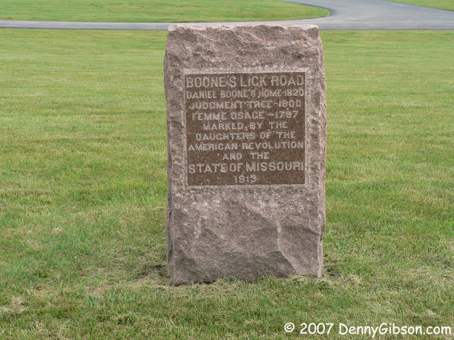
the first twenty miles or so decidedly unpleasant. In 1913, the DAR placed
thirty some stone markers along the road and this one caught my eye a few
miles west of US-40 & US-61. A quick check in Dan Rothwell's "Along
the Boone's Lick Road" showed this to be the Boone's Settlement marker and
obviously not in it's 1999 setting. That setting was about a mile and a
half down the road. In the last photograph, it would be in the far corner
near where the green tractors are.
In St Charles, Boone's Lick Road is slightly winding and rather pleasant
until it hits MO-94. Once that happens, it becomes immersed in what Kip
called "the pox of suburbia". In addition to the normal mix of gas
stations and shopping malls, there are numerous new housing developments.
They fill a whole lot of the space between and behind the stations and
malls and blanket every intersection with signs. It all combines to make
the first twenty miles or so decidedly unpleasant. In 1913, the DAR placed
thirty some stone markers along the road and this one caught my eye a few
miles west of US-40 & US-61. A quick check in Dan Rothwell's "Along
the Boone's Lick Road" showed this to be the Boone's Settlement marker and
obviously not in it's 1999 setting. That setting was about a mile and a
half down the road. In the last photograph, it would be in the far corner
near where the green tractors are.
I believe this is my first mention of Dan Rothwell's book which makes it a good place to credit it with providing much of the routing and other information for my drive. The book was available at the Daniel Boone House and at the First Capital Interpretive Center in St Charles. People at both placed knew Dan and I was told he sometimes does volunteer work at the interpretive center. |
|
|
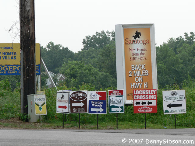
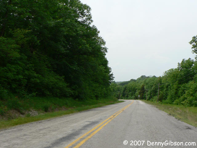
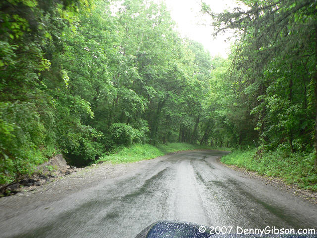
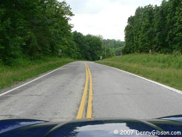
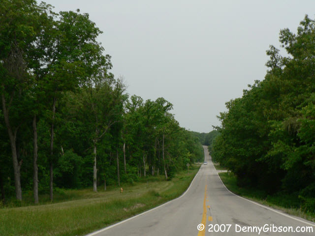 West of Route Z, the population density was decreasing although it could
hardly be called sparse. There is an occasional scenic stretch like that
in the first picture but the second picture hints that this may not be the
case much longer.
West of Route Z, the population density was decreasing although it could
hardly be called sparse. There is an occasional scenic stretch like that
in the first picture but the second picture hints that this may not be the
case much longer.
|
|
|
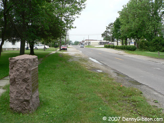
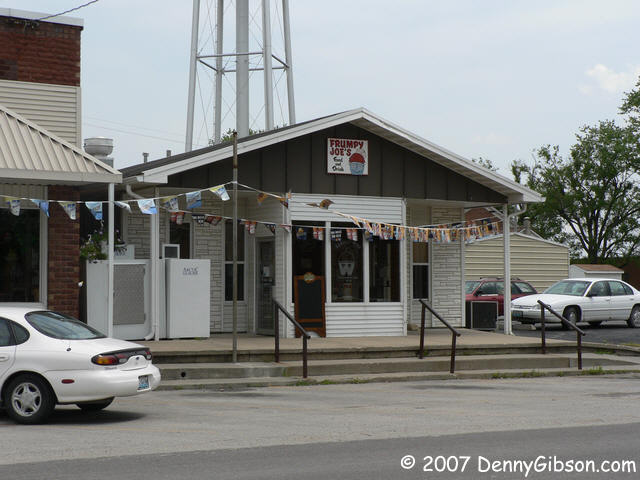
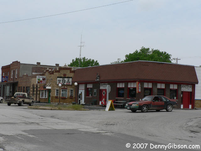
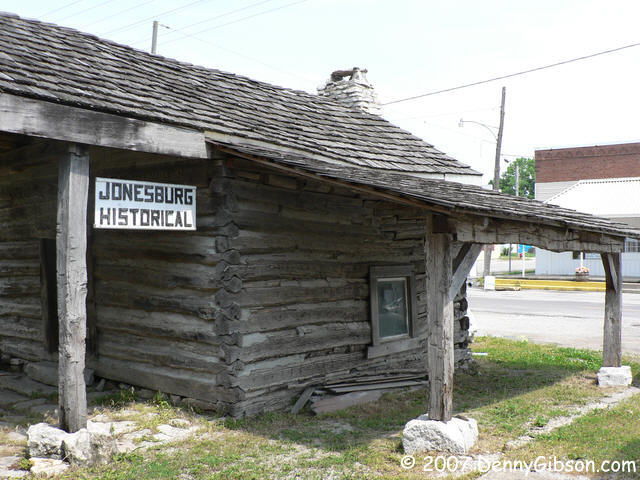
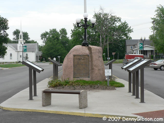
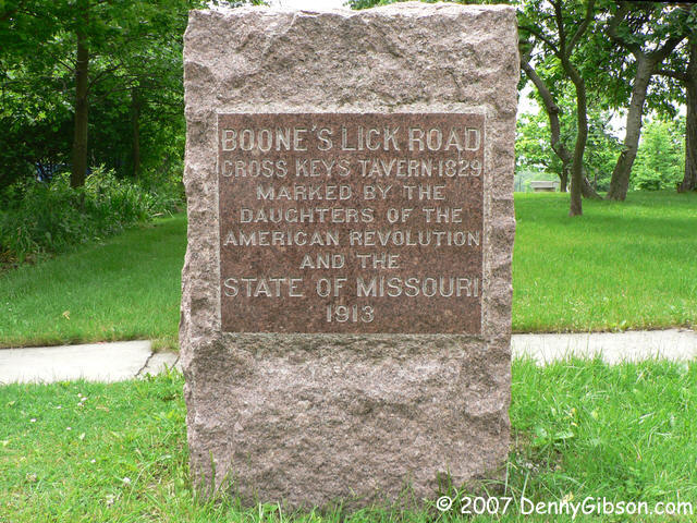
 This is Jonesburg and I think it's where the day's drive started to be
fun. Memories of the malls and housing developments were dimming and the
town seems to have more than its share of eating and drinking
establishments. I guess it's been that way since the Cross Keys Tavern
opened in 1829. The first picture is of a DAR marker remembering the long
gone tavern (readable version here) with
downtown visible in the distance. Then there's Frumpy Joe's, which has at
least one billboard that can be seen from the interstate, the Backdraft
Bar & Grill, Italiano's (closed May 26, 27, 28), and Ole Town. I had a
burger ($2.75) and a draft ($1.25) at Ole Town and believe it's the place
recommended by Sweetheart Cruiser Kent Sanderson for their "home put
together hamburgers". I second that.
This is Jonesburg and I think it's where the day's drive started to be
fun. Memories of the malls and housing developments were dimming and the
town seems to have more than its share of eating and drinking
establishments. I guess it's been that way since the Cross Keys Tavern
opened in 1829. The first picture is of a DAR marker remembering the long
gone tavern (readable version here) with
downtown visible in the distance. Then there's Frumpy Joe's, which has at
least one billboard that can be seen from the interstate, the Backdraft
Bar & Grill, Italiano's (closed May 26, 27, 28), and Ole Town. I had a
burger ($2.75) and a draft ($1.25) at Ole Town and believe it's the place
recommended by Sweetheart Cruiser Kent Sanderson for their "home put
together hamburgers". I second that.
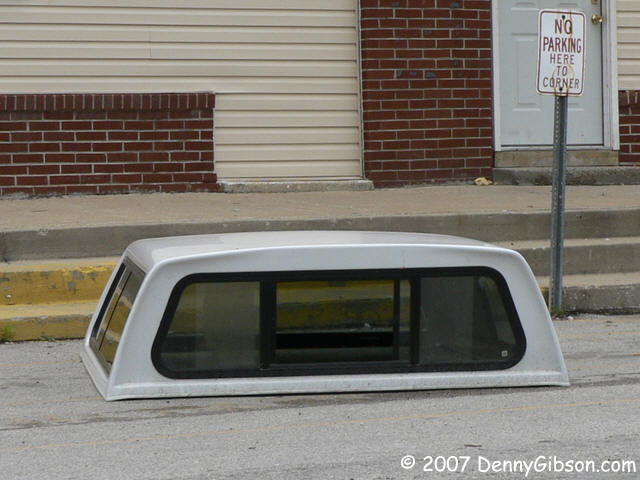
My take on the "No Parking" parking situation in the last picture is "If it ain't got wheels, it aint' parkin'". |
|
|
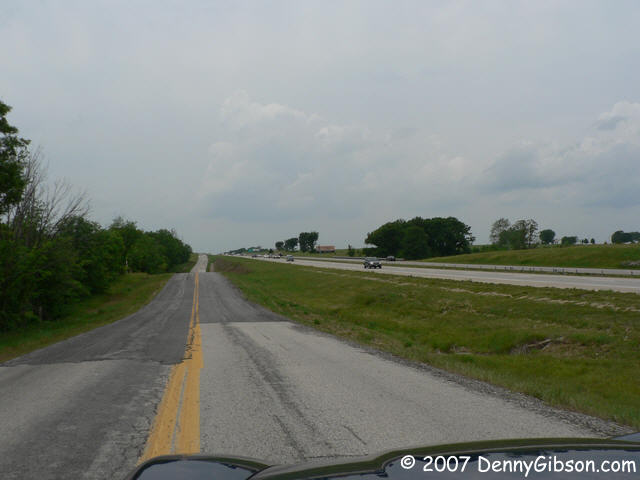
 This rear view of the Lewistown DAR marker
shows how closely the old two-lane parallels the interstate in spots. Same
with the third picture. But if they
move apart just a bit, the feeling is entirely different.
This rear view of the Lewistown DAR marker
shows how closely the old two-lane parallels the interstate in spots. Same
with the third picture. But if they
move apart just a bit, the feeling is entirely different.
|
|
|
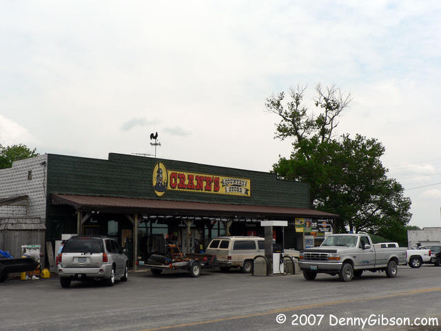
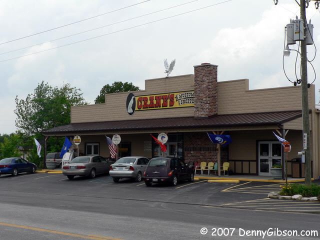
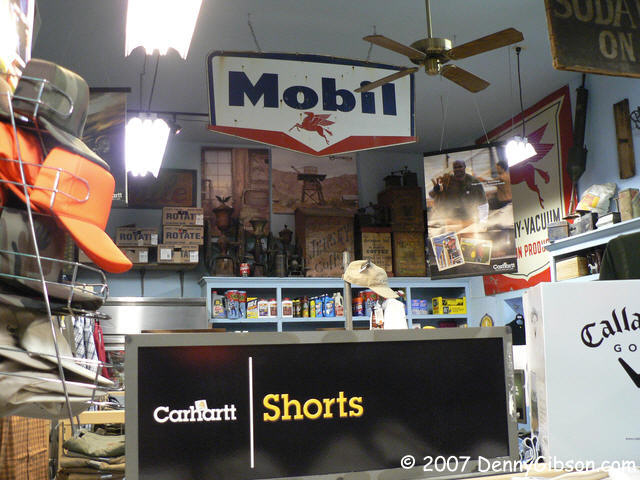
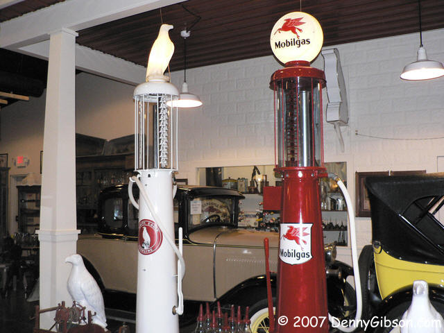
 This store and museum "complex" was the surprise highlight of the day. The
first Crane's Store opened in 1898 and this one in 1926. The
museum is much newer, 2004 I think, but almost everything in it was in
that store at one time or another. There were too many people in the store
for me to feel comfortable running around willy-nilly taking pictures but
I did get the one. It gives only the slightest hint of what the place is
really like. The front door opens on a convenience store of sorts with
groceries and drinks packed in tightly. The checkout counter is almost
hidden but from there you can have cold cut sandwiches made to order with
a smile. There are rooms full of clothing, sporting goods, and just about
everything else you can think of and looking up is often rewarded with
displays of old-time not-for-sale items.
This store and museum "complex" was the surprise highlight of the day. The
first Crane's Store opened in 1898 and this one in 1926. The
museum is much newer, 2004 I think, but almost everything in it was in
that store at one time or another. There were too many people in the store
for me to feel comfortable running around willy-nilly taking pictures but
I did get the one. It gives only the slightest hint of what the place is
really like. The front door opens on a convenience store of sorts with
groceries and drinks packed in tightly. The checkout counter is almost
hidden but from there you can have cold cut sandwiches made to order with
a smile. There are rooms full of clothing, sporting goods, and just about
everything else you can think of and looking up is often rewarded with
displays of old-time not-for-sale items.
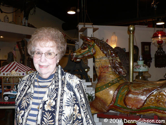
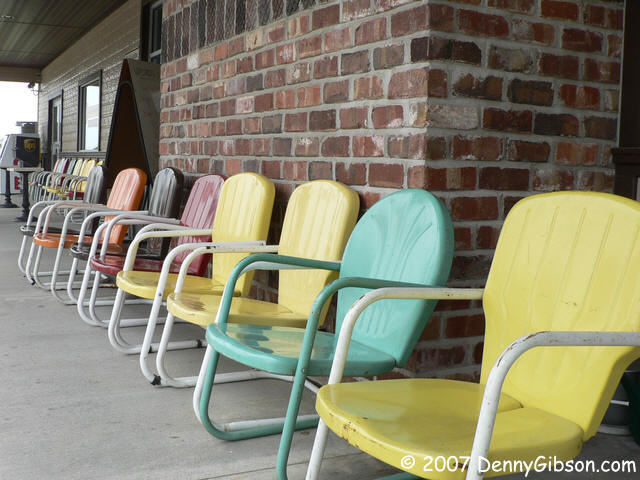
The museum building includes a restaurant, ice cream parlor, and jewelry gallery with the museum in the back. It's $2.50 to visit the museum once or $5 for a one year pass. I went for the one time ticket but it only took me a few minutes in the museum to realize what a good deal I had passed up. Who knew it would be this cool. Marlene Crane herself gives overviews of what's there to everyone who enters. That's her in the picture. Joe, her husband, is the third Crane generation to run the store and their son David is now pretty active in that role. He has two young sons so a fifth generation of family operation seems likely. The store added White Eagle gas in 1927 and essentially stayed the course when Mobil bought White Eagle ten years later. Marlene says that the museum has only about a third of the stuff Joe has tucked away. Maybe they'll expand some day. A visit is a marvelous step back in time and Marlene is a marvelous guide. Out front you can rest on one of the lawn chairs while you're licking your ice cream cone and thinking about the other two-thirds of Joe's stuff. |
|
|


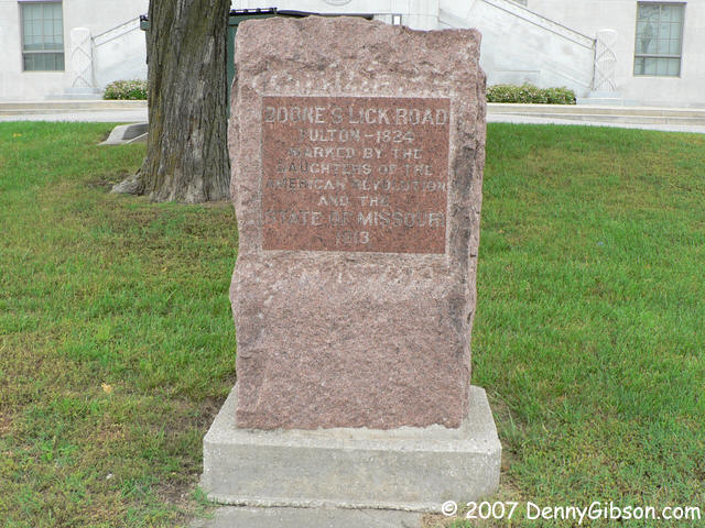
 The morning started wet & gray but it hadn't rained all morning and
the sun was actually shining when I left Crane's. Inspired by a group of
motorcyclists who stopped at the store, I took the top off of the car and
headed down the road with a big smile. About the time I reached Fulton,
the GPS announced that it had "lost satellite reception". That had already
happened a couple of times today so I didn't think much of it. I drove
past the town's DAR marker and headed out of town
on highway F.
The morning started wet & gray but it hadn't rained all morning and
the sun was actually shining when I left Crane's. Inspired by a group of
motorcyclists who stopped at the store, I took the top off of the car and
headed down the road with a big smile. About the time I reached Fulton,
the GPS announced that it had "lost satellite reception". That had already
happened a couple of times today so I didn't think much of it. I drove
past the town's DAR marker and headed out of town
on highway F.
Near the edge of town, a sign warned of a road closure 7 1/2 miles ahead and pointed to a detour. Pshaw, I thought. Surely there would be plenty of side roads in 7 1/2 miles and the GPS would guide me around the problem when necessary. I drove by the detour sign and enjoyed over seven miles of some of the nicest driving of the whole trip. When the end did come, I couldn't recall seeing any side roads for quite awhile and the GPS was still "Acquiring Satellites". Yeah, it was somewhat cloudy but there was some sun coming through and there wasn't even a roof to block anything. Either the GPS was broken or there was some nasty weather somewhere. I skipped a couple of gravel roads and held out for the paved route KK something over four miles back. Aside from possibly keeping me from getting lost, that only delayed the inevitable. A pavement ends sign soon appeared. So here I am on a gravel road in Missouri with a non-functioning GPS when inevitable number two hits. Big drops, too. I managed to get the top on before there was standing water in the car and reminded myself that I ought to practice that more. Into every lap a little rain must fall. |
|
|
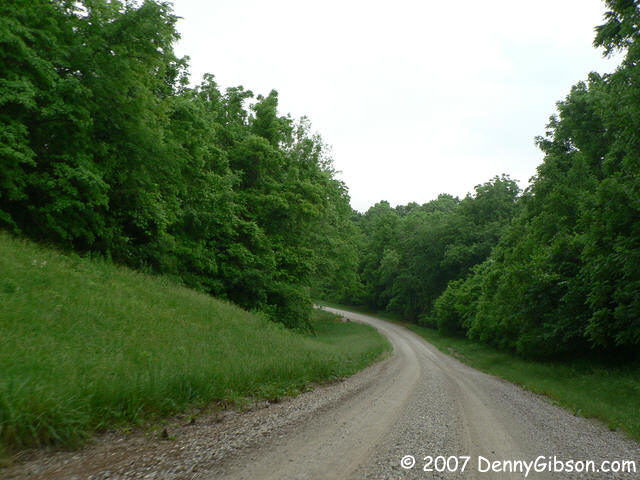 Sorry, but here's one more picture of gravel road. This one intentional
and quite pretty. It's near Rocheport and I had clearly included in my
route. But it bypassed Rocheport itself and that makes me doubt myself. I
recheck that when I get home.
Sorry, but here's one more picture of gravel road. This one intentional
and quite pretty. It's near Rocheport and I had clearly included in my
route. But it bypassed Rocheport itself and that makes me doubt myself. I
recheck that when I get home.
|
|
|

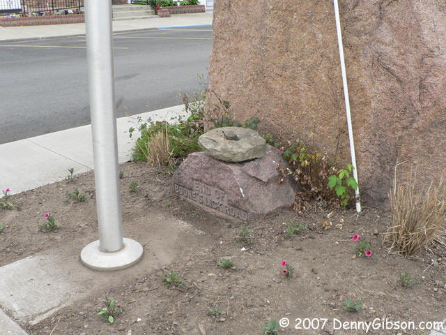
 This is New Franklin where the road officially ends. There's a nice big
island in the middle of town with several informational panels and a big
rock marker. That marker is from the DAR and commemorates the start of the
Santa Fe Trail. Of course the Boone's Lick Road ends where the Santa Fe
Trail starts and there's a marker for it, too. It's on the back side of
the big rock and is somewhat smaller. It's only slightly blocked by a flag
pole and, perhaps to keep it from blowing away, has what looks like the
first wheel on top of it. Well, I suppose a 1000 mile trail does deserve a
bigger monument than a 150 mile trail and so what if the words are often
obscured by dirt and the flag pole prevents even a photo from straight
ahead. The rock is there and so was I. I'll probably be happier about the
situation when I drive the Santa Fe.
This is New Franklin where the road officially ends. There's a nice big
island in the middle of town with several informational panels and a big
rock marker. That marker is from the DAR and commemorates the start of the
Santa Fe Trail. Of course the Boone's Lick Road ends where the Santa Fe
Trail starts and there's a marker for it, too. It's on the back side of
the big rock and is somewhat smaller. It's only slightly blocked by a flag
pole and, perhaps to keep it from blowing away, has what looks like the
first wheel on top of it. Well, I suppose a 1000 mile trail does deserve a
bigger monument than a 150 mile trail and so what if the words are often
obscured by dirt and the flag pole prevents even a photo from straight
ahead. The rock is there and so was I. I'll probably be happier about the
situation when I drive the Santa Fe.
|
|
|
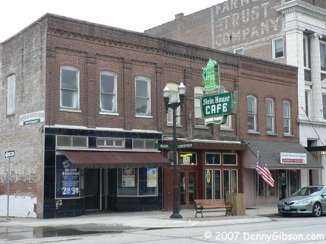
 Dinner was at the Stein House where I didn't have to eat alone. Besides my
Jim Beam loving companion, Jeff, one of the owners, provided good company
and good information when he wasn't tending to other things. From him, I
learned that the building was originally built as a John Deere show room
and has oversized floor joists for that reason. A cool and friendly place
with darned good food, too. It wasn't quite dark when I left but I did
what I could to get a shot of the neon stein before heading to the motel.
Dinner was at the Stein House where I didn't have to eat alone. Besides my
Jim Beam loving companion, Jeff, one of the owners, provided good company
and good information when he wasn't tending to other things. From him, I
learned that the building was originally built as a John Deere show room
and has oversized floor joists for that reason. A cool and friendly place
with darned good food, too. It wasn't quite dark when I left but I did
what I could to get a shot of the neon stein before heading to the motel.
|
|
|
| [Prev] [Site Home] [Trip Home] [Contact] [Next] |