Clear & Cool
Prev
Next


|
Day 2: March 3, 2012 Clear & Cool |
Prev Next |
|
|
|
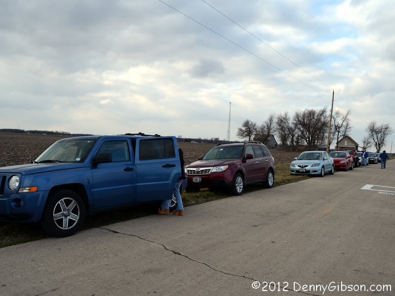
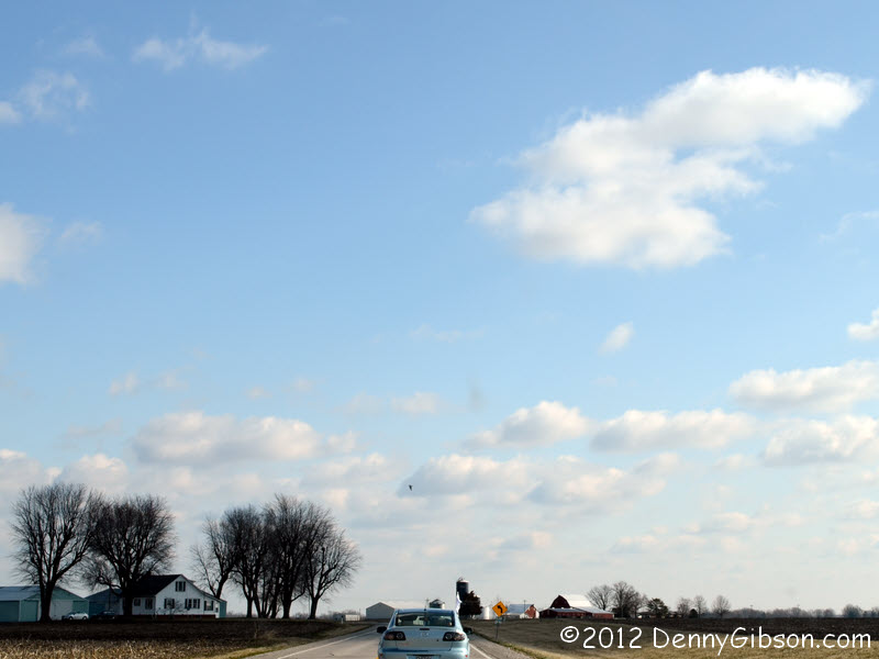 The cruise collection point was the White Hen restaurant near Mitchell.
Some came a little early and ate breakfast while others arrived nearer the
planned 8:30 departure. A total of eight cars rolled out under some
beautiful blue backed clouds.
The cruise collection point was the White Hen restaurant near Mitchell.
Some came a little early and ate breakfast while others arrived nearer the
planned 8:30 departure. A total of eight cars rolled out under some
beautiful blue backed clouds.
|
|
|


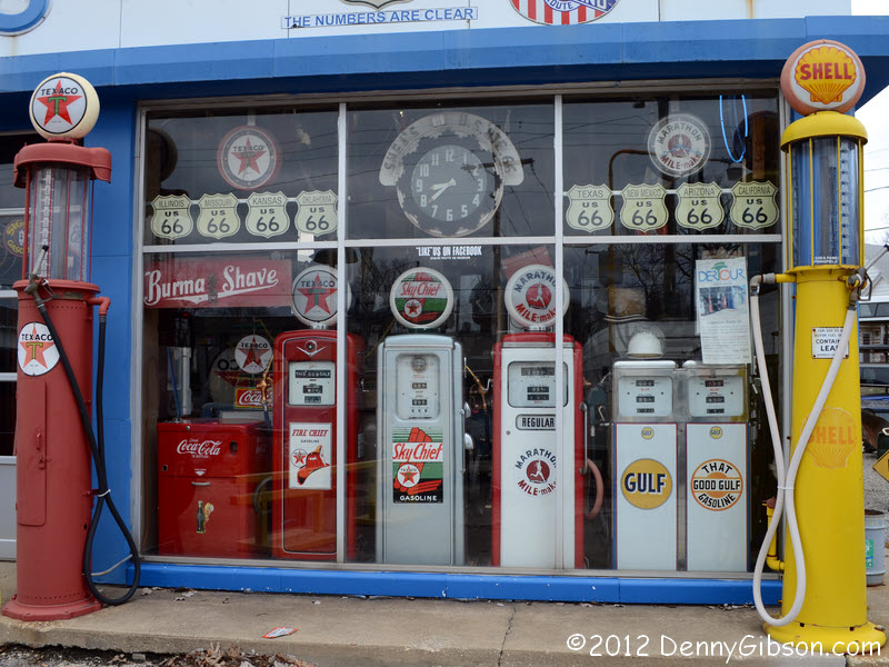
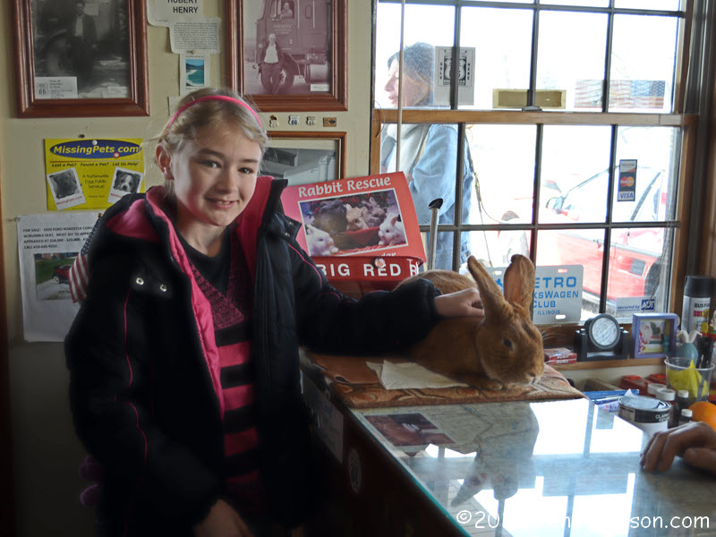 The need to reach Shea's Museum before the noon closing kept our stop at
Henry's Rabbit
Ranch brief but it was still a lot of fun. I got a shot of most of our
caravan and of Natalie with Big Red, the ranch's official greeter rabbit.
The need to reach Shea's Museum before the noon closing kept our stop at
Henry's Rabbit
Ranch brief but it was still a lot of fun. I got a shot of most of our
caravan and of Natalie with Big Red, the ranch's official greeter rabbit.
|
|
|
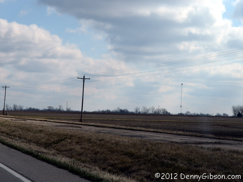 Those time constraints also prompted our choice of the quicker 1930s
alignment for the northbound trip with plans to return on the older one.
Like the stretch of US-40 I drove yesterday, abandoned pavement can often
be seen next to this stretch of the former US-66. However, none of it is
brick and it has been retired rather than replaced. In the days before
I-55, most of this section had progressed to divided four-lane. After the
interstate grabbed enough traffic to make all four lanes unnecessary,
two were retired and are no longer maintained.
Those time constraints also prompted our choice of the quicker 1930s
alignment for the northbound trip with plans to return on the older one.
Like the stretch of US-40 I drove yesterday, abandoned pavement can often
be seen next to this stretch of the former US-66. However, none of it is
brick and it has been retired rather than replaced. In the days before
I-55, most of this section had progressed to divided four-lane. After the
interstate grabbed enough traffic to make all four lanes unnecessary,
two were retired and are no longer maintained.
|
|
|

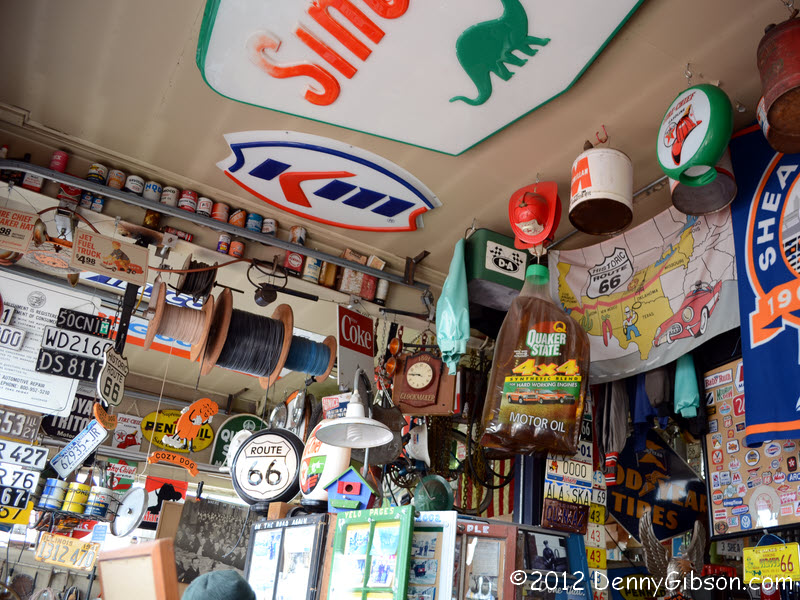
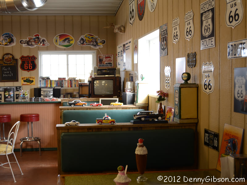
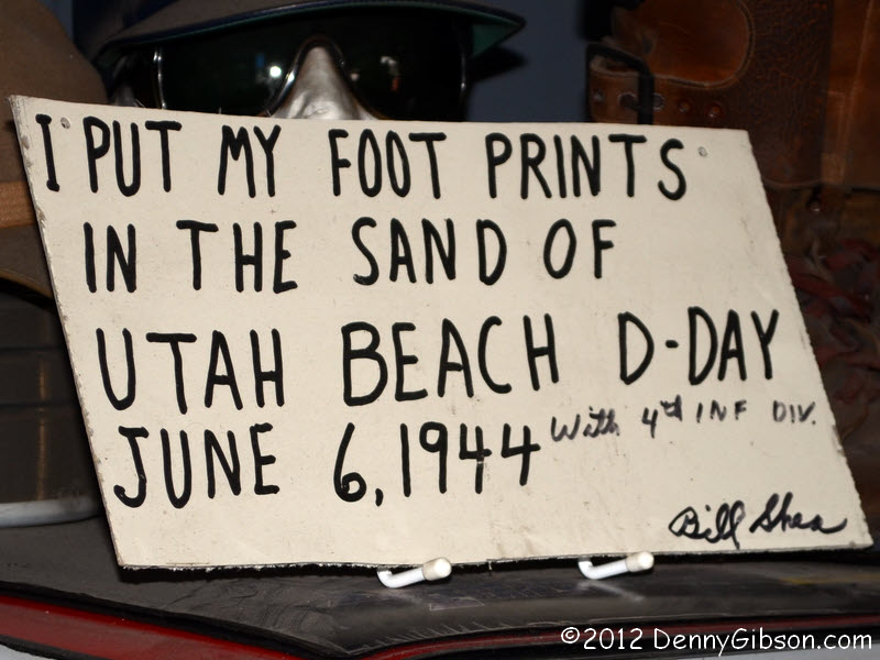
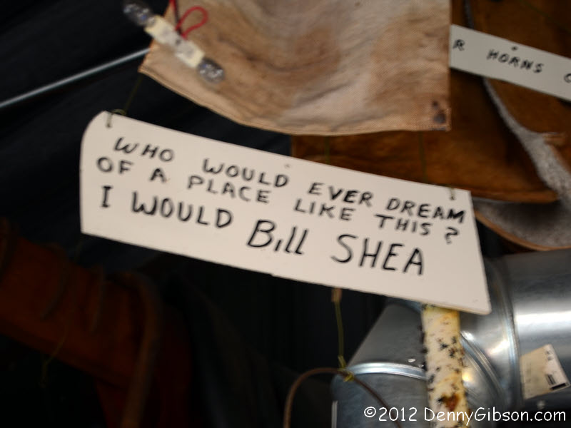 I have been by
Bill Shea's Museum a few times but never when it was
open. I assumed I was alone in that but learned that our group contained
several others who were seeing the collection of petro -- and other --
belia for the first time. Bill may look a little extra sharp today because
he was part of some filming for an Illinois tourism commercial before we
arrived. His son, grandson, and great-granddaughter were all on hand
meaning that four generations of Sheas were "in the house"
today. Quote filled cards like the one in the last picture are spread
about the place and include a signed one concerning Bill's
"day on the beach".
I have been by
Bill Shea's Museum a few times but never when it was
open. I assumed I was alone in that but learned that our group contained
several others who were seeing the collection of petro -- and other --
belia for the first time. Bill may look a little extra sharp today because
he was part of some filming for an Illinois tourism commercial before we
arrived. His son, grandson, and great-granddaughter were all on hand
meaning that four generations of Sheas were "in the house"
today. Quote filled cards like the one in the last picture are spread
about the place and include a signed one concerning Bill's
"day on the beach".
|
|
|
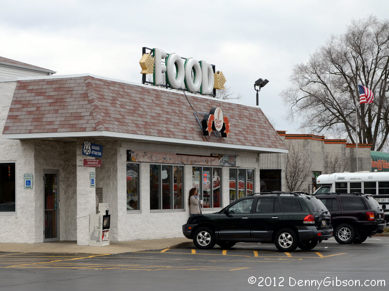 Approximately half the population of Springfield arrived at the
Cozy Dog just before we did but tables eventually
cleared and the fast service kept anyone from being too hungry too long.
Approximately half the population of Springfield arrived at the
Cozy Dog just before we did but tables eventually
cleared and the fast service kept anyone from being too hungry too long.
|
|
|
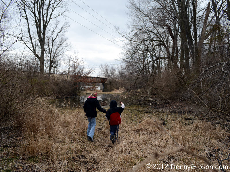
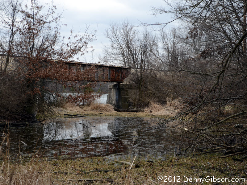

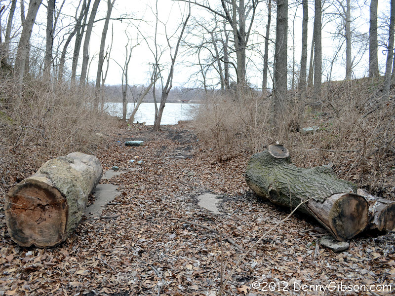
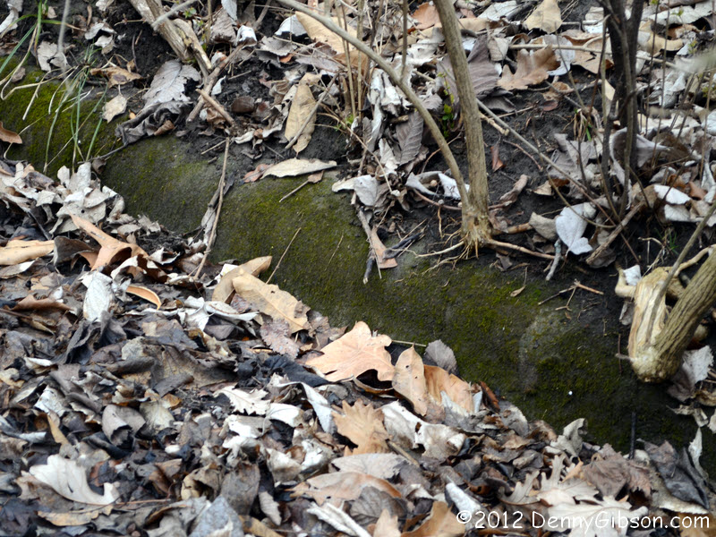
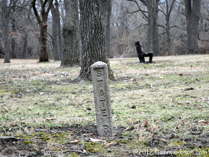
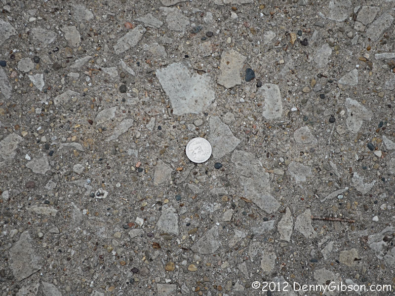
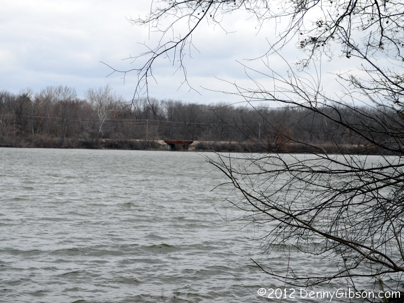 When Lake Springfield was created in 1933, part of US-66 disappeared under
water. The first three pictures are from the north end of the submerged
section and the last three are from the south. The road went through the
railroad overpass seen in the second and sixth pictures.
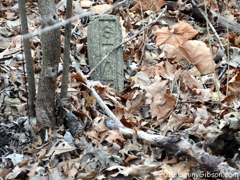
Raised curb is evident on the north section. Right
of way markers exist on both sides. Here is one
on the south side to go with the north side one shown. The size of
rocks in the pavement seems to support the theory
that the size of the aggregate indicates the age of the paving.
When Lake Springfield was created in 1933, part of US-66 disappeared under
water. The first three pictures are from the north end of the submerged
section and the last three are from the south. The road went through the
railroad overpass seen in the second and sixth pictures.
Raised curb is evident on the north section. Right
of way markers exist on both sides. Here is one
on the south side to go with the north side one shown. The size of
rocks in the pavement seems to support the theory
that the size of the aggregate indicates the age of the paving.
|
|
|
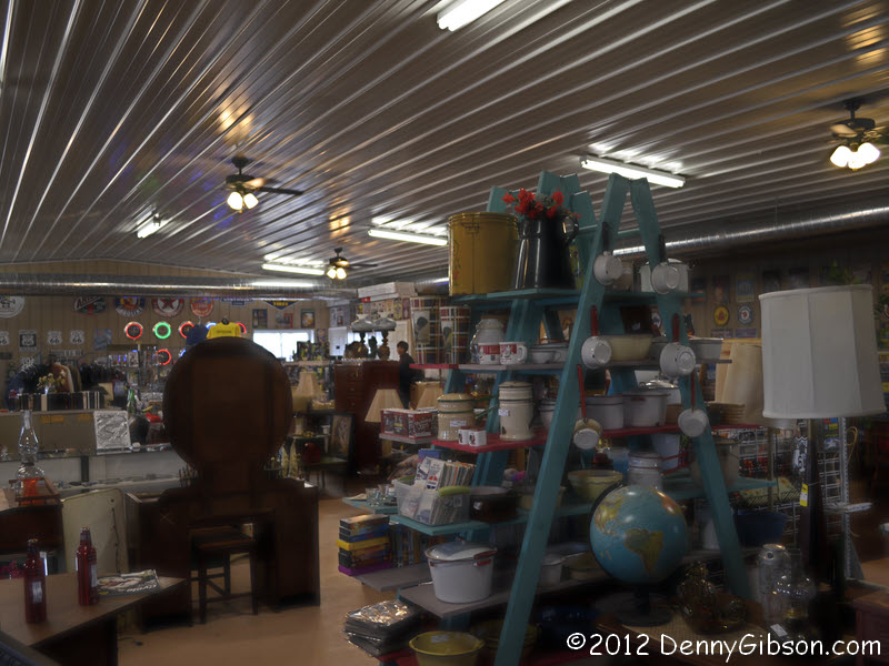 Another place I had seen but never been in is Becky's Barn. Actually, I'd never even seen the outside
of this particular "barn" since it was still a dream when I was
here in 2009. It's not quite as full as Shea's with more room to walk and
most things for sale.
Another place I had seen but never been in is Becky's Barn. Actually, I'd never even seen the outside
of this particular "barn" since it was still a dream when I was
here in 2009. It's not quite as full as Shea's with more room to walk and
most things for sale.
|
|
|
 Becky identifies her place as "Off the Bricks on Route 66" and
so it is. We continued down the rest of the brick section when we left.
Becky identifies her place as "Off the Bricks on Route 66" and
so it is. We continued down the rest of the brick section when we left.
|
|
|
 Kip's day was complete once he had seen -- and sat on -- the Nilwood
turkey tracks. The sign and paint now make them pretty hard to miss.
Kip's day was complete once he had seen -- and sat on -- the Nilwood
turkey tracks. The sign and paint now make them pretty hard to miss.
Another car, the Bremers from Indianapolis, had joined us at Shea's so there were now nine cars in our little caravan. One car headed home before dinner but a couple of locals, including Rich Henry, joined us so I think the dinner group was around twenty. Good food and great conversation to end a really nice cruise. It was a tad cold but it was dry and, considering what could happen in early March, no one seriously complained about the temperature. |
|
|
| [Prev] [Site Home] [Trip Home] [Contact] [Next] |