Around the Bay
Prev
Next


|
Day 10: August 11, 2008 Around the Bay |
Prev Next |
|
|
|
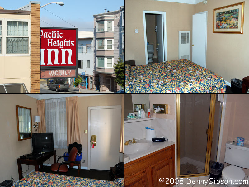
 My motel in San Francisco is the
Pacific
Heights Inn on Union. Rick Sebak of Pittsburgh's WQED mentioned
staying here while filming for a Lincoln Highway documentary and it
sounded like an OK place. It is. I don't know how it compares to other
motels in the area but it worked for me. My room is
here.
My motel in San Francisco is the
Pacific
Heights Inn on Union. Rick Sebak of Pittsburgh's WQED mentioned
staying here while filming for a Lincoln Highway documentary and it
sounded like an OK place. It is. I don't know how it compares to other
motels in the area but it worked for me. My room is
here.
|
|
|
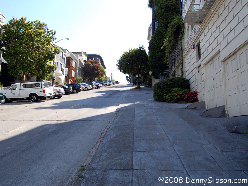

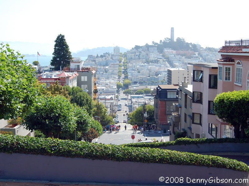
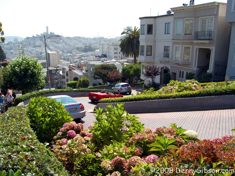
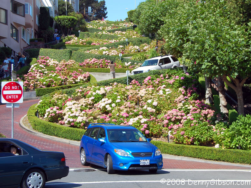 I hooked up with Crispian, my oldest son, on Sunday evening but took no
pictures. Today is a workday for him so I'm doing a little exploring on my
own. The only thing firmly on my agenda was a visit to Lincoln Park and I
decided on a little walkabout before driving to the park. My path to the
waterfront led directly to the crooked part of Lombard Street so I climbed
up the straight side of the hill and down the wiggly side. An almost
non-stop parade of cars, many with cameras poking from a window or pointed
through the windshield, rolled down the "crookedest street in
America" while tourists strolled on and beside the road posing for
souvenir pictures or photographing the cars. This last group included me.
I hooked up with Crispian, my oldest son, on Sunday evening but took no
pictures. Today is a workday for him so I'm doing a little exploring on my
own. The only thing firmly on my agenda was a visit to Lincoln Park and I
decided on a little walkabout before driving to the park. My path to the
waterfront led directly to the crooked part of Lombard Street so I climbed
up the straight side of the hill and down the wiggly side. An almost
non-stop parade of cars, many with cameras poking from a window or pointed
through the windshield, rolled down the "crookedest street in
America" while tourists strolled on and beside the road posing for
souvenir pictures or photographing the cars. This last group included me.
|
|
|
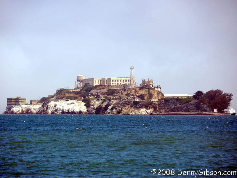
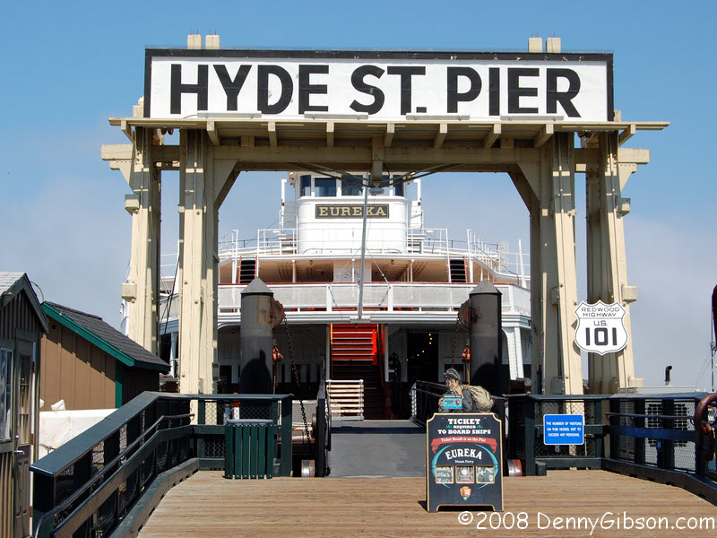
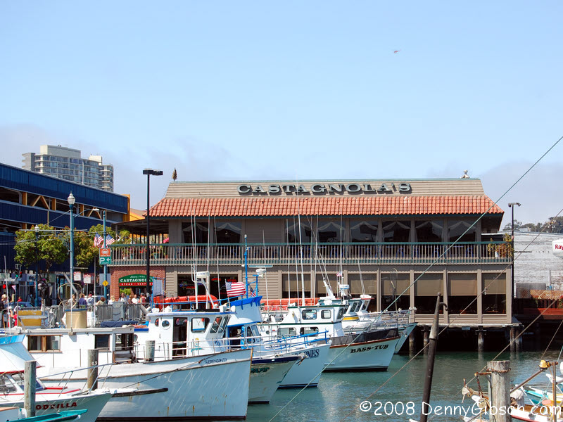
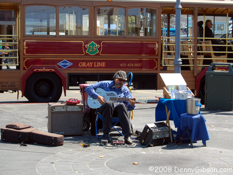
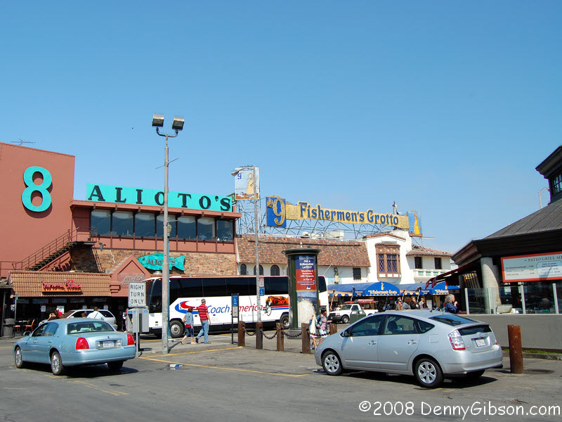 I did some random wandering on the waterfront and took some random
pictures. Here's the proof. That last picture is of Alcatraz.
I did some random wandering on the waterfront and took some random
pictures. Here's the proof. That last picture is of Alcatraz.
|
|
|
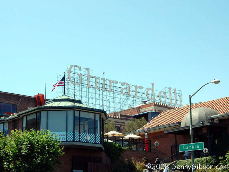
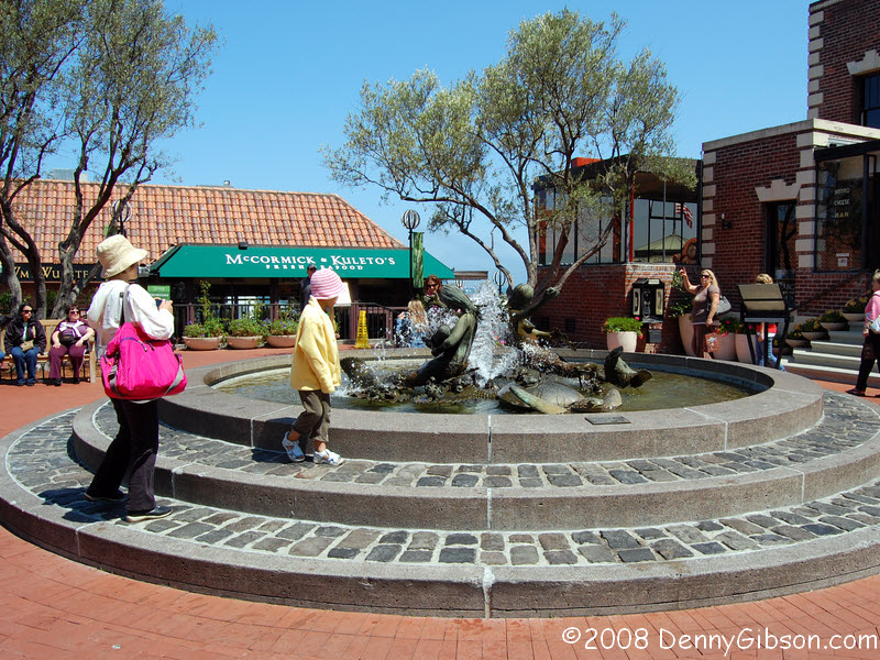
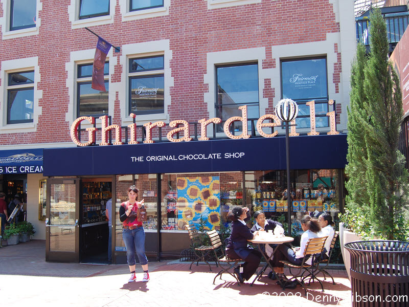

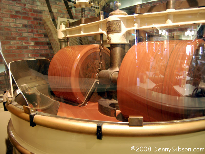 At Ghirardelli's I bought a chocolate malt (The same thing I did on my
only other visit.) and then returned to the fountain in front of the store
to enjoy it.
At Ghirardelli's I bought a chocolate malt (The same thing I did on my
only other visit.) and then returned to the fountain in front of the store
to enjoy it.
|
|
|
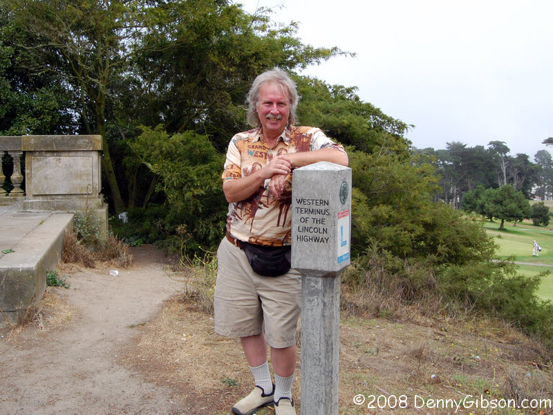
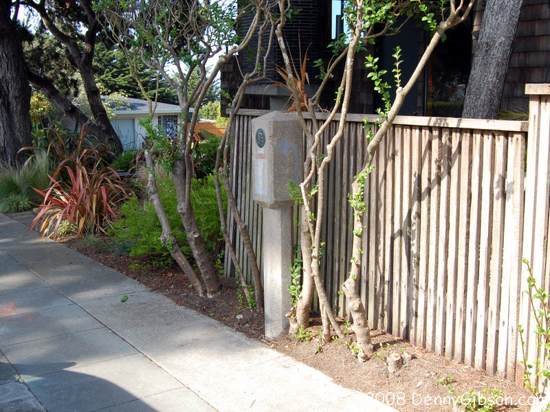 Then it was off to Lincoln Park to find the reproduction Lincoln Highway
terminus marker and the most western remaining original marker. The
terminus marker is in Lincoln Park. The "next-to-last marker" is
on the southeast corner of El Camino Del Mar & 32nd Avenue. An email
exchange with Brian
Butko refreshed my knowledge of the "next-to-last marker"
but I still had trouble finding it. Pictures I had seen, including those
from Rick Sebak's
August 2007 visit, showed the marker hiding in
shrubbery and, for some unknown reason, I thought it was some distance
from the corner. Brian had told me that the shrubs had been trimmed since
Rick was here but I didn't realize how much. I went peeking and poking in
hedges way too far from the corner. After awhile, I decided I might have
written down the wrong corner and went off studying various clumps of
greenery on the other corners. Finally, when I walked by the concrete
marker for the third time, it almost jumped out at me. I was laughing
aloud as I looked at the completely exposed eighty year old post.
Then it was off to Lincoln Park to find the reproduction Lincoln Highway
terminus marker and the most western remaining original marker. The
terminus marker is in Lincoln Park. The "next-to-last marker" is
on the southeast corner of El Camino Del Mar & 32nd Avenue. An email
exchange with Brian
Butko refreshed my knowledge of the "next-to-last marker"
but I still had trouble finding it. Pictures I had seen, including those
from Rick Sebak's
August 2007 visit, showed the marker hiding in
shrubbery and, for some unknown reason, I thought it was some distance
from the corner. Brian had told me that the shrubs had been trimmed since
Rick was here but I didn't realize how much. I went peeking and poking in
hedges way too far from the corner. After awhile, I decided I might have
written down the wrong corner and went off studying various clumps of
greenery on the other corners. Finally, when I walked by the concrete
marker for the third time, it almost jumped out at me. I was laughing
aloud as I looked at the completely exposed eighty year old post.
When I first drove by the terminus marker, a couple stood by it posing for pictures of each other. They were still there when I had parked and walked back to the marker. Guessing that anyone who bothered to photograph the marker might have an interest in the highway, I asked. Yes indeed. They had just driven the whole thing but were rather disappointed in it. There wasn't much to it, they said. "It's not at all like Sixty-Six." Quite recently I had heard almost the same statement made about the Dixie Highway. I suspect that the speakers are not completely aware of the chronology of the roads and think that the Lincoln, the Dixie, Route 66, and other "old" roads, were contemporary and that Route 66 was just named by someone who liked numbers. I love Sixty-Six but am ecstatic to see folks exploring other roads, too. It's great that they're interested. It's horrible that they're disappointed. Sadly, I have no idea what the answer might be. The couple I met in Lincoln Park had the recent Wallis & Williamson book in the car and had used it as their only guide. They ended up disappointed not only in the road but in the book, too. "It doesn't even have a map." I told them that their book was certainly a good one but it wasn't a guide book. I've told others that Wallis gets you in the mood to go (with The Lincoln Highway: Coast to Coast from Times Square to the Golden Gate) and that Butko helps get you there (with Greetings from the Lincoln Highway). It's not quite the same but it is somewhat similar to the relationship that Wallis (Route 66: The Mother Road) and McClanahan (Route 66: EZ66 Guide for Travelers) have on Route 66. I don't yet know of anything equivalent for the Dixie or others. |
|
|
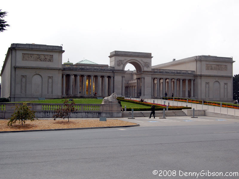

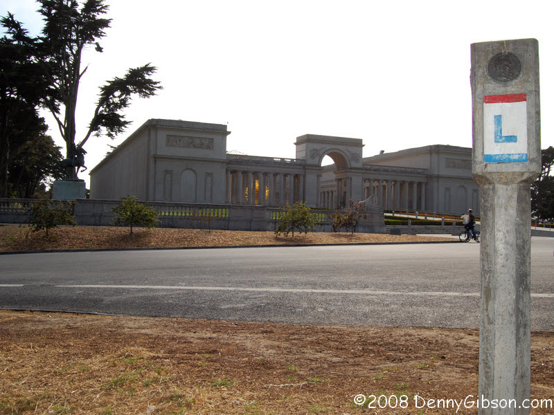
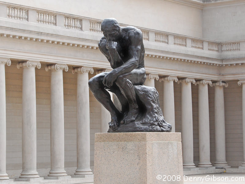 The Palace of the
Legion of Honor is just across the street from
the Lincoln Highway Terminus marker but it's closed on Mondays. The
Thinker was safely behind bars but I got his picture, anyway.
The Palace of the
Legion of Honor is just across the street from
the Lincoln Highway Terminus marker but it's closed on Mondays. The
Thinker was safely behind bars but I got his picture, anyway.
Graeme Edge, 1969: I think... I think I am. Therefore I am! I think... |
|
|
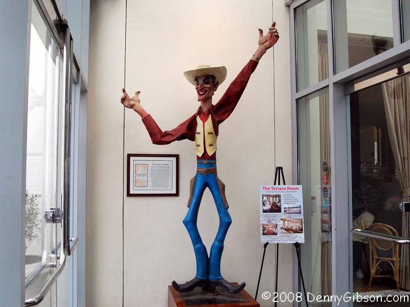
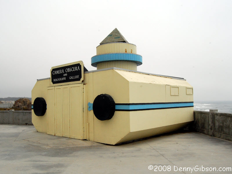
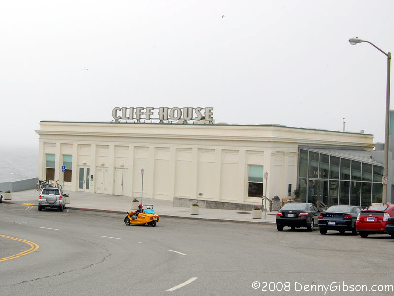 A bit past Lincoln Park is Cliff House where early coast-to-coast drives
really ended; often with a ceremonial "dipping" of front wheels
in the Pacific. The Camera Obscura was closed, presumedly since all that
could have been seen was gray fog, but the Cliff House itself was open. I
stopped in for a brew and a picture of the Playland Cowboy from the
Frontierland Arcade that used to be nearby.
A bit past Lincoln Park is Cliff House where early coast-to-coast drives
really ended; often with a ceremonial "dipping" of front wheels
in the Pacific. The Camera Obscura was closed, presumedly since all that
could have been seen was gray fog, but the Cliff House itself was open. I
stopped in for a brew and a picture of the Playland Cowboy from the
Frontierland Arcade that used to be nearby.
|
|
|
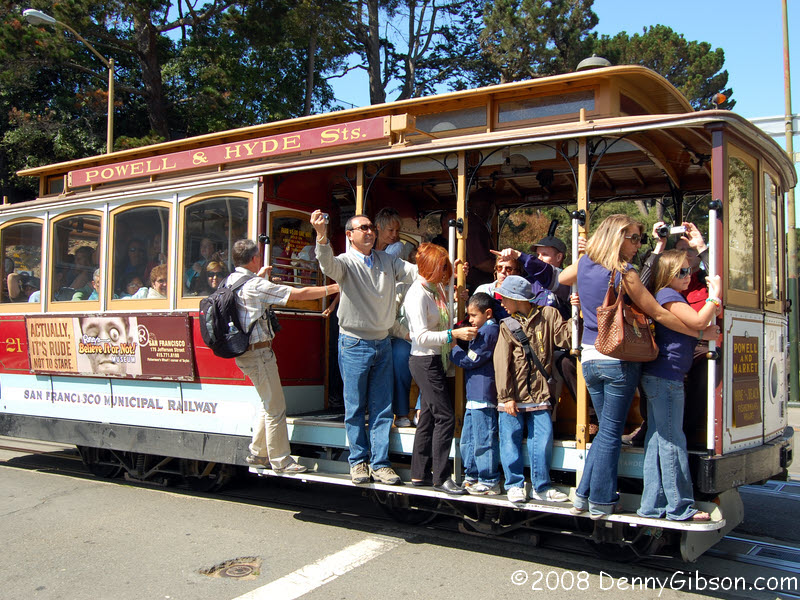

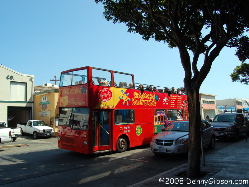
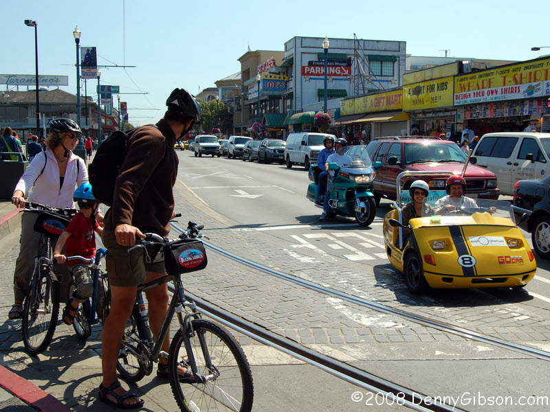

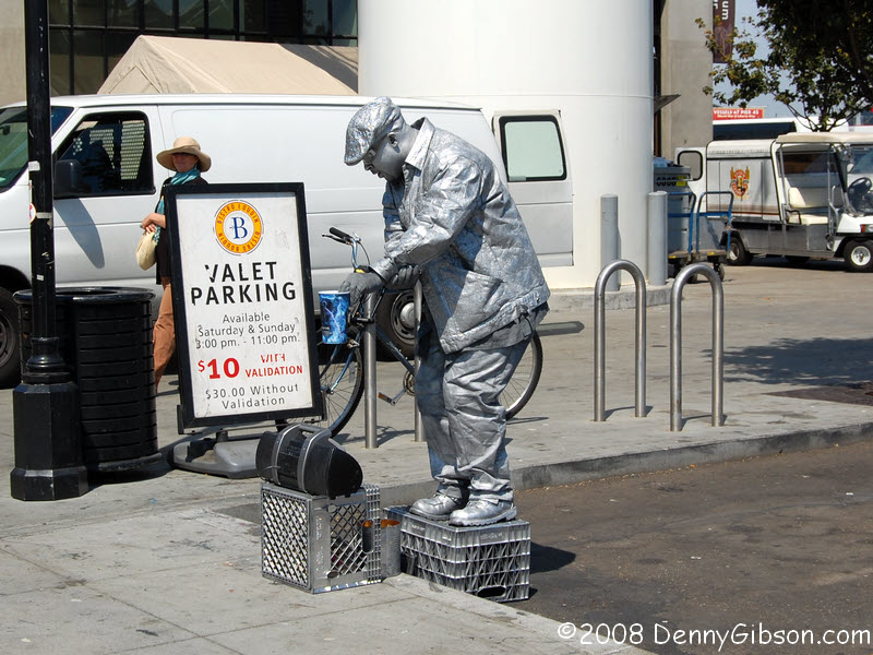
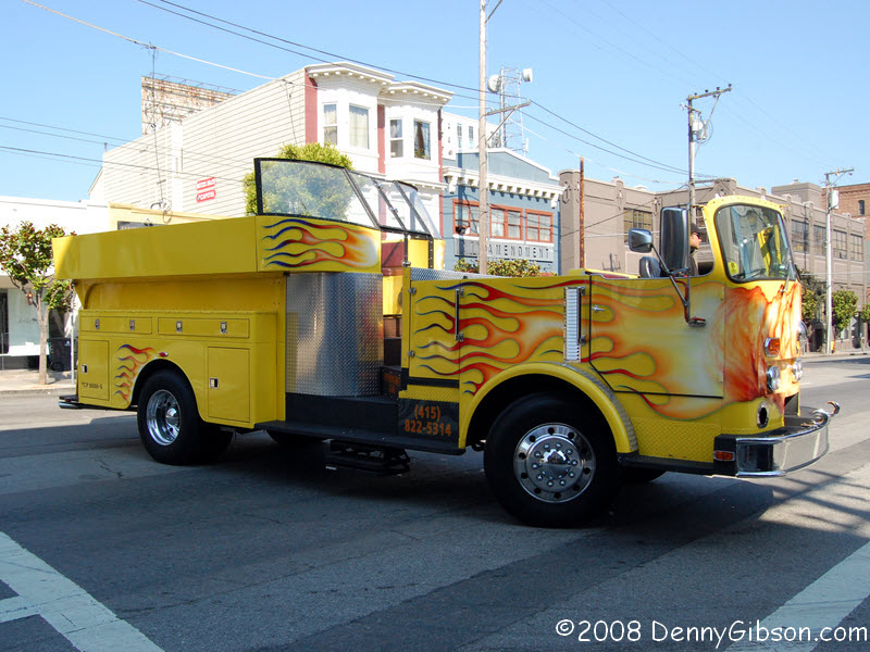 These photos aren't in sequence with the others on the page but are just
a few of the modes of transportation used in San Francisco. Even though I
missed getting a picture of the guy on a skateboard being pulled by four
dogs, there is a little variety.
These photos aren't in sequence with the others on the page but are just
a few of the modes of transportation used in San Francisco. Even though I
missed getting a picture of the guy on a skateboard being pulled by four
dogs, there is a little variety.
|
|
|
| [Prev] [Site Home] [Trip Home] [Contact] [Next] |