|
Day 4: May 31, 2004 |
Prev Next |
|
Day 4: May 31, 2004 |
Prev Next |
|
|
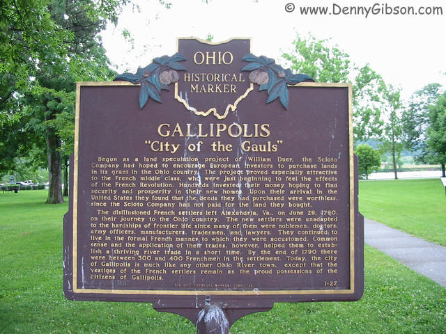
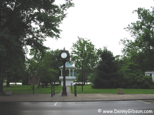
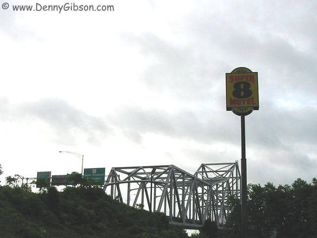 In Gallipolis, I stayed in a Super 8 and ate Captain D's carry-out so I
figure no pictures are required. I have included one from the motel
parking lot since it is immediately next to the Silver Memorial bridge
that carries traffic to West Virginia. The Ohio River forms one side of
the downtown park. In addition to a fairly normal assortment of statues
and plaques, the park contains a large fleur-de-leis carved from a
standing tree trunk. My camera started acting up a bit before the trip and
has cost me a few pictures. Normally, it simply refuses to take certain
pictures and records a dark grey panel instead. I've taken to verifying
each picture and can often get something similar to what I want by
applying black magic that I don't even begin to understand. I think that
the camera tricked me into believing that it had recorded several
pictures, including one of a six-foot wooden fleur-de-leis when it had
done nothing of the sort. That will be significant later.
In Gallipolis, I stayed in a Super 8 and ate Captain D's carry-out so I
figure no pictures are required. I have included one from the motel
parking lot since it is immediately next to the Silver Memorial bridge
that carries traffic to West Virginia. The Ohio River forms one side of
the downtown park. In addition to a fairly normal assortment of statues
and plaques, the park contains a large fleur-de-leis carved from a
standing tree trunk. My camera started acting up a bit before the trip and
has cost me a few pictures. Normally, it simply refuses to take certain
pictures and records a dark grey panel instead. I've taken to verifying
each picture and can often get something similar to what I want by
applying black magic that I don't even begin to understand. I think that
the camera tricked me into believing that it had recorded several
pictures, including one of a six-foot wooden fleur-de-leis when it had
done nothing of the sort. That will be significant later.
|
|
|
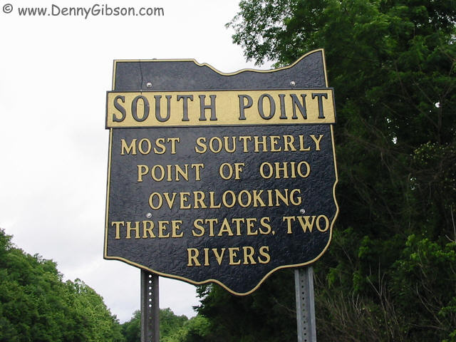
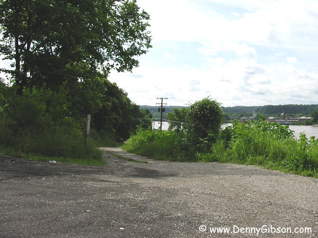 Near, or perhaps even in the town of South Point, this sign is posted on
the NORTH side of US-52 (SR-7 ended just a couple of miles back.). While I
was photographing the sign, I was struck by realization that if it
was on the north side of the road than it could hardly mark
the true "most southerly point of Ohio". Pretty clever, eh? So I
went off seeking that point and, according to the GPS, it's somewhere near
the other end of that gravel path.
Near, or perhaps even in the town of South Point, this sign is posted on
the NORTH side of US-52 (SR-7 ended just a couple of miles back.). While I
was photographing the sign, I was struck by realization that if it
was on the north side of the road than it could hardly mark
the true "most southerly point of Ohio". Pretty clever, eh? So I
went off seeking that point and, according to the GPS, it's somewhere near
the other end of that gravel path.
|
|
|
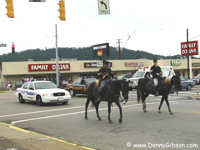
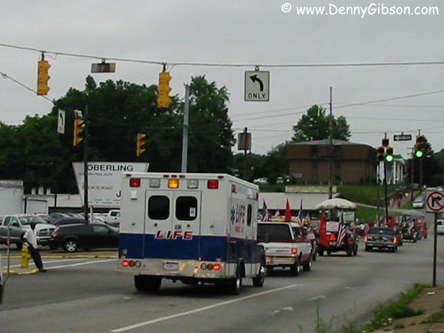 I reached Portsmouth just as their Memorial Day parade was ending - and I
mean exactly that. By the time I figured out why traffic wasn't moving,
pulled through an alley to a parking space, and walked to within camera
range, there was almost nothing left to aim the camera at.
I reached Portsmouth just as their Memorial Day parade was ending - and I
mean exactly that. By the time I figured out why traffic wasn't moving,
pulled through an alley to a parking space, and walked to within camera
range, there was almost nothing left to aim the camera at.
|
|
|
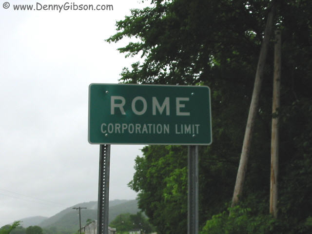
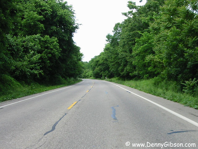
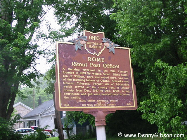 I guess I should have known that the road would lead here but I was still
a little surprised.
I guess I should have known that the road would lead here but I was still
a little surprised.
|
|
|
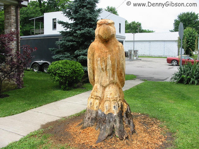
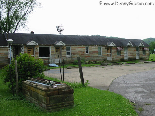
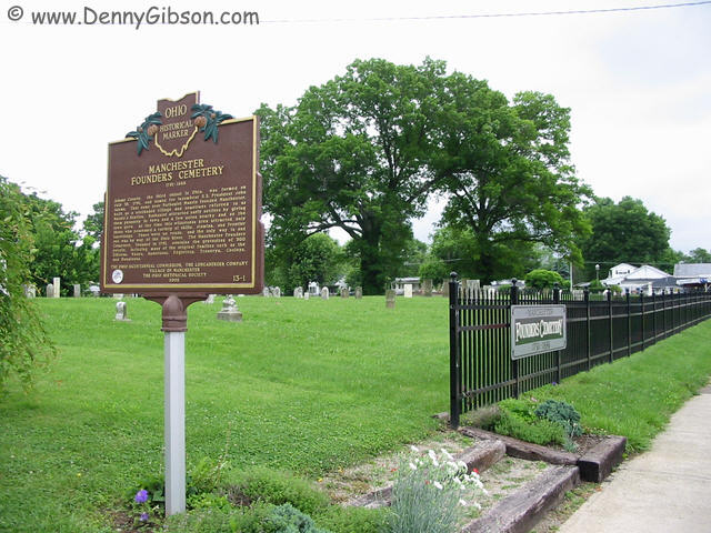
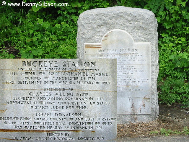 Three men who were significant in the area's early history once lived a
half mile north of this white stone. One of those men was Nathaniel Massie
who founded the nearby town of Manchester. The stone fronted tourist
cabins are just across the street from the Founder's Cemetery and just
seemed worth recording. When I took the eagle picture, it was with the
idea of comparing it to the fleur-de-leis in Gallipolis. See, I said it
would be significant.
Three men who were significant in the area's early history once lived a
half mile north of this white stone. One of those men was Nathaniel Massie
who founded the nearby town of Manchester. The stone fronted tourist
cabins are just across the street from the Founder's Cemetery and just
seemed worth recording. When I took the eagle picture, it was with the
idea of comparing it to the fleur-de-leis in Gallipolis. See, I said it
would be significant.
|
|
|
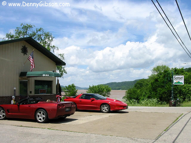
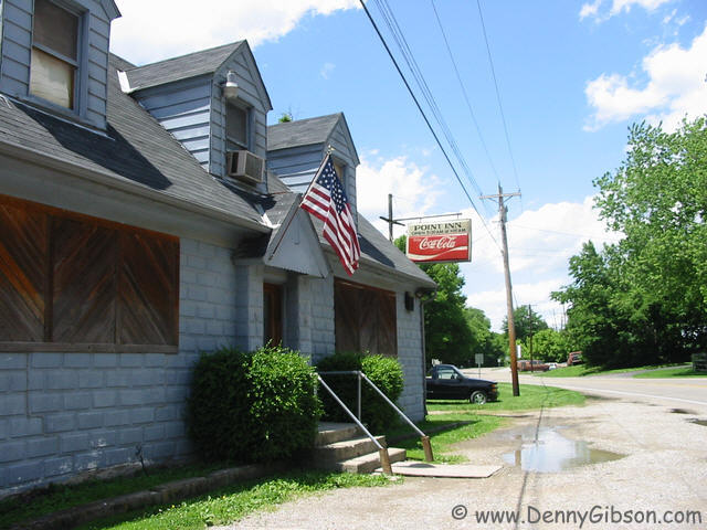 I'm definitely on the downhill run now. I'm getting close to home and into
semi-familiar territory. On top of that, it hadn't rained since Aberdeen
and was becoming nicer by the minute. Besides just enjoying some of the
scenic spots along US-52, I took the opportunity to visit three
establishments that I had seen in the past but had never stopped at. I
kept my visits short - about twelve ounces. The Sunset Bar & Grill was
the first. Janay (sp?) and David, the owner, were really friendly and the
place had a good feel. I know I'll get back there sometime to drink a
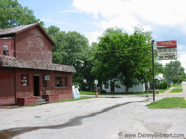
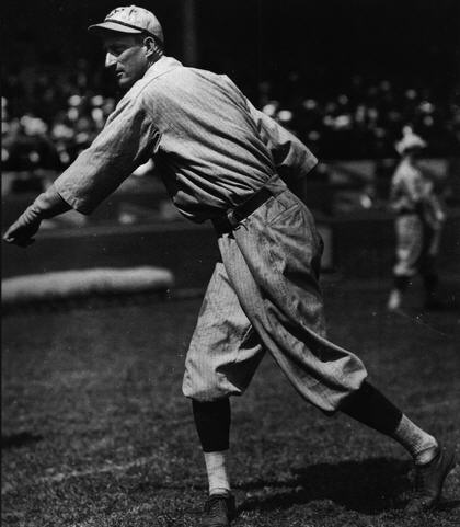
Stroh's or a Black Label. In Higginsport, I stopped at Karen's Hi-Port.
There I learned that the place had once been owned by Cincinnati Reds
pitcher, Harry "Slim"
Sallee. In the 1919 World Series against Chicago, Harry won one and
lost one. The last stop was at the Point Inn in Point Pleasant. Another
friendly group. A sign hung behind the bar at the high water mark of the
1997 flood. It was four or five feet above the floor and carved of wood
with the letters and numbers in silhouette. The top line was "Point
Inn 3-5-97" with "Flood Level 647". The four was reversed.
I'm definitely on the downhill run now. I'm getting close to home and into
semi-familiar territory. On top of that, it hadn't rained since Aberdeen
and was becoming nicer by the minute. Besides just enjoying some of the
scenic spots along US-52, I took the opportunity to visit three
establishments that I had seen in the past but had never stopped at. I
kept my visits short - about twelve ounces. The Sunset Bar & Grill was
the first. Janay (sp?) and David, the owner, were really friendly and the
place had a good feel. I know I'll get back there sometime to drink a
Stroh's or a Black Label. In Higginsport, I stopped at Karen's Hi-Port.
There I learned that the place had once been owned by Cincinnati Reds
pitcher, Harry "Slim"
Sallee. In the 1919 World Series against Chicago, Harry won one and
lost one. The last stop was at the Point Inn in Point Pleasant. Another
friendly group. A sign hung behind the bar at the high water mark of the
1997 flood. It was four or five feet above the floor and carved of wood
with the letters and numbers in silhouette. The top line was "Point
Inn 3-5-97" with "Flood Level 647". The four was reversed.
|
|
|