Old Ends and Will's Place
Comment via blog
Prev
Next


|
Day 13: November 13, 2016 Old Ends and Will's Place Comment via blog |
Prev Next |
|
|
|
 I started following River Pilot's
Route 66 GPS Turn by Turn instructions. I knew the
schedule could get a little tight after Tulsa and half expected that I
would need to turn to expressways at some point but planned to stay on the
Route as far as I could. As it turned out, with the exception of a couple
of construction detours and the heavy rain in Amarillo, I was able to
follow the route all the way to the Saga. I decided to finish it off
today. This is a drive-by shot of the Colorado Boulevard and Arroyo Seco
Parkway which was the official western terminus of US-66 from the
beginning of 1965 through the end of 1974.
I started following River Pilot's
Route 66 GPS Turn by Turn instructions. I knew the
schedule could get a little tight after Tulsa and half expected that I
would need to turn to expressways at some point but planned to stay on the
Route as far as I could. As it turned out, with the exception of a couple
of construction detours and the heavy rain in Amarillo, I was able to
follow the route all the way to the Saga. I decided to finish it off
today. This is a drive-by shot of the Colorado Boulevard and Arroyo Seco
Parkway which was the official western terminus of US-66 from the
beginning of 1965 through the end of 1974.
|
|
|
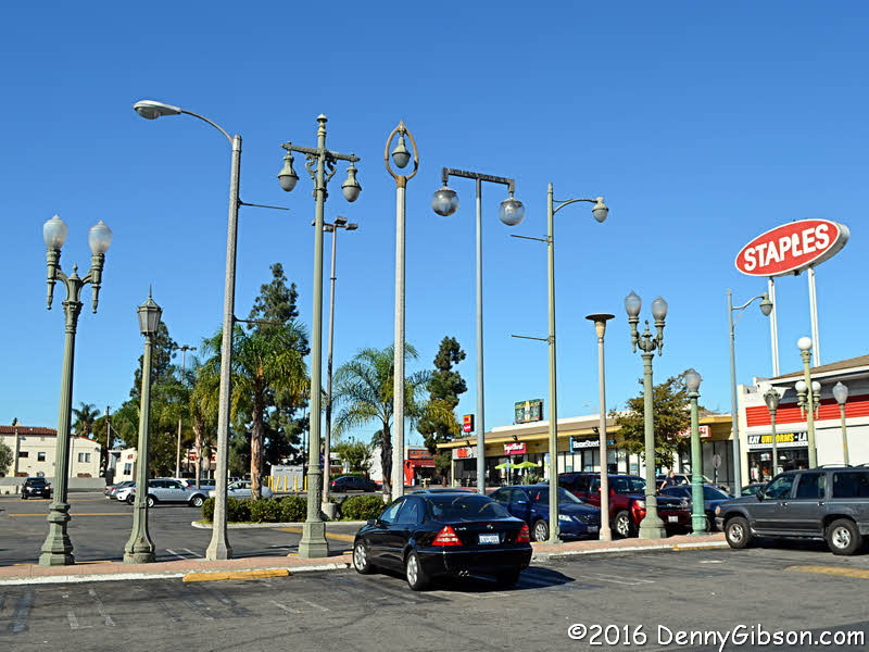
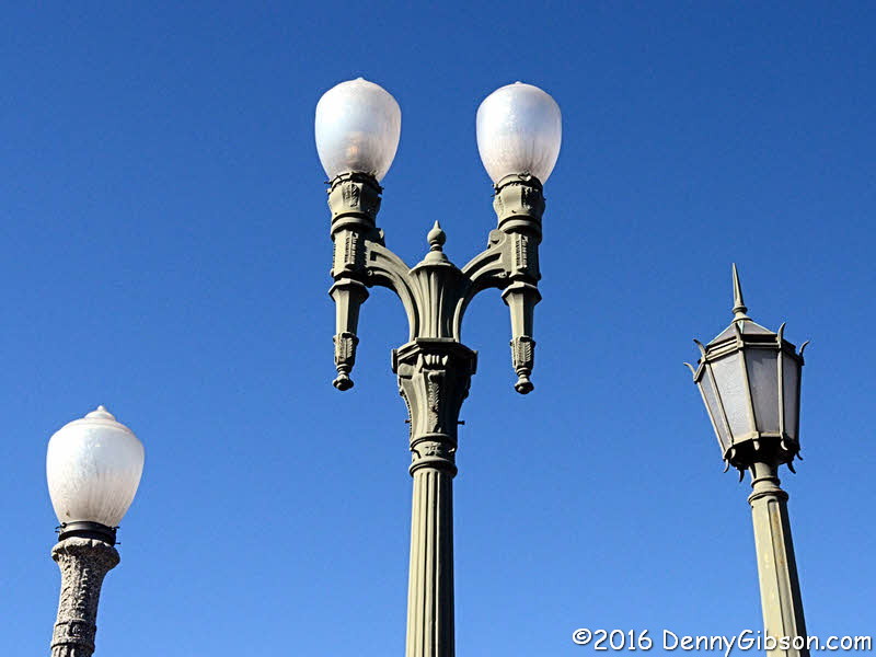 Back in 2012, I received a Scott Piotrowski personal tour of Los Angeles
Route 66 attractions. Telling me he had to pick up something at Staples,
he pulled into this lot and let me figure out that there was more to it
than office supplies. So when the
RoadsideAmerica GPS app announced a "Home for
Wayward Streetlights", I knew exactly what it meant.
Back in 2012, I received a Scott Piotrowski personal tour of Los Angeles
Route 66 attractions. Telling me he had to pick up something at Staples,
he pulled into this lot and let me figure out that there was more to it
than office supplies. So when the
RoadsideAmerica GPS app announced a "Home for
Wayward Streetlights", I knew exactly what it meant.
|
|
|
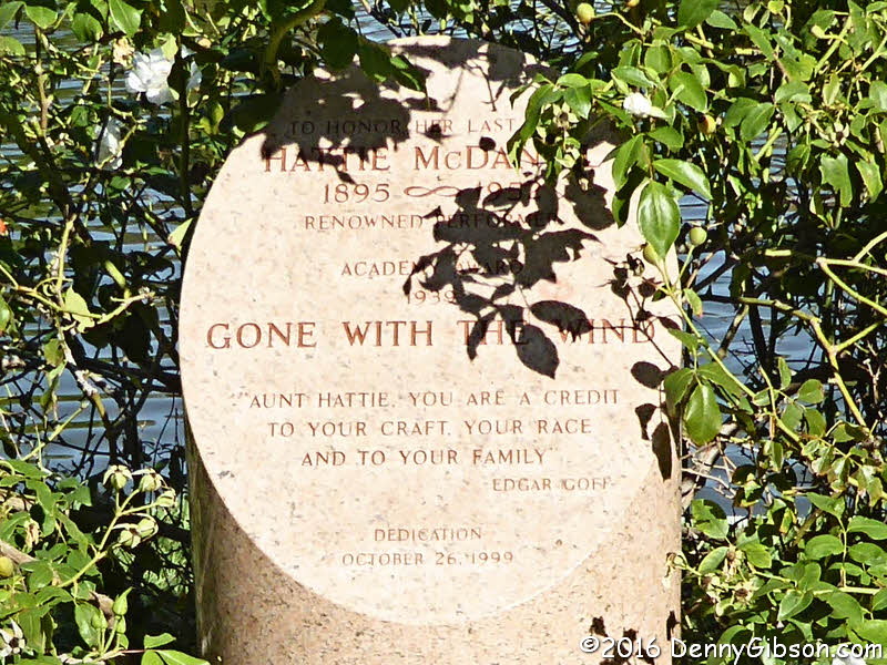
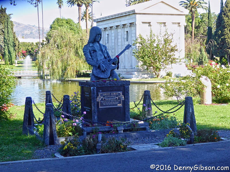 One of the world's most photogenic tombstones is on Historic Route 66. I
knew this was here and intended to stop but
RoadsideAmerica helped me out again. The white
cylinder on the right of the full size picture marks the grave of Hattie
McDaniel, the first African American to win an Oscar.
One of the world's most photogenic tombstones is on Historic Route 66. I
knew this was here and intended to stop but
RoadsideAmerica helped me out again. The white
cylinder on the right of the full size picture marks the grave of Hattie
McDaniel, the first African American to win an Oscar.
|
|
|
 US-66 officially ended here at Lincoln and Olympic throughout 1936 and
1964.
US-66 officially ended here at Lincoln and Olympic throughout 1936 and
1964.
Although I more or less intended to, I didn't make it onto the Santa Monica Pier. It wasn't because it was never the official end of US-66 although that fact meant the urgency wasn't there. It was because the parking lot at what has become the sentimental end of Route 66 was full. |
|
|
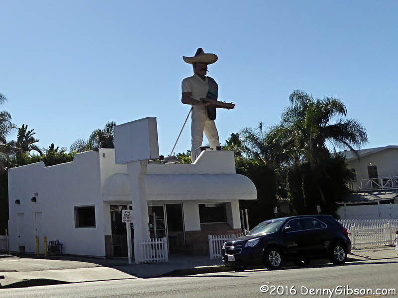 After cruising by the "LOT FULL" sign, I headed up the Pacific
Coast Highway and made it as far as
Salsa
Man in Malibu.
After cruising by the "LOT FULL" sign, I headed up the Pacific
Coast Highway and made it as far as
Salsa
Man in Malibu.
|
|
|
 Some of the folks at the Saga had visited
Will Rogers
State Historic Park yesterday and their reports piqued my interest. I
at first thought it was north of LA but eventually learned that it is a
few miles north of Santa Monica. When that's just where I found myself, I
got serious about locating the park and discovered I was about ten miles
to the east and turned around.
Some of the folks at the Saga had visited
Will Rogers
State Historic Park yesterday and their reports piqued my interest. I
at first thought it was north of LA but eventually learned that it is a
few miles north of Santa Monica. When that's just where I found myself, I
got serious about locating the park and discovered I was about ten miles
to the east and turned around.
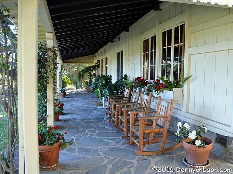
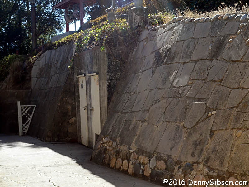
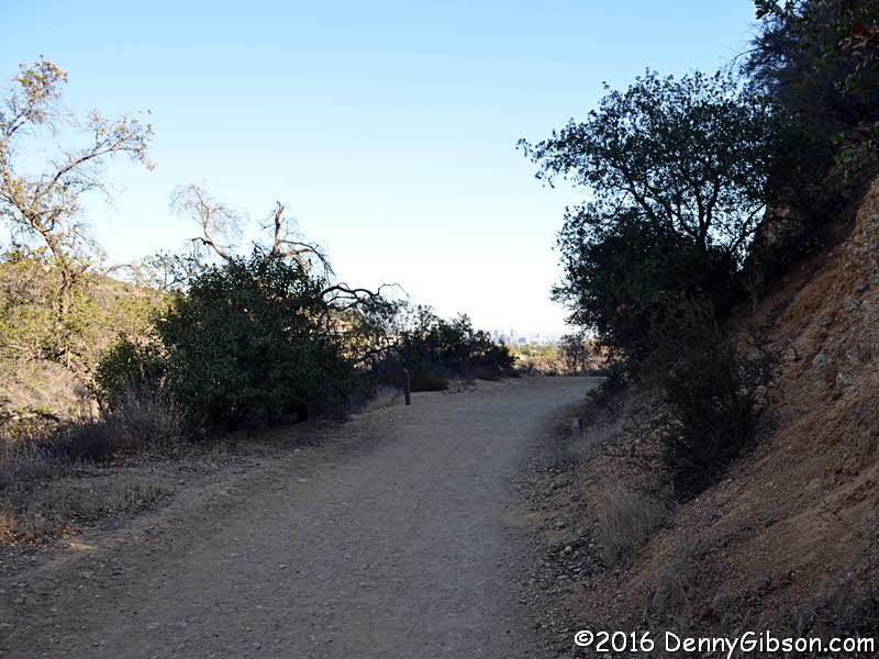
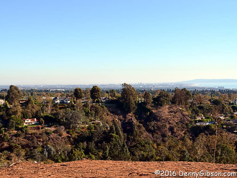
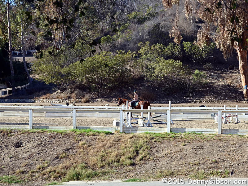
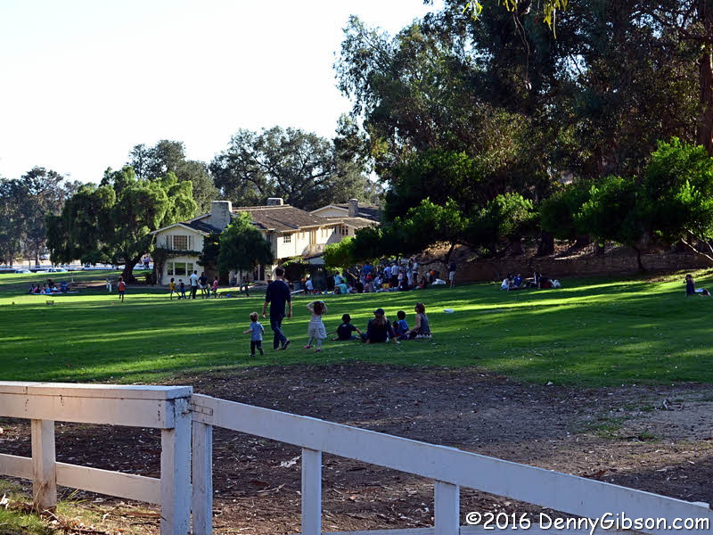
I arrived just in time to catch an introductory video before a tour of the house was set to begin. Between video and tour, I passed some eighty year old advice. The home contains all original furnishings but no photos are allowed. The guide mentioned that the retaining wall behind the house was faced with pieces of sidewalk removed when Wilshire Boulevard was widened so I got a picture of that after the tour. I planned on doing no hiking, didn't grab a map, then decided to check out Inspiration Point. I'm sure I didn't follow the easy path described and I'm not even sure I actually reached the Point but I did see some incredible views. Riding lessons were in process when I returned from my impromptu hike and some sort of picnic was going on in the large field next to the house. |
|
|
 Knowing I'd be in the area, I noted a recent
Retro Roadmap article on the Spadena House and drove
by it today. I did not pick any berries.
Knowing I'd be in the area, I noted a recent
Retro Roadmap article on the Spadena House and drove
by it today. I did not pick any berries.
|
|
|

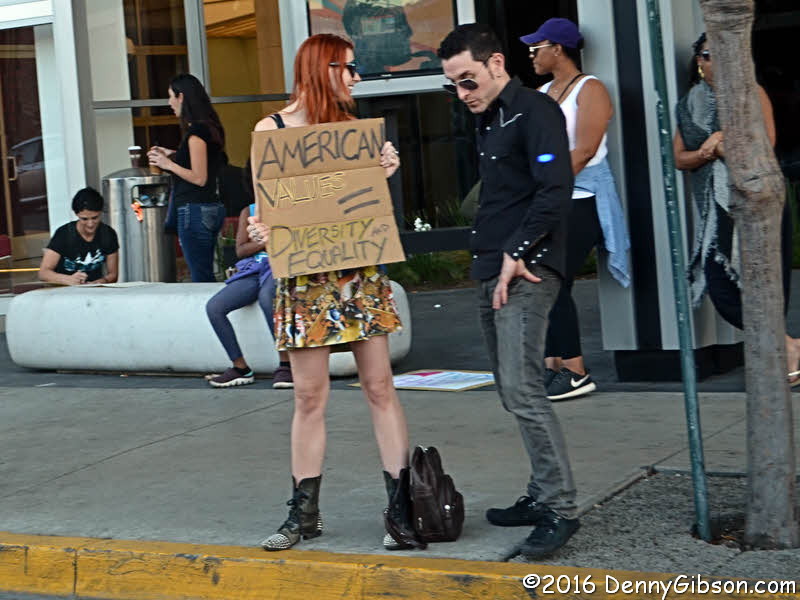
 I passed these protesters while driving east on Sunset Boulevard.
|
|
|
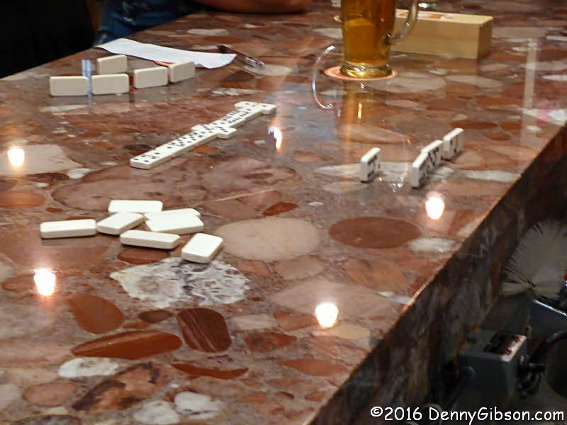

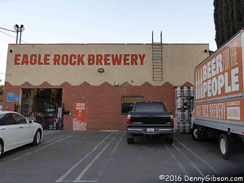 Scott Piotrowski is familiar with beer as well as Route 66 landmarks.
On his advice I did a little tasting at
Eagle Rock
Brewery. As I sipped one of their very nice beers, a three way domino
match broke out and any belief that I still remembered how to play the
game was instantly dashed.
Scott Piotrowski is familiar with beer as well as Route 66 landmarks.
On his advice I did a little tasting at
Eagle Rock
Brewery. As I sipped one of their very nice beers, a three way domino
match broke out and any belief that I still remembered how to play the
game was instantly dashed.
|
|
|
| [Prev] [Site Home] [Trip Home] [Contact] [Next] |