Side Trip
Comment via blog
Prev
Next


|
Day 8: August 3, 2014 Side Trip Comment via blog |
Prev Next |
|
|
|

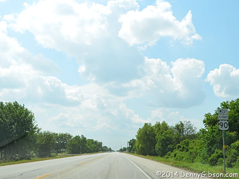
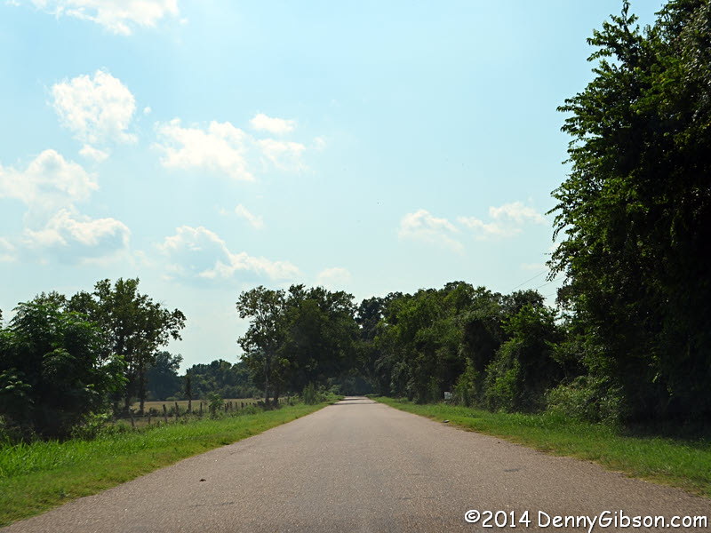
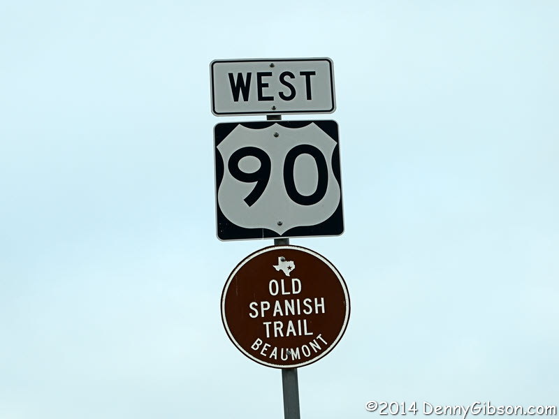 Inside the city of Beaumont, some of the US-90 signs are paired with Old
Spanish Trail signs. Outside of the city, US-90 provided a very pleasant
drive all the way to Houston.
Inside the city of Beaumont, some of the US-90 signs are paired with Old
Spanish Trail signs. Outside of the city, US-90 provided a very pleasant
drive all the way to Houston.
|
|
|

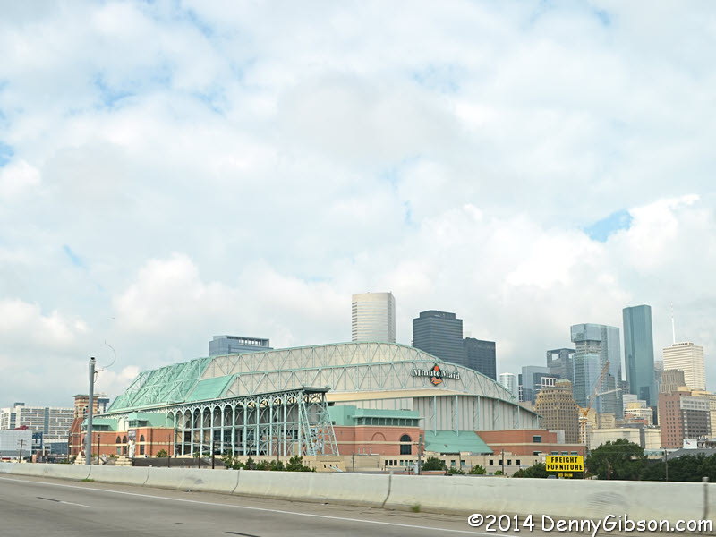
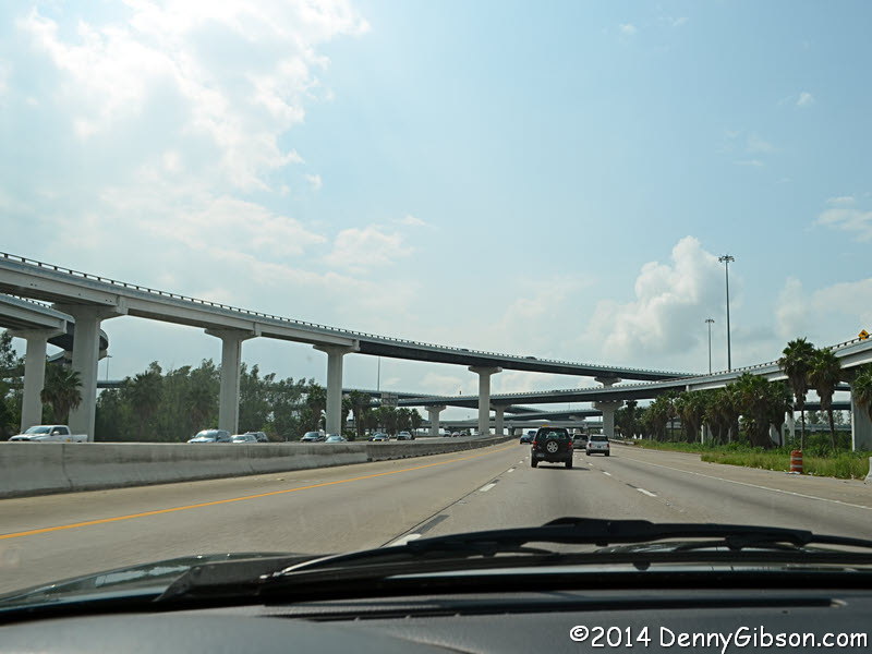 The drive became decidedly less pleasant as I neared Houston. As I
plotted my route, it was clear that little or none of the Old Spanish
Trail was intact in Houston so I planned a route that I thought would
connect the OST on the east side to the OST on the west side with minimal
pain. I also mentally filed away the fact that it was fairly close to
Galveston with the idea of a side trip if time allowed. Today, I decided
that time did allow and turned south on I-45. That's where the third
picture was taken. It isn't nearly the most complex set of crisscrossing
streets in Houston but it does provide a taste of the soaring over &
underpasses that seem to be everywhere. It also offers a glimpse of the
filled and crawling northbound lanes that made me wonder if I'd be able to
get back from Galveston once I got there.
The drive became decidedly less pleasant as I neared Houston. As I
plotted my route, it was clear that little or none of the Old Spanish
Trail was intact in Houston so I planned a route that I thought would
connect the OST on the east side to the OST on the west side with minimal
pain. I also mentally filed away the fact that it was fairly close to
Galveston with the idea of a side trip if time allowed. Today, I decided
that time did allow and turned south on I-45. That's where the third
picture was taken. It isn't nearly the most complex set of crisscrossing
streets in Houston but it does provide a taste of the soaring over &
underpasses that seem to be everywhere. It also offers a glimpse of the
filled and crawling northbound lanes that made me wonder if I'd be able to
get back from Galveston once I got there.
|
|
|
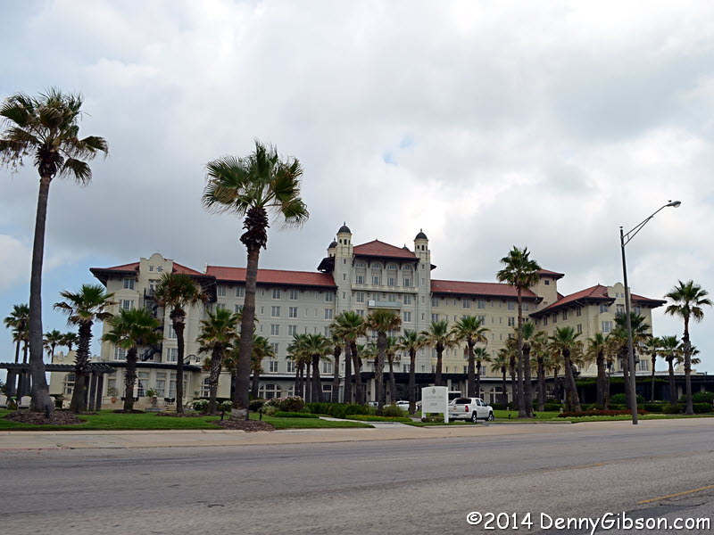
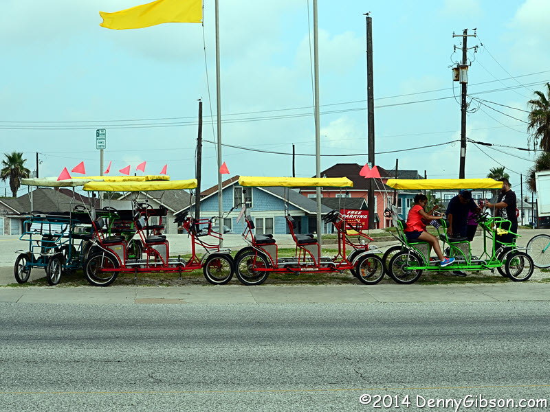

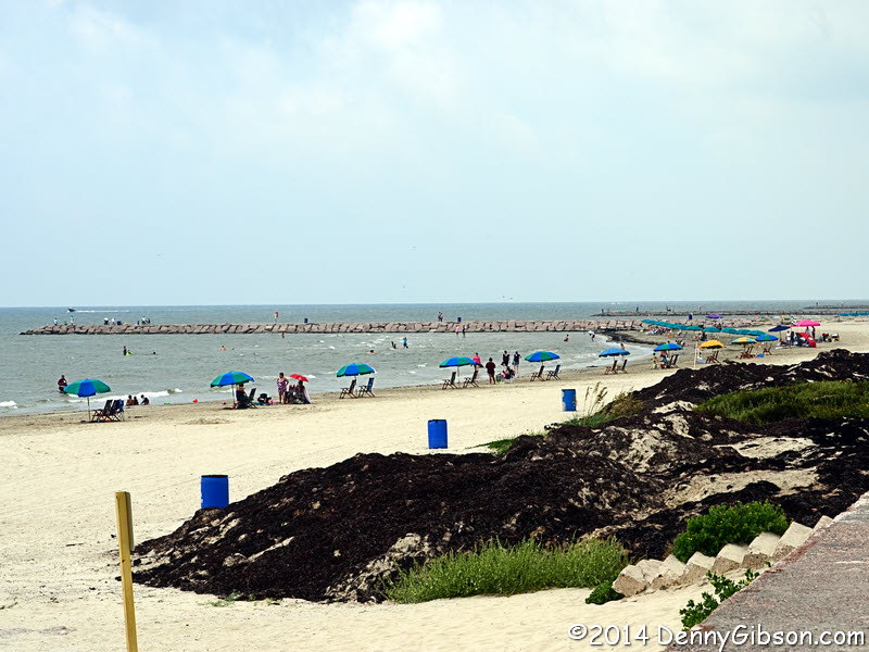
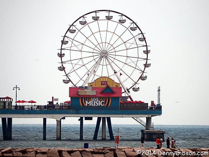
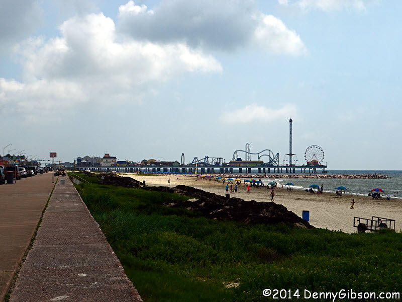 Of course big Galveston attractions are the beaches and
Pleasure Pier
and there are plenty of signs directing you there. There's also a lot
going on on the inland side of Seawall Boulevard which is where the
elegant and historic Hotel Galvez stands.
Of course big Galveston attractions are the beaches and
Pleasure Pier
and there are plenty of signs directing you there. There's also a lot
going on on the inland side of Seawall Boulevard which is where the
elegant and historic Hotel Galvez stands.
|
|
|


 There are not a bunch of signs pointing to this place. In fact, there may
not be any at all. I learned of it from a blog. Specifically from a blog
written by a pair of full time RVers named Chuck and Kate who call
themselves and their blog
The Wanderers. The Wanderers spend days and sometimes
weeks in the same location and sampling -- and reporting on -- much of
what an area has to offer. They both appreciate and understand food so
their reviews of restaurants are usually insightful and useful. Their
visit to Medicinal Purposes is
here and contains a lot more photos and information
than this little panel.
There are not a bunch of signs pointing to this place. In fact, there may
not be any at all. I learned of it from a blog. Specifically from a blog
written by a pair of full time RVers named Chuck and Kate who call
themselves and their blog
The Wanderers. The Wanderers spend days and sometimes
weeks in the same location and sampling -- and reporting on -- much of
what an area has to offer. They both appreciate and understand food so
their reviews of restaurants are usually insightful and useful. Their
visit to Medicinal Purposes is
here and contains a lot more photos and information
than this little panel.
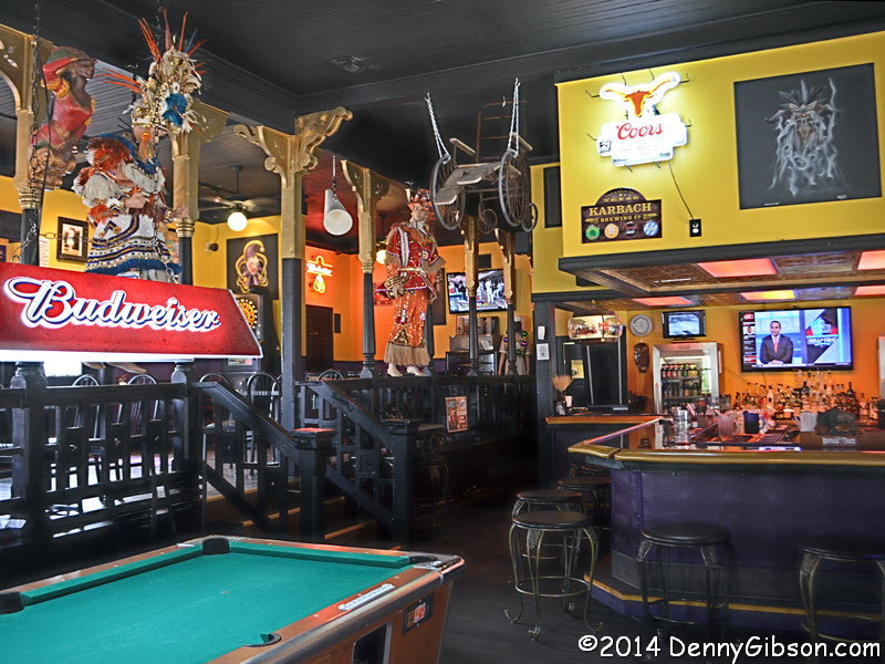
Medicinal Purposes is several blocks away from the beach but only about a block from the University of Texas Medical Branch. The distance from the beach skews its clientele slightly away from the touristy set and toward the locals. The nearness to the medical school provides the basis for the name and some ideas for the decor. What you see in the last picture is the day's special, the Islander. It's a 'burger with pineapple, bell peppers, and teriyaki sause that was almost, but not quite, as messy as it was tasty. |
|
|

 The main thing I know about Galveston is that it was the site of the 1900
hurricane that remains the deadliest natural disaster in United States
history. I also knew about the beaches, the fact that it contains a lot
of beautiful and historic homes, and, thanks to another
article from The Wanderers, the oak tree carvings
resulting from a more recent storm. Hurricane Ike damaged many of
Galveston's old oak trees when it hit Galveston in September of 2008.
Carving the broken off stumps into works of art didn't make up for the
loss of the trees but it did make the loss a little easier to take. I
didn't have time for a lot of exploration but I did want to see and
photograph some examples. Jennifer, the friendly bartender at Medicinal
Purposes who used to be a Segway tour guide, pointed me to a couple right
down the street. I further cheated by grabbing my house pictures at my
tree sculpture stops.
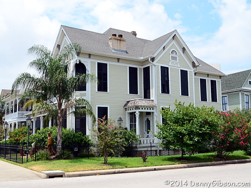
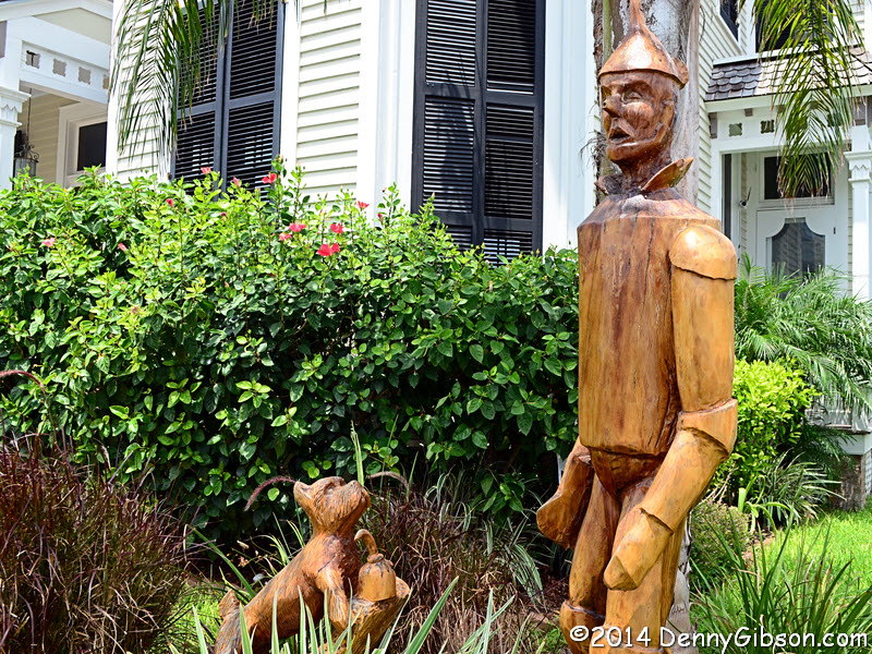
The main thing I know about Galveston is that it was the site of the 1900
hurricane that remains the deadliest natural disaster in United States
history. I also knew about the beaches, the fact that it contains a lot
of beautiful and historic homes, and, thanks to another
article from The Wanderers, the oak tree carvings
resulting from a more recent storm. Hurricane Ike damaged many of
Galveston's old oak trees when it hit Galveston in September of 2008.
Carving the broken off stumps into works of art didn't make up for the
loss of the trees but it did make the loss a little easier to take. I
didn't have time for a lot of exploration but I did want to see and
photograph some examples. Jennifer, the friendly bartender at Medicinal
Purposes who used to be a Segway tour guide, pointed me to a couple right
down the street. I further cheated by grabbing my house pictures at my
tree sculpture stops.
The first honors teachers and is on a children's playground. The house in the picture is directly behind it. Toto and the Tin Man are in front of film director King Vidor's childhood home. Vidor's long list of accomplishments includes the black and white portion of The Wizard of Oz. I've pointed to Wanderers' posts on the restaurant and the carvings. Other articles on Galveston and similar articles on other locations can be found on their website with a little searching. Though I think this is the first time I've been able to directly use something I've read there, I really do enjoy reading The Wanderers and I certainly recommend it. |
|
|

 I returned to the expressways and reached the welcoming emptiness of
two-lane US-90 west of Houston only after verifying that the city is one
of the worst places to drive in the nation.
I returned to the expressways and reached the welcoming emptiness of
two-lane US-90 west of Houston only after verifying that the city is one
of the worst places to drive in the nation.
|
|
|

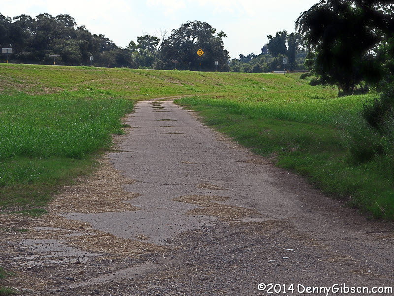
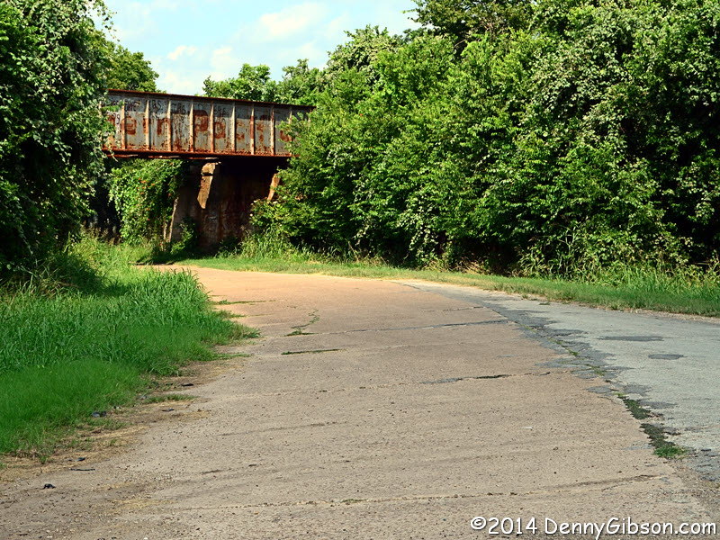
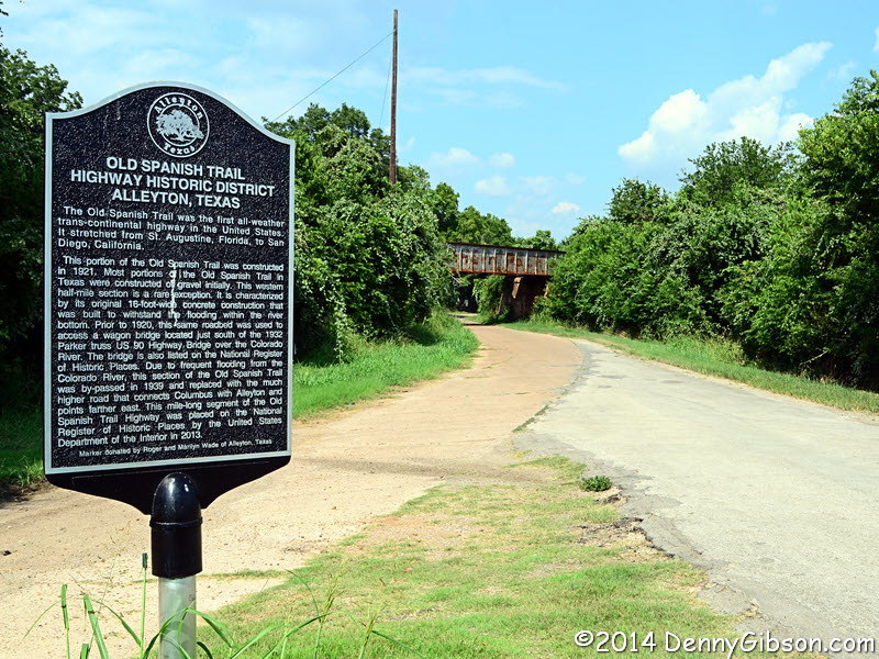

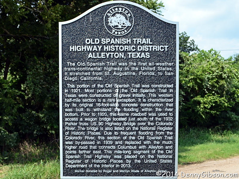
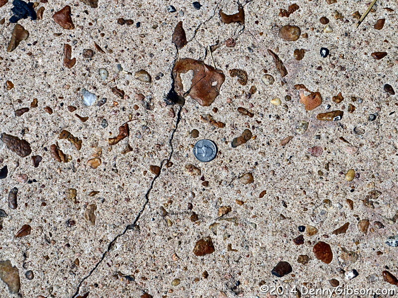
 As the driving day ended, a sign made an interesting stretch of road even
more so. I included the road because modern maps identify it as Old US 90.
The sign appeared just before the Old 90 rejoined current 90. A readable
version is here and it can actually be seen
beyond the underpass in the second photo. It explains that the road was
paved in 1921 as part of the Old Spanish Trail. The size of 1921 paving
gravel can be seen here. To the west, the
old pavement fades into the grass but once led to the 1932 bridge shown in
the last picture and mentioned on the sign.
As the driving day ended, a sign made an interesting stretch of road even
more so. I included the road because modern maps identify it as Old US 90.
The sign appeared just before the Old 90 rejoined current 90. A readable
version is here and it can actually be seen
beyond the underpass in the second photo. It explains that the road was
paved in 1921 as part of the Old Spanish Trail. The size of 1921 paving
gravel can be seen here. To the west, the
old pavement fades into the grass but once led to the 1932 bridge shown in
the last picture and mentioned on the sign.
|
|
|
| [Prev] [Site Home] [Trip Home] [Contact] [Next] |