Heading West
Prev
Next
|
Day 3: June 16, 2007 Heading West |
Prev Next |
|
|
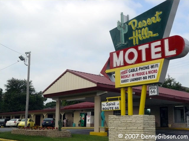 Before I left what has been my home for the last two night, I took a shot
of the sign in the daylight along with some of my
room. I also got to meet the owner, Jack. I'd spoken with him on the
phone but he was out when I checked in. Jack is one of the surprisingly
few motel owners who appreciates the historic road running by his door.
Before I left what has been my home for the last two night, I took a shot
of the sign in the daylight along with some of my
room. I also got to meet the owner, Jack. I'd spoken with him on the
phone but he was out when I checked in. Jack is one of the surprisingly
few motel owners who appreciates the historic road running by his door.
|
|
|
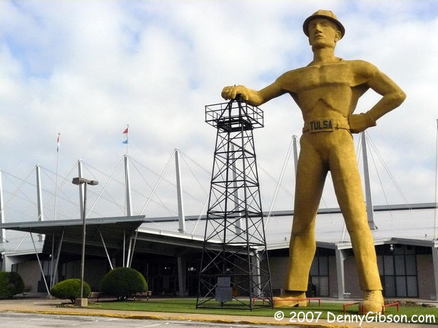
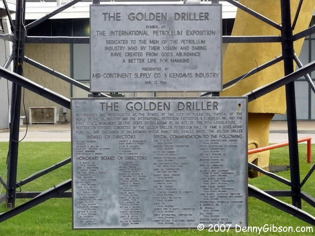 My first stop was to get a picture of the
Golden Driller at the
fairgrounds. We had been by here Thursday evening but it had started to
rain so this is kind of a "make up" shot. The Driller was erected in 1966
for the National Petroleum Exposition. I understand that this is not the
original Driller but I'm not sure that really matters. The building behind
him is described as having "world's largest unobstructed interior volume".
The roof is suspended from those tall poles so there are no obstructions
inside.
My first stop was to get a picture of the
Golden Driller at the
fairgrounds. We had been by here Thursday evening but it had started to
rain so this is kind of a "make up" shot. The Driller was erected in 1966
for the National Petroleum Exposition. I understand that this is not the
original Driller but I'm not sure that really matters. The building behind
him is described as having "world's largest unobstructed interior volume".
The roof is suspended from those tall poles so there are no obstructions
inside.
|
|
|
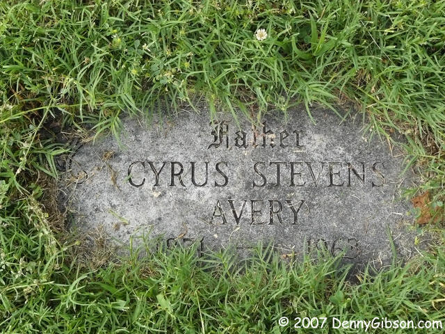 Then I headed just a bit north to the original alignment of US-66 and the
grave of Cyrus Avery, the "Father of the Mother Road". The grave is in
Rose Hill Cemetery and is actually not far from that first Sixty-Six
alignment. If the cemetery office is open, they can provide some help in
finding the general location and even a cemetery map. I've put a little
help of my own here
Then I headed just a bit north to the original alignment of US-66 and the
grave of Cyrus Avery, the "Father of the Mother Road". The grave is in
Rose Hill Cemetery and is actually not far from that first Sixty-Six
alignment. If the cemetery office is open, they can provide some help in
finding the general location and even a cemetery map. I've put a little
help of my own here
|
|
|
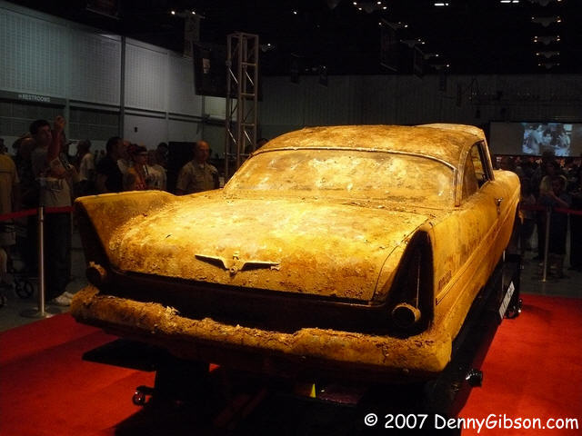
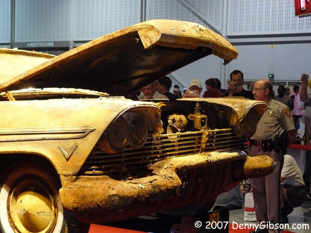
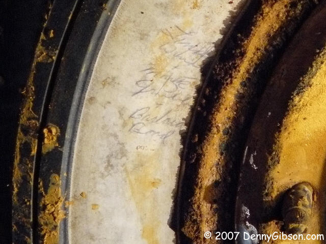 I continued west on the old alignment (Admiral) and soon found myself near
downtown Tulsa. It was a few minutes after 10:00 - opening time for the
car show - and I decided I could spare a few minutes to get a closer few
of Miss Belvedere. She's certainly no prettier up close but those signatures
on the white walls are rather impressive. In one of the film clips shown
last night, a couple of no longer young boys remembered writing their
names on the tires with a fairly new invention - a ballpoint pen. That
1957 ink must have been some pretty good stuff.
I continued west on the old alignment (Admiral) and soon found myself near
downtown Tulsa. It was a few minutes after 10:00 - opening time for the
car show - and I decided I could spare a few minutes to get a closer few
of Miss Belvedere. She's certainly no prettier up close but those signatures
on the white walls are rather impressive. In one of the film clips shown
last night, a couple of no longer young boys remembered writing their
names on the tires with a fairly new invention - a ballpoint pen. That
1957 ink must have been some pretty good stuff.
|
|
|

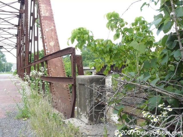

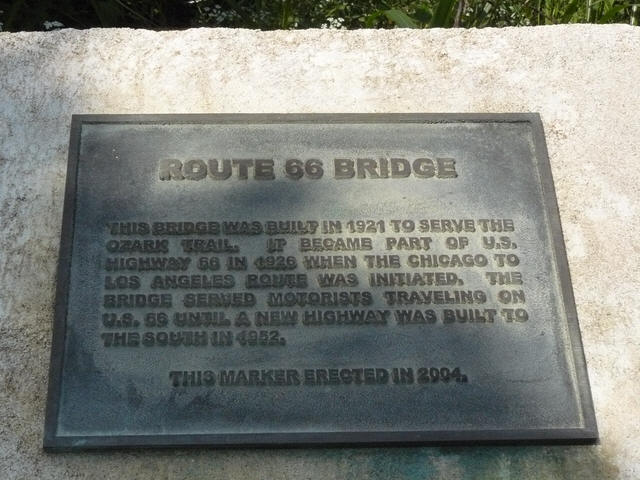
 Everyone can breathe a sigh of relief as I've made it out of Tulsa and
they will be no more Miss Belvedere photos. These pictures are on an old
Sixty-Six alignment which was the Ozark Trail before that. It's just a bit
west of Sapulpa. The EZ66 Guide says the bridge was built in 1925 but a nearby
plaque and Jim Ross' Oklahoma Route 66
say 1921. I imagine Jerry accidentally used the date from the railroad
overpass in the last picture. The bridge has been bumped a few times and
one of its cement guard rails has been reduced to cables but it still works.
But it doesn't have to work quite as hard as it did for its first
thirty-one years. This was the primary route through here until 1951.
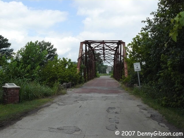
Everyone can breathe a sigh of relief as I've made it out of Tulsa and
they will be no more Miss Belvedere photos. These pictures are on an old
Sixty-Six alignment which was the Ozark Trail before that. It's just a bit
west of Sapulpa. The EZ66 Guide says the bridge was built in 1925 but a nearby
plaque and Jim Ross' Oklahoma Route 66
say 1921. I imagine Jerry accidentally used the date from the railroad
overpass in the last picture. The bridge has been bumped a few times and
one of its cement guard rails has been reduced to cables but it still works.
But it doesn't have to work quite as hard as it did for its first
thirty-one years. This was the primary route through here until 1951.
|
|
|

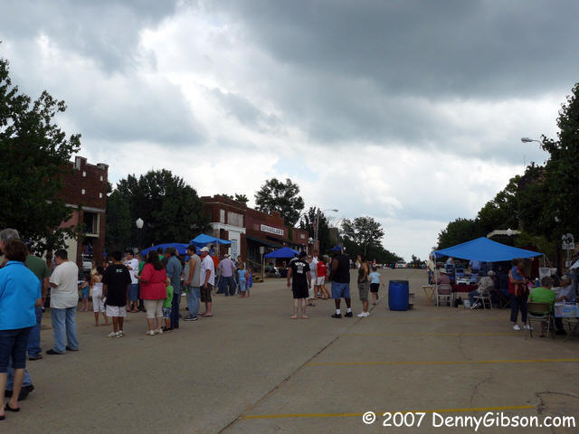
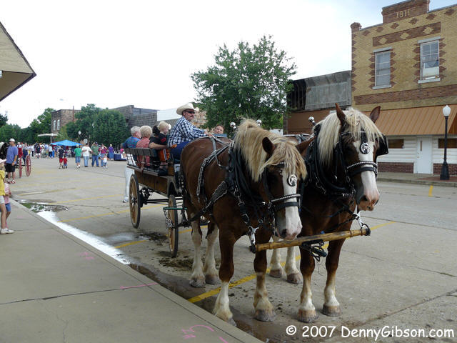
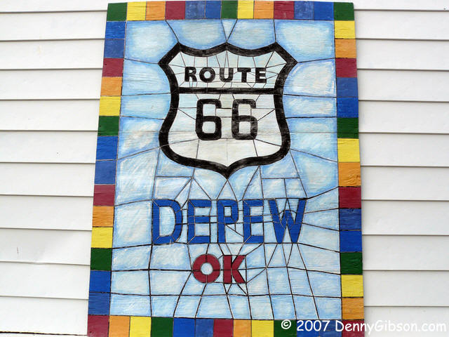 I intended to make the jog through Depew that Sixty-Six did during its
first few years but figured I'd have to do it on my own. Not necessary as
an Historic 66 sign points the way and Sixty-Six shields have been painted
on the pavement. But, despite plans & painting, I did not drive the old
alignment. I drove it into and out of town but the Main Street segment was
blocked off for the first ever Patchwork Day. The local historical society,
apparently only a year or so old itself, put the event together as a fund
raiser. It's great to see this place showing its pride and I hope they did
well.
I intended to make the jog through Depew that Sixty-Six did during its
first few years but figured I'd have to do it on my own. Not necessary as
an Historic 66 sign points the way and Sixty-Six shields have been painted
on the pavement. But, despite plans & painting, I did not drive the old
alignment. I drove it into and out of town but the Main Street segment was
blocked off for the first ever Patchwork Day. The local historical society,
apparently only a year or so old itself, put the event together as a fund
raiser. It's great to see this place showing its pride and I hope they did
well.
I only recently learned that the town of Depew was named for Chauncey Depew but I have long been an admirer of Chauncey for this quote: "I get my exercise acting as a pallbearer for my friends who exercise." Chauncey died at 94. |
|
|

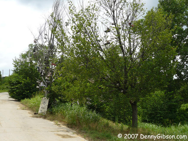 This is the Shoe Tree, actually two trees, east of Stroud. The old loop of
Sixty-Six that it is on is private property. It seems the current owner
leaves the old road open but there's nothing guaranteeing it will always be that
way. Be nice.
This is the Shoe Tree, actually two trees, east of Stroud. The old loop of
Sixty-Six that it is on is private property. It seems the current owner
leaves the old road open but there's nothing guaranteeing it will always be that
way. Be nice.
|
|
|

 Today I ate at the Rock Cafe for the second time and for the second time
did not meet Dawn. In 2003 I met her husband but Dawn was napping. Today,
the gal doing the cooking and, it seemed to me, sort of in control didn't
quite look like the picture or two I've seen but I made a fool of myself
by asking anyway. Nope, Dawn wasn't there so meeting her is still on my
"next time" list. The Cafe is clearly benefiting from the
Cars connection.
Today I ate at the Rock Cafe for the second time and for the second time
did not meet Dawn. In 2003 I met her husband but Dawn was napping. Today,
the gal doing the cooking and, it seemed to me, sort of in control didn't
quite look like the picture or two I've seen but I made a fool of myself
by asking anyway. Nope, Dawn wasn't there so meeting her is still on my
"next time" list. The Cafe is clearly benefiting from the
Cars connection.
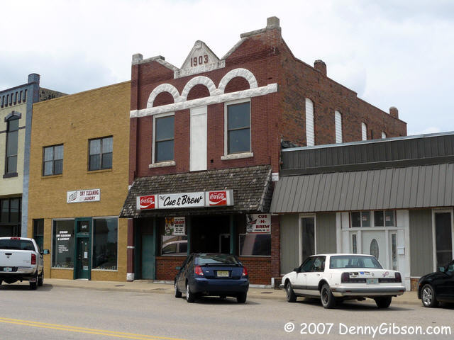
I again stopped at the Cue & Brew and again took a picture. Not much has changed there and the beer was still cold. |
|
|
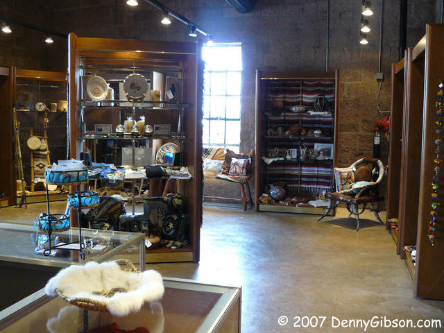
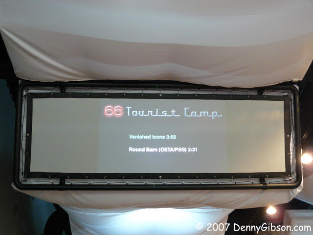
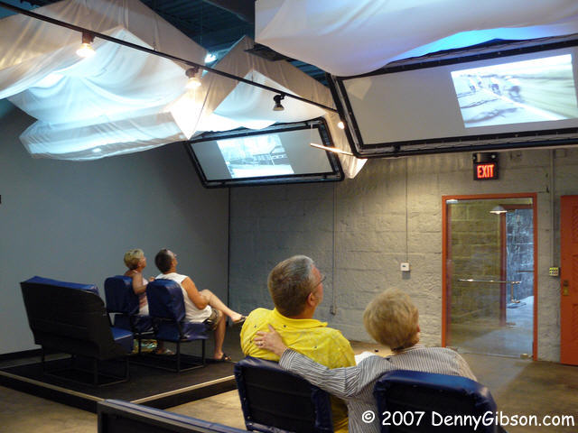
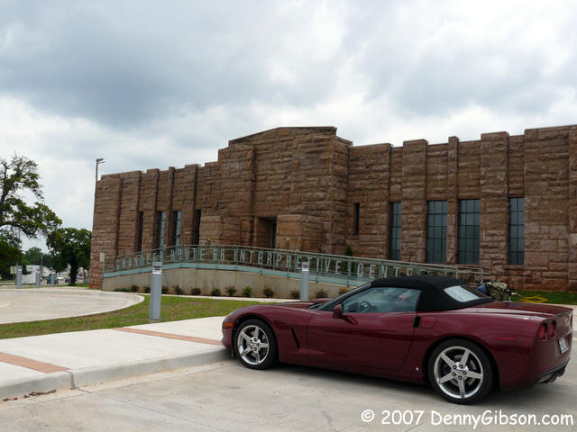 A Route
66 Interpretive Center opened in the old Chandler armory just weeks
ago. Inside the center, six video screens hang from the ceiling; Each
controlled by its own touch screen. Seating at the screens is intended to
invoke some aspect of the road. Three represent cars (Ford Model T,
WWII era Jeep, & Ford Mustang) and their screens represent windshields.
The others are bed like platforms representing
the many motels along Sixty-Six and their screens represent TV screens. Most
of the stations had two video choices. One was new and produced specifically
for the center. Scripts for all of these were written by Jim Ross. The second
choice was often a PBS offering from the recent past. I think all the videos
were in the 2 or 3 minute range. The
touch screens, reachable from car seat or bed, are used to select and start the videos. A seventh screen is
wall mounted with a theater like setting using seats from an old Chandler movie
theater. I understand that a specially prepared video is in the works for
this but today it was playing the "Oklahoma Rising" video that promotes
the state's centennial. The gift shop is pretty classy with a few trinket/souvenir
things but a lot more regional art/craft things.
A Route
66 Interpretive Center opened in the old Chandler armory just weeks
ago. Inside the center, six video screens hang from the ceiling; Each
controlled by its own touch screen. Seating at the screens is intended to
invoke some aspect of the road. Three represent cars (Ford Model T,
WWII era Jeep, & Ford Mustang) and their screens represent windshields.
The others are bed like platforms representing
the many motels along Sixty-Six and their screens represent TV screens. Most
of the stations had two video choices. One was new and produced specifically
for the center. Scripts for all of these were written by Jim Ross. The second
choice was often a PBS offering from the recent past. I think all the videos
were in the 2 or 3 minute range. The
touch screens, reachable from car seat or bed, are used to select and start the videos. A seventh screen is
wall mounted with a theater like setting using seats from an old Chandler movie
theater. I understand that a specially prepared video is in the works for
this but today it was playing the "Oklahoma Rising" video that promotes
the state's centennial. The gift shop is pretty classy with a few trinket/souvenir
things but a lot more regional art/craft things.
The only technical problems were low batteries on a couple of the touch screen units. This will be solved over time by additional batteries but the fact that they are seeing enough use to run them down during a day is probably a good sign. The center isn't really all that interactive. The touch screens serve as remote controls for DVDs with two scene selections each. But that's probably about the right level of complexity for this sort of facility and I'm sure that two videos per station is just the opening bid. The available material is sure to grow. Chandler is rising. |
|
|
 Seaba Station was closed when I stopped but I hope to see the Prestons in Clinton.
|
|
|

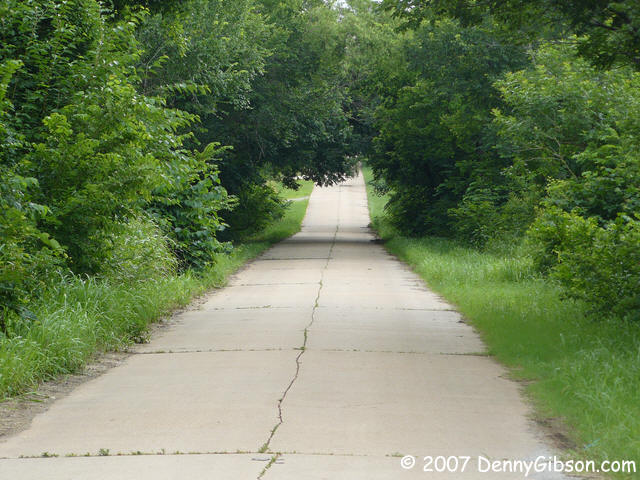
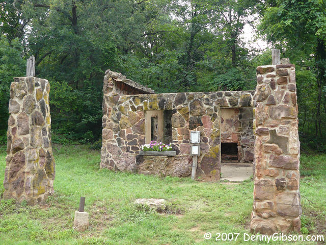
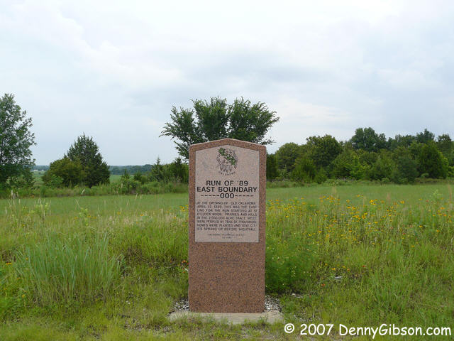 A few items just east of Arcadia. The stone marks the eastern side of the
1889 Oklahoma Land Run. The ruins are of a gas station from the 1920s and
'30s. Someone is keeping it clean and tending the flowers. The road is
a long ago bypassed Portland Cement section of the original US 66 alignment
and the house is Jim Ross' gas station inspired home on that bypassed alignment.
A few items just east of Arcadia. The stone marks the eastern side of the
1889 Oklahoma Land Run. The ruins are of a gas station from the 1920s and
'30s. Someone is keeping it clean and tending the flowers. The road is
a long ago bypassed Portland Cement section of the original US 66 alignment
and the house is Jim Ross' gas station inspired home on that bypassed alignment.
|
|
|
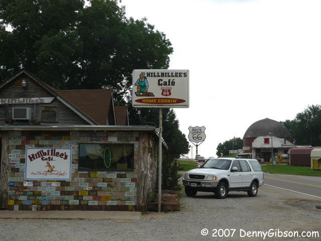
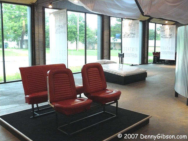
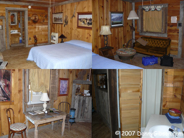
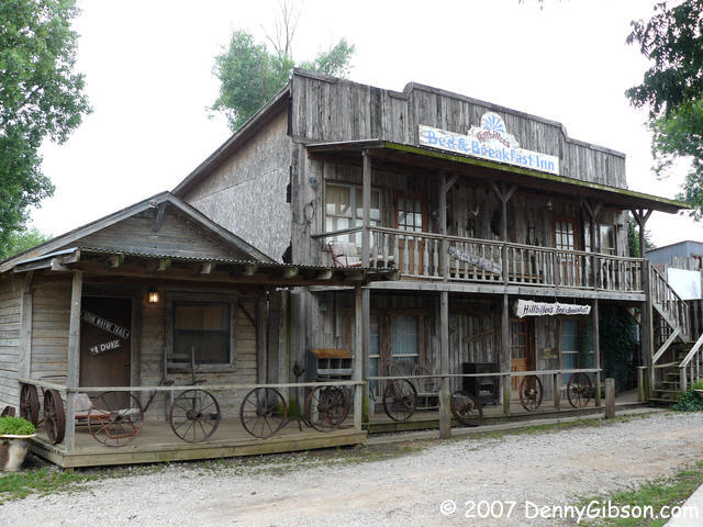 In Arcadia, my home is Hillbillee's Hotel
with that big round barn in sight across the road. I'm staying in The Duke
which is right behind the restaurant and looks like
this inside.
In Arcadia, my home is Hillbillee's Hotel
with that big round barn in sight across the road. I'm staying in The Duke
which is right behind the restaurant and looks like
this inside.
|
|
|
| [Prev] [Site Home] [Trip Home] [Contact] [Next] |