To Mexico -- Almost
Prev
Next


|
Day 9: December 27, 2009 To Mexico -- Almost |
Prev Next |
|
|
|
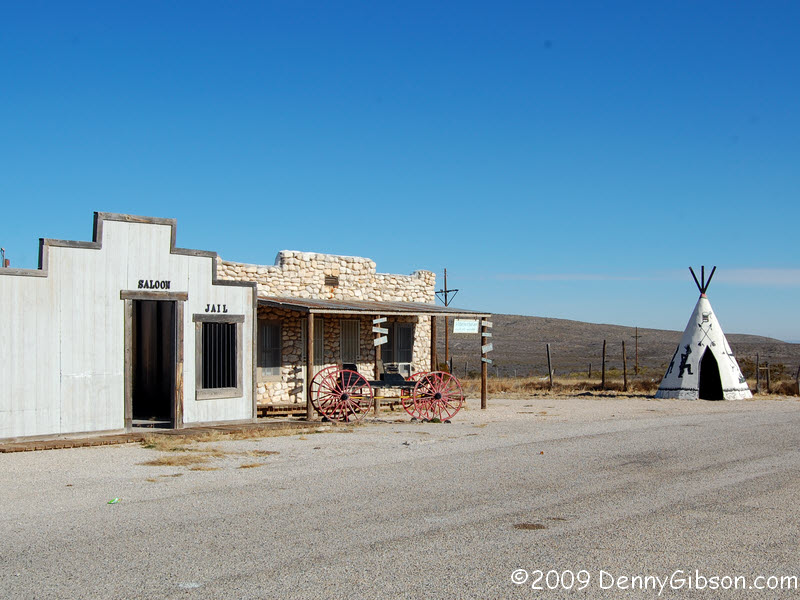
 The Apache Canyon Trading Post is just a short distance north of Whites
City. I don't know if it's an ex-business or maybe just closed for the
season.
The Apache Canyon Trading Post is just a short distance north of Whites
City. I don't know if it's an ex-business or maybe just closed for the
season.
|
|
|

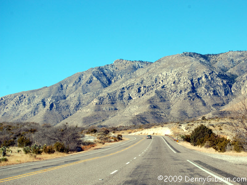 This entrance into Texas is a little fancier than the one from Oklahoma
and the scenery just beyond it is a bit more dramatic.
This entrance into Texas is a little fancier than the one from Oklahoma
and the scenery just beyond it is a bit more dramatic.
|
|
|

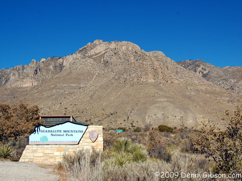
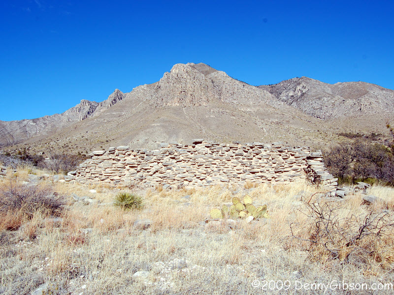
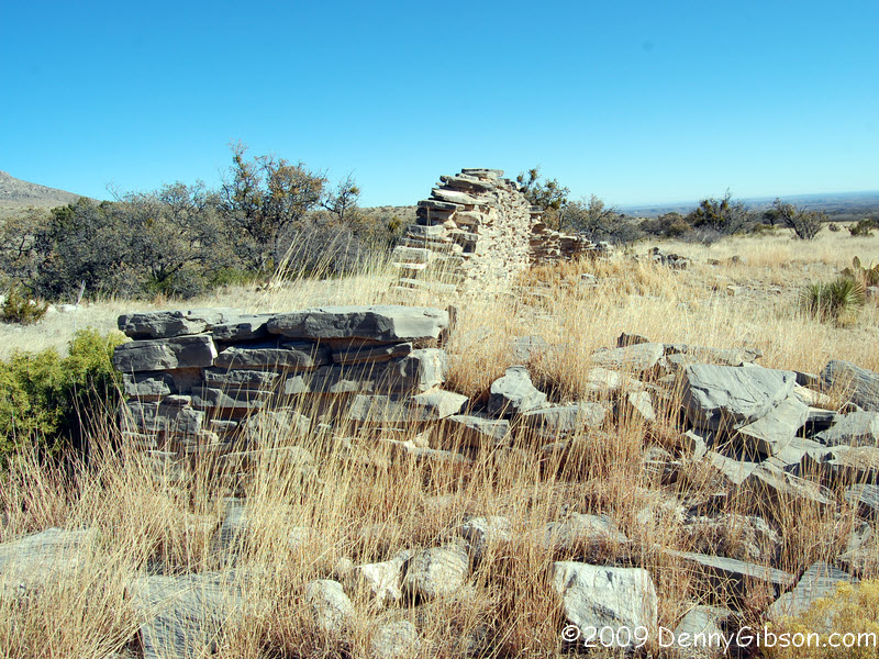
 Just before the entrance to the visitors center at
Guadalupe
Mountains National Park there is a parking lot with easy access to the
ruins of the highest station on the Butterfield Overland Mail route. As
explained by the marker on the right, the station was built in 1858 and
abandoned in 1859 when the route was moved. The marker on the left tells
of another marker placed atop Guadalupe Peak on the centennial of the
first transcontinental St Louis to San Francisco mail run in 1858. That
mountain top marker was placed by American Airlines who
had pioneered transcontinental delivery of mail by air. American Airlines
got its start in 1929 at Lunken Field in Cincinnati, OH.
Just before the entrance to the visitors center at
Guadalupe
Mountains National Park there is a parking lot with easy access to the
ruins of the highest station on the Butterfield Overland Mail route. As
explained by the marker on the right, the station was built in 1858 and
abandoned in 1859 when the route was moved. The marker on the left tells
of another marker placed atop Guadalupe Peak on the centennial of the
first transcontinental St Louis to San Francisco mail run in 1858. That
mountain top marker was placed by American Airlines who
had pioneered transcontinental delivery of mail by air. American Airlines
got its start in 1929 at Lunken Field in Cincinnati, OH.
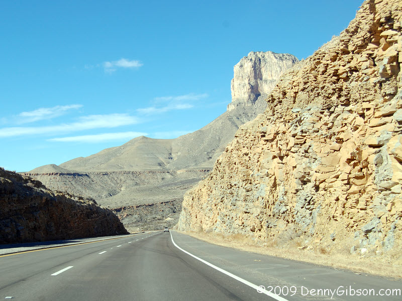
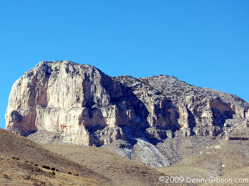
When I took the pictures of the station wall and the park entrance sign, I guessed that the mountain behind them was Guadalupe Peak. A ranger at the visitors center told me that it is Hunters Peak. Guadalupe Peak, the highest point in Texas, can be seen to the right of El Capitan in this picture. US-62 winds its way through some spectacular scenery. |
|
|
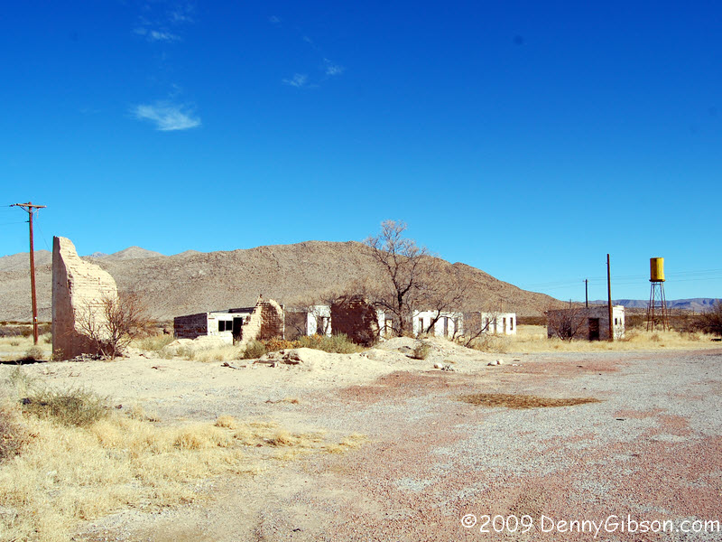
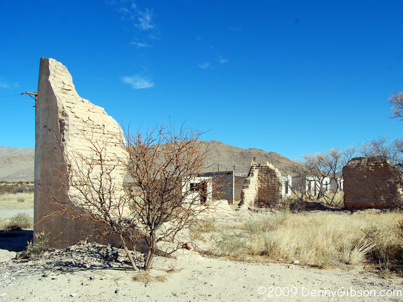
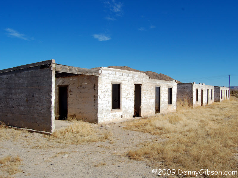
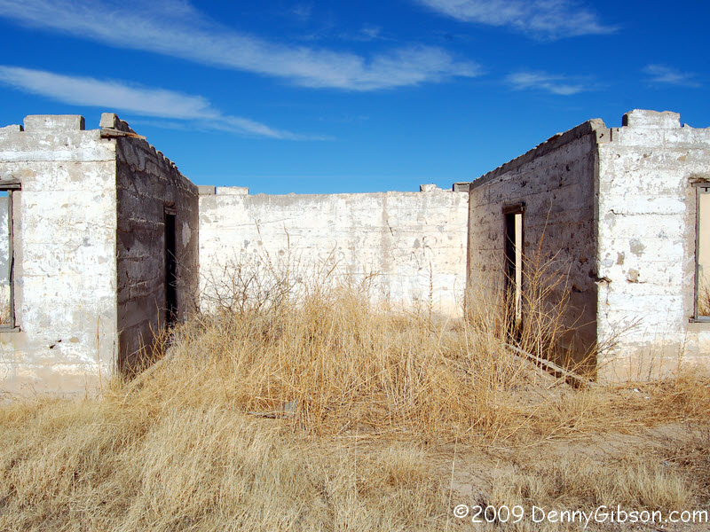
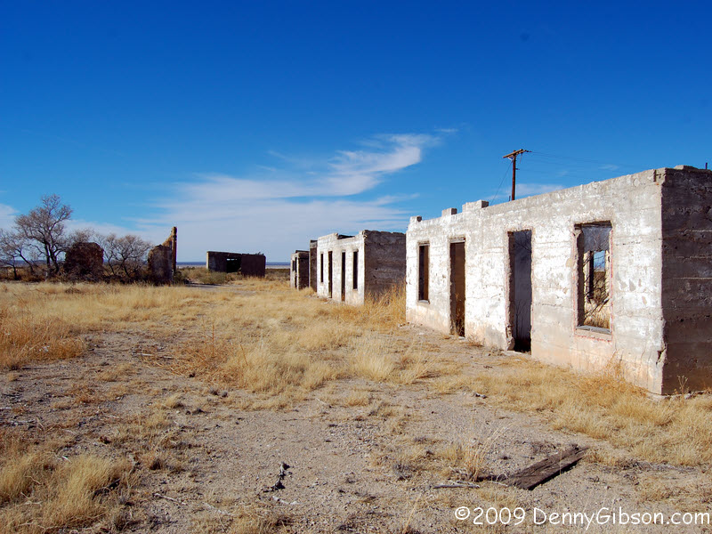 This cluster of what once were buildings is about fourteen miles from the
Guadalupe Mountains National Park visitors center; just over the Hudspeth
County line. With its own water tower, it might be considered a small
town, although baby water towers aren't uncommon around here. Near one end
are remnants of what I'm pretty sure are adobe walls. At there other end,
there are buildings that clearly were once held motel rooms. There were
restrooms in the building in front of them and there is another small
building of unknown use beside them. At the west end, beyond the adobe
walls, there is a building with a lube pit in front
of that was most likely a service station. On a discard pile to the east
is what surely must be a base for gas pumps.
Three buildings hold two rooms each. There is a single car garage at each
end with doubles between the buildings. I think I learned a lot about this
little grouping in the few minutes I was there but, oh, what a list of
unanswered questions I compiled.
This cluster of what once were buildings is about fourteen miles from the
Guadalupe Mountains National Park visitors center; just over the Hudspeth
County line. With its own water tower, it might be considered a small
town, although baby water towers aren't uncommon around here. Near one end
are remnants of what I'm pretty sure are adobe walls. At there other end,
there are buildings that clearly were once held motel rooms. There were
restrooms in the building in front of them and there is another small
building of unknown use beside them. At the west end, beyond the adobe
walls, there is a building with a lube pit in front
of that was most likely a service station. On a discard pile to the east
is what surely must be a base for gas pumps.
Three buildings hold two rooms each. There is a single car garage at each
end with doubles between the buildings. I think I learned a lot about this
little grouping in the few minutes I was there but, oh, what a list of
unanswered questions I compiled.
|
|
|
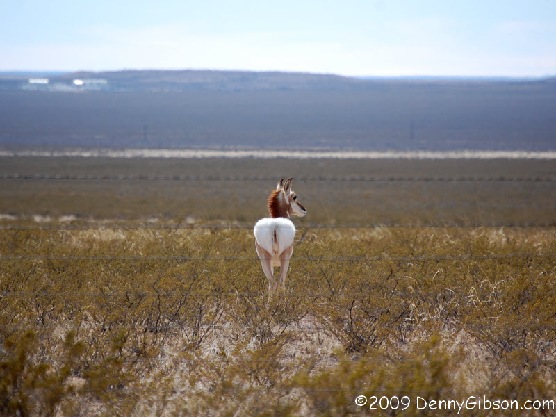
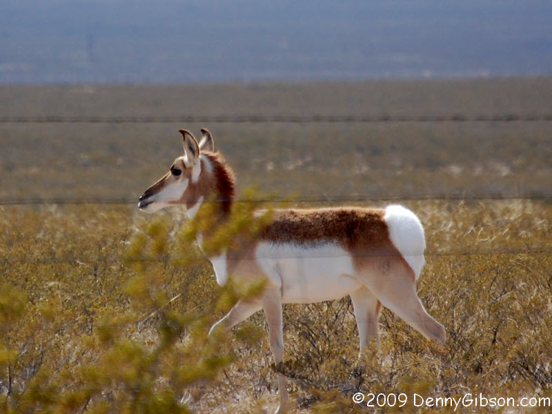
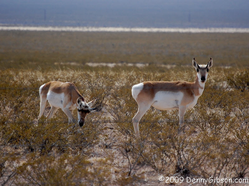
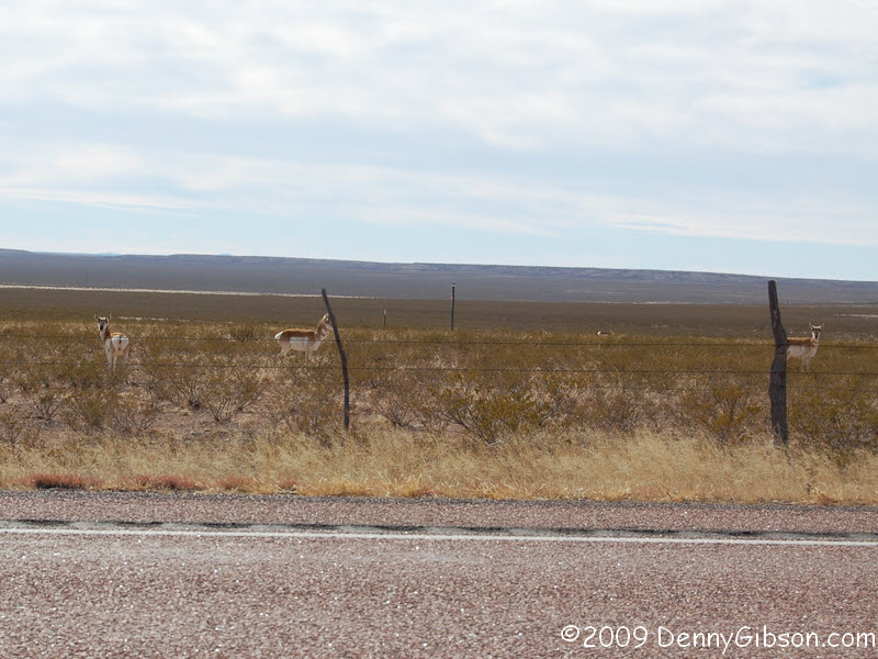 Whatever these are, there were about a dozen of them grazing not far from
the road when I saw them. They eyed me when I pulled over but didn't seem
particularly alarmed. The biggest reaction I got was one of the animals
turning its bright white rump to me and walking slowly away. Mule deer,
roe deer, and white tailed deer all seem possibilities but none quite
match completely. I'd welcome an ID from any naturalist reading this.
Whatever these are, there were about a dozen of them grazing not far from
the road when I saw them. They eyed me when I pulled over but didn't seem
particularly alarmed. The biggest reaction I got was one of the animals
turning its bright white rump to me and walking slowly away. Mule deer,
roe deer, and white tailed deer all seem possibilities but none quite
match completely. I'd welcome an ID from any naturalist reading this.
ADDENDUM: Dec 28, 2009 - Two readers have identified these as pronghorn antelope and online photos sure look like a match. Thanks go to Dave Reese & Baby Boomer Bob. |
|
|


 I followed US-62 into downtown El Paso but didn't make the final turn
toward the border. That leaves about a half mile uncovered and I've
decided that's acceptable. I never intended to drive into Mexico, as I did
with Canada at US-62's other end, but I did think I might walk over to
Ciudad Juárez as I once did with Tijuana. That just doesn't seem prudent.
References to the high levels of violence are plentiful and locals have
advised against it. A recent
El Paso Times article compares the murder rate to Miami's
"highest in the world" rate of the 1980s and Juárez comes out on
top. The state department has a standing travel alert. I believe I'll stay on this side of the
border.
I followed US-62 into downtown El Paso but didn't make the final turn
toward the border. That leaves about a half mile uncovered and I've
decided that's acceptable. I never intended to drive into Mexico, as I did
with Canada at US-62's other end, but I did think I might walk over to
Ciudad Juárez as I once did with Tijuana. That just doesn't seem prudent.
References to the high levels of violence are plentiful and locals have
advised against it. A recent
El Paso Times article compares the murder rate to Miami's
"highest in the world" rate of the 1980s and Juárez comes out on
top. The state department has a standing travel alert. I believe I'll stay on this side of the
border.
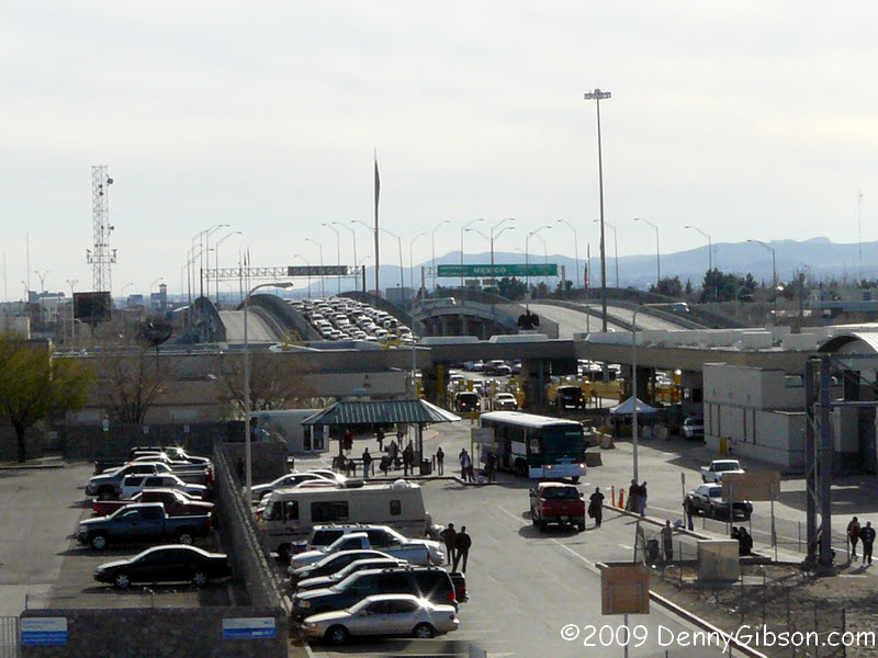
These pictures were taken on the drive back toward my motel near the airport. I stopped by the Chamizal National Memorial but the visitors center was not open. They've matched my schedule perfectly by closing both Sunday and Monay. The picture of the Mexico sign on the Bridge of the Americas was taken from the park at the memorial. The second picture of the bridge was taken from US-62 and shows long lines of cars waiting to enter the US while the south bound lanes are essentially clear. After my 2004 drive on Sixty-Two's east end, former Buffalo, New York, resident Laurel Kane and I exchanged some "Get your kicks..." style lines about the route. The absolute best was Laurel's "See Buffaloo on Route 62" I can't top that but I can now add "See the zoo on Route 62". |
|
|
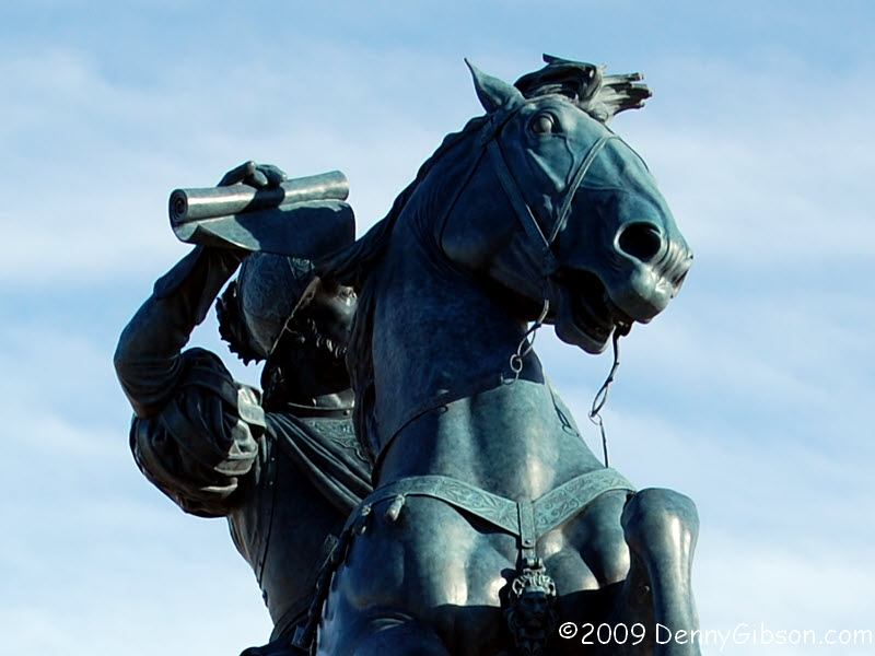
 I'd read about this statue and thought I'd like to see it if it was
convenient but never thought it would be just outside my motel door. I'm
staying at the Microtel near the airport and The Equestrian is
directly across the street. The thing is huge -- the horse is thirty-six
feet tall -- and, if you can ignore the size, amazingly realistic. And
The Equestrian is something of an alias. The statue was originally
to be named Don Juan de Oñate, to honor the conquistador credited
with celebrating the first Thanksgiving in the New World. But as tales of
Oñate's cruelty to the locals surfaced, the name became increasingly
unpopular. It may be called The Equestrian but everyone knows that
the scroll he holds in his right hand is La Toma, the document from
the King of Spain that Oñate carried and which claimed the area for
the king.
I'd read about this statue and thought I'd like to see it if it was
convenient but never thought it would be just outside my motel door. I'm
staying at the Microtel near the airport and The Equestrian is
directly across the street. The thing is huge -- the horse is thirty-six
feet tall -- and, if you can ignore the size, amazingly realistic. And
The Equestrian is something of an alias. The statue was originally
to be named Don Juan de Oñate, to honor the conquistador credited
with celebrating the first Thanksgiving in the New World. But as tales of
Oñate's cruelty to the locals surfaced, the name became increasingly
unpopular. It may be called The Equestrian but everyone knows that
the scroll he holds in his right hand is La Toma, the document from
the King of Spain that Oñate carried and which claimed the area for
the king.
|
|
|
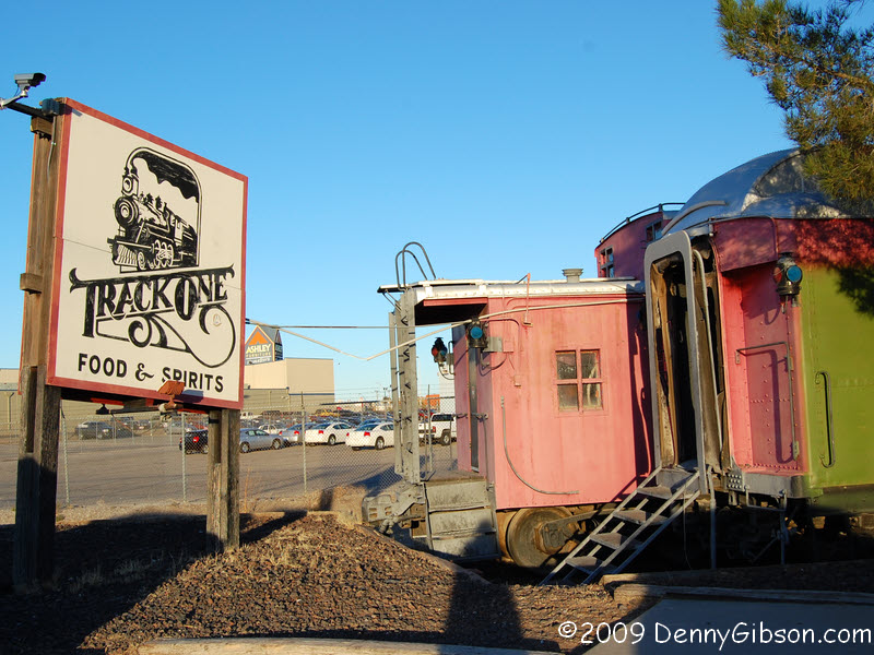 In my motel room, I realized that I was within a mile of
Smitty's BBQ which Roadfood's Michael Stern calls
"an exemplary West Texas barbecue experience". I headed there,
of course, but, you guessed it, they're closed on Sundays. So dinner was
at a place called Track One. It's a pretty cool place, with decent food,
inside some railroad cars and.
In my motel room, I realized that I was within a mile of
Smitty's BBQ which Roadfood's Michael Stern calls
"an exemplary West Texas barbecue experience". I headed there,
of course, but, you guessed it, they're closed on Sundays. So dinner was
at a place called Track One. It's a pretty cool place, with decent food,
inside some railroad cars and.
|
|
|
| [Prev] [Site Home] [Trip Home] [Contact] [Next] |