
Into Pennsylvania
Prev
Next
|
|
Day 6: July 6, 2006 Into Pennsylvania |
Prev Next |
|
|
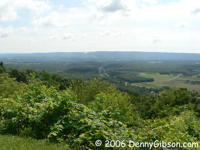
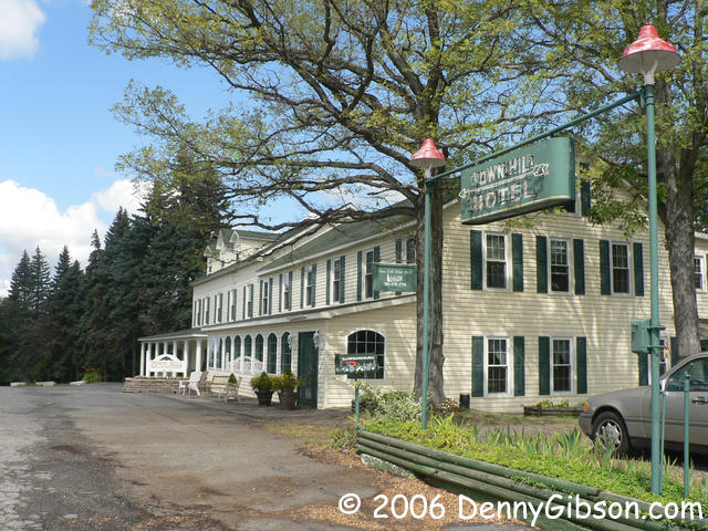 The rain was gone and the weather glorious as I retraced yesterday's high
speed escape route. I was soon back on track and found this at the top of
a hill. It's the Town
Hill Bed and Breakfast in the middle of the Green Ridge State Forest
and the marvelous overlook is right across the road. The last picture
shows the west bound road heading down from the parking lot's edge. The
east bound road does the same thing at the other end.
The rain was gone and the weather glorious as I retraced yesterday's high
speed escape route. I was soon back on track and found this at the top of
a hill. It's the Town
Hill Bed and Breakfast in the middle of the Green Ridge State Forest
and the marvelous overlook is right across the road. The last picture
shows the west bound road heading down from the parking lot's edge. The
east bound road does the same thing at the other end.
|
|
|
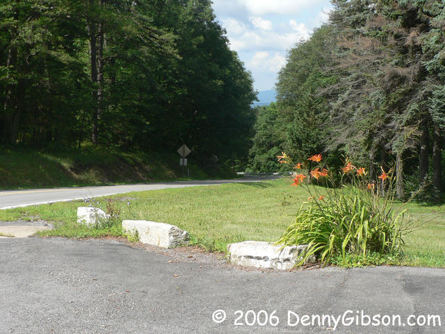
 I'm on the signed byway (MD-144 at this point) and see a sign indicating
the "Old National Road" branched off to the left. Even though there was a
Gilpin Road sign at the intersection, I made the turn and this was my
reward.
I'm on the signed byway (MD-144 at this point) and see a sign indicating
the "Old National Road" branched off to the left. Even though there was a
Gilpin Road sign at the intersection, I made the turn and this was my
reward.
|
|
|
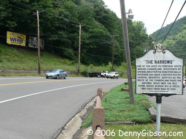
 A quick pass through Cumberland just so I could say I drove by the
original National Road start point and then up through the Narrows. This
is the same path I followed last Saturday on the train.
A quick pass through Cumberland just so I could say I drove by the
original National Road start point and then up through the Narrows. This
is the same path I followed last Saturday on the train.
|
|
|

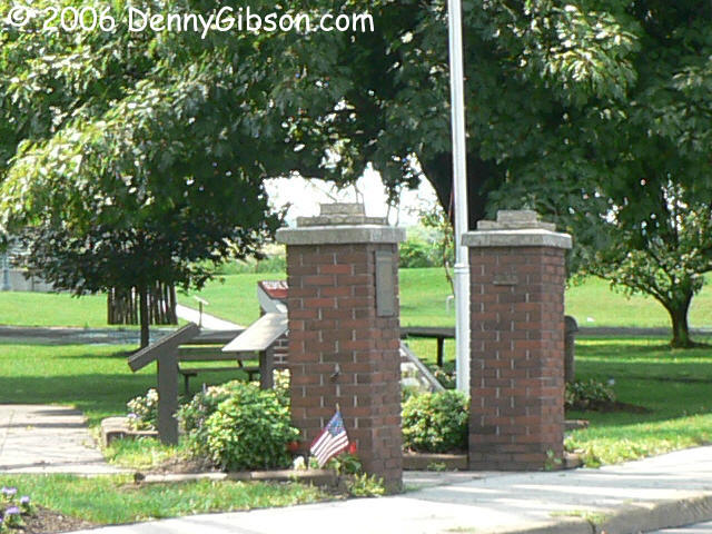
 The La Vale Toll House & Museum is open on Saturdays and not many
other days. Last Friday and Saturday nights I stayed, without realizing
it, less than a mile up the road. After the train ride, I could have
visited it just by turning left instead of right. Today it was closed so I
had to make do with walking around the outside and taking a picture of the
old gate posts.
The La Vale Toll House & Museum is open on Saturdays and not many
other days. Last Friday and Saturday nights I stayed, without realizing
it, less than a mile up the road. After the train ride, I could have
visited it just by turning left instead of right. Today it was closed so I
had to make do with walking around the outside and taking a picture of the
old gate posts.
|
|
|
 Even before I realized that the house and barn were the ones I
photographed in 2001, I was struck by the amount of paved surface visible
at one time. I-68 and an exit ramp is on the left with US-40 separating
barn and house. I guess I somehow missed all that asphalt five years ago.
Even before I realized that the house and barn were the ones I
photographed in 2001, I was struck by the amount of paved surface visible
at one time. I-68 and an exit ramp is on the left with US-40 separating
barn and house. I guess I somehow missed all that asphalt five years ago.
|
|
|
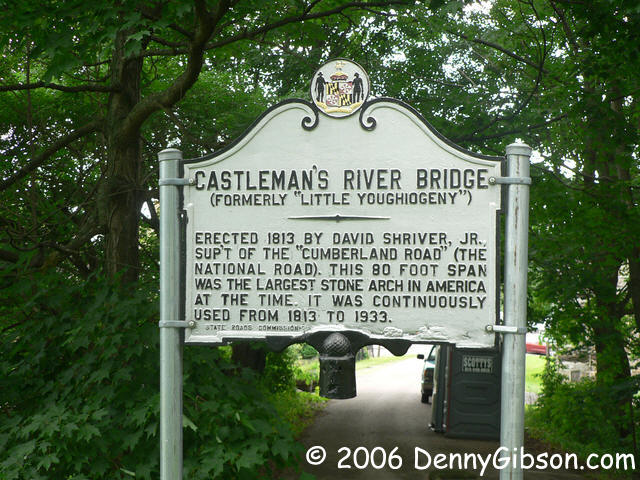

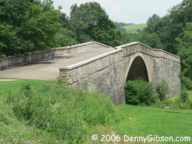
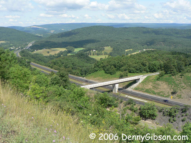
 There are theories that the bridge was built extra high to accommodate
boats of the C & O Canal should they ever reach here. That
could be but the fact that the bridge was built twelve years before the
first shovel of dirt was moved for the canal makes it at least a little
suspect. In the last photo, its replacement, the green metal bridge, is in
the middle with the latest of the set, the I-68 bridge, visible in the
background.
There are theories that the bridge was built extra high to accommodate
boats of the C & O Canal should they ever reach here. That
could be but the fact that the bridge was built twelve years before the
first shovel of dirt was moved for the canal makes it at least a little
suspect. In the last photo, its replacement, the green metal bridge, is in
the middle with the latest of the set, the I-68 bridge, visible in the
background.
|
|
|
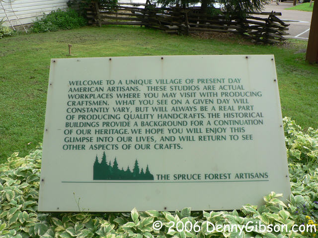 Adjacent to the bridge is Penn Alps Restaurant and the
Spruce Mountain
artists colony. You could spend some time and some money here.
Adjacent to the bridge is Penn Alps Restaurant and the
Spruce Mountain
artists colony. You could spend some time and some money here.
|
|
|
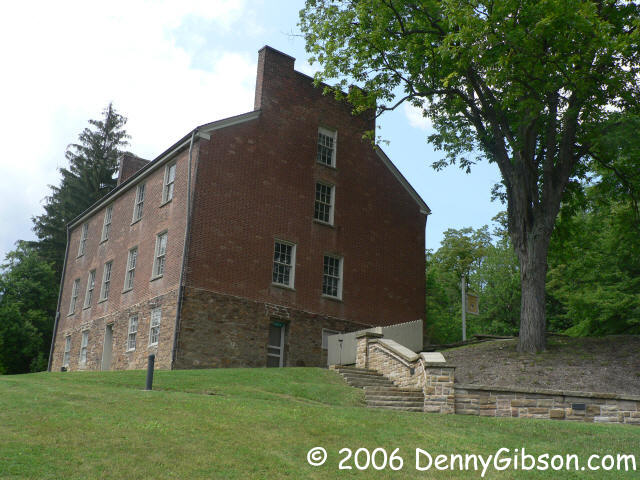
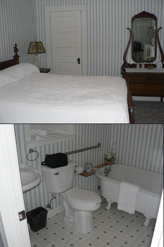
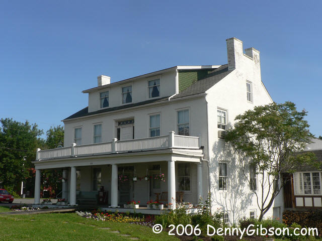 This is the Casselman Inn where I stayed last night. The picture
was taken this morning before I backtracked to pickup where I had bolted
for the expressway but I've put it here in the correct geographic
sequence. Built in 1824, it has been updated considerably but not to
excess. The restaurant serves good food at very reasonable prices and
rooms are also available in the Casselman Motor Inn if you'd like more
modern accommodations. I thought those in the historic inn were quite
modern enough. You can peek at my room here.
This is the Casselman Inn where I stayed last night. The picture
was taken this morning before I backtracked to pickup where I had bolted
for the expressway but I've put it here in the correct geographic
sequence. Built in 1824, it has been updated considerably but not to
excess. The restaurant serves good food at very reasonable prices and
rooms are also available in the Casselman Motor Inn if you'd like more
modern accommodations. I thought those in the historic inn were quite
modern enough. You can peek at my room here.
|
|
|

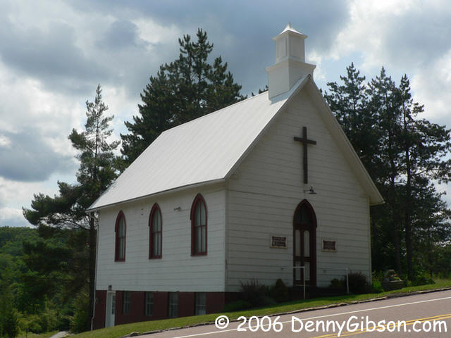
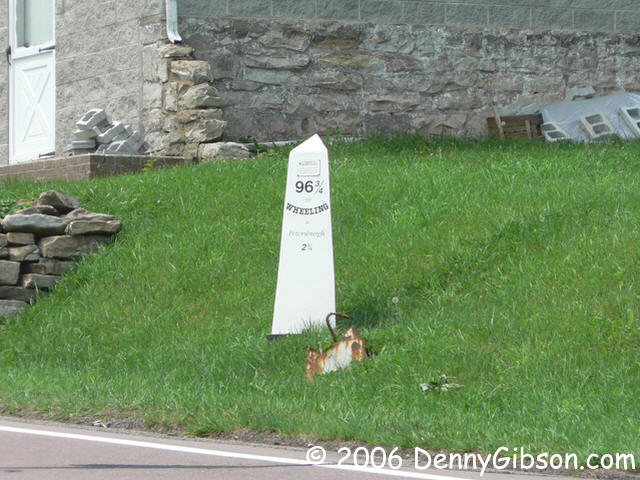
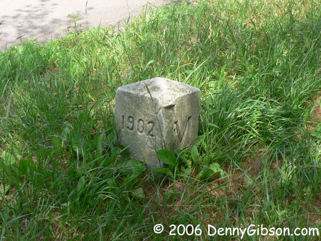 Where the National Road crosses into Pennsylvania, there is a Mason-Dixon
marker, a mile marker, and a church known officially as the State Line
Methodist Church. There is also a road named Pig Ear but that name may
have little to do with the boundary.
Where the National Road crosses into Pennsylvania, there is a Mason-Dixon
marker, a mile marker, and a church known officially as the State Line
Methodist Church. There is also a road named Pig Ear but that name may
have little to do with the boundary.
|
|
|

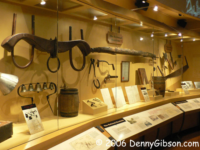
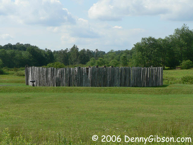
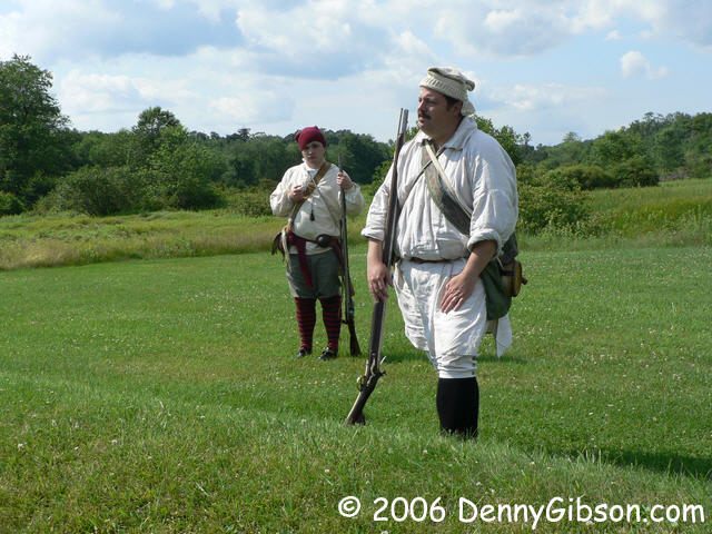
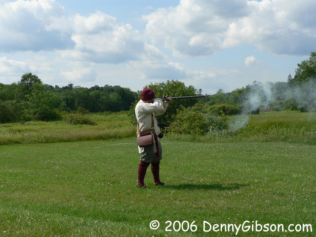 The focus of Fort
Necessity National Battlefield is the battle that took place there in
1754 but, because of its proximity, Washington Tavern is included and the
museum includes several National Road exhibits. At the fort, a "soldier"
did a good job of explaining the events of July 3, 1754 and placing them
in history. This is commonly considered the start of the French and Indian
War.
The focus of Fort
Necessity National Battlefield is the battle that took place there in
1754 but, because of its proximity, Washington Tavern is included and the
museum includes several National Road exhibits. At the fort, a "soldier"
did a good job of explaining the events of July 3, 1754 and placing them
in history. This is commonly considered the start of the French and Indian
War.
|
|
|
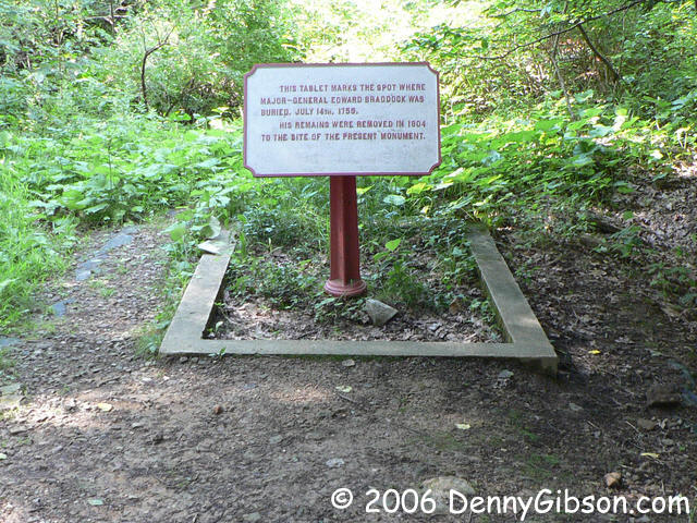
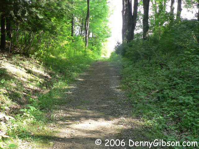
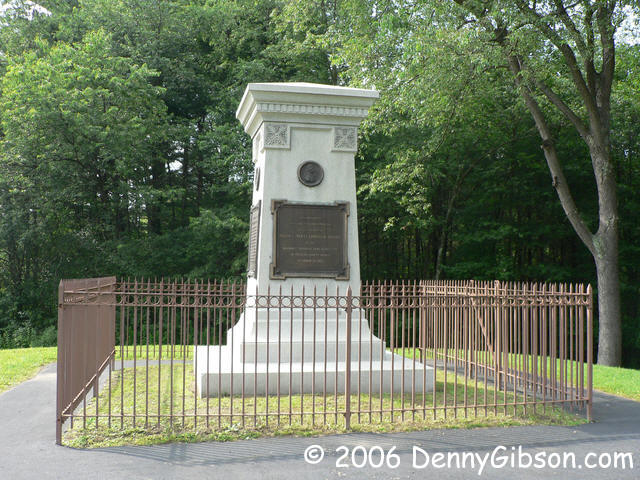 Braddock's Grave is part of the Fort Necessity park although it is about a
mile and a half from the fort. The tall monument that marks the current
burial site is easily seen from the US-40. Behind the monument is a short
section of the original "road" with Braddock's original burial site marked.
He was buried in the middle of the road to hide the body from pursuers.
Braddock's Grave is part of the Fort Necessity park although it is about a
mile and a half from the fort. The tall monument that marks the current
burial site is easily seen from the US-40. Behind the monument is a short
section of the original "road" with Braddock's original burial site marked.
He was buried in the middle of the road to hide the body from pursuers.
|
|
|
| [Prev] [Site Home] [Home] [Contact] [Next] |