|
Day 4: June 5, 2005 |
Prev Next |
|
Day 4: June 5, 2005 |
Prev Next |
|
|
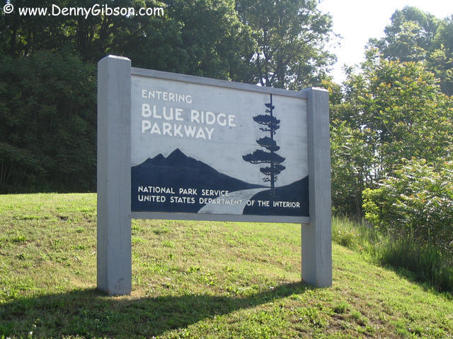
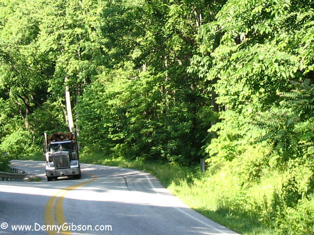
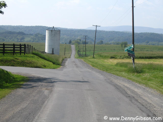
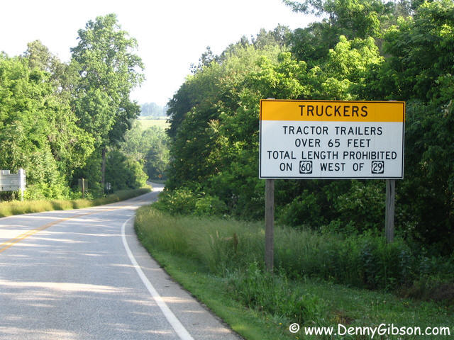 This sign greeted me almost immediately on leaving Amherst. Maybe there
are a few truck drivers who are upset but drivers of sports cars have a
different view. I snapped the picture of the log truck after passing it
and its twin stopped in the road. Apparently one of the pair had broken
down. The drive along this section of US-60 was gorgeous but I knew even
better was ahead. That "better" was the
Blue Ridge Parkway
and I entered it some twenty miles from Amherst.
This sign greeted me almost immediately on leaving Amherst. Maybe there
are a few truck drivers who are upset but drivers of sports cars have a
different view. I snapped the picture of the log truck after passing it
and its twin stopped in the road. Apparently one of the pair had broken
down. The drive along this section of US-60 was gorgeous but I knew even
better was ahead. That "better" was the
Blue Ridge Parkway
and I entered it some twenty miles from Amherst.
|
|
|
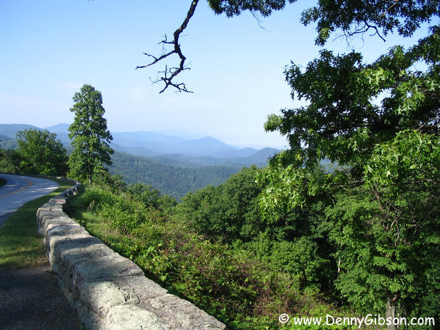


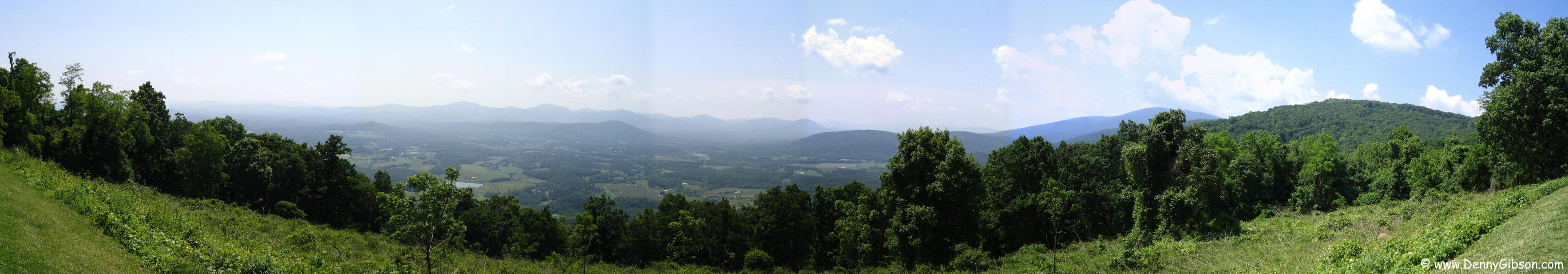
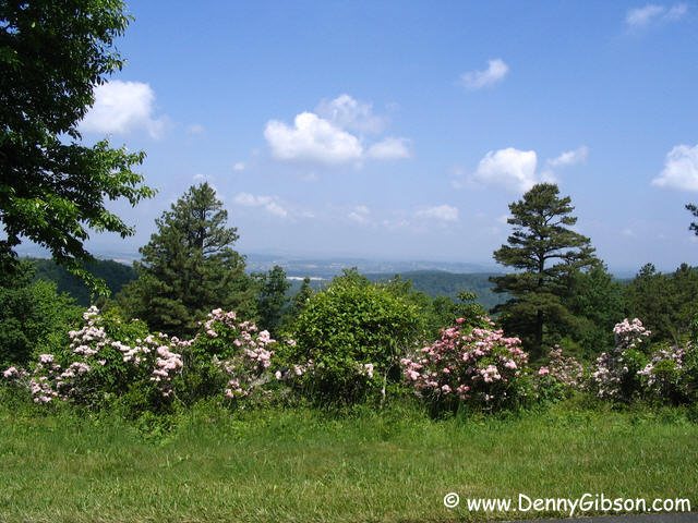 Awesome views appeared almost instantly and continued non-stop. A
significantly straighter and less scenic I-81 sort of parallels the
parkway in this area and I would be using the expressway to return to
Sixty. My destination was actually the parkway's beginning and I realize
that I probably should have done the parkway & expressway in the
reverse sequence. As it was, I drove from near mile 45 to mile 0. One of
the pull offs is at a reconstruction of a 1920 narrow gauge railway that
was used to haul more than 100 million board feet of forest to the mill.
In a rare stroke of timing luck the motorcycles appeared just as I was
snapping a shot of the rock wall.
Awesome views appeared almost instantly and continued non-stop. A
significantly straighter and less scenic I-81 sort of parallels the
parkway in this area and I would be using the expressway to return to
Sixty. My destination was actually the parkway's beginning and I realize
that I probably should have done the parkway & expressway in the
reverse sequence. As it was, I drove from near mile 45 to mile 0. One of
the pull offs is at a reconstruction of a 1920 narrow gauge railway that
was used to haul more than 100 million board feet of forest to the mill.
In a rare stroke of timing luck the motorcycles appeared just as I was
snapping a shot of the rock wall.
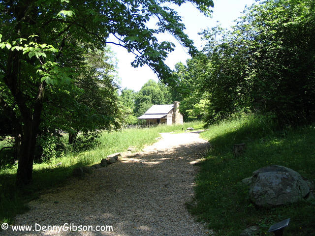
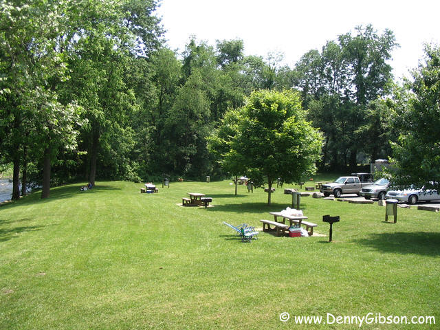
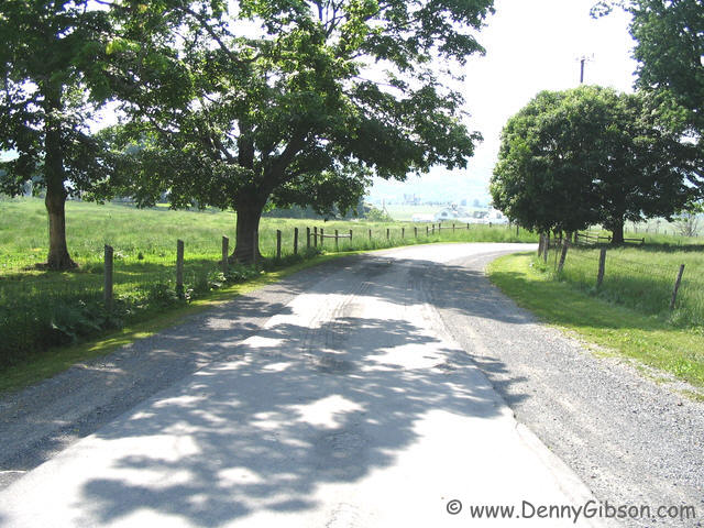
A number of log structures have been relocated to an area beside the Humpback Rocks Visitor Center and organized into a farm like setting. The cabin is furnished with original items and today park employee Gary was there in farmer garb to explain the furnishings, the buildings, and the area. The trail continues on a short distance from the cabin and I liked this view of it looking back. I guess my reward for strolling the streets of Williamsburg in the rain is perfect weather for my Blue Ridge Parkway drive. Hillsides covered by colorful blooms are more evidence of the good timing. There are 469 miles of sights like this connecting the Shenandoah and Great Smoky Mountains National Parks. Skyline Drive connects directly with the Blue Ridge Parkway making it possible to drive all the way from Front Royal, VA, (about 60 mile straight west of the nation's capital) to Cherokee, NC, with scenery like this all the way. Some day. |
|
|
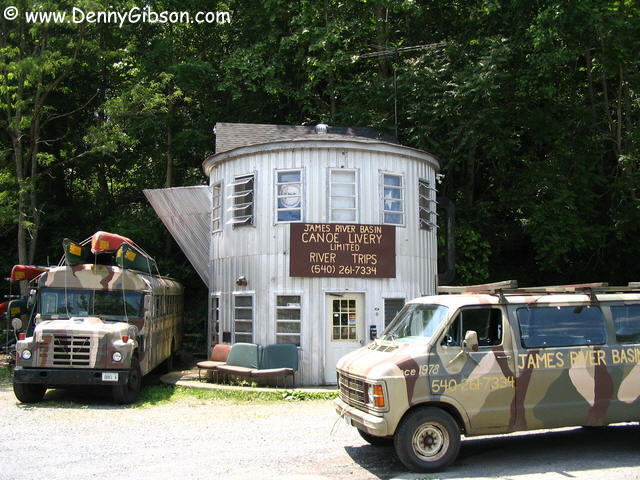 At the end/beginning of the Blue Ridge Parkway, I dashed to I-81 on I-64
and to US-60 on I-81. As I traced Sixty back to where I had left it, I
spotted this giant coffee pot near Lexington. I don't know its history but
do know that it is now serving as headquarters for
James River Basin
Canoe Livery. Incidentally, the section of US-60 that connects Buena
Vista to the Blue Ridge Parkway is one of the more fun sections of the
road I've been on.
At the end/beginning of the Blue Ridge Parkway, I dashed to I-81 on I-64
and to US-60 on I-81. As I traced Sixty back to where I had left it, I
spotted this giant coffee pot near Lexington. I don't know its history but
do know that it is now serving as headquarters for
James River Basin
Canoe Livery. Incidentally, the section of US-60 that connects Buena
Vista to the Blue Ridge Parkway is one of the more fun sections of the
road I've been on.
|
|
|
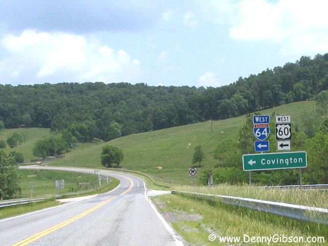
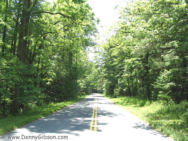 Like most of today's US highways, US-60 is a mixed bag. There are pretty
and entertaining stretches like those around Amherst & Buena Vista,
boring divided four lane, congested city passages, and some interstate
piggybacks. The second picture here is of a piece of old Sixty that was
retired by I-64. I hadn't researched this in advance and saw no obvious
way of connecting with the new interstate routing on both ends so I had to
drive this section in both directions. Poor, poor, pitiful me.
Like most of today's US highways, US-60 is a mixed bag. There are pretty
and entertaining stretches like those around Amherst & Buena Vista,
boring divided four lane, congested city passages, and some interstate
piggybacks. The second picture here is of a piece of old Sixty that was
retired by I-64. I hadn't researched this in advance and saw no obvious
way of connecting with the new interstate routing on both ends so I had to
drive this section in both directions. Poor, poor, pitiful me.
|
|
|
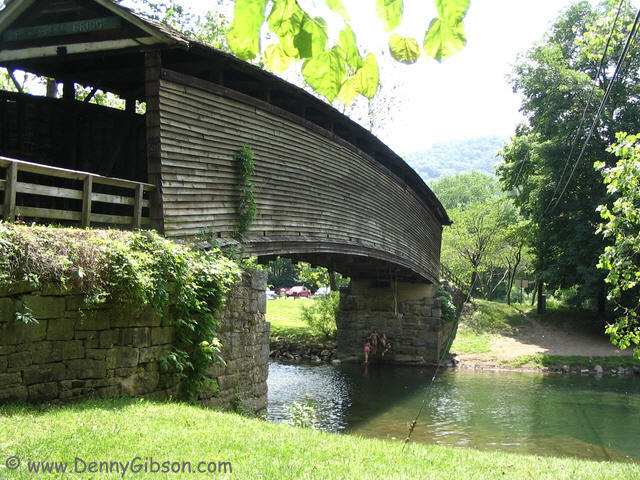 After passing through Covington, VA, and before being dumped back on the
interstate, I stopped at the Humpback Bridge Wayside. The bridge was built
in 1835 as part of the James River Kanawha Turnpike. It was in service
until 1929 and was reconditioned and brought out of retirement in 1953 to
serve as the centerpiece of the park.
After passing through Covington, VA, and before being dumped back on the
interstate, I stopped at the Humpback Bridge Wayside. The bridge was built
in 1835 as part of the James River Kanawha Turnpike. It was in service
until 1929 and was reconditioned and brought out of retirement in 1953 to
serve as the centerpiece of the park.
|
|
|
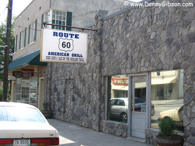
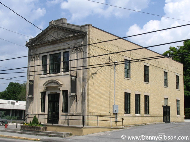
 The thermometer in the car read 85F (I saw 90F on a bank sign) so I was
getting hot and thirsty when I read "GOOD EATS AND ALE ON THE MIDLAND
TRAIL" in White Sulphur Springs. I paused for a refreshing beverage
but when I saw the guy working the grill I decided to sample something
more solid, too. Hand formed burgers, fresh cut fries, "big kosher
pickle and a cold draft beer" (get ready for a musical head snap)
"these are a few of my favorite things". Directly across the
street is a bank turned art gallery that dates from the year that US-60
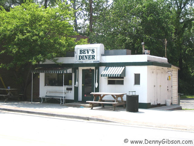
and the other US routes were created - MCMXXVI. I really liked the looks
of Bev's Diner just up the street but it was closed. In the Route 60
American Grill I learned that it's only closed on Sundays and when the
owner (it's a one gal operation) is sick.
The thermometer in the car read 85F (I saw 90F on a bank sign) so I was
getting hot and thirsty when I read "GOOD EATS AND ALE ON THE MIDLAND
TRAIL" in White Sulphur Springs. I paused for a refreshing beverage
but when I saw the guy working the grill I decided to sample something
more solid, too. Hand formed burgers, fresh cut fries, "big kosher
pickle and a cold draft beer" (get ready for a musical head snap)
"these are a few of my favorite things". Directly across the
street is a bank turned art gallery that dates from the year that US-60
and the other US routes were created - MCMXXVI. I really liked the looks
of Bev's Diner just up the street but it was closed. In the Route 60
American Grill I learned that it's only closed on Sundays and when the
owner (it's a one gal operation) is sick.
|
|
|
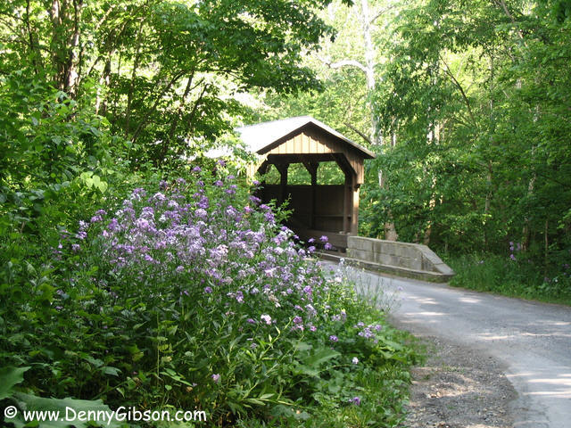
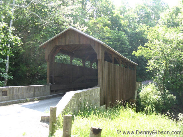

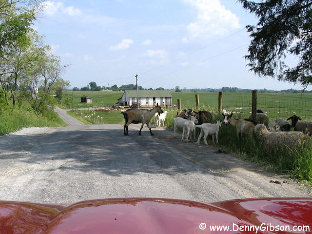
 Not far from Lewisburg, WV, I spotted a "covered bridge next
left" sign and went for it. Right away I found some surprises. First
was the narrow "sidewalk" style road. It looks similar to some
remaining bits of Route 66 "sidewalk" but is much smoother. The
next surprise was goats in the road closely followed by a single llama
among the goats and sheep. Perhaps a shepherd's version of The Ugly
Duckling (The Ugly Lamb?). But the biggest surprise was the lack of a
bridge. Turns out that, probably in my excitement over the road, I had
missed this well marked turn (the bottom sign does point to the bridge).
Anyway, here's the bridge going and coming.
Not far from Lewisburg, WV, I spotted a "covered bridge next
left" sign and went for it. Right away I found some surprises. First
was the narrow "sidewalk" style road. It looks similar to some
remaining bits of Route 66 "sidewalk" but is much smoother. The
next surprise was goats in the road closely followed by a single llama
among the goats and sheep. Perhaps a shepherd's version of The Ugly
Duckling (The Ugly Lamb?). But the biggest surprise was the lack of a
bridge. Turns out that, probably in my excitement over the road, I had
missed this well marked turn (the bottom sign does point to the bridge).
Anyway, here's the bridge going and coming.
|
|
|
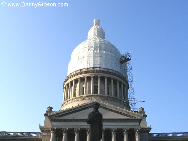
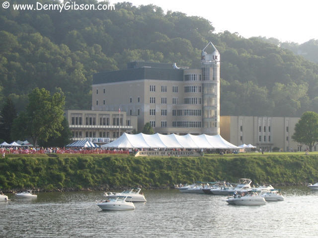
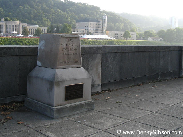 It looks as if West Virginia has just received a new capitol and was just
starting to unwrap it as I passed through. I don't think anyone was
surprised as the shape and size of the package kind of gave it away.
Directly across the river, at the University of Charleston, a concert
(lots of bagpipes for some reason) was in progress and provided background
music as I snapped pictures. Precisely across the street from the capitol
is West Virginia's Zero Mile Stone.
It looks as if West Virginia has just received a new capitol and was just
starting to unwrap it as I passed through. I don't think anyone was
surprised as the shape and size of the package kind of gave it away.
Directly across the river, at the University of Charleston, a concert
(lots of bagpipes for some reason) was in progress and provided background
music as I snapped pictures. Precisely across the street from the capitol
is West Virginia's Zero Mile Stone.
|
|
|