Utah 1
Prev
Next


|
|
Day 8: August 22, 2009 Utah 1 |
Prev Next |
|
|
|
|
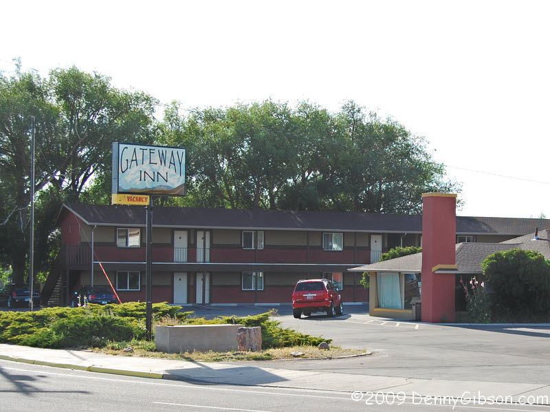 Last night was at the Gateway
Inn in Lyman, Wyoming. Here's my room.
There's a laundromat next door (same owners) so
I have some clean clothes. The Branding Iron and Bon Rico restaurants are
within walking distance.
Last night was at the Gateway
Inn in Lyman, Wyoming. Here's my room.
There's a laundromat next door (same owners) so
I have some clean clothes. The Branding Iron and Bon Rico restaurants are
within walking distance.
|
 August 22,1999
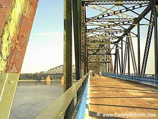
What a neat surprise this was. I knew of the Chain of Rocks Bridge but I had no idea that it had been opened as a foot bridge. I barely beat closing time to walk a short way out on the bridge for a picture. That digital camera I mentioned, had resolution approaching -- but not reaching -- one megapixel. As I recall, it was a closeout but still around a couple hundred bucks. That was at the upper end of my budget and the higher resolution cameras of the day were way above that. The primitive zone focus Agfa did, however, let me post pictures on the web the same day I took them and that seemed pretty cool to me. |
|
|
|
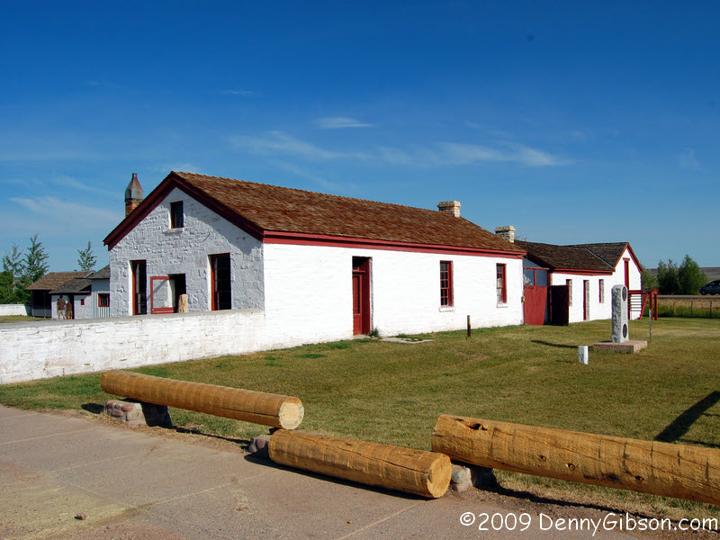
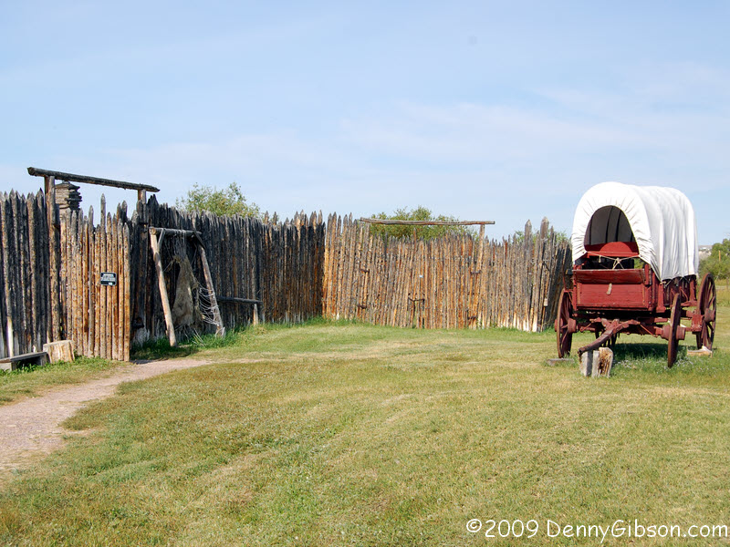

 Jim Bridger and Louis Vasquez "established a small fort" and
trading post here in 1843. It became a hub for many western expansion trails
and roads. The Pony Express, Overland Stage, Union Pacific Railroad, and
the Lincoln Highway all visited Fort Bridger. The pictures are of the trader's
store, replicas of Bridger's fort and one of the cabins in it, and the 1880s
barracks.
Jim Bridger and Louis Vasquez "established a small fort" and
trading post here in 1843. It became a hub for many western expansion trails
and roads. The Pony Express, Overland Stage, Union Pacific Railroad, and
the Lincoln Highway all visited Fort Bridger. The pictures are of the trader's
store, replicas of Bridger's fort and one of the cabins in it, and the 1880s
barracks.
|
|
|
|
|

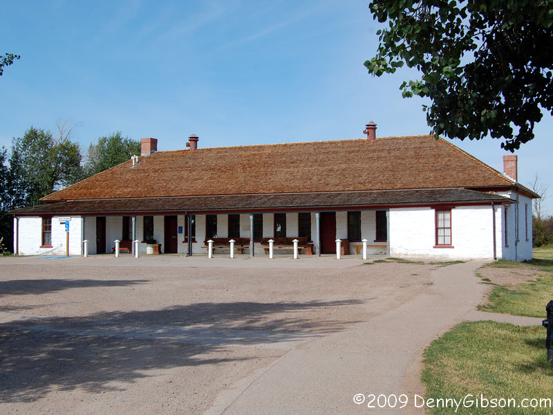
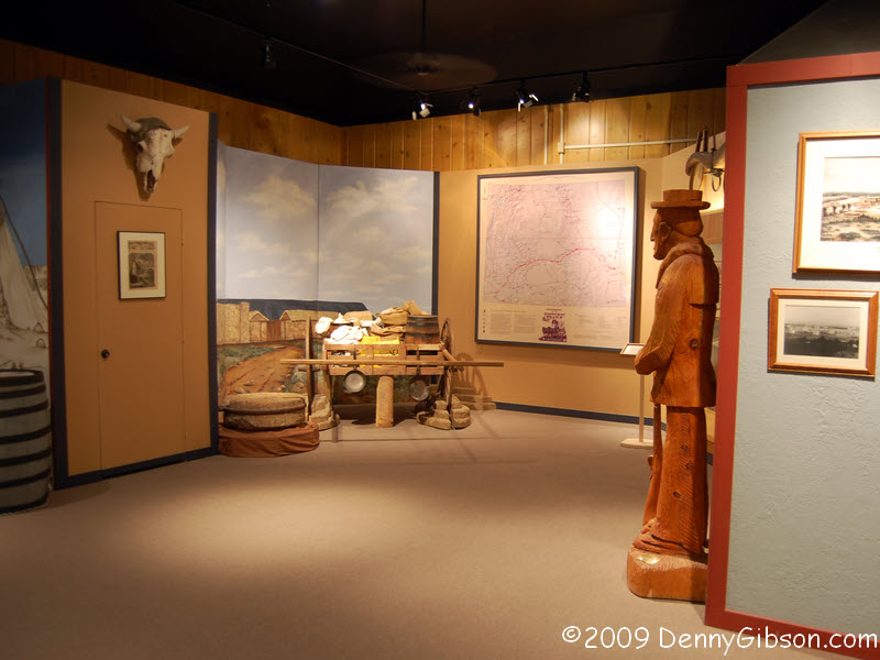 The former barracks is now a museum with many displays on Fort Bridger and
even one on the Lincoln Highway.
The former barracks is now a museum with many displays on Fort Bridger and
even one on the Lincoln Highway.
|
|
|
|
|
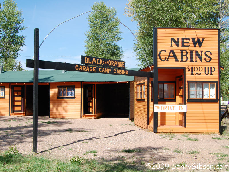

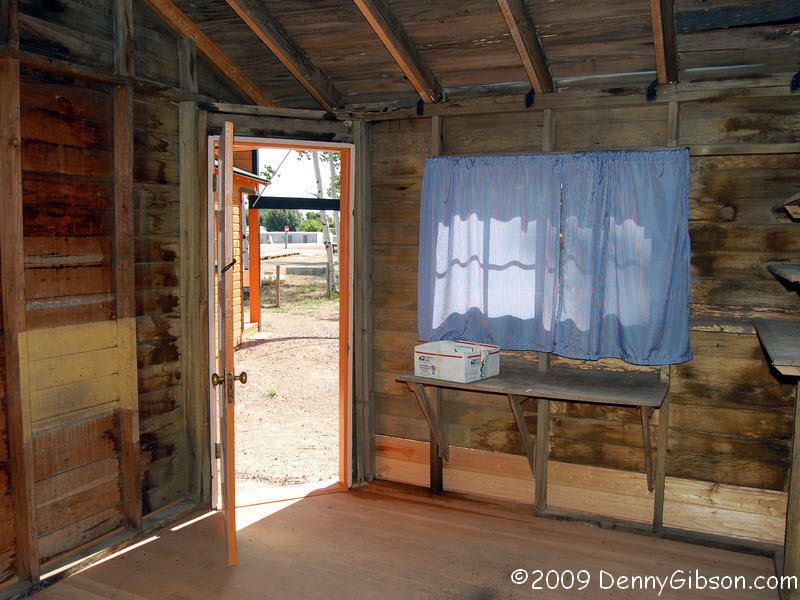
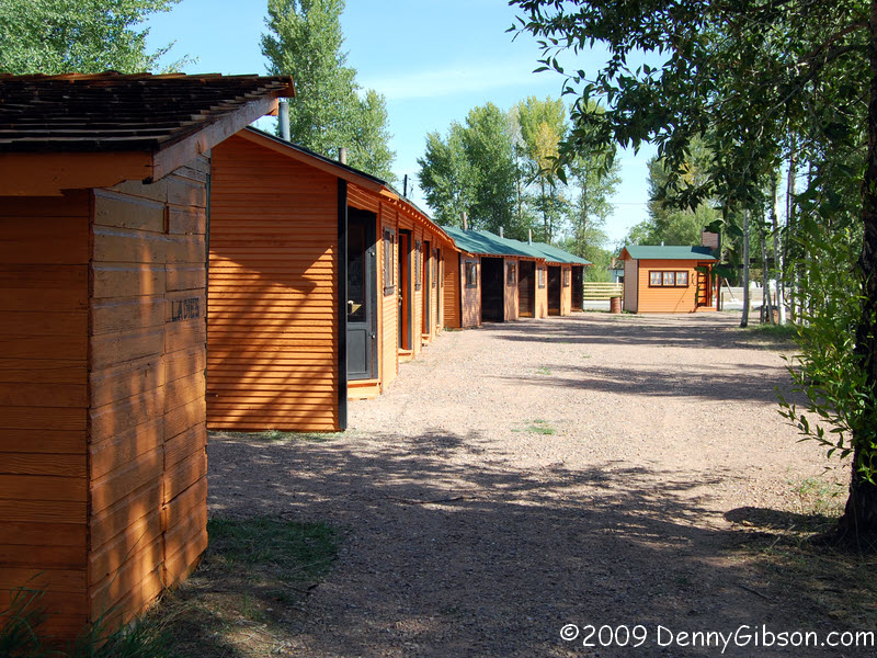 But the big Lincoln Highway display is at the front of the park in the form
of the recently (July 1, 2009) restored Black and Orange cabins. Some of
the cabins have been furnished as they might have been in the 1930s when
they opened. The interiors are viewed through Plexiglass panels. One cabin
is open and unfurnished so you can get a feel for the size and construction.
As you can tell by the size of the carports, they were expecting a lot more Ford
Model Ts than Packards & Overlands. Actually, these cabins were an
extension of the Rocheford Hotel which is likely where the Packards parked.
But the big Lincoln Highway display is at the front of the park in the form
of the recently (July 1, 2009) restored Black and Orange cabins. Some of
the cabins have been furnished as they might have been in the 1930s when
they opened. The interiors are viewed through Plexiglass panels. One cabin
is open and unfurnished so you can get a feel for the size and construction.
As you can tell by the size of the carports, they were expecting a lot more Ford
Model Ts than Packards & Overlands. Actually, these cabins were an
extension of the Rocheford Hotel which is likely where the Packards parked.
|
|
|
|
|
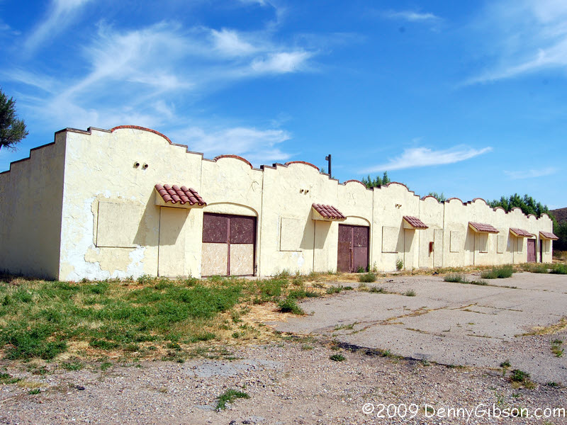
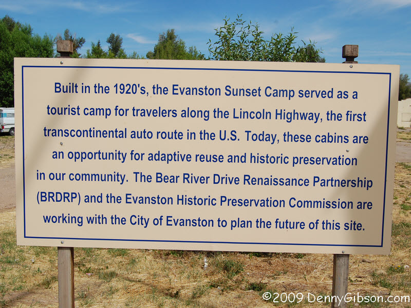
 The Sunset Cabins in Evanston haven't been restored but they are being
protected and there is promise. A readable version
of the sign on the pedestal is here.
The Sunset Cabins in Evanston haven't been restored but they are being
protected and there is promise. A readable version
of the sign on the pedestal is here.
|
|
|
|
|
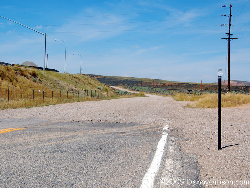
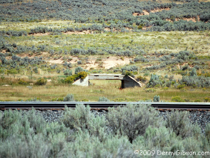 On Wasatch road, the Utah line is marked by a three inch disk... and
gravel. I continued on far enough to photograph this 1920s Lincoln Highway
bridge then turned back to pick up the expressway. The bridge
can be seen from the expressway.
On Wasatch road, the Utah line is marked by a three inch disk... and
gravel. I continued on far enough to photograph this 1920s Lincoln Highway
bridge then turned back to pick up the expressway. The bridge
can be seen from the expressway.
|
|
|
|
|

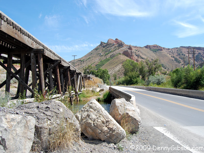 Although my route would not naturally take me there, I wanted to see
Devil's Slide. I tried to plot a two-lane course to it with mixed results.
Going by this pair of old bridges was purely accidental. The LH never came
by here but I like the bridges anyway.
Although my route would not naturally take me there, I wanted to see
Devil's Slide. I tried to plot a two-lane course to it with mixed results.
Going by this pair of old bridges was purely accidental. The LH never came
by here but I like the bridges anyway.
|
|
|
|
|
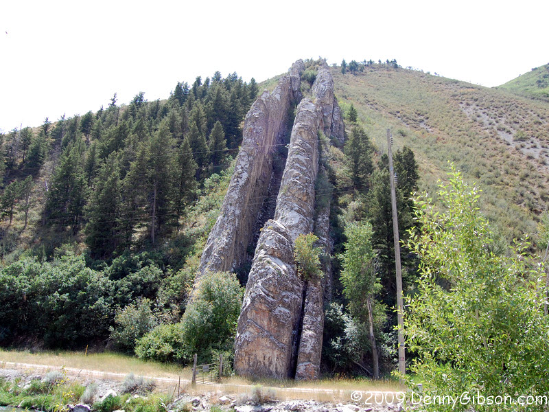 Yep, it was just as cool as I expected; though harder to find. It's
Devil's Slide north of Salt Lake City.
Yep, it was just as cool as I expected; though harder to find. It's
Devil's Slide north of Salt Lake City.
|
|
|
|
|
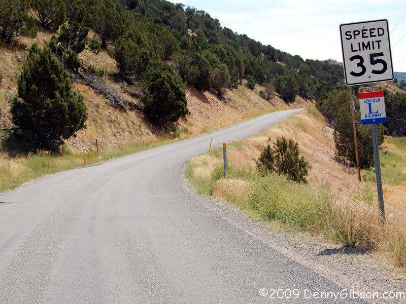 The pavement on Wanship Road may have improved but little else has changed
since the 1920s.
The pavement on Wanship Road may have improved but little else has changed
since the 1920s.
|
|
|
|
|


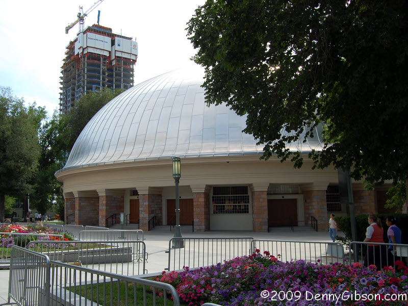
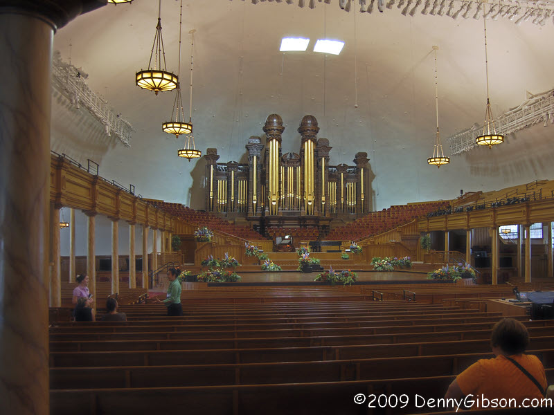 There was never a thought of visiting Salt Lake City without a stop at
Temple Square. Pictures are of the Temple and the beautiful open space
in front of it and the Tabernacle outside and in.
There was never a thought of visiting Salt Lake City without a stop at
Temple Square. Pictures are of the Temple and the beautiful open space
in front of it and the Tabernacle outside and in.
|
|
|
|
| [Prev] [Site Home] [Trip Home] [Contact] [Next] |