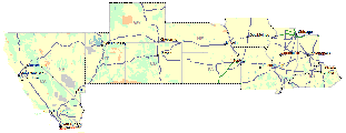
Illinois
Prev
Next


|
|
Day 1: August 15, 2009 Illinois |
Prev Next |
|
|
|
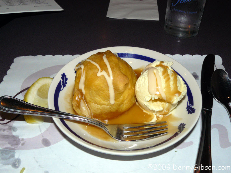
 Last night's dinner was at Teible's, a Route 30 mainstay since 1929. They've become
known for their chicken, perch, frog legs, and
apple dumplings. Two down and two to go. The
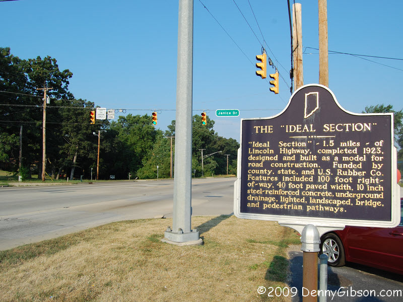
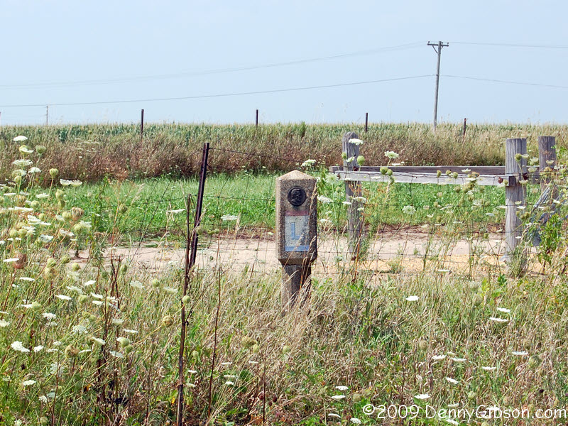
"Ideal Section" marker is on the north side of the road.
Last night's dinner was at Teible's, a Route 30 mainstay since 1929. They've become
known for their chicken, perch, frog legs, and
apple dumplings. Two down and two to go. The
"Ideal Section" marker is on the north side of the road.
|
|
|
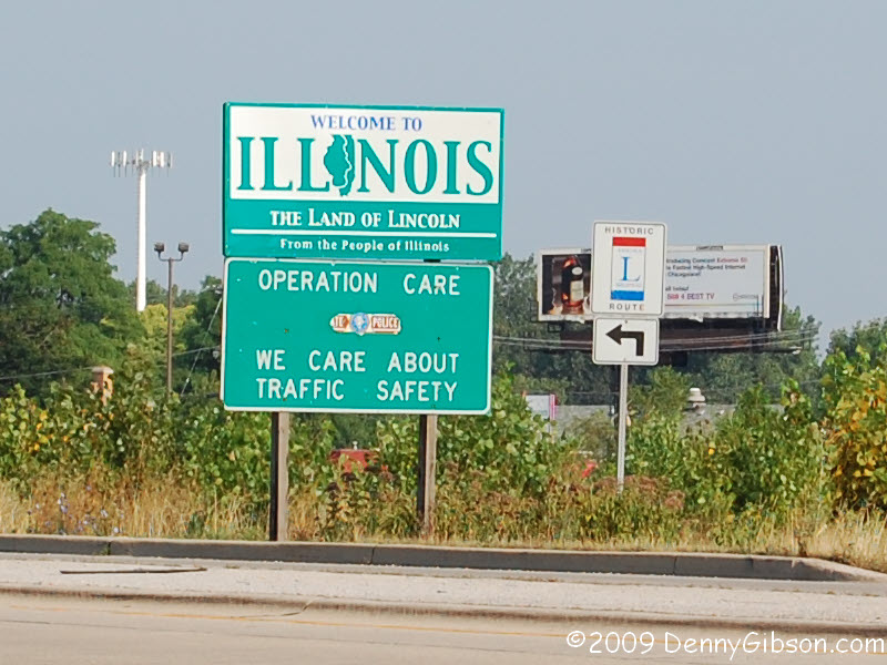
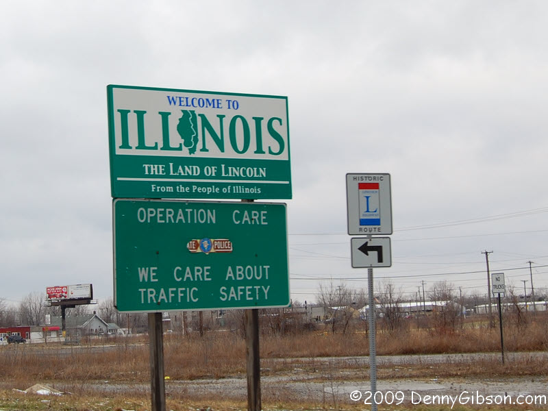
 We passed the Illinois sign last
March and drove down just a little bit of Sauk Trail before turning
around but that's as far as we got. It's new-to-me Lincoln Highway from
here on out.
We passed the Illinois sign last
March and drove down just a little bit of Sauk Trail before turning
around but that's as far as we got. It's new-to-me Lincoln Highway from
here on out.
|
|
|
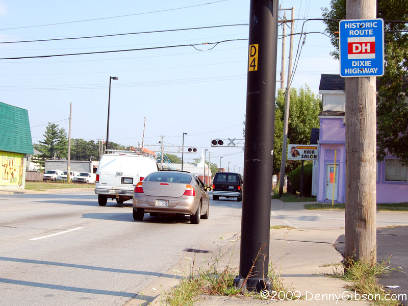 I spotted a couple of Dixie Highway signs in Chicago Heights.
|
|
|
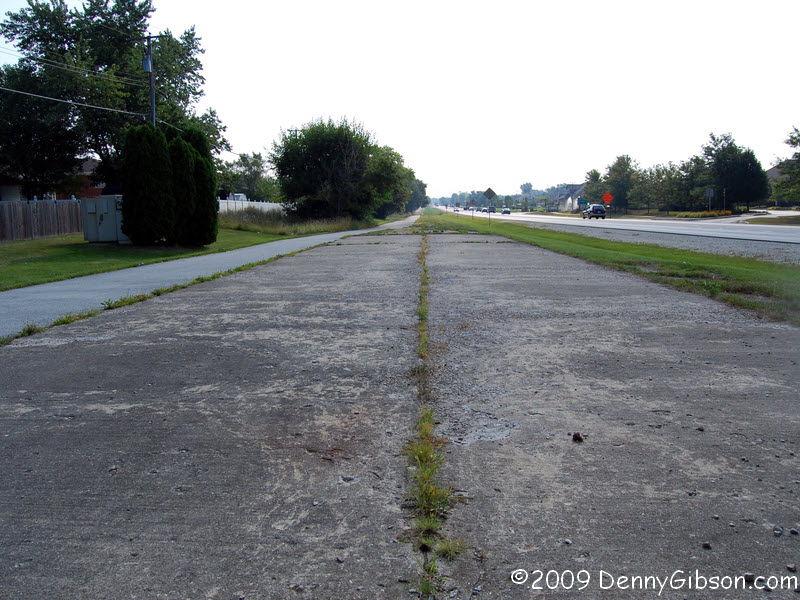
 This bit of concrete pavement was part of the original 1913 LH alignment.
The concrete itself probably dates from the 1920s. Heading east, it turns
to asphalt then fades into the grass. The second picture is looking west.
This bit of concrete pavement was part of the original 1913 LH alignment.
The concrete itself probably dates from the 1920s. Heading east, it turns
to asphalt then fades into the grass. The second picture is looking west.
|
|
|
 This is kind of cool but I'm not all that excited about it. It does show
that the numbered US highways were initially routed over existing roads
just like the Lincoln Highway and all the other named highways that came
before.
This is kind of cool but I'm not all that excited about it. It does show
that the numbered US highways were initially routed over existing roads
just like the Lincoln Highway and all the other named highways that came
before.
|
|
|
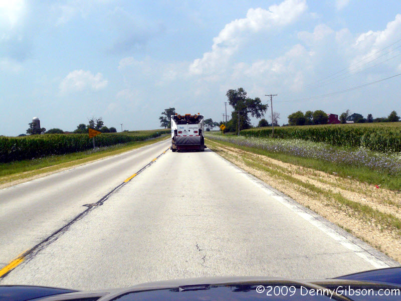
 The first picture in facing west from the turn in Geneva and the last is
in Dekalb. In between is picturesque Illinois farm land -- with a road
sweeper in the middle.
The first picture in facing west from the turn in Geneva and the last is
in Dekalb. In between is picturesque Illinois farm land -- with a road
sweeper in the middle.
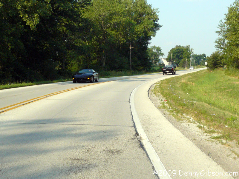
"Any old kind of an automobile can get from New York to Chicago, and tourists have nice hotels to stop at and everything is lovely. But west of Chicago, the real trip commences. We were motorists as far west as Chicago. Then we became pioneers." Victor Eubank, "Log of an Auto Prairie Schooner", Sunset, February 1912 Drake Hokanson uses this quote to begin a chapter of "The Lincoln Highway: Main Street across America" in which he talks of the middle third of the LH. He uses Chicago and Salt Lake City as the dividing points. In wrapping up the previous chapter, Hokanson called the "first third of the coast-to-coast trip" a "shakedown cruise, an easy trial run to test equipment and skills." Driving the eastern third of the Lincoln Highway in bits and pieces over nearly five years is hardly a "shakedown cruise" and I'm certainly no pioneer. There is, however, no doubt that things are going to be different from here west. |
|
|
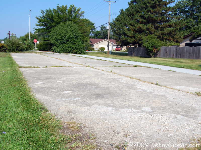
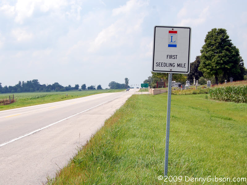 A mile of concrete pavement in the middle of a muddy wagon path was a
pretty effective way to demonstrate the value of improving the roads. The
Lincoln Highway Association and concrete manufacturers helped put in a
number of "Seedling Miles". The very first one is underneath
this stretch of modern asphalt just west of Dekalb.
A mile of concrete pavement in the middle of a muddy wagon path was a
pretty effective way to demonstrate the value of improving the roads. The
Lincoln Highway Association and concrete manufacturers helped put in a
number of "Seedling Miles". The very first one is underneath
this stretch of modern asphalt just west of Dekalb.
|
|
|
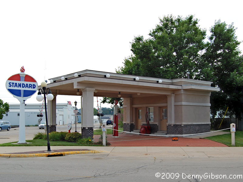
 Rochelle has turned a 1918 gas station into a really nice visitor center.
The station was definitely the first in town and one of the first, if not
the first, on the Lincoln Highway anywhere. 1918 was a long time ago.
Rochelle has turned a 1918 gas station into a really nice visitor center.
The station was definitely the first in town and one of the first, if not
the first, on the Lincoln Highway anywhere. 1918 was a long time ago.
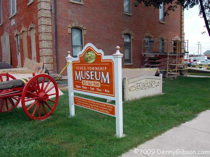
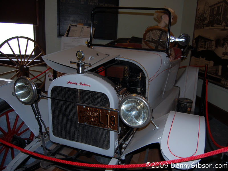
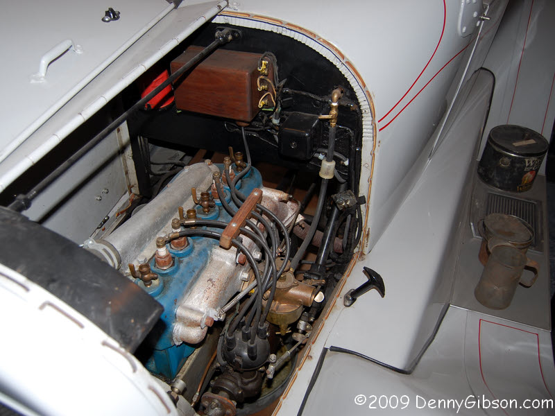
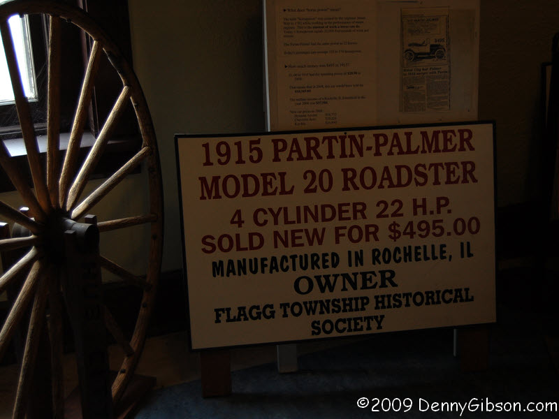
As I started to leave, Keith, the fellow manning the visitor center, mentioned the nearby museum and I started telling him how I wanted to get to Franklin Grove. Then he mentioned the Rochelle built car on display there and I decided I could squeeze it in. I was told that this 1915 Partin-Palmer is one of only two in existence though I don't know where the other is. I experienced some very strange behavior from my flash while at the museum. I later decided that it was just low batteries but its odd misfires made me think it was something worse. When it comes to flashes and cameras, you're sunk if they can't synch. |
|
|
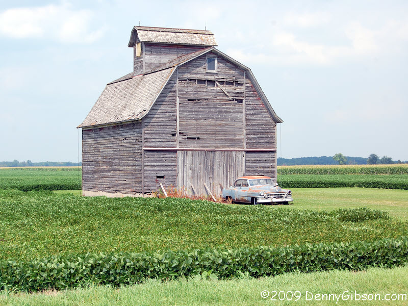 I believe this barn & Cadillac west of Rochelle are on the way to
becoming Lincoln Highway icons. The in-the-wild marker is on a curve just
east of Franklin Grove.
I believe this barn & Cadillac west of Rochelle are on the way to
becoming Lincoln Highway icons. The in-the-wild marker is on a curve just
east of Franklin Grove.
|
|
|
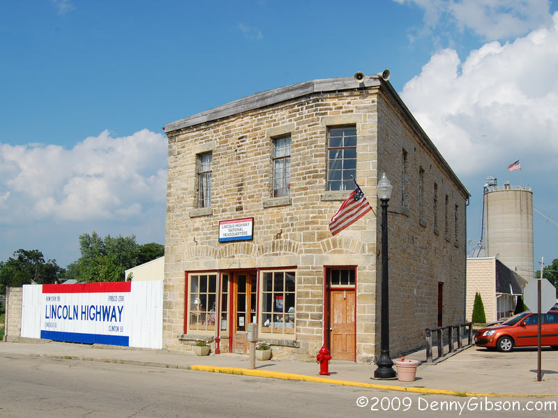
 Henry Isaac Lincoln built this store in 1860; just about the time his
cousin was moving into the White House. Extensive restoration began in
1995 and the Lincoln Highway Association's Tourism Headquarters moved in
in 1999. Lynn Asp is the friendly and knowledgeable director.
Henry Isaac Lincoln built this store in 1860; just about the time his
cousin was moving into the White House. Extensive restoration began in
1995 and the Lincoln Highway Association's Tourism Headquarters moved in
in 1999. Lynn Asp is the friendly and knowledgeable director.
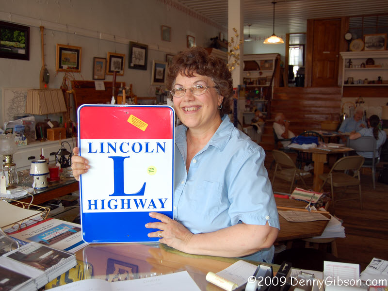
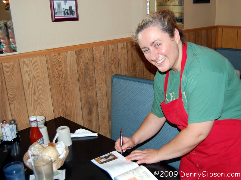
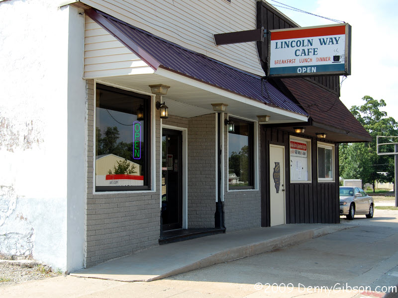
When Brian Butko's Lincoln Highway Companion came out a few months ago, I thought he might do a promotional tour and I could get an autographed copy on one of his Ohio stops. But noooooo... I don't think he did a tour at all and I know he didn't visit Ohio. So I've had to resort to having others sign the book. Lynn, at the LHA HQ was the first and Flamure Rushiti, across the street at the Lincoln Way Cafe, became the second. Friendly, accommodating, and good food. |
|
|

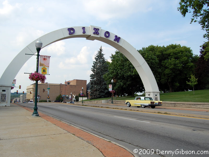 At night, the word "Dixon" lights up in the War Memorial Arch in
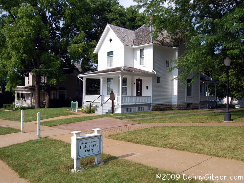
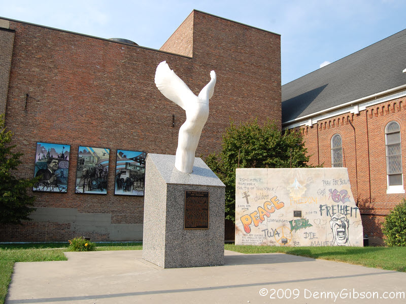
the city of Dixon. Dixon was Ronald Reagan's boyhood home which explains
the piece of the Berlin wall displayed downtown. The house where he lived
is open for tours although its day had ended just before I got there.
At night, the word "Dixon" lights up in the War Memorial Arch in
the city of Dixon. Dixon was Ronald Reagan's boyhood home which explains
the piece of the Berlin wall displayed downtown. The house where he lived
is open for tours although its day had ended just before I got there.
|
|
|
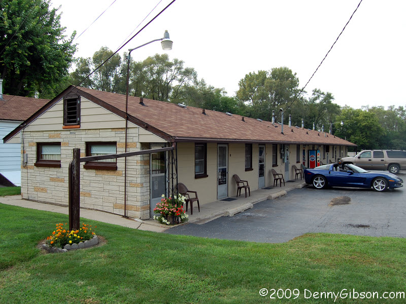

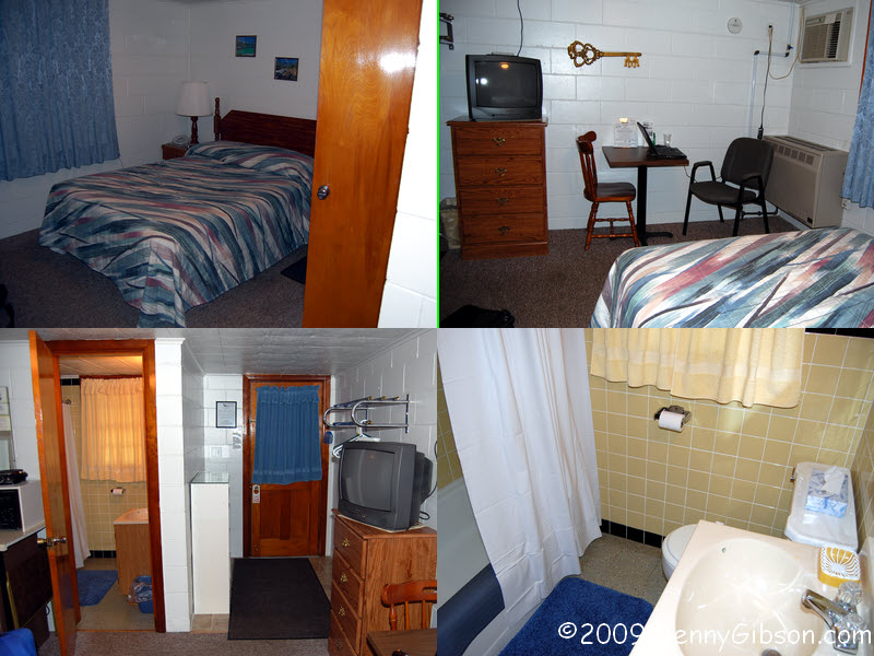
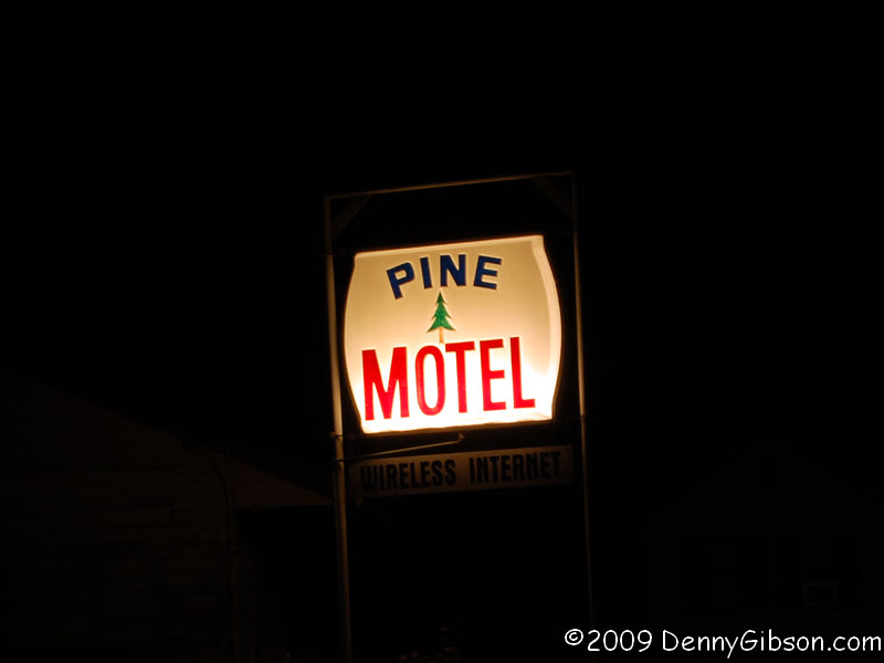 That Lincoln Highway Companion I mentioned lists several restaurants
and motels in each state. In many cases, Brian quotes a particular
individual in the description. In others, he describes his own experience.
Either approach gives me a pretty high level of faith. Other description
are unattributed and, for those, my faith is a bit more reserved. The
listing for the Pine Motel begins "Folks describe..." and was
clearly in the third category. Whatever concern I had was unwarranted and
the Pine Motel is a fine place to stay. Others know that, too, and I got
the last of nine rooms for Saturday night. It's
the smallest but was certainly enough for me. Clean, kitchenette (sink,
fridge, microwave, & hot plate), and wi-fi). All for barely $40.
That Lincoln Highway Companion I mentioned lists several restaurants
and motels in each state. In many cases, Brian quotes a particular
individual in the description. In others, he describes his own experience.
Either approach gives me a pretty high level of faith. Other description
are unattributed and, for those, my faith is a bit more reserved. The
listing for the Pine Motel begins "Folks describe..." and was
clearly in the third category. Whatever concern I had was unwarranted and
the Pine Motel is a fine place to stay. Others know that, too, and I got
the last of nine rooms for Saturday night. It's
the smallest but was certainly enough for me. Clean, kitchenette (sink,
fridge, microwave, & hot plate), and wi-fi). All for barely $40.
In downtown Fulton, there was no way could I bypass a place named Denny's that's within view of the welcome center windmill on the Mississippi and advertises PBR on tap. Turns out they weren't entirely truthful about the PBR but two out of three's not bad. |
|
|
| [Prev] [Site Home] [Trip Home] [Contact] [Next] |