Mostly Indiana
Prev
Next


|
Day 3: June 11, 2011 Mostly Indiana |
Prev Next |
|
|
|

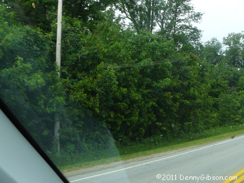
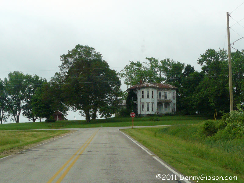

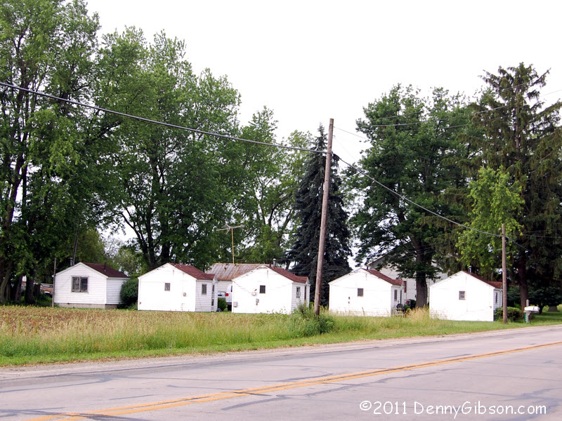
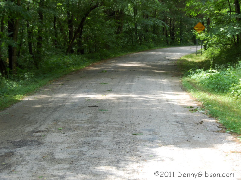
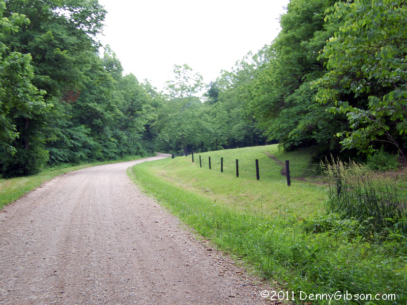
 US 36 once departed Greenville along the backside of the fair grounds on
what is now OH 121. I assume this row of cabins at the edge of town once
sheltered tourists but I know nothing of its history. The shape of the
path on a 1947 road map indicated that US 36 did not flow straight to its
current routing as would seem natural with the current roads. This
morning, my step-mom confirmed that the US highway had followed what is
now Bishop Road. She also remembered that the winter of 1950 turned the
road into "nothing but potholes". One rabbit and numerous
squirrels scurried out of my way as I drove over Bishop but I only got one
photograph. The interestingly shaped house stands where Bishop connects
with the current US 36.
US 36 once departed Greenville along the backside of the fair grounds on
what is now OH 121. I assume this row of cabins at the edge of town once
sheltered tourists but I know nothing of its history. The shape of the
path on a 1947 road map indicated that US 36 did not flow straight to its
current routing as would seem natural with the current roads. This
morning, my step-mom confirmed that the US highway had followed what is
now Bishop Road. She also remembered that the winter of 1950 turned the
road into "nothing but potholes". One rabbit and numerous
squirrels scurried out of my way as I drove over Bishop but I only got one
photograph. The interestingly shaped house stands where Bishop connects
with the current US 36.
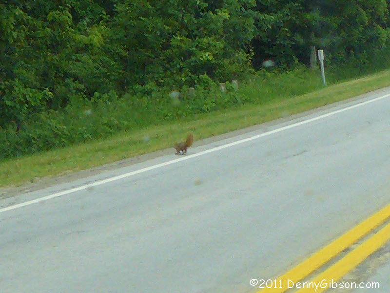
The small speck near the right edge of the next photo is a squirrel whose life I saved today. Just west of the little town of Palestine my eyes caught a hawk launch itself from a low branch on the road's south side. As I reached for the camera, I saw motion in the middle of the road and instantly realized that it was a squirrel that the hawk had targeted for breakfast. Sensing, I assume, the car approaching from behind it, the hawk veered off and the squirrel scampered to safety. I fired away with the camera but captured no hawk and barely caught the squirrel. I think I made one friend -- and one enemy -- today. |
|
|
 I'm including this picture partly in order to give a plug to the folks at
Roadside
America. I've installed their Attractions and Oddities
application on my Garmin and am quite pleased with it (though I have a few
gripes about the Garmin itself). One thing it does is raise an alert,
which is rather alarming the first time, when you are close to an
attraction or oddity. This, I'm fairly certain, is on the
"oddity" side of things.
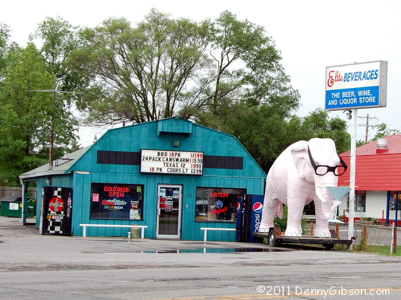
I'm including this picture partly in order to give a plug to the folks at
Roadside
America. I've installed their Attractions and Oddities
application on my Garmin and am quite pleased with it (though I have a few
gripes about the Garmin itself). One thing it does is raise an alert,
which is rather alarming the first time, when you are close to an
attraction or oddity. This, I'm fairly certain, is on the
"oddity" side of things.
|
|
|
 And I'm including this picture partly in order to give a plug to the
Bremer Tour Guide Service. I'd plotted my course months ago and was not
now certain that it followed any US 36 alignment through Indianapolis let
alone which one. In a Facebook triggered e-versation, Pat volunteered to
lead me through town on the alignment shown in his 1965 Amoco map. Of
course I accepted his offer and met him and Jennifer and grandson Jameson
at a conveniently located Dunkin' Donuts. Pat & Jennifer operate
Road Trip
Memories and really know their roads -- and movies. I'd follow them
through the gates of...
And I'm including this picture partly in order to give a plug to the
Bremer Tour Guide Service. I'd plotted my course months ago and was not
now certain that it followed any US 36 alignment through Indianapolis let
alone which one. In a Facebook triggered e-versation, Pat volunteered to
lead me through town on the alignment shown in his 1965 Amoco map. Of
course I accepted his offer and met him and Jennifer and grandson Jameson
at a conveniently located Dunkin' Donuts. Pat & Jennifer operate
Road Trip
Memories and really know their roads -- and movies. I'd follow them
through the gates of...
|
|
|
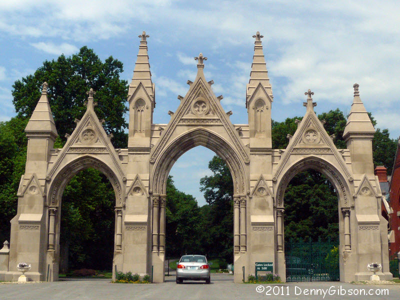
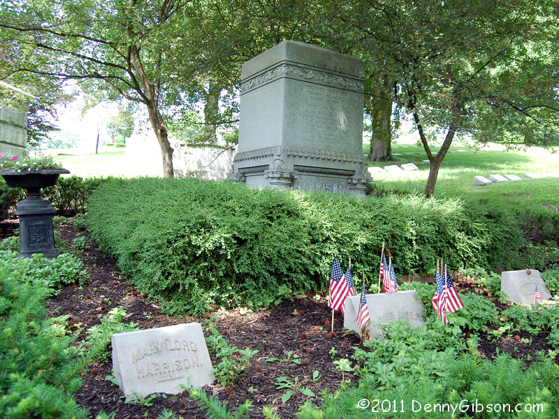
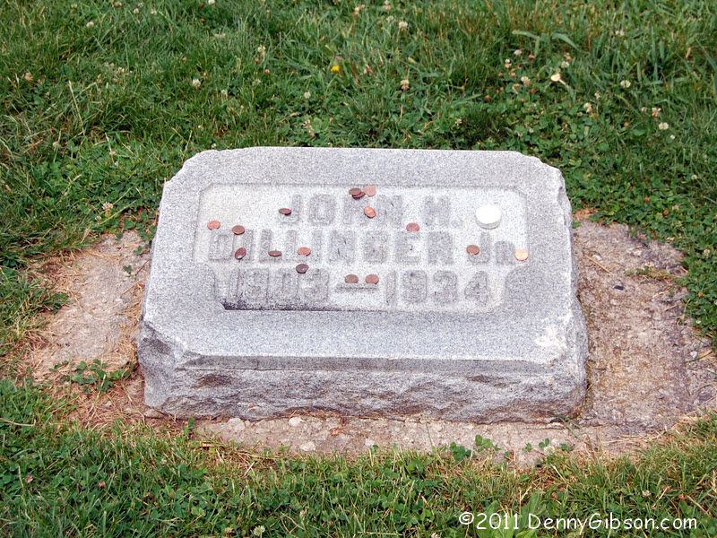
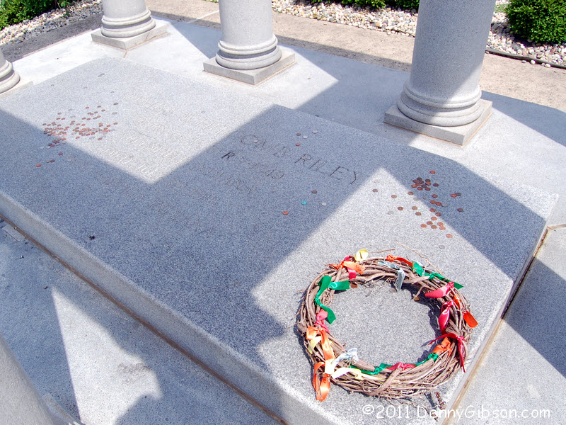
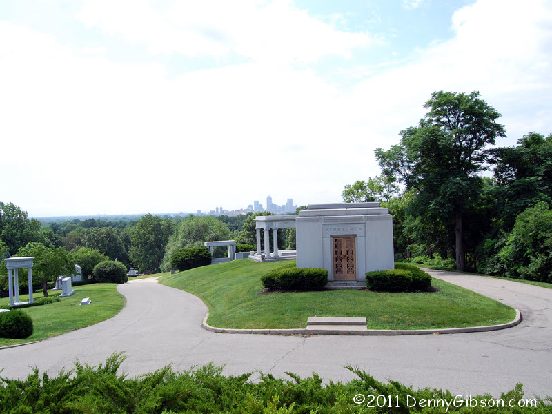
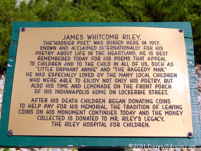
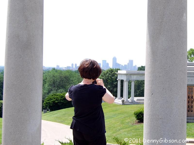
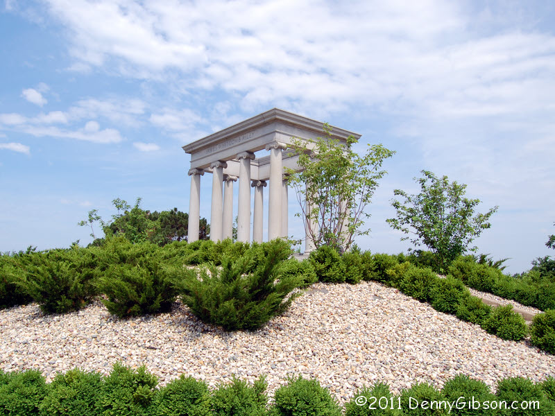 ...Indiana's largest cemetery. That 1965 alignment actually passes through
Crown Hill
Cemetery on 38th Street. Among the residents we visited were President
Benjamin Harrison, who seems to have no money, John Dillinger, who has a
little money, and James Whitcomb Riley, who has
more. He also has the best view in the place since he is buried on the
highest point in the city.
...Indiana's largest cemetery. That 1965 alignment actually passes through
Crown Hill
Cemetery on 38th Street. Among the residents we visited were President
Benjamin Harrison, who seems to have no money, John Dillinger, who has a
little money, and James Whitcomb Riley, who has
more. He also has the best view in the place since he is buried on the
highest point in the city.
And by the way, have you heard the one about the two poles and the Italian? |
|
|

 Pat wasn't sure if this now dead end street was ever signed as US 36 but
it was certainly part of the Pikes Peak Ocean to Ocean Highway. Back then
the street would have connected with Washington Street (a.k.a. US 40),
which carried both the PP-OO and the National Old Trails Road. The segment
is called Rockville Avenue and its western end connects with Rockville
Road.
Pat wasn't sure if this now dead end street was ever signed as US 36 but
it was certainly part of the Pikes Peak Ocean to Ocean Highway. Back then
the street would have connected with Washington Street (a.k.a. US 40),
which carried both the PP-OO and the National Old Trails Road. The segment
is called Rockville Avenue and its western end connects with Rockville
Road.
|
|
|
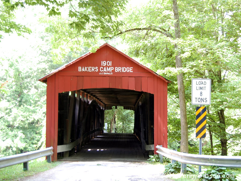
 The travel shown in the next several panels benefited greatly from the
excellent research and field work of Jim Grey. My site will leave you with questions. The
answers are probably here.
The travel shown in the next several panels benefited greatly from the
excellent research and field work of Jim Grey. My site will leave you with questions. The
answers are probably here.
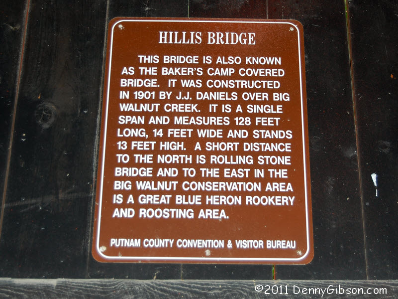
This bridge is on an old US 36 alignment between Groveland and Bainbridge. Apparently it's known to some as Hollis Bridge. When I walked over the bridge I was accompanied by a group of kids who were heading to a field to play baseball. To them the 110 year old structure is just a handy path but it was pretty cool to see about a half dozen teens (or close) walk over a wooden bridge to play real ball rather than Wii ball. |
|
|
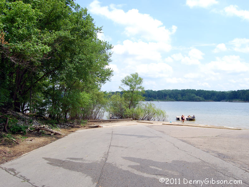

 Sometime around 1960 the waters, aided by the Army Corp of Engineers, rose
up and swallowed US 36. For reasons entirely unknown to me, the swallowing
lake is sometimes called Raccoon Lake and sometimes called Cecil M Harden
Lake. Your choice, I guess. The first two pictures are of the east side
where a dirt barrier keeps you from driving any nearer the water than
about half a mile. On the west side, getting near the water is encouraged.
Although the old road itself has been barricaded, a public boat ramp
extends from its side.
Sometime around 1960 the waters, aided by the Army Corp of Engineers, rose
up and swallowed US 36. For reasons entirely unknown to me, the swallowing
lake is sometimes called Raccoon Lake and sometimes called Cecil M Harden
Lake. Your choice, I guess. The first two pictures are of the east side
where a dirt barrier keeps you from driving any nearer the water than
about half a mile. On the west side, getting near the water is encouraged.
Although the old road itself has been barricaded, a public boat ramp
extends from its side.
|
|
|

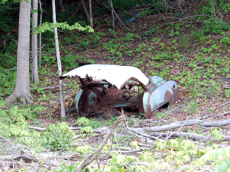

 We did drive down one dead end which we could have avoided if we'd
remembered what Jim said. But then we'd have missed the half car and our
moment of "huh?" We did remember what Jim said about the next
old segment and avoided diving into the otherwise inviting (no dead end
sign) east end of the bridgeless road whose western end is shown behind
the humongous tree. The tree stands where a north-south road connects with
the middle of the old alignment and allowed us to drive the western half.
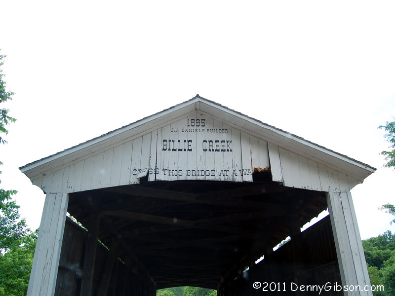
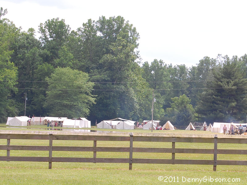
We reached the Billie Creek Bridge, and Billie Creek Vilage by following
another old alignment. Billie Creek Village is a commercial operation with
entrance fees, etc. As you can see, a Civil War encampment was taking
place this weekend but we managed to pass through without paying and
without being fired on. Guess we didn't look very threatening.
We did drive down one dead end which we could have avoided if we'd
remembered what Jim said. But then we'd have missed the half car and our
moment of "huh?" We did remember what Jim said about the next
old segment and avoided diving into the otherwise inviting (no dead end
sign) east end of the bridgeless road whose western end is shown behind
the humongous tree. The tree stands where a north-south road connects with
the middle of the old alignment and allowed us to drive the western half.
We reached the Billie Creek Bridge, and Billie Creek Vilage by following
another old alignment. Billie Creek Village is a commercial operation with
entrance fees, etc. As you can see, a Civil War encampment was taking
place this weekend but we managed to pass through without paying and
without being fired on. Guess we didn't look very threatening.
|
|
|
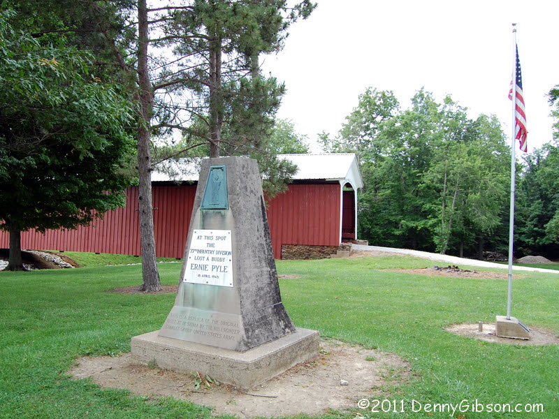
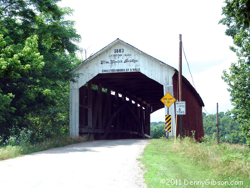
 Rockville is just past Billie Creek Village and there the Bremers headed
south on US 41. I drove a couple more old segments, crossed one more
covered bridge, and stopped at the Ernie Pyle Memorial. There is, or at
least was, an Ernie Pyle Museum at his birthplace in nearby Dana. While
writing this, I've read that the museum may have closed last year due to
state budget cuts. Boy do I feel guilty about not stopping there today.
Every time Pyle's name comes up, I try to remind people that he was a
great travel writer before he was a great war reporter. His many
dispatches about 1940s roadside -- and beyond -- attractions are wonderful
reading.
Rockville is just past Billie Creek Village and there the Bremers headed
south on US 41. I drove a couple more old segments, crossed one more
covered bridge, and stopped at the Ernie Pyle Memorial. There is, or at
least was, an Ernie Pyle Museum at his birthplace in nearby Dana. While
writing this, I've read that the museum may have closed last year due to
state budget cuts. Boy do I feel guilty about not stopping there today.
Every time Pyle's name comes up, I try to remind people that he was a
great travel writer before he was a great war reporter. His many
dispatches about 1940s roadside -- and beyond -- attractions are wonderful
reading.
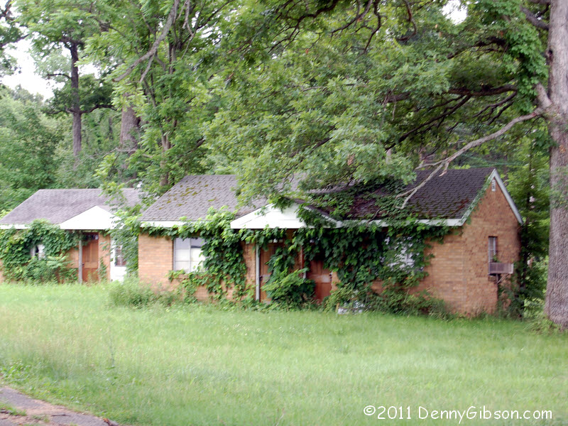
Before we separated, Pat reminded me about this collection of cabins just west of IL 1 and wondered if they were still there. It was good to see that they are and that they still look pretty sturdy though I doubt there's any chance of a resurrection. |
|
|
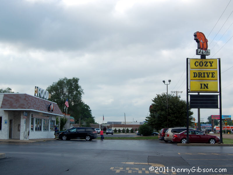
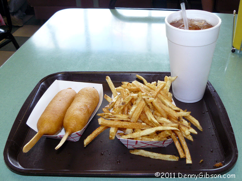
 I had not researched old US 36 through Springfield so just followed the
current alignment around the town. That took me within a couple miles of
the Cozy Dog
so I headed there for a taste of Route 66. I didn't stay long and after
grabbing dinner and a proof-I-was-there picture, I headed on to
Jacksonville, Illinois, for the night.
I had not researched old US 36 through Springfield so just followed the
current alignment around the town. That took me within a couple miles of
the Cozy Dog
so I headed there for a taste of Route 66. I didn't stay long and after
grabbing dinner and a proof-I-was-there picture, I headed on to
Jacksonville, Illinois, for the night.
|
|
|
| [Prev] [Site Home] [Trip Home] [Contact] [Next] |