Following the Feeder
Comment via blog
Prev
Next


|
Day 4: June 22, 2015 Following the Feeder Comment via blog |
Prev Next |
|
|
|
 This is a look up Jackson Boulevard as I begin my eastward drive on the
feeder route.
This is a look up Jackson Boulevard as I begin my eastward drive on the
feeder route.
|
|
|
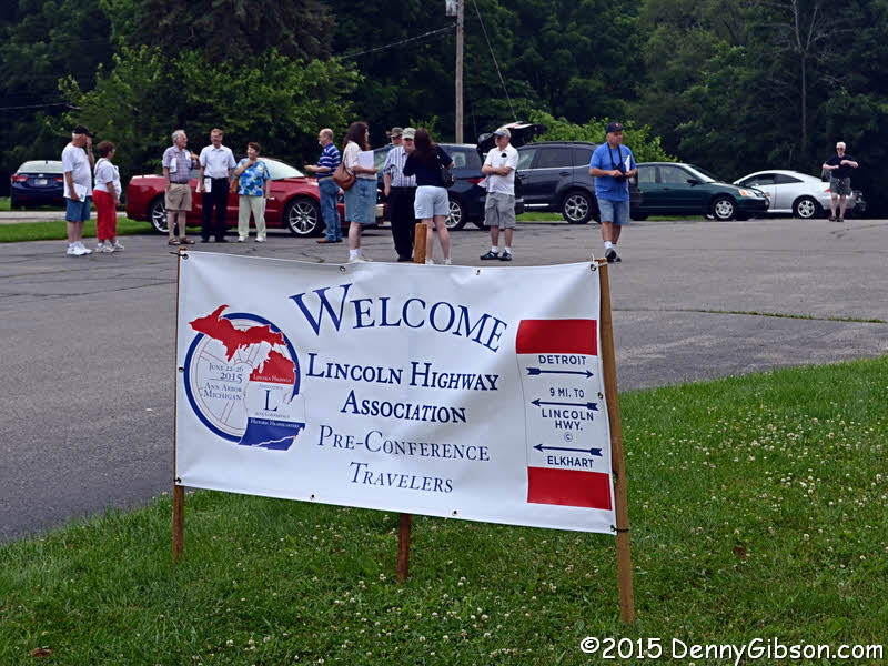 The start of the organized tour was a few miles further on at the Elkhart
County Historical Museum where a parking lot was available.
The start of the organized tour was a few miles further on at the Elkhart
County Historical Museum where a parking lot was available.
|
|
|
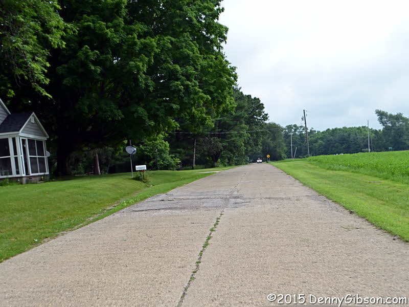
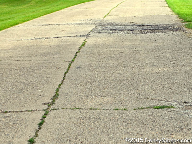 I had plotted the feeder from the online map but, just a few miles from
the start, the newly provided instructions guided us onto this alignment,
Old M103, that I hadn't known about. Those instructions, by the way, were
excellent.
I had plotted the feeder from the online map but, just a few miles from
the start, the newly provided instructions guided us onto this alignment,
Old M103, that I hadn't known about. Those instructions, by the way, were
excellent.
|
|
|

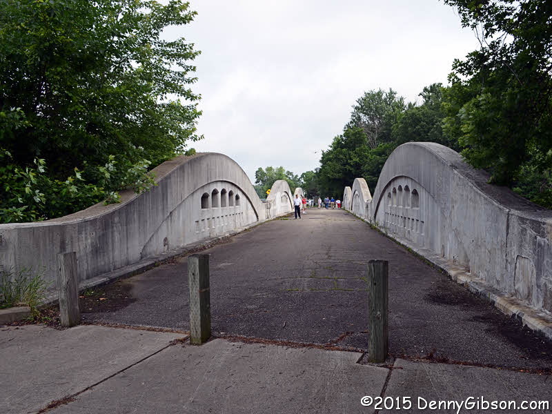

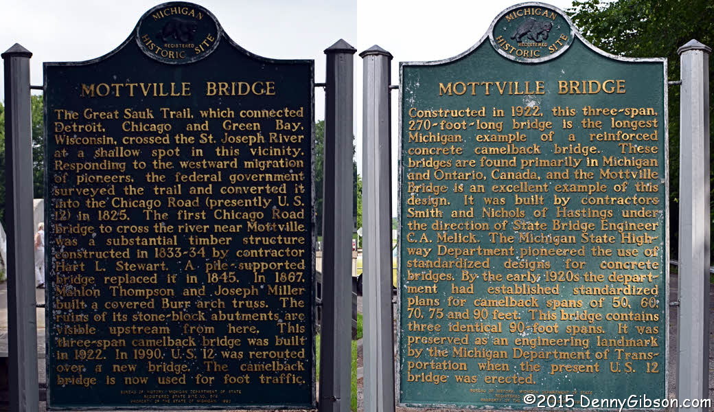
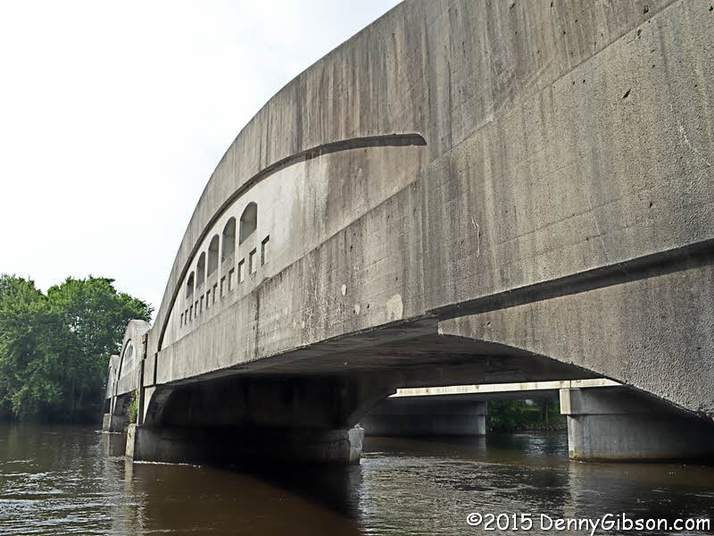 What was actually the tour's only stop as a full group was at the 1922
Mottville Bridge. The three span concrete camelback replaced a wooden
covered bridge whose abutments can still be seen in the river. Wooden
steps permit a look at beneath the bridge where water level looks pretty
high. A sign contains one panel describing the
bridge's importance to transportation and another on its engineering
significance.
What was actually the tour's only stop as a full group was at the 1922
Mottville Bridge. The three span concrete camelback replaced a wooden
covered bridge whose abutments can still be seen in the river. Wooden
steps permit a look at beneath the bridge where water level looks pretty
high. A sign contains one panel describing the
bridge's importance to transportation and another on its engineering
significance.
|
|
|
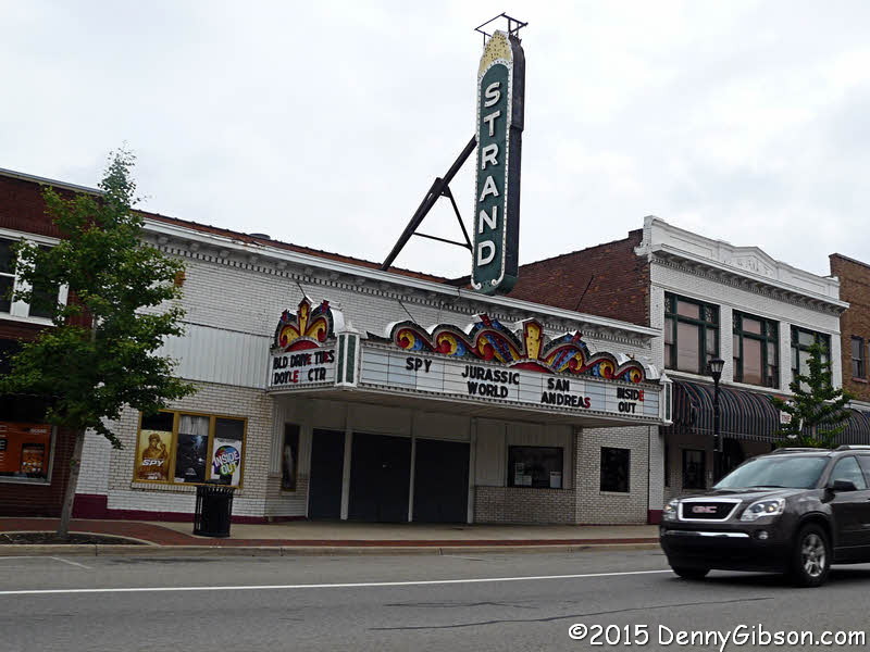
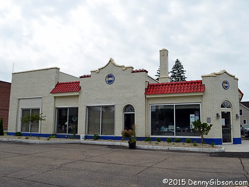
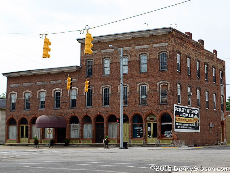
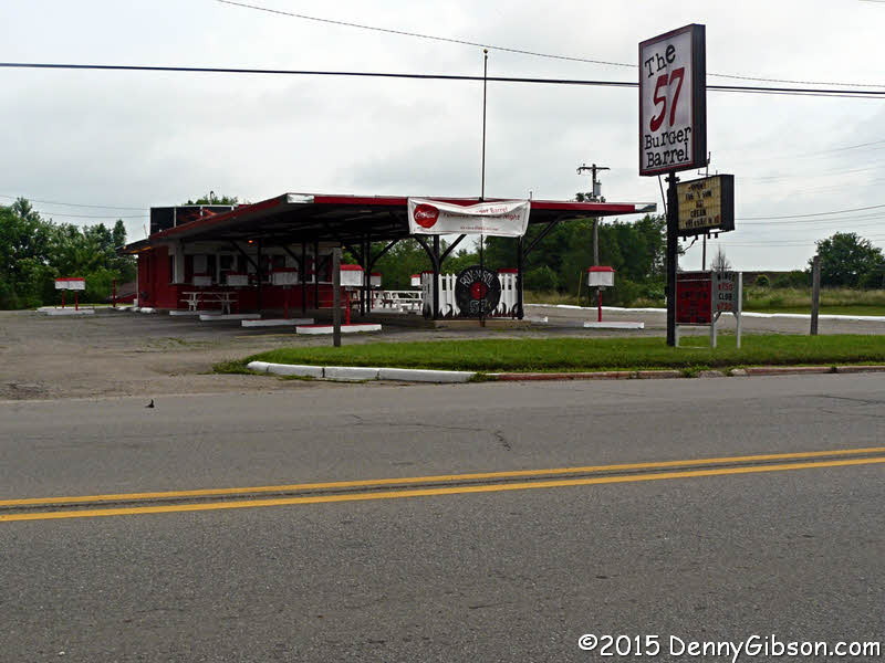 Numerous roadside attractions included the 57 Burger Barrel Drive-in and
1920 Tasty Nut Shop in White Pigeon and a restored gas station and nice
looking theater in Sturgis.
Numerous roadside attractions included the 57 Burger Barrel Drive-in and
1920 Tasty Nut Shop in White Pigeon and a restored gas station and nice
looking theater in Sturgis.
|
|
|
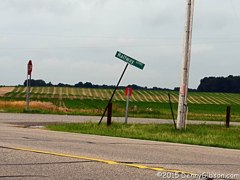
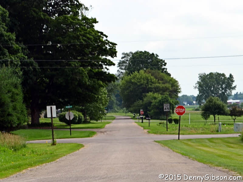
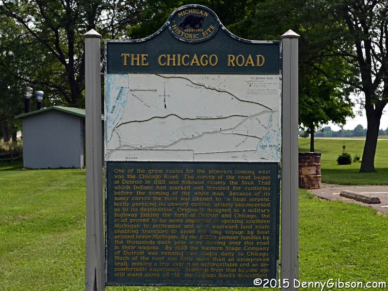
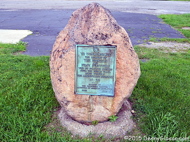
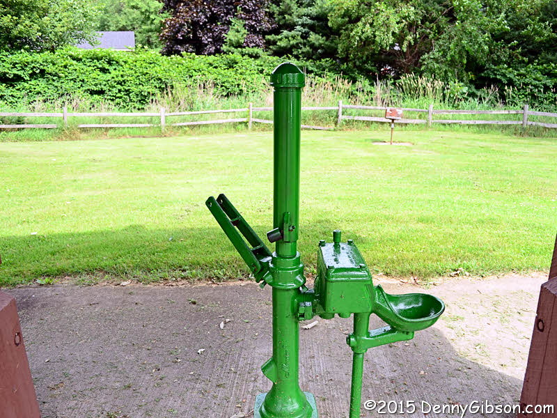 Although it is now signed US-12 and we are driving it today as the Lincoln
Highway Detroit Feeder Route, this road has been called many things
including the Sauk Trail, the Abe Lincoln Trail, and the Chicago Road. It
was extremely important as a path between Detroit and Chicago and the
"halfway" this crossroad is named for is the one between those
cities. A few miles east of Halfway Road, the old alignment shown in the
second picture passes behind the park containing the sign shown in the
the third. The park also contains a pump that doesn't work. Bob Dylan can
tell you why.
Although it is now signed US-12 and we are driving it today as the Lincoln
Highway Detroit Feeder Route, this road has been called many things
including the Sauk Trail, the Abe Lincoln Trail, and the Chicago Road. It
was extremely important as a path between Detroit and Chicago and the
"halfway" this crossroad is named for is the one between those
cities. A few miles east of Halfway Road, the old alignment shown in the
second picture passes behind the park containing the sign shown in the
the third. The park also contains a pump that doesn't work. Bob Dylan can
tell you why.
|
|
|
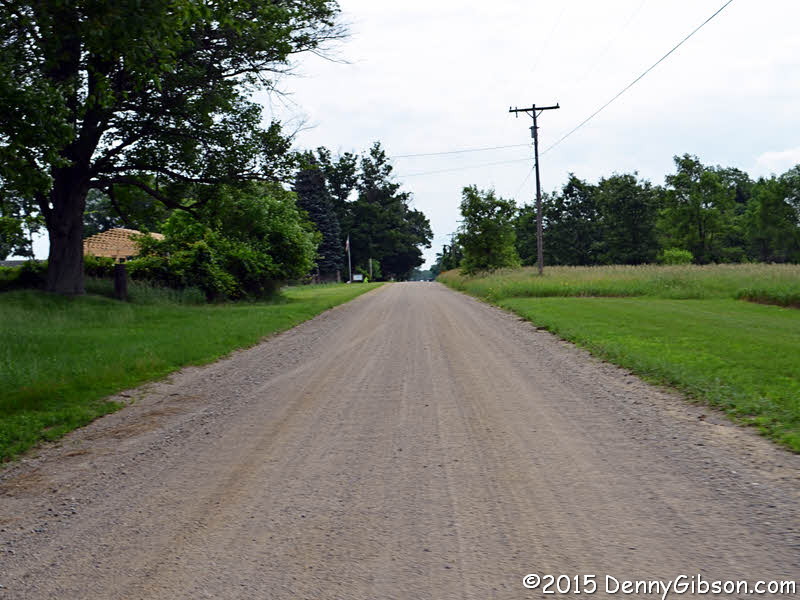
 A couple of miles before Bronson, there is an old alignment that I did
know about. This one is gravel. I hadn't gone far before I spotted the
truck across the road. I slowed down and before long could see that it was
parked there and being used to transfer something to or from the barn. As
I was considering my options, I realized that a man standing near the
truck was waving me forward. He guided me through the grass and when I
shouted "Thanks", he answered with a cheery "You're
welcome". I was traveling alone at the time so I don't know how many
of the group he had to wave around the truck but I hope his good cheer
continued.
A couple of miles before Bronson, there is an old alignment that I did
know about. This one is gravel. I hadn't gone far before I spotted the
truck across the road. I slowed down and before long could see that it was
parked there and being used to transfer something to or from the barn. As
I was considering my options, I realized that a man standing near the
truck was waving me forward. He guided me through the grass and when I
shouted "Thanks", he answered with a cheery "You're
welcome". I was traveling alone at the time so I don't know how many
of the group he had to wave around the truck but I hope his good cheer
continued.
|
|
|
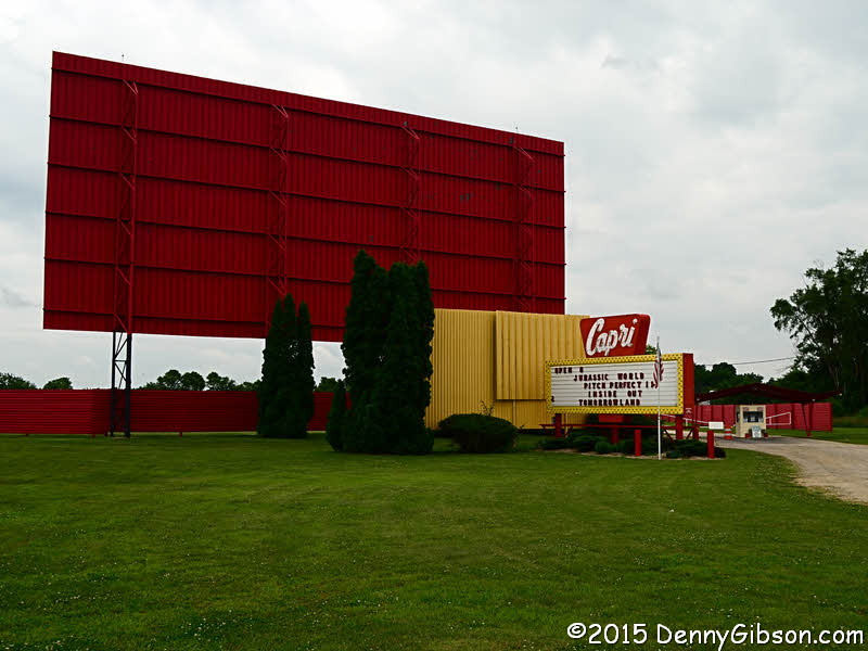 The Capri
Drive-In near Batavia looks like a great place to spend a summer
evening.
The Capri
Drive-In near Batavia looks like a great place to spend a summer
evening.
|
|
|
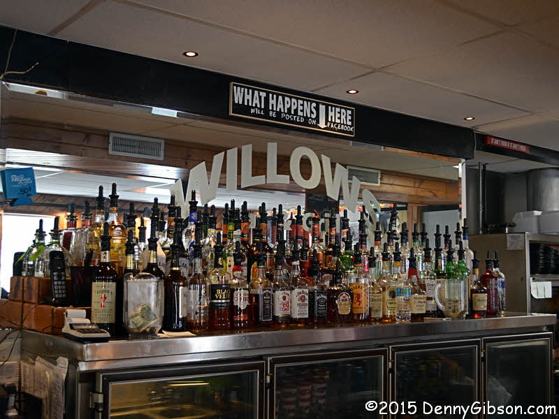
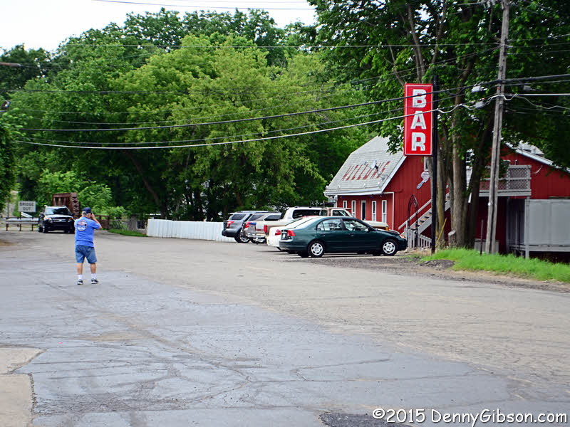
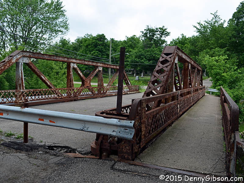
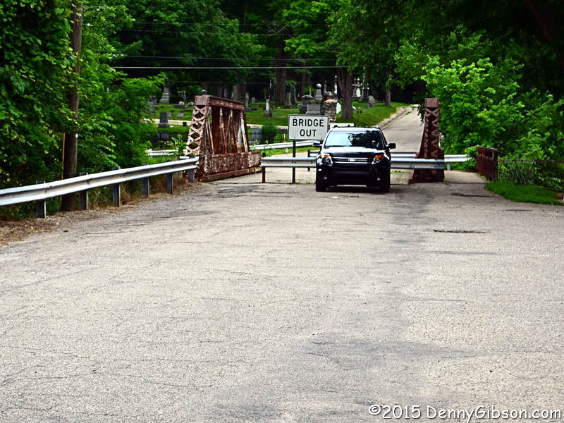

 The Capri Drive-in actually has a Coldwater address and so does
The Willows. Several road related items are in the
vicinity of the bar and grill. One is a bypassed scrap of pavement at the
base of the cemetery. Another is a commemorative
plaque placed by the Daughters of the American Revolution in 1925.
The road itself is notable since the mile or so east of the river was
paved to Seedling Mile standards in 1916 and the 1920 bridge is also
interesting.
The Capri Drive-in actually has a Coldwater address and so does
The Willows. Several road related items are in the
vicinity of the bar and grill. One is a bypassed scrap of pavement at the
base of the cemetery. Another is a commemorative
plaque placed by the Daughters of the American Revolution in 1925.
The road itself is notable since the mile or so east of the river was
paved to Seedling Mile standards in 1916 and the 1920 bridge is also
interesting.
My picture of the Willows includes Steve Rider taking his own picture of it. The two of us then went inside. Steve just wanted to look things over and I sat down at the bar for a beer. When it came time to leave, I was surprised to find Steve still outside in the company of most of the tour group. They had decided to eat lunch here and found seats on the outside deck. That sounded inviting but I wasn't the least bit hungry so headed on down the road. So did Steve. |
|
|
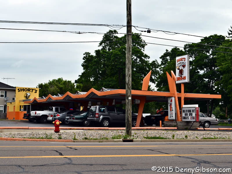
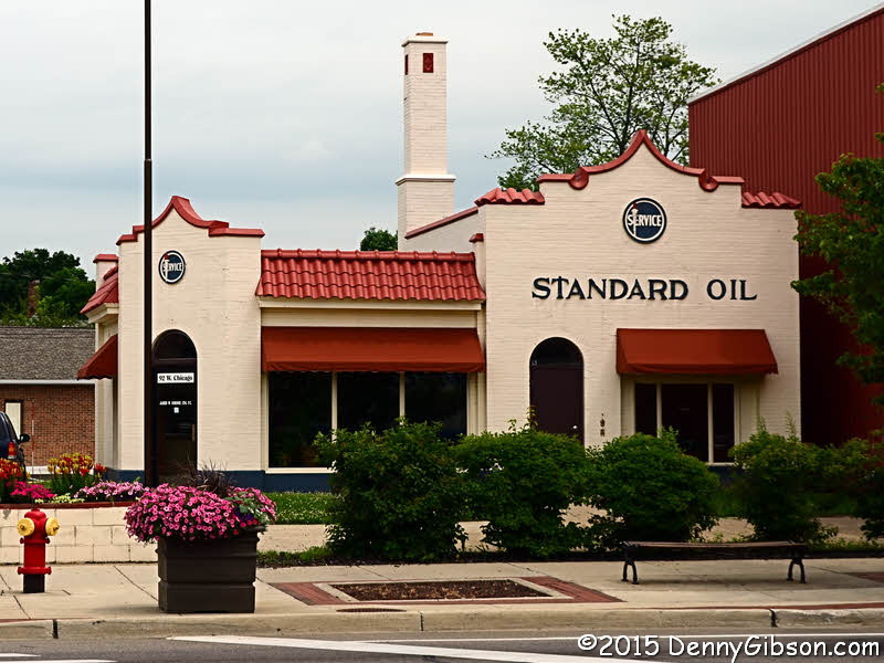 Short's Rootbeer Stand and the restored gas station
are actually in Coldwater.
Short's Rootbeer Stand and the restored gas station
are actually in Coldwater.
|
|
|
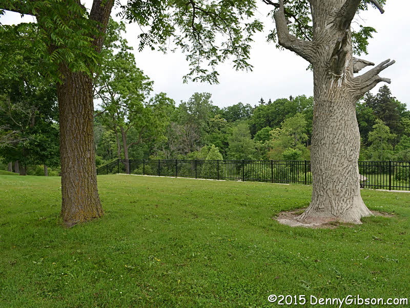
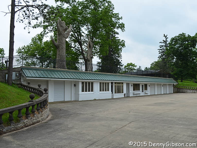
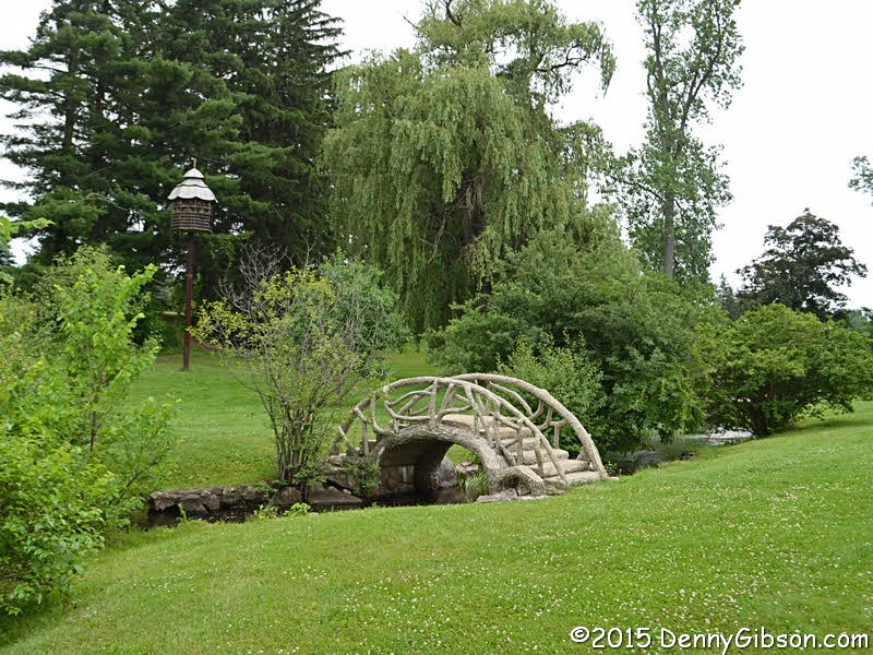
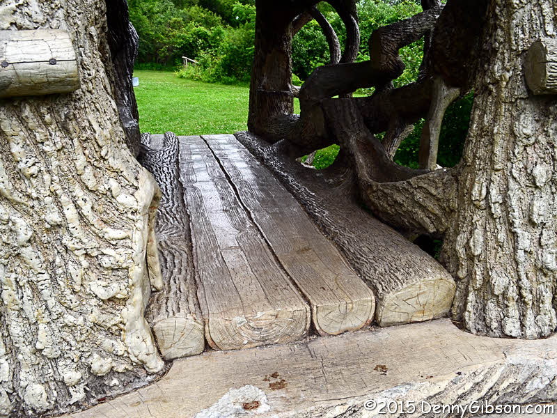
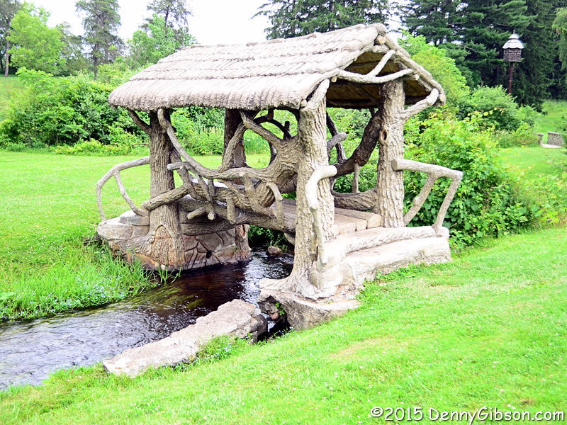 There are seventeen bridges in
McCourtie Park. The bridges and other features of the
park are wonderful examples of a technique known as "el trabajo
rustico". Though the material is concrete, the results look like wood
or rope. This was the estate of W.H.L. McCourtie. He often entertained in
the white structure which could not be seen from the road. The two
"trees" standing over the structure are actually chimneys. One
is shown in the last picture along with a real tree.
There are seventeen bridges in
McCourtie Park. The bridges and other features of the
park are wonderful examples of a technique known as "el trabajo
rustico". Though the material is concrete, the results look like wood
or rope. This was the estate of W.H.L. McCourtie. He often entertained in
the white structure which could not be seen from the road. The two
"trees" standing over the structure are actually chimneys. One
is shown in the last picture along with a real tree.
|
|
|
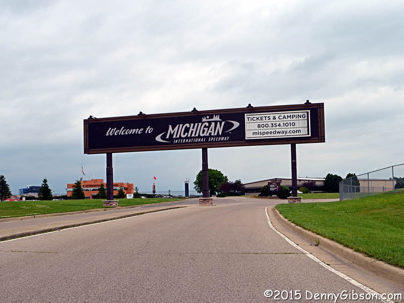 The feeder goes right by Michigan International Speedway.
|
|
|
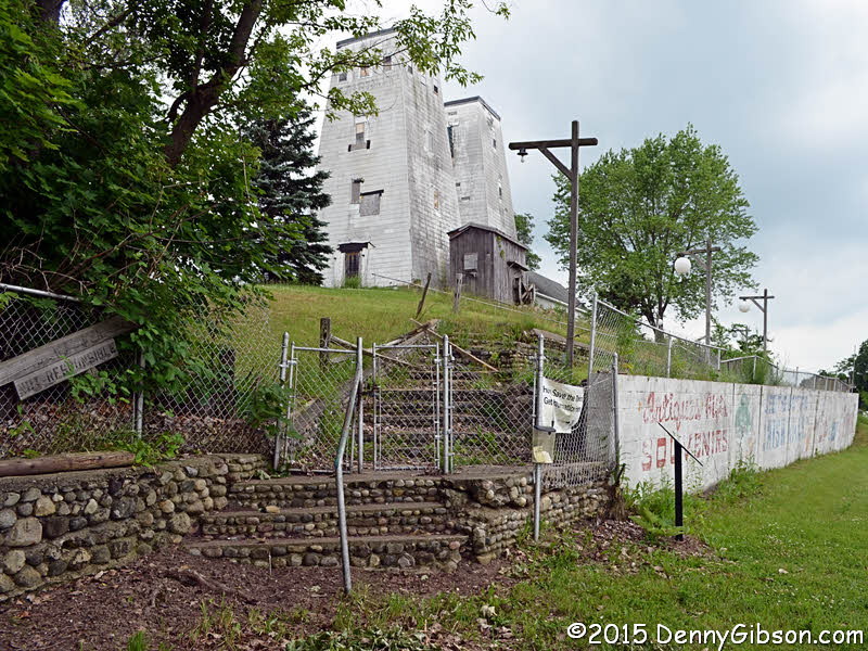

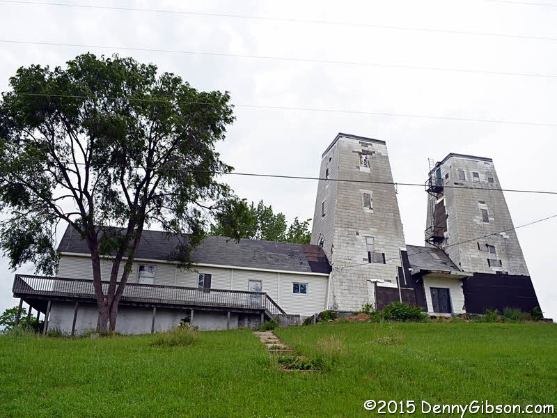 The story of the Irish Hills Towers is one of a farmer and a company
building competing observation towers as close as possible to the property
line between them. The competition started in 1924 and did not really end
until the two properties were combined in 1957. When I spotted the towers,
I turned earlier than needed and ended up on a road behind the towers for
the unusual "dark side of the moon" view in the first photo.
The story of the Irish Hills Towers is one of a farmer and a company
building competing observation towers as close as possible to the property
line between them. The competition started in 1924 and did not really end
until the two properties were combined in 1957. When I spotted the towers,
I turned earlier than needed and ended up on a road behind the towers for
the unusual "dark side of the moon" view in the first photo.
|
|
|
| [Prev] [Site Home] [Trip Home] [Contact] [Next] |