Facerocks
Comment via blog
Prev
Next


|
Day 18: June 25, 2014 Facerocks Comment via blog |
Prev Next |
|
|
|
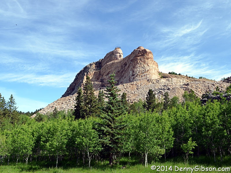
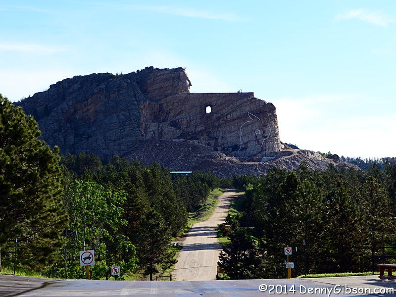 I arrived at the Crazy Horse Memorial shortly after it opened and
grabbed my first picture from the parking lot. I may have been the first
visitor of the day as the orientation movie started as soon as I was
seated. After that, showings of the twenty minute movie alternated between
two theaters so that one was starting every ten minutes. The movie was
well done and informative. The theater exited into an area with a wall of
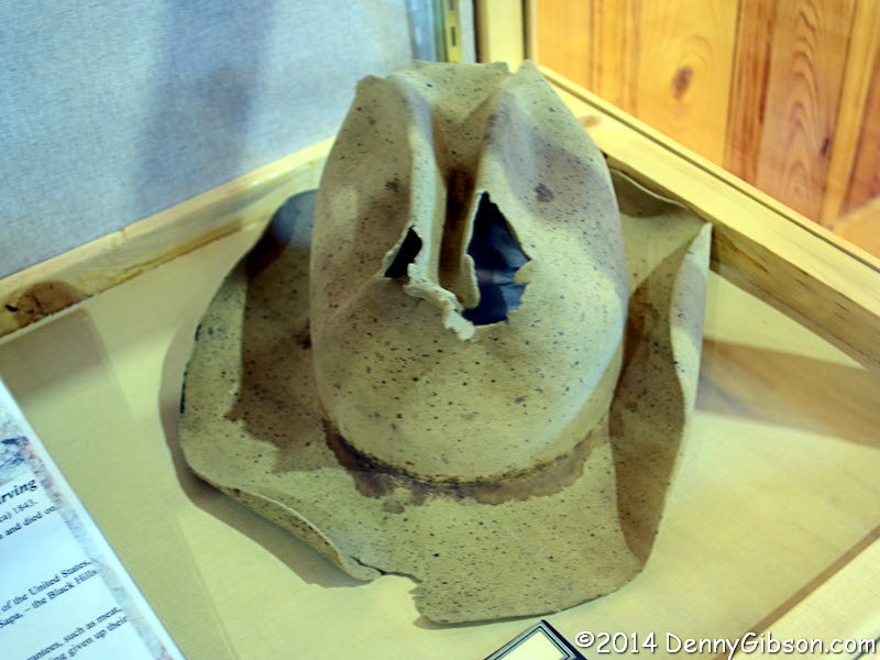
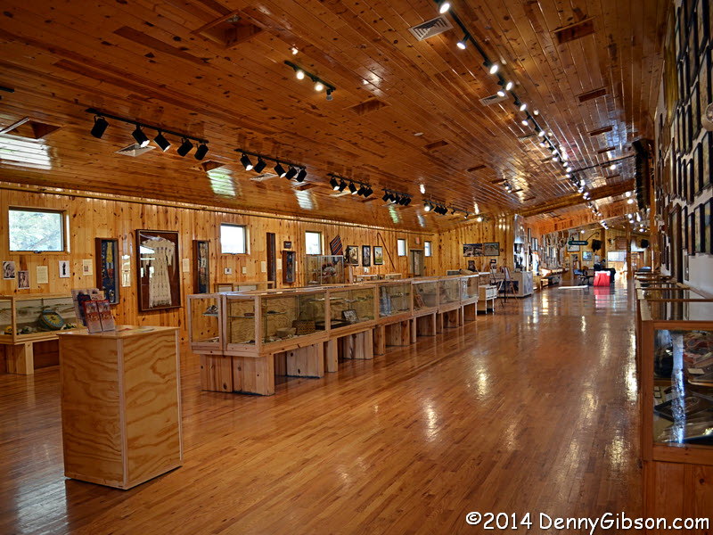
windows facing the memorial. This area connects to a large museum filled
with lots of Native American articles, many donated, as well as items
related to the monument. Perhaps the most iconic item on display is the
well worn hat of Korczak Ziolkowski, who designed and initially worked
alone on the sculpture.
I arrived at the Crazy Horse Memorial shortly after it opened and
grabbed my first picture from the parking lot. I may have been the first
visitor of the day as the orientation movie started as soon as I was
seated. After that, showings of the twenty minute movie alternated between
two theaters so that one was starting every ten minutes. The movie was
well done and informative. The theater exited into an area with a wall of
windows facing the memorial. This area connects to a large museum filled
with lots of Native American articles, many donated, as well as items
related to the monument. Perhaps the most iconic item on display is the
well worn hat of Korczak Ziolkowski, who designed and initially worked
alone on the sculpture.
|
|
|
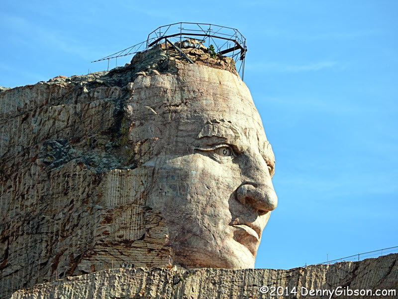

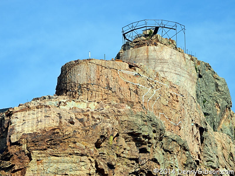
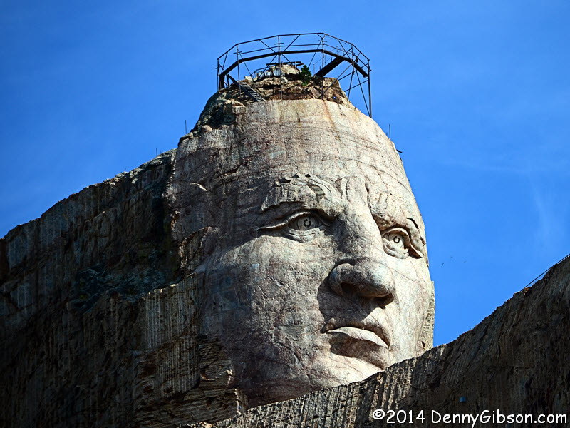
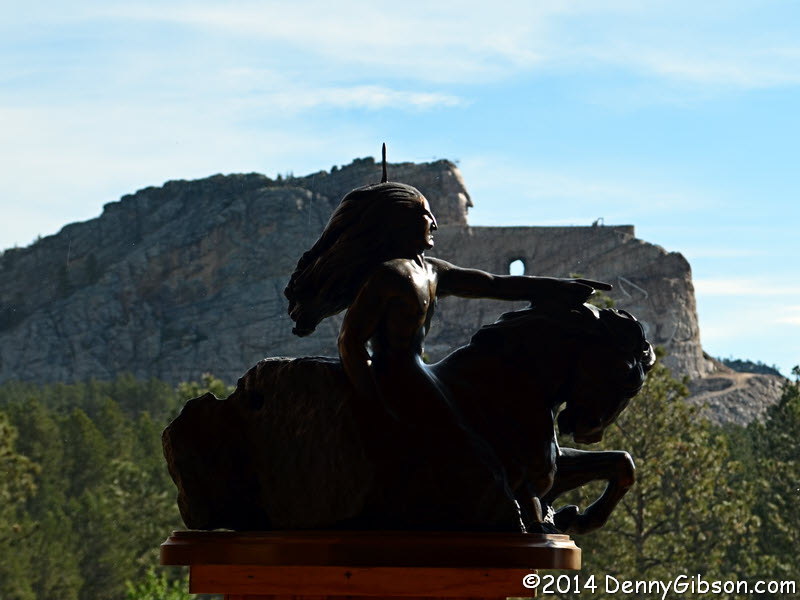
 As I had been the only viewer for the first showing of the movie, I was
the lone passenger on the first bus to the base of the memorial. Kim, my
driver/guide, was knowledgeable and friendly. That's not a crown on Crazy
Horse's head. It's a measuring device to transfer points from scale models
to the mountain. The second picture includes workers near the tunnel under
the arm. The third is as close as we got to the "dark side of the
moon". Plans call for this side to be carved as well. A hint of Crazy
Horse's unfinished left cheek can be seen in the fourth picture.
As I had been the only viewer for the first showing of the movie, I was
the lone passenger on the first bus to the base of the memorial. Kim, my
driver/guide, was knowledgeable and friendly. That's not a crown on Crazy
Horse's head. It's a measuring device to transfer points from scale models
to the mountain. The second picture includes workers near the tunnel under
the arm. The third is as close as we got to the "dark side of the
moon". Plans call for this side to be carved as well. A hint of Crazy
Horse's unfinished left cheek can be seen in the fourth picture.
|
|
|

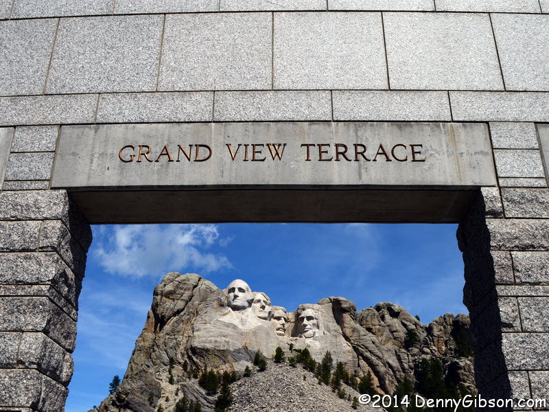
 I went directly from the Crazy Horse Memorial to
Mount Rushmore.
Although there was never any doubt about me stopping here, this is a place
I'm really uncomfortable with. On one hand, it has existed my entire life
and has appeared in just about every conceivable patriotic setting. It is,
without question, a universally recognizable symbol of the United States
and I accept and frequently embrace it. On the other hand, it is official
defacement, on a massive scale, of a place considered sacred by some. Two
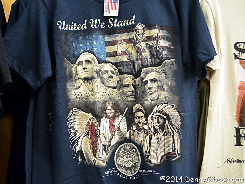
weeks ago, back at Fort Cody Trading Post, I took a picture of a shirt
that I thought one of the most bizarre I'd ever seen. I edited it and had
it ready for that day's post but I found no place for it. It fits today's
post much better though it seems even more bizarre now than then.
Here it is.
I went directly from the Crazy Horse Memorial to
Mount Rushmore.
Although there was never any doubt about me stopping here, this is a place
I'm really uncomfortable with. On one hand, it has existed my entire life
and has appeared in just about every conceivable patriotic setting. It is,
without question, a universally recognizable symbol of the United States
and I accept and frequently embrace it. On the other hand, it is official
defacement, on a massive scale, of a place considered sacred by some. Two
weeks ago, back at Fort Cody Trading Post, I took a picture of a shirt
that I thought one of the most bizarre I'd ever seen. I edited it and had
it ready for that day's post but I found no place for it. It fits today's
post much better though it seems even more bizarre now than then.
Here it is.
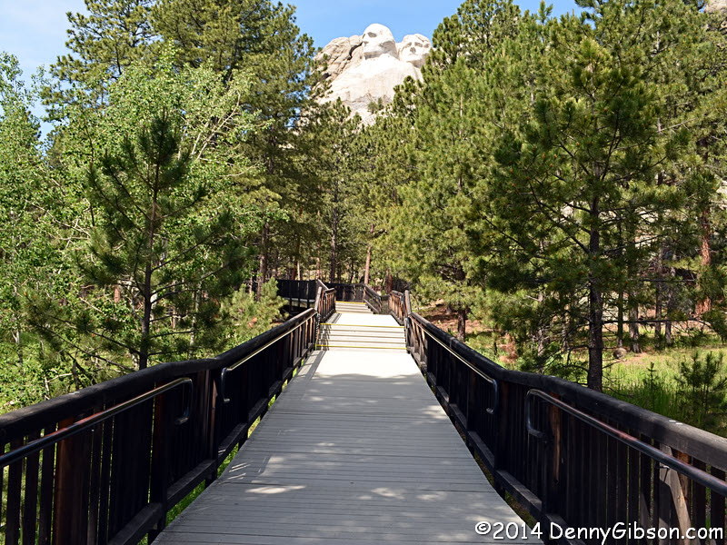
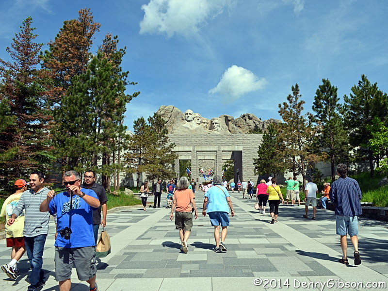
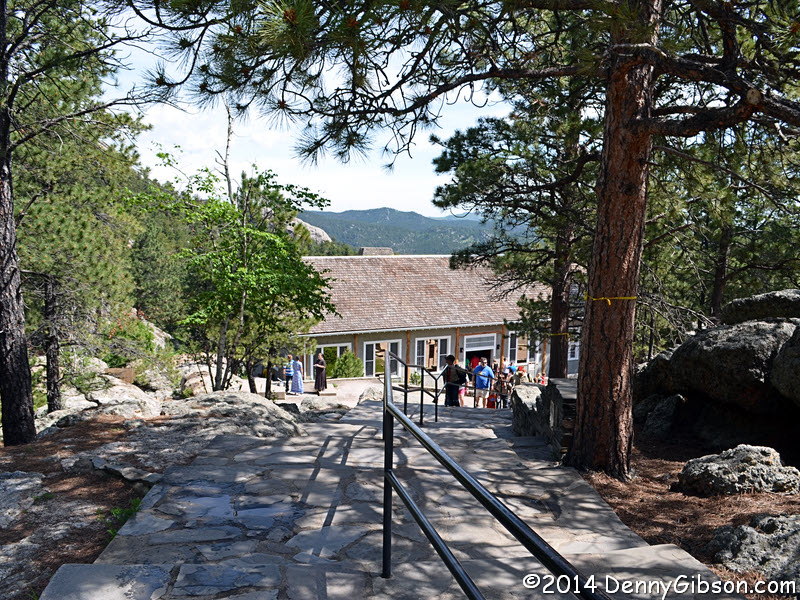
I snapped pictures with the rest as I walked toward the stone faces. A posted schedule indicated that a ranger presentation would be beginning shortly in Sculptor's Studio and that's where I headed. The ranger gave her talk in front of the often revised model that sculptor Gutzon Borglum created. It was a nice overview mixed with some human interest stories. According to markers for the benefit of a recorded audio tour, the end of the Presidential Trail is near the Sculptor's Studio and its beginning at the other side of the carvings. The last picture shows the Presidential Trail descending to the studio. There are plenty more steps beyond that. Being too cheap to spring for the audio tour, I had absolutely no reason to go back up the steps I had walked down to reach the studio so I traveled "backward" along the Presidential Trail. I was not alone. |
|
|
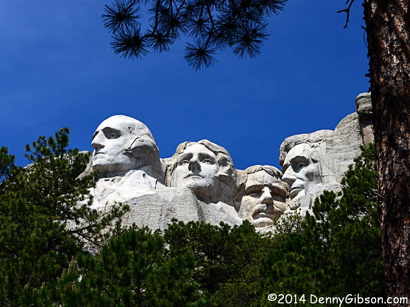
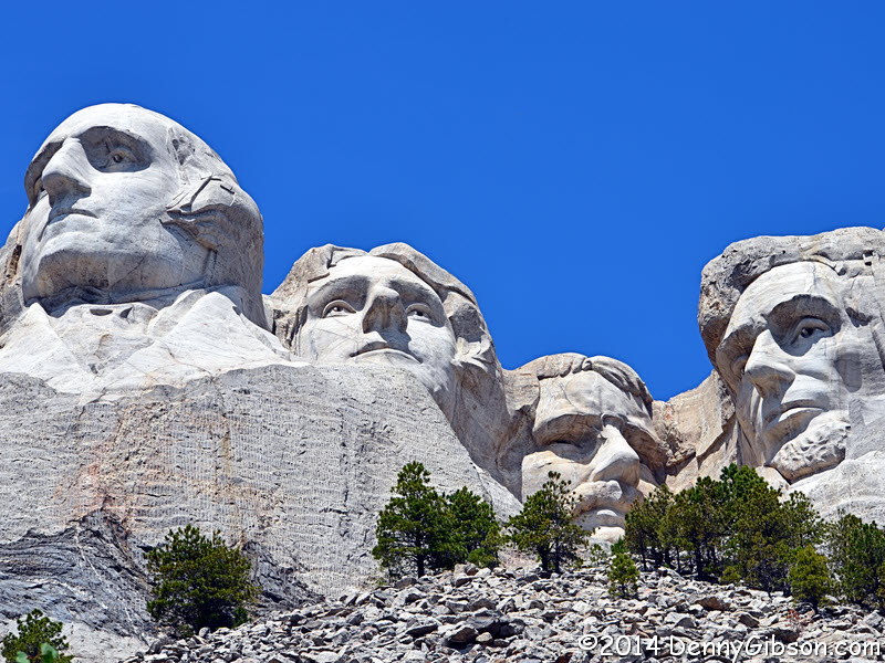
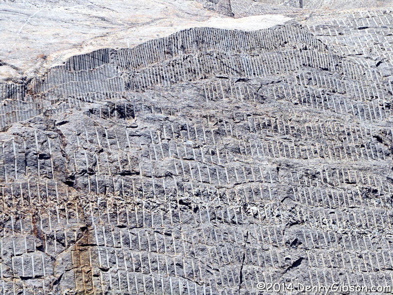
 The second picture was taken from the trail's closest approach to the
carvings although cranking the zoom provides a closer
look. It also lets the left over drilling and blasting
scars be seen a little better.
The second picture was taken from the trail's closest approach to the
carvings although cranking the zoom provides a closer
look. It also lets the left over drilling and blasting
scars be seen a little better.
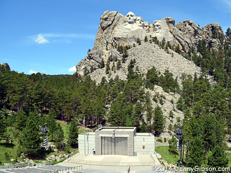
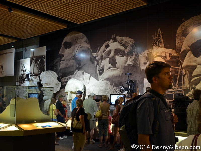
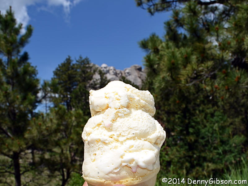
After walking the Presidential Trail, I took a picture over the amphitheater, checked out the museum, watched a movie, and ate some ice cream made from a Thomas Jefferson recipe. All of those were, I suppose, in the reverse order except for the ice cream. That was a reward for walking the trail at all. |
|
|

 The family I shared a table with last night had talked of a wonderful
drive on the Needles Highway. When I looked into that, I discovered that
it was just one of the area's
scenic drives. Another one, Iron Mountain Road,
sounded interesting and, since its northern end was near Mount Rushmore, I
tackled it first. The road's "pigtail bridges", which allow the
road to change elevation quickly by looping back on itself are tough to
photograph from a vehicle on the road though I did try. Follow that
"scenic drives" link for a nice overhead shot.
The family I shared a table with last night had talked of a wonderful
drive on the Needles Highway. When I looked into that, I discovered that
it was just one of the area's
scenic drives. Another one, Iron Mountain Road,
sounded interesting and, since its northern end was near Mount Rushmore, I
tackled it first. The road's "pigtail bridges", which allow the
road to change elevation quickly by looping back on itself are tough to
photograph from a vehicle on the road though I did try. Follow that
"scenic drives" link for a nice overhead shot.
|
|
|
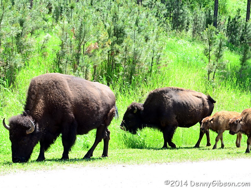 Iron Mountain Road ends near an entrance to Custer State Park but it is
also US-16A which continues west through the park to the town of Custer.
In reality, a good portion of the road appears to be inside the park. Fees
are posted at the entrance. I pulled up to the entrance and asked if I
needed a permit just to drive to Custer. No, I was told, as long as I was
just using US-16A to cross the park, no fee was required. That's just what
I did after navigating through a cluster of cars stopped to watch and
photograph a small herd of buffalo. Although the buffalo were on both
sides of the road, they weren't a problem. The cars however...
Iron Mountain Road ends near an entrance to Custer State Park but it is
also US-16A which continues west through the park to the town of Custer.
In reality, a good portion of the road appears to be inside the park. Fees
are posted at the entrance. I pulled up to the entrance and asked if I
needed a permit just to drive to Custer. No, I was told, as long as I was
just using US-16A to cross the park, no fee was required. That's just what
I did after navigating through a cluster of cars stopped to watch and
photograph a small herd of buffalo. Although the buffalo were on both
sides of the road, they weren't a problem. The cars however...
|
|
|

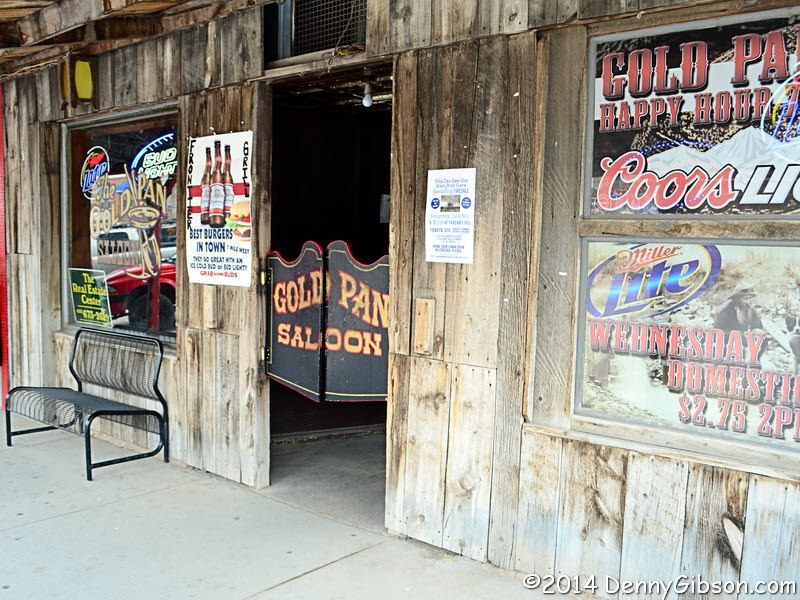
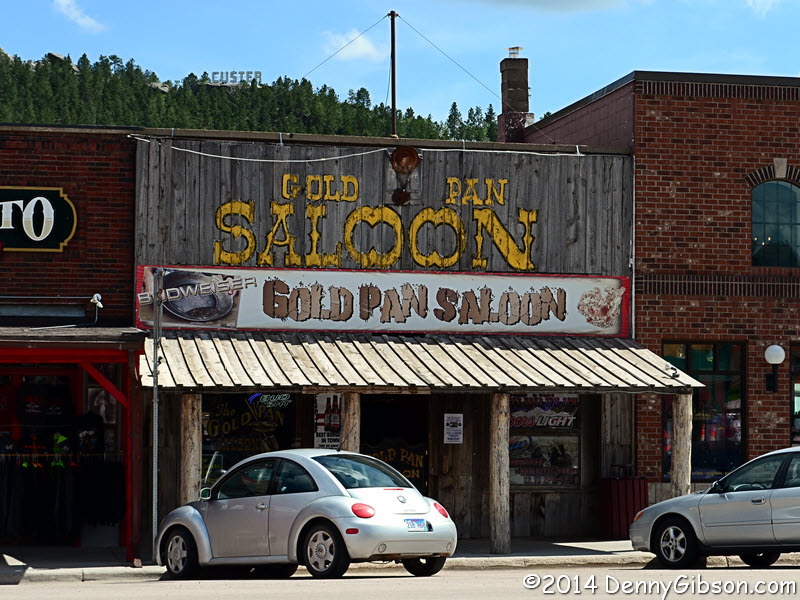
 Just beyond another park station, I passed Needles Highway and I probably
should have taken it. Instead, I drove on to Custer and would eventually
drive Needles Highway north to south. The buffalo in Custer are of a
different and less troublesome sort. The Gold Pan Saloon had caught my eye
earlier and I thought it might be a good place for a cold one. According
to the bartender, the building has been a bar since gold rush days. In
those days, miners might pay for drinks with gold dust which sometimes
slipped away. Frequent siftings of the sawdust floor provided a tidy
income for the bar owner. Today the sawdust is refreshed and sifted
monthly. The last sifting yielded nearly $90 in change and a diamond
earring.
Just beyond another park station, I passed Needles Highway and I probably
should have taken it. Instead, I drove on to Custer and would eventually
drive Needles Highway north to south. The buffalo in Custer are of a
different and less troublesome sort. The Gold Pan Saloon had caught my eye
earlier and I thought it might be a good place for a cold one. According
to the bartender, the building has been a bar since gold rush days. In
those days, miners might pay for drinks with gold dust which sometimes
slipped away. Frequent siftings of the sawdust floor provided a tidy
income for the bar owner. Today the sawdust is refreshed and sifted
monthly. The last sifting yielded nearly $90 in change and a diamond
earring.
|
|
|
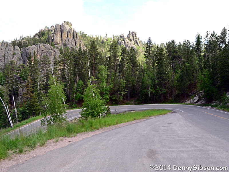
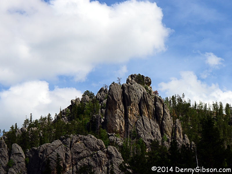
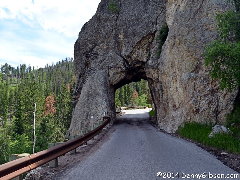 From Custer, I headed to the north end of Needles Highway for another
beautiful drive. At US-16A, I turned east. The park attendant commented on
my Ohio plates and I told her that was essentially where I was now headed.
Even cars driving straight through the park had to pay, she said. I told
her of my experience in the other direction and she said that was an
error. The return trip would cost me $15. I declined and headed north on
Needles Highway. That was OK even though much of it is inside the park
boundaries. I thought $15 was a bit much to pay for the one time use of
nine miles of US highway.
From Custer, I headed to the north end of Needles Highway for another
beautiful drive. At US-16A, I turned east. The park attendant commented on
my Ohio plates and I told her that was essentially where I was now headed.
Even cars driving straight through the park had to pay, she said. I told
her of my experience in the other direction and she said that was an
error. The return trip would cost me $15. I declined and headed north on
Needles Highway. That was OK even though much of it is inside the park
boundaries. I thought $15 was a bit much to pay for the one time use of
nine miles of US highway.
|
|
|
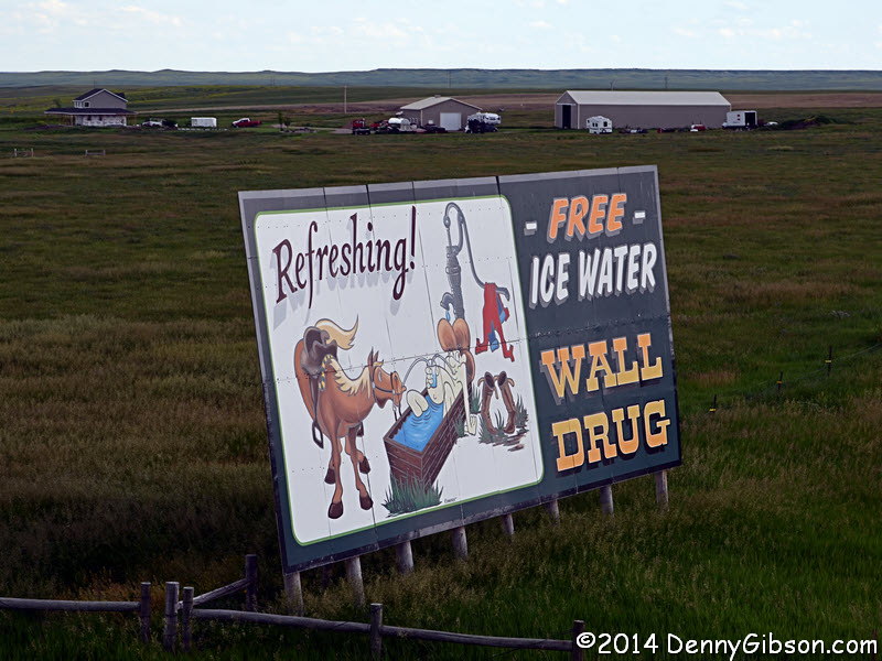
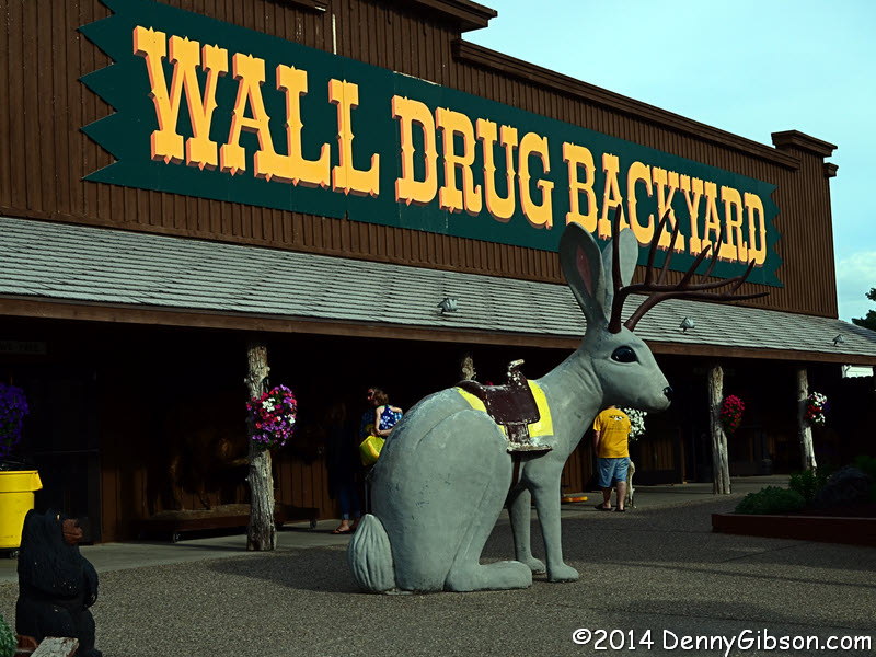
 Even after I got my picture of a Wall Drug sign yesterday, I remained on
the lookout for an ice water sign. Free ice water was the idea that
prompted the very first Wall Drug roadside sign in 1936. I would have been
satisfied with the little blurry thing I barely caught through the dirty
windshield but, just a few miles from Wall, I hit the jackpot.
Even after I got my picture of a Wall Drug sign yesterday, I remained on
the lookout for an ice water sign. Free ice water was the idea that
prompted the very first Wall Drug roadside sign in 1936. I would have been
satisfied with the little blurry thing I barely caught through the dirty
windshield but, just a few miles from Wall, I hit the jackpot.
|
|
|
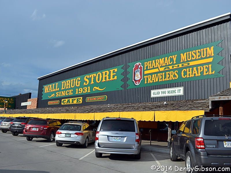
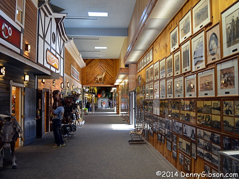
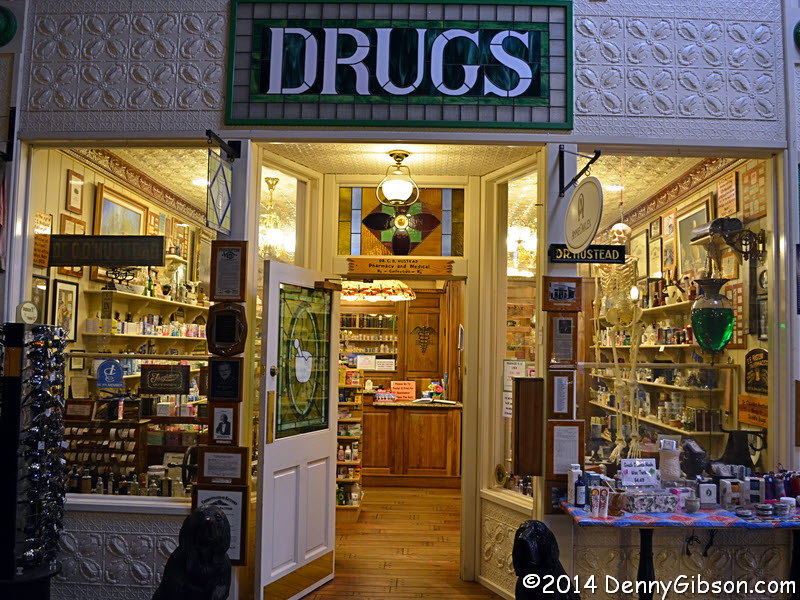
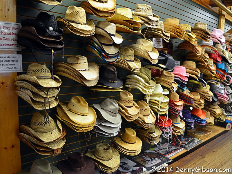
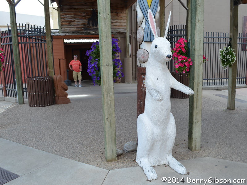 Wall Drug was
everything I expected and maybe a little more. These are just a few of the
photos I took and I only took photos of a few of the things I saw and it's
a certainty that I only saw a fraction of what there is to see.
Wall Drug was
everything I expected and maybe a little more. These are just a few of the
photos I took and I only took photos of a few of the things I saw and it's
a certainty that I only saw a fraction of what there is to see.
|
|
|
| [Prev] [Site Home] [Trip Home] [Next] |