No Pavement Required
Prev
Next


|
Day 5: January 31, 2012 No Pavement Required |
Prev Next |
|
|
|
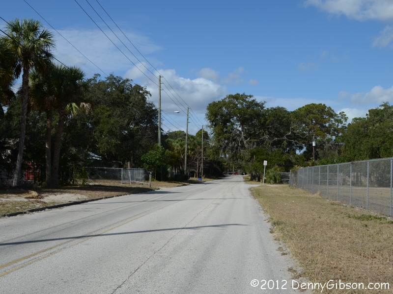

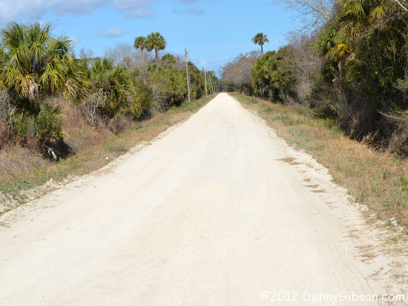
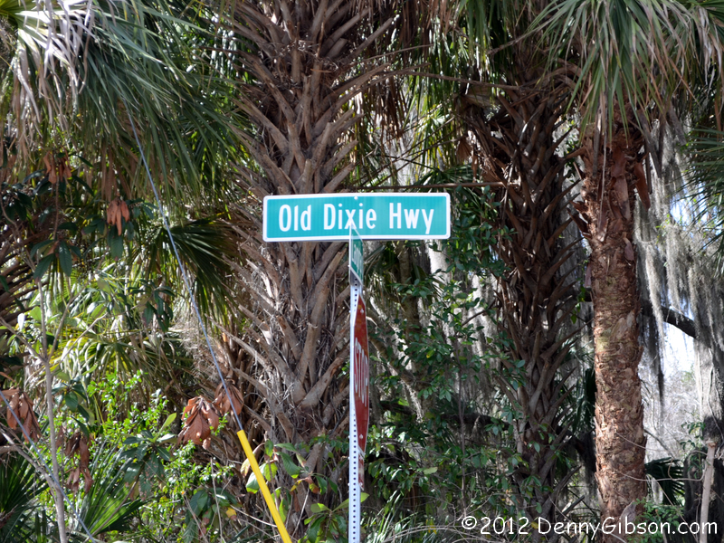 Unlike the past couple of days which we mostly let slip by while we drank
coffee and shot the bull, today Uncle Eldon and I were on the road at the
crack of not-yet-noon. Our first target was a stretch of Old Dixie Highway
running north from Titusville. The
marker in the middle picture is for the
Hernandez Trail. I know very little about the trail
but wouldn't be surprised if the Dixie Highway overlayed parts of it.
Unlike the past couple of days which we mostly let slip by while we drank
coffee and shot the bull, today Uncle Eldon and I were on the road at the
crack of not-yet-noon. Our first target was a stretch of Old Dixie Highway
running north from Titusville. The
marker in the middle picture is for the
Hernandez Trail. I know very little about the trail
but wouldn't be surprised if the Dixie Highway overlayed parts of it.
|
|
|
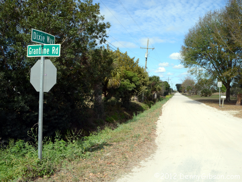


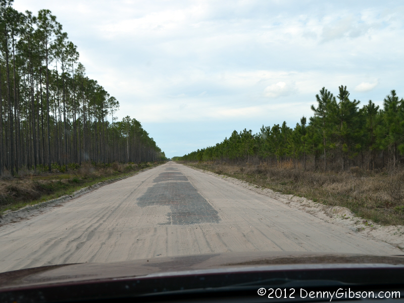
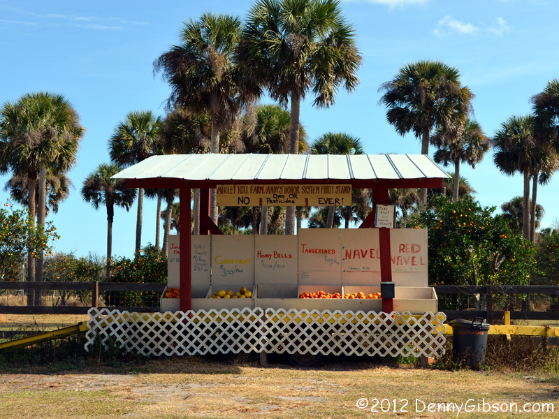 We returned to pavement near Mims but, after a little less than four miles,
headed off for some more dirt near Turnbull. The unpaved stretch that begins
at Grantline Road is right at seven miles long. Apparently the road has
enough traffic on it to justify a fruit stand and enough honesty to permit
self service.
We returned to pavement near Mims but, after a little less than four miles,
headed off for some more dirt near Turnbull. The unpaved stretch that begins
at Grantline Road is right at seven miles long. Apparently the road has
enough traffic on it to justify a fruit stand and enough honesty to permit
self service.
|
|
|
 I was drawn to this particular section by a discussion about Robert E. Lee
/ Dixie Highway Monuments over at
American Road Magazine Forum. The discussion revealed
the possibility that one of the markers once existed at the
Brevard-Volusia County Line. Since I was relatively nearby, I thought
taking a look made sense. Not quite thriving orange groves surround the
intersection of County Line Ditch Road and Dixie Way and it's possible
that a marker is hiding behind a tree but I saw none along the road.
I was drawn to this particular section by a discussion about Robert E. Lee
/ Dixie Highway Monuments over at
American Road Magazine Forum. The discussion revealed
the possibility that one of the markers once existed at the
Brevard-Volusia County Line. Since I was relatively nearby, I thought
taking a look made sense. Not quite thriving orange groves surround the
intersection of County Line Ditch Road and Dixie Way and it's possible
that a marker is hiding behind a tree but I saw none along the road.
|
|
|
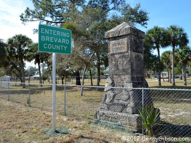 The current US-1 lies just under a mile west of the intersection. I don't
know that this was ever the Dixie Highway but it certainly seems possible.
No Lee/Dixie marker but there is a nice welcome pillar.
The current US-1 lies just under a mile west of the intersection. I don't
know that this was ever the Dixie Highway but it certainly seems possible.
No Lee/Dixie marker but there is a nice welcome pillar.
|
|
|
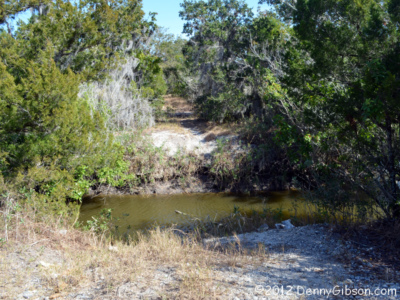

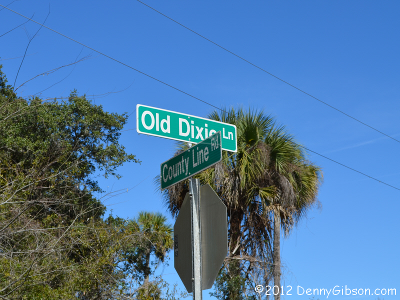 We returned to the dirt Dixie Way and continued north. Eldon spotted this
Old Dixie Lane sign and we decided to take a look. The "road"
ended after about half a mile at the banks of a stream where a visible
path on the other side suggested that a bridge might once have crossed
here. Since this was running essentially east-west, I figured it really
was just a lane or some minor road that someone decided to tack a Dixie
related name onto. Then, at the end of the day when I took a look at
DeLorme Street Atlas, I saw the road labeled Old US 1. If that is indeed
true then there was certainly once a bridge across the Turnbull River here
and it's seems very likely that this was once Dixie Highway.
We returned to the dirt Dixie Way and continued north. Eldon spotted this
Old Dixie Lane sign and we decided to take a look. The "road"
ended after about half a mile at the banks of a stream where a visible
path on the other side suggested that a bridge might once have crossed
here. Since this was running essentially east-west, I figured it really
was just a lane or some minor road that someone decided to tack a Dixie
related name onto. Then, at the end of the day when I took a look at
DeLorme Street Atlas, I saw the road labeled Old US 1. If that is indeed
true then there was certainly once a bridge across the Turnbull River here
and it's seems very likely that this was once Dixie Highway.
|
|
|
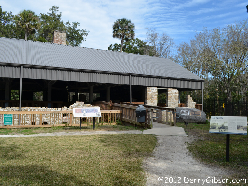

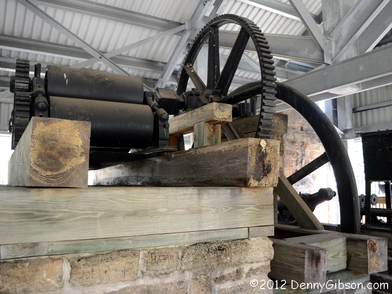
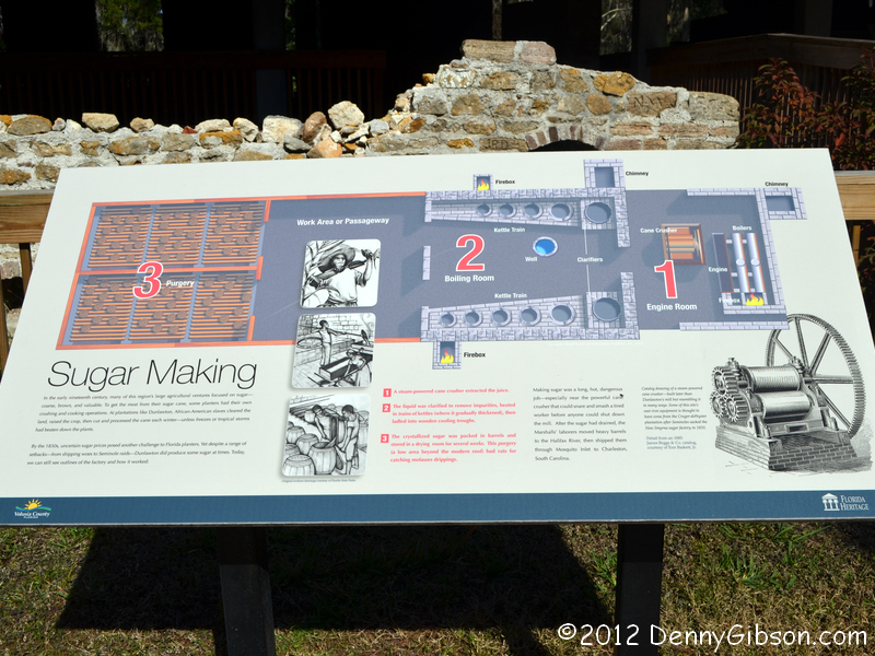
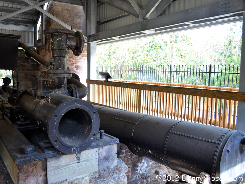 In Port Orange, we headed west a mile or so to see the
Sugar Mill
Botanical Gardens. This is the same tourist attraction that I visited
in 2008 and
2001 and my
great-grandparents (Eldon's grandparents) visited in 1921. The roof and
some of the signage have been put in place
since my last visit.
In Port Orange, we headed west a mile or so to see the
Sugar Mill
Botanical Gardens. This is the same tourist attraction that I visited
in 2008 and
2001 and my
great-grandparents (Eldon's grandparents) visited in 1921. The roof and
some of the signage have been put in place
since my last visit.
|
|
|
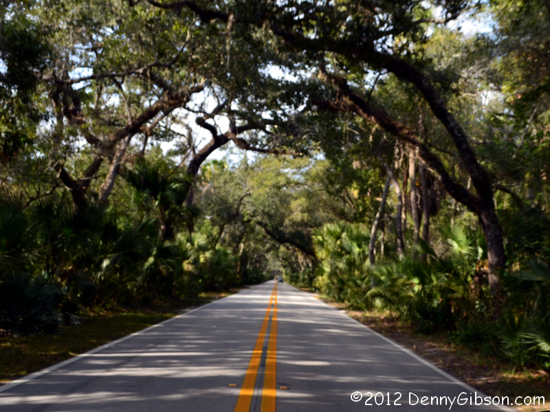 This tree covered "tunnel" through Tomoka State Park is one of
my favorite spots on the Dixie Highway. Today I just snapped some pictures
from the car without stopping.
This tree covered "tunnel" through Tomoka State Park is one of
my favorite spots on the Dixie Highway. Today I just snapped some pictures
from the car without stopping.
|
|
|
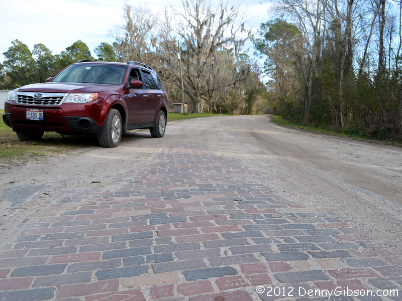
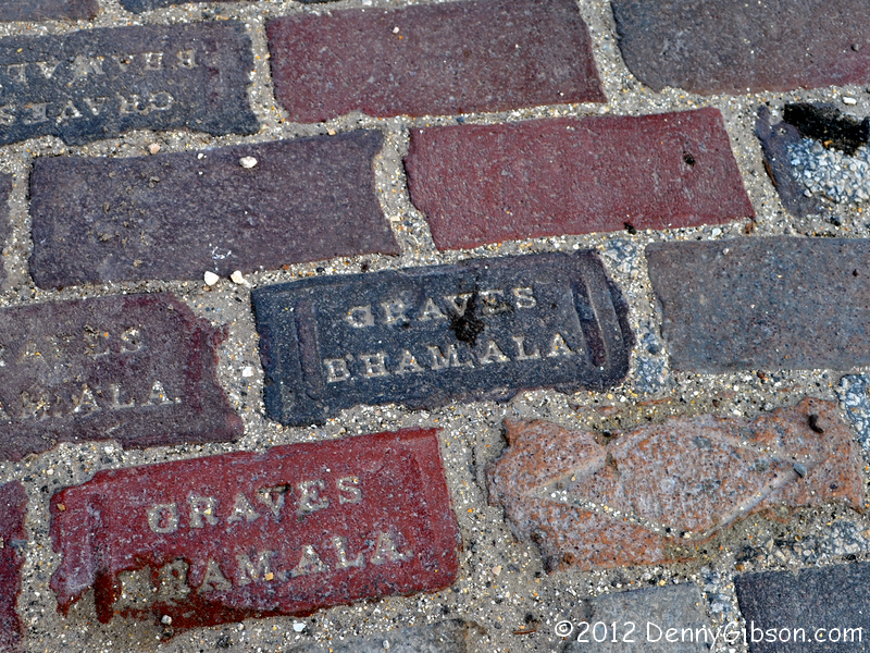 In 2008 I tried to
drive the Old Dixie Highway (a.k.a, Brick Road) between Espanola and
County Road 204 and discovered that it was no place for a Corvette. This
time, with all wheel drive and considerably more clearance, I was
determined to cover the six and a half miles I bypassed four years ago.
That was easily done though it did get ever so slightly squirmy in the
middle.
In 2008 I tried to
drive the Old Dixie Highway (a.k.a, Brick Road) between Espanola and
County Road 204 and discovered that it was no place for a Corvette. This
time, with all wheel drive and considerably more clearance, I was
determined to cover the six and a half miles I bypassed four years ago.
That was easily done though it did get ever so slightly squirmy in the
middle.
|
|
|
| [Prev] [Site Home] [Trip Home] [Contact] [Next] |