To the First Key
Prev
Next


|
|
Day 3: December 26, 2008 To the First Key |
Prev Next |
|
|
|
 It initially looked like Christmas dinner might be a problem. My motel was
a little east of Naples and I cruised a few miles beyond it before
deciding that my best chances were back toward town. I passed a couple
dozen closed restaurants, including multiple McDonald's and Burger Kings,
before I saw an open Sonic. That would be my safety net if all else
failed. In Naples, I left the Dixie to follow an "Historic
Downtown" sign. "Historic Downtown" Naples had some people
and at least four open restaurants. One was a steak house with a long line
and one was a sidewalk cafe that would have worked but it didn't appeal to
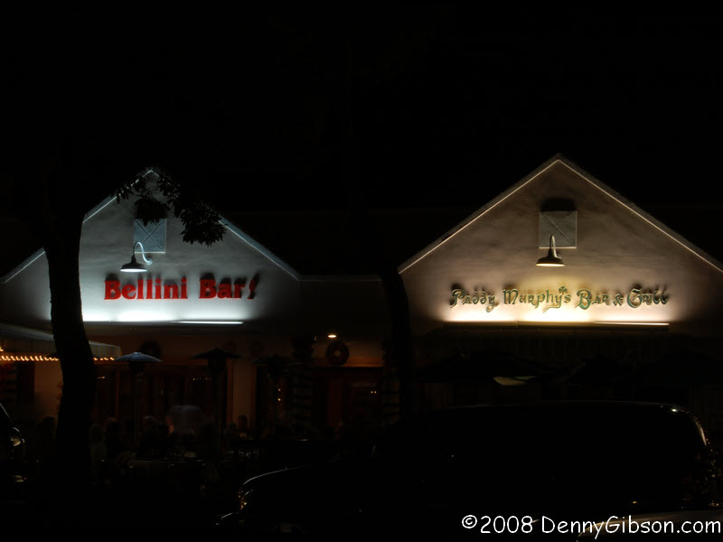
me all that much. I sensed a winner when I found an Italian restaurant and
an Irish pub side by side. The Italian place had a one hour wait for a
table and the wait at the pub was almost that long. But the pub had a bar
with open stools. It also had cold beer and soon had me.
It initially looked like Christmas dinner might be a problem. My motel was
a little east of Naples and I cruised a few miles beyond it before
deciding that my best chances were back toward town. I passed a couple
dozen closed restaurants, including multiple McDonald's and Burger Kings,
before I saw an open Sonic. That would be my safety net if all else
failed. In Naples, I left the Dixie to follow an "Historic
Downtown" sign. "Historic Downtown" Naples had some people
and at least four open restaurants. One was a steak house with a long line
and one was a sidewalk cafe that would have worked but it didn't appeal to
me all that much. I sensed a winner when I found an Italian restaurant and
an Irish pub side by side. The Italian place had a one hour wait for a
table and the wait at the pub was almost that long. But the pub had a bar
with open stools. It also had cold beer and soon had me.
Both beer and food were good but I enjoyed a conversation at the end of the bar even more. I couldn't hear it all but I could tell that the two men had just met for the first time. The one with the beard was telling stories with lines like "I had just finished the job in Mogadishu." At one point he told of meeting Mother Teresa and having a conversation with her. The other fellow was astounded. Of course, he was properly impressed with the story but this was the second time he had met someone who had met the saint in the making. What were the odds of that, he wondered. In all likelihood, everything both men said is certifiable truth but I can't help but wonder if "I've met two guys who..." was a preemptive strike. Since no one could possibly meet two Mother Teresas, meeting two guys who had met her sets a hard to top standard. |
|
|

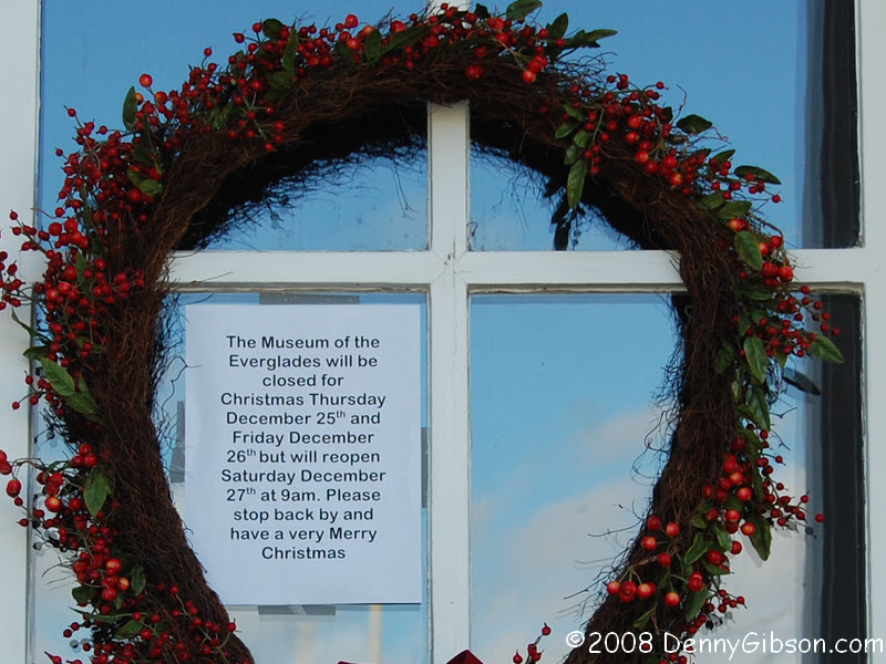
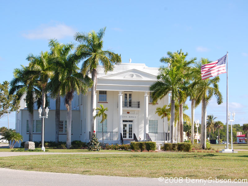
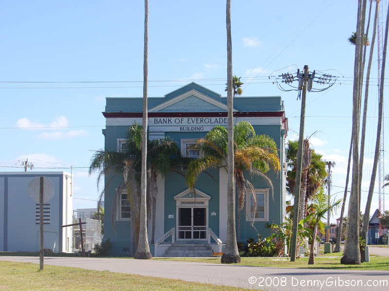 This morning I continued on US-41 towards Miami. I turned off at
Everglades City intending to visit the Museum of the Everglades. It was
closed but the town has a neat City Hall and bank.
This morning I continued on US-41 towards Miami. I turned off at
Everglades City intending to visit the Museum of the Everglades. It was
closed but the town has a neat City Hall and bank.
|
|
|
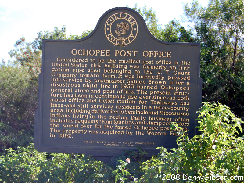
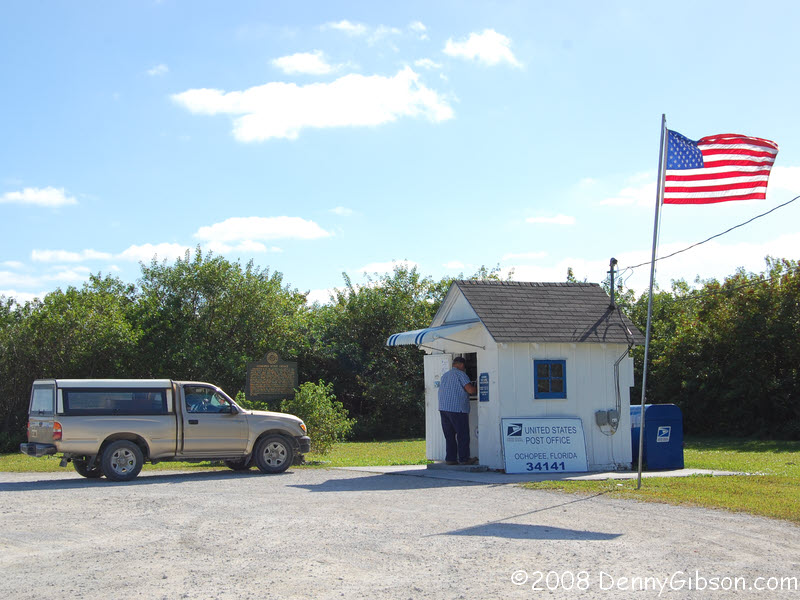 I happened by the country's smallest post office
while the day's mail was being picked up. I bought three picture postcards
and mailed one to myself. My own, standard sized, post office will hold it
for me until I get home. For some reason, I didn't even think of it until
I was well down the road so I wasted the opportunity to photograph the
postmistress or the building's interior.
I happened by the country's smallest post office
while the day's mail was being picked up. I bought three picture postcards
and mailed one to myself. My own, standard sized, post office will hold it
for me until I get home. For some reason, I didn't even think of it until
I was well down the road so I wasted the opportunity to photograph the
postmistress or the building's interior.
|
|
|
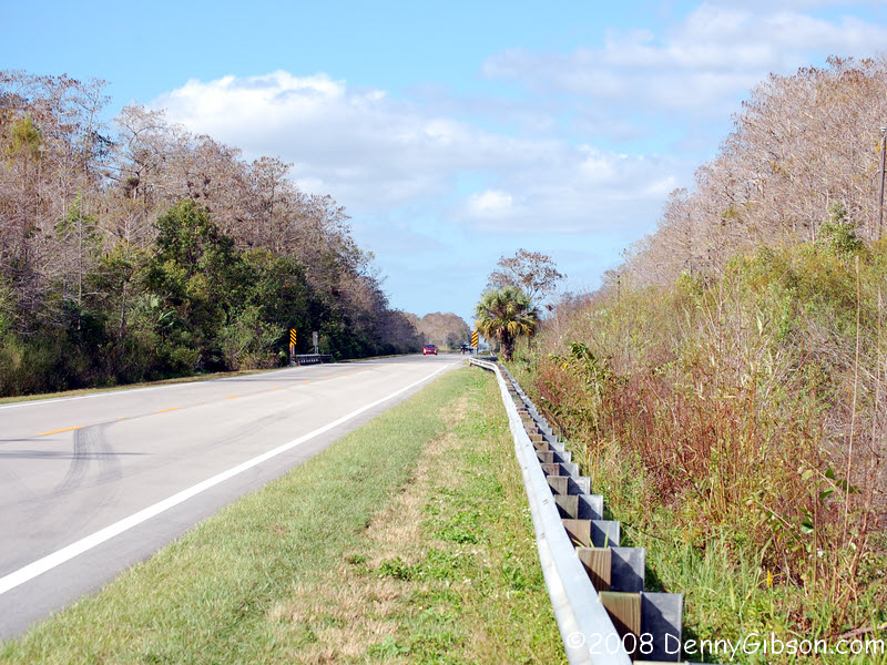
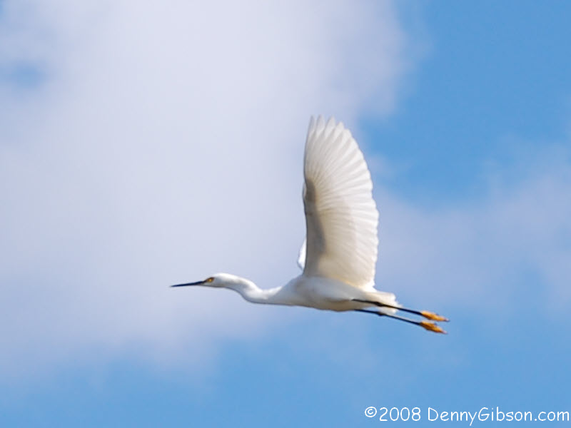
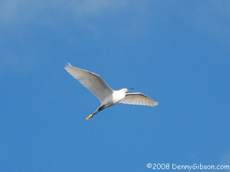
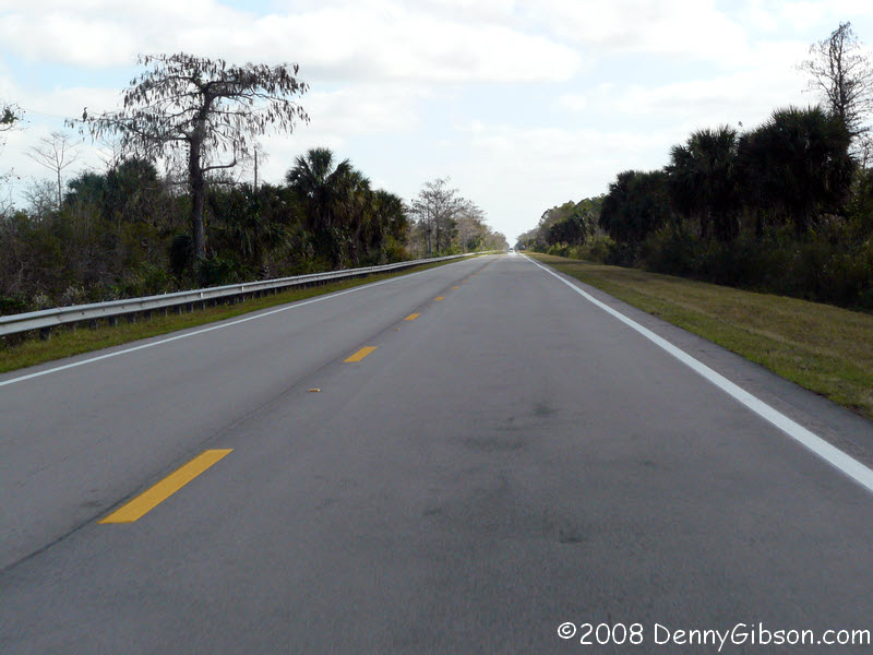
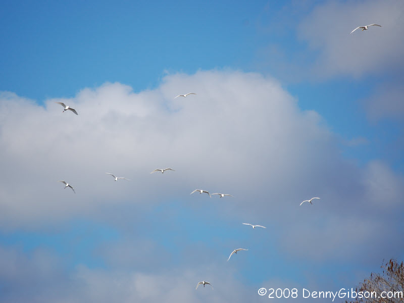 The road itself isn't all that interesting. It's mostly a straight line
that passes few structures. I'm sure there are alligators in the canal
that flows beside the road but I didn't see any. I did see lots of egrets
and other birds standing in the water or perched in the trees. The birds
tend to go airborne when a car stops near them. That's usually just a bird
or two but occasionally a dozen or so will launch simultaneously.
The road itself isn't all that interesting. It's mostly a straight line
that passes few structures. I'm sure there are alligators in the canal
that flows beside the road but I didn't see any. I did see lots of egrets
and other birds standing in the water or perched in the trees. The birds
tend to go airborne when a car stops near them. That's usually just a bird
or two but occasionally a dozen or so will launch simultaneously.
|
|
|
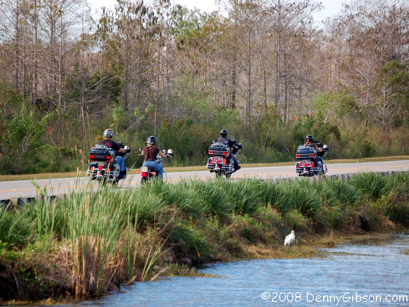
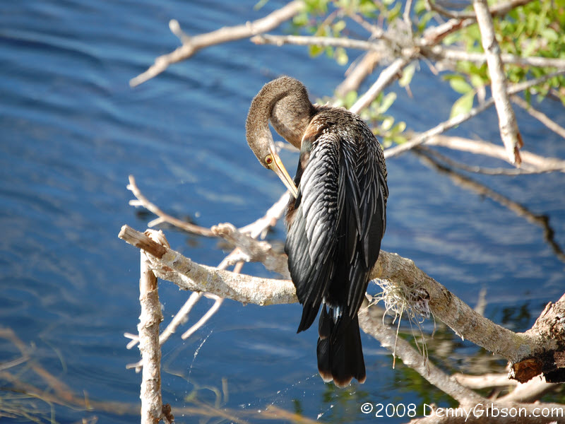
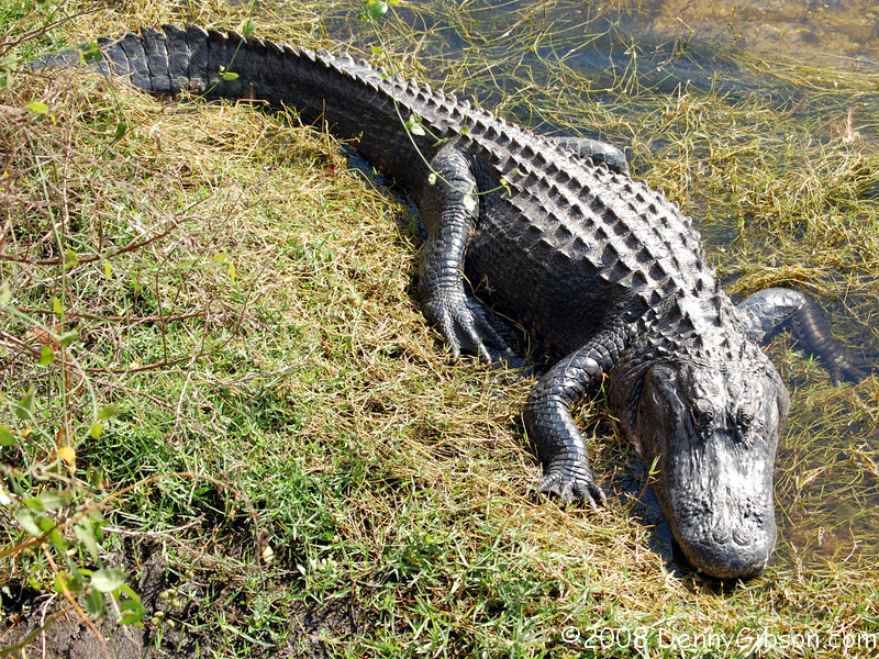
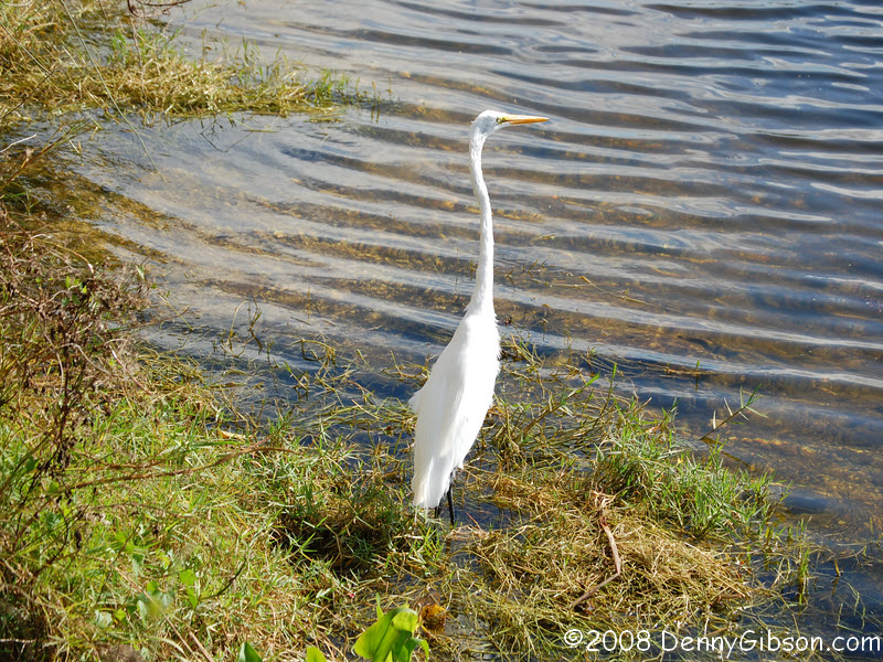 The road passes through the Big Cypress National Preserve. A wooden walkway at the
visitor center provided a good view of a section of the canal and of the
alligators that are somehow encouraged to hang around. All the photos in
this panel were taken from the walkway.
The road passes through the Big Cypress National Preserve. A wooden walkway at the
visitor center provided a good view of a section of the canal and of the
alligators that are somehow encouraged to hang around. All the photos in
this panel were taken from the walkway.
|
|
|
 Near a curve labeled "Fortymile Bend", the map shows a section
of Old Tamiami Trail and I cut over to check it out at the first
opportunity. It's pavement is older and it's a little narrower but it
doesn't differ significantly from the current road. The
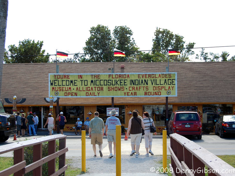
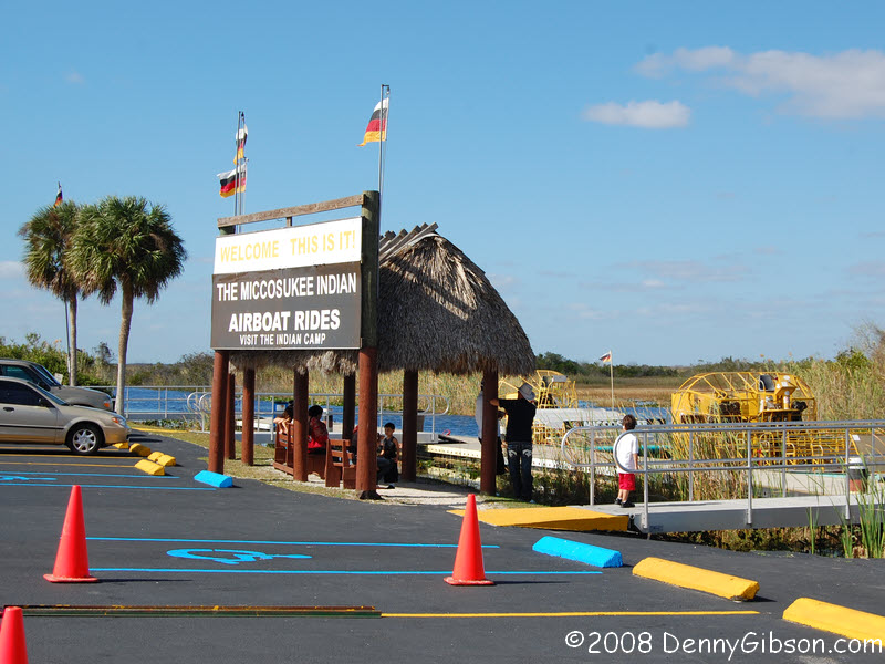
Miccosukee Indian Village is at one end of the
section. That's the old road that people are walking across in the second
picture. Here, the area between the old and new roads is filled with a
parking lot and air boat rides are available by walking across the current
Tamiami Trail/US-41.
Near a curve labeled "Fortymile Bend", the map shows a section
of Old Tamiami Trail and I cut over to check it out at the first
opportunity. It's pavement is older and it's a little narrower but it
doesn't differ significantly from the current road. The
Miccosukee Indian Village is at one end of the
section. That's the old road that people are walking across in the second
picture. Here, the area between the old and new roads is filled with a
parking lot and air boat rides are available by walking across the current
Tamiami Trail/US-41.
|
|
|

 I wasn't particularly interested in a boat ride but had halfway planned on
stopping at Coopertown, where the air boat was born but the place was
packed. Before that, the road leading to
Shark Valley had a "Lot Full" sign posted
and cars lined the side of the highway for some distance. I had skipped
it, too.
I wasn't particularly interested in a boat ride but had halfway planned on
stopping at Coopertown, where the air boat was born but the place was
packed. Before that, the road leading to
Shark Valley had a "Lot Full" sign posted
and cars lined the side of the highway for some distance. I had skipped
it, too.
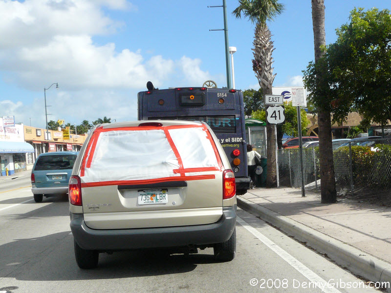
Miami traffic begins not far from Coopertown. I had read that, south of Naples, US-41 is signed as east-west but this is the only such sign I noticed. There may be others but I know for a fact that signs read "south" well beyond Naples. US-1 is what was once Dixie Highway East and the Tamiami Trail and Dixie Highway West end here. |
|
|
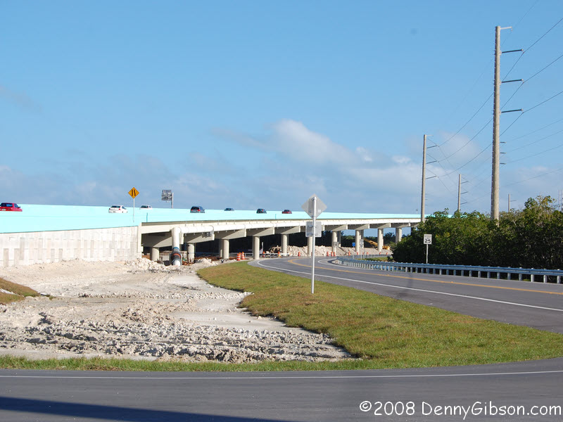
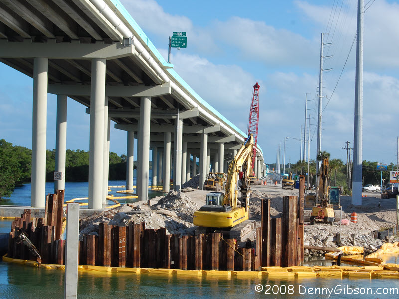 Traffic got worse before it got better and was still fairly heavy when I
came to the accepted entrance to the keys. The new Jewfish Creek Bridge
opened just before Memorial Day this year. Roads on both sides of the
creek allow access to businesses there and allow a view of the on going
removal of the 1944 drawbridge.
Traffic got worse before it got better and was still fairly heavy when I
came to the accepted entrance to the keys. The new Jewfish Creek Bridge
opened just before Memorial Day this year. Roads on both sides of the
creek allow access to businesses there and allow a view of the on going
removal of the 1944 drawbridge.
|
|
|

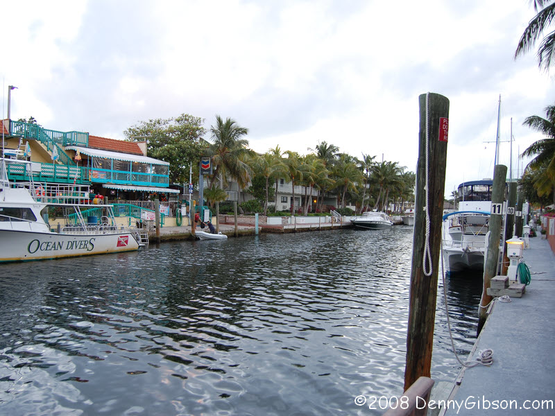
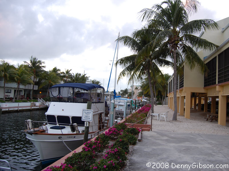 In Key Largo, I paid more than I wanted but less than I feared for a bed.
The bed was in a two story space that was more like an apartment than a
motel room; a full kitchen, two bathrooms, and a balcony overlooking a
marina. It's on the right side of the first picture; just past the palm
trees. The place with the blue rails in the second picture is Sharkey's
Pub & Grill. I never did get there but I didn't have to. The last
picture is from my balcony where I listened to some really good live music
while working on this page and a bottle of rum.
In Key Largo, I paid more than I wanted but less than I feared for a bed.
The bed was in a two story space that was more like an apartment than a
motel room; a full kitchen, two bathrooms, and a balcony overlooking a
marina. It's on the right side of the first picture; just past the palm
trees. The place with the blue rails in the second picture is Sharkey's
Pub & Grill. I never did get there but I didn't have to. The last
picture is from my balcony where I listened to some really good live music
while working on this page and a bottle of rum.
|
|
|
| [Prev] [Site Home] [Trip Home] [Contact] [Next] |