Free? Advertising on the Dixie

Seeing things like signs, banners, and menus for local businesses bearing the logo of some large corporation is quite common. Details vary but the basic model is that the big corporation shoulders some or all of the cost and the small business gets some advertising for little or nothing. The idea is hardly new and the concept has never been restricted to purely commercial enterprises. During the last half of the 1920s, a pairing of this sort existed between a major highway and an American hereditary association. The major highway was, of course, the Dixie Highway. The hereditary association was the United Daughters of the Confederacy (UDC).

The UDC was the “advertiser” in this instance. Between 1926 and 1935 the organization was responsible for at least ten plaques being erected beside the highway. It’s unclear whether or not the Dixie Highway Association was an active participant in this arrangement. Because the 1926 creation of the United States Numbered Highway System brought an end to all of the named auto trails, the DHA was not very active at this point.

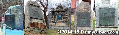
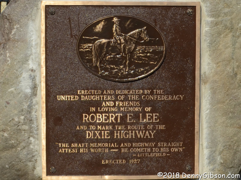
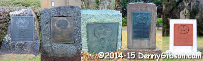
Combined, the previous picture and the one at right show the ten plaques in north to south sequence. The northernmost marker is in Ohio, the southernmost is in Florida, the one preceding it is in South Carolina, and the others are in North Carolina. Except for the date erected, eight of the plaques are identical. The one in Florida contains the same text as those eight but has a different image of Lee. The one in South Carolina contains different text but has the same image as the bulk of the plaques.

The South Carolina plaque is the bigger oddity. All the others were erected in 1926, ’27, or ’28. It was erected in 1935. One of the differences in its text is its specific identification of the Greenville and Fort Sumter Chapters of the UDC as being responsible for erecting the marker. All others simply identify the overall UDC. The Florida marker was erected in 1927 ahead of at least three others. None of the other nine markers uses this image of General Lee.

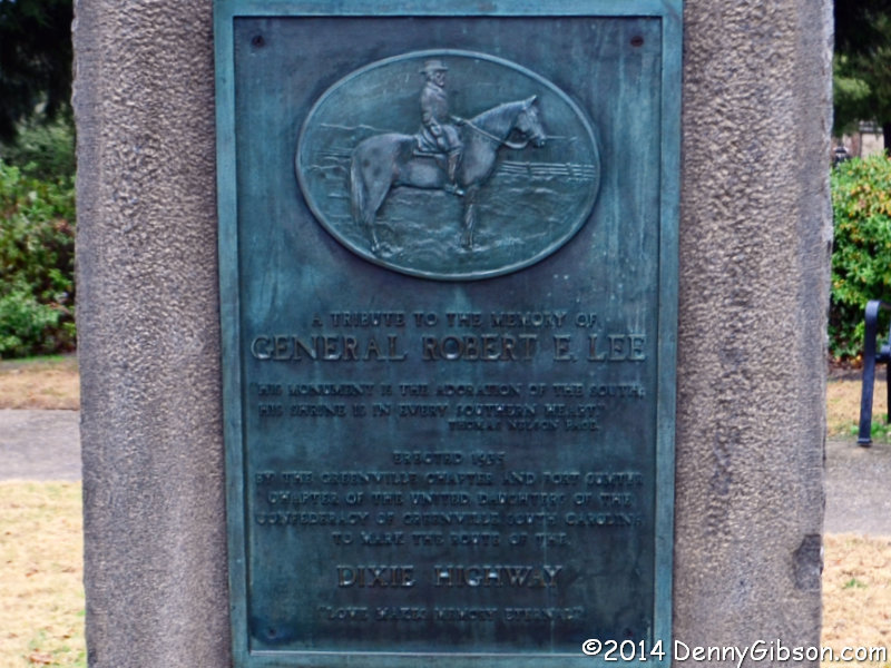
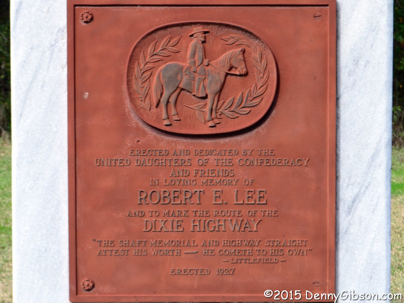
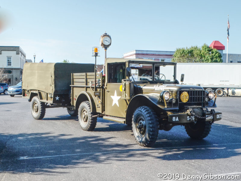
Eight of the plaques essentially look just like this one which happens to be in Ohio. All plaques follow this general format even when some details vary. Approximately the top one-third is occupied by an image of General Lee on horseback. His name appears below the image in large letters. A bit farther down is the name of the auto trail. The letters in DIXIE HIGHWAY are larger than the general text but smaller than the letters in Lee’s name.

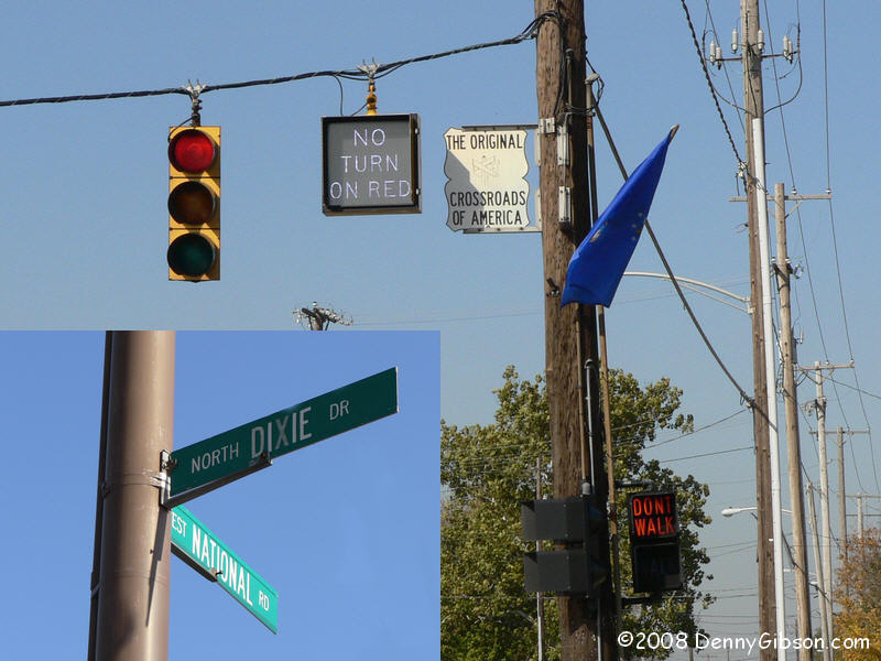
Maybe what I’ve written so far will help explain how I’m currently thinking about these markers. My first contact with the markers was in 2008 when I stumbled upon the one in Marshall, NC. After I learned there were others, I made a point of visiting them all and accomplished that in early 2015. At the time I thought of them as something similar to the Madonna of the Trail markers on the National Old Trails Road. That’s pretty much how I saw them until the summer of 2017.

Streets, parks, and statues honoring military and civilian leaders of the Confederate States of America had been drawing more and more attention. In August of 2017, the death of a counterprotester at a white supremacist rally in Charlottesville, VA, cranked that attention up several notches. There was now enough attention for some of it to fall on one of those UDC plaques less than twenty miles from my home. Within days of the events in Charlottesville, a group in Dayton, OH, announced plans for a protest at the plaque near Franklin, OH. Plans to protest the protesters formed almost as quickly. City officials made a preemptive strike by removing and hiding the marker in the middle of the night. It didn’t make anybody happy but it didn’t make anybody dead, either.

Some news crews and some of those not happy people made it to the site on the morning following the removal. I made it, too, in the role of curious bystander. I chatted casually with a couple of the reporters and tried to defend the Dixie Highway a bit. I’d been calling the plaques and their mountings Dixie-Lee markers. Everyone else was calling the Franklin marker a Robert E. Lee monument and occasionally mentioning that it was on the Dixie Highway. It slowly sunk in that, for the reasons above, they were right. The monuments were not primarily concerned with marking a road like the Madonnas of the Trail or the concrete posts along the Lincoln Highway. I found myself explaining that the Dixie Highway was not associated with the Confederacy and asking that they not tie it too closely to Lee. For the first time, I compared the markers to a big branded beer sign with “Bob’s Bar” at its bottom. Learning that the brand on the sign was run by crooks, doesn’t automatically mean that Bob is a crook.

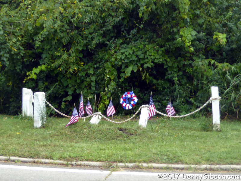
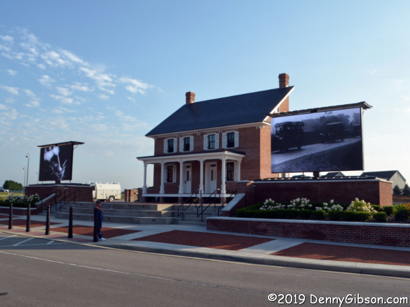
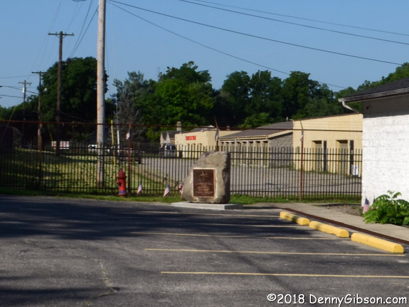
The plaque has been pried from the stone at the NC-SC border. It is lost or possibly destroyed. The marker in downtown Asheville has been attacked and damaged twice. The Franklin, OH, marker is back at roadside but is now on private property. That’s it in the picture at left. It’s even been buffed up and polished a bit. I want all the markers to stay. I deplore the vandalism that has occurred in the Carolinas but I don’t consider it an attack on the Dixie Highway. I now see that those markers really are what others have called them, Robert E. Lee monuments that happen to be on the Dixie Highway.

This topic came to me as I was writing last week’s post about the name of the Dixie Highway. I initially thought of it as a paragraph or two tacked onto that post. The length of the Dixie name post left no room to tack on anything and it is now quite obvious that a paragraph or two wouldn’t have been nearly enough. But it’s also pretty obvious that the two belong together. Again, I want all the markers to stay. But I don’t want them to stay at the expense of the Dixie Highway. Controversy will continue to swirl around statues, flags, and other items legitimately tied to the Confederacy. The Dixie Highway should not be part of that. Saying, as I have, that neither the word Dixie nor the Dixie Highway is inherently racist loses some sincerity if defending the road includes defending these markers.

A Dixie by Any Other Name

If something called a dixie existed, I have little doubt that we could refer to it differently without changing its aroma, but the word “dixie” doesn’t really identify anything. It is not, in other words, a common noun. As a proper noun — with a capital ‘D’ — it is used as both a surname and a given name and to identify a wide variety of things including a region of our country. People with a first, last, or nickname of Dixie surely outnumber things bearing the name but there are certainly plenty of those. It has been used to identify buildings, songs, currency, music groups, towns, counties, movies, beer, boats, ships, taverns, race tracks, waterways, restaurants, mountain ranges, athletic conferences, grocery stores, airports, schools, universities, and much more. With an ‘X’ made of a stylized flower, Dixie is a registered trademark of Georgia-Pacific for a brand of paper products.

In the 1960s, an all-girl singing group borrowed the name — without the flowery ‘X’ — of those familiar disposable cups and topped the charts with hits like “Chapel of Love” and “Iko Iko”. Near the end of the twentieth century, another all-girl group hit the charts with a name containing the word “dixie”. That group, the Dixie Chicks, generated some controversy, but it came from political statements and not from their name. I’m not aware of any controversy at all associated with the Dixie Cups, and I’m guessing that they didn’t consider the word “dixie” to be racist.

But recently the word has been associated with racism by some. The Dixie Highway has been included in some of these claims which naturally caused me to take notice. It is an outgrowth of the rise of controversy and confrontation over Confederate monuments and streets named after Confederate generals. If the move to change a roughly six-mile-long street from Hood to Hope was complicated, renaming a piece of the nearly 6,000-mile-long Dixie Highway must be at least three orders of magnitude more so.

The aforementioned Hood Street was in Hollywood, FL, where three streets (Hood, Lee, and Forest) were renamed (Hope, Liberty, and Freedom) in November 2017. In Riviera Beach, FL, a couple of miles of Old Dixie Highway were renamed President Barack Obama Highway in 2015. The picture at left was taken between the two, near Boyton Beach. Of course, the word “dixie” had nothing to do with the renamings in Hollywood. The generals after which the streets were named had clearly been chosen because of their roles in the Confederacy. The word didn’t have much to do with the name change in Riviera Beach, either. Residents cited the role of the street as a dividing line between black and white and the site of KKK cross burnings.

Although I’d have preferred it hadn’t happened, I have no serious objection to the Riviera Beach action. It was based on specific and painful memories. That doesn’t always appear to be the case where replacing the Dixie Highway name is proposed. Published reports of these proposals have occasionally prompted me to send emails to people connected with them. It is not done to protest but to inform. We road fans often comment — and sometimes laugh or cry — about people being completely oblivious to a major historic highway running right by their door. Knowing how common that is with “celebrities” like the Lincoln Highway and Route 66, we shouldn’t be surprised that it is even more often the case with the lesser known and more complex Dixie Highway. Not knowing just how important or far-reaching all the roads in your neighborhood once were is a pretty natural situation.

It seems that even we fans don’t always consider that “far-reaching” bit. It’s OK to be saddened by a name change, but there is no reason to verbally abuse, as I’ve seen too many times, those backing a change. Removing the name Dixie Highway from a few miles of Florida — or other — roadway is not going to affect all those other miles any more than Cheyenne, WY, (The first town to do so.) changing its Main Street to Lincoln Way impacted the rest of the continent crossing highway. The Dixie Highway, as well as every other named auto trail, was never labeled with its name in every jurisdiction it passed through. Numbered US and state highways utilize streets and roads with all sorts of names. Not one inch of US-66 officially exists at present yet people follow it every day. The Adairsville, GA, pavement in the picture at left is officially named and signed Main Street but that doesn’t change its past as a part of the Dixie Highway or prevent it being unofficially marked as such.

Most of the talk about renaming sections of the Dixie Highway has originated in Florida. In some sense, that’s ironic since the Dixie Highway was a major factor in the development of the state. On the other hand, development is rarely 100% beneficial to all and I’ve no doubt that many were negatively impacted by the development and the road that helped it along. Plus, as those Riviera Beach memories show, experiences generate stronger feelings than a name or a physical path ever could. About two weeks ago, the New York Times published an article based on discussions in Florida’s Miami-Dade County. Its audience was almost certainly wider than that of similar articles publishes by Florida based news organizations. One indication of that was a small but obvious two-day blip in visits to an eight year old Dixie Highway related post on this blog. Maybe that’s somehow fitting since I’ve often quoted the Times when trying to convey that the Dixie Highway is not inherently evil. In 1915, the paper referred to the route as “The Dixie Peaceway” when it reported the formation of the Dixie Highway Association. It described the road as “a monument to celebrate the half century of peace within the Union”. Maybe that was hyperbole or maybe it really reflected the feelings of the time. If so, it seems extra sad that so many see it as something entirely different today.

Those people who found this site after reading the New York Times article didn’t learn a whole lot during their visit but they were obviously curious. They were brought by search engines which may have also taken them to other sites where they learned much more. Whether curiosity was their only reason for visiting or they were decision-makers gathering background, I’ll never know. Regardless, I suspect we will see a few more miles of Dixie Highway get renamed before it’s all over. That’s unfortunate but hardly a disaster. No matter the name, it will still smell like a rose — or maybe an orange blossom — with strong undertones of asphalt and Model T brake bands.

ADDENDUM 9-Feb-2020: Some thoughts on the markers placed along the Dixie Highway by the United Daughters of the Confederacy were considered for this post but have been given their own post instead. Free? Advertising on the Dixie

Book Review
After Ike
Michael S. Owen

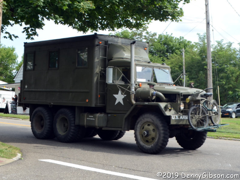
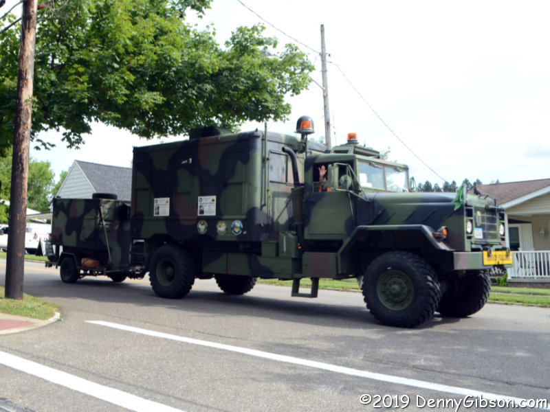
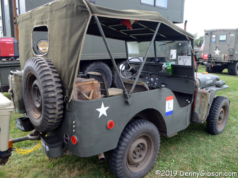
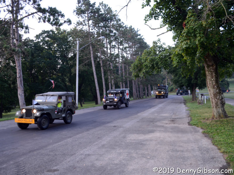
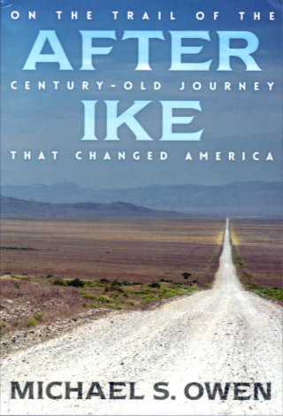
There are things that fans of old roads or of transportation history in general falsely assume that everyone knows about. One such item is the continent crossing Motor Transport Corps convoy of 1919. In the summer following the end of the first World War, a group of military personnel and vehicles set off from Washington, DC, to test the nation’s roads all the way to San Francisco. Although he was primarily an observer on the trip, his future accomplishments make Dwight Eisenhower the member of the convoy best-known today. Michael Owen uses the future president’s nickname in naming this telling of his own retracing of the 3,250-mile-long path that some 300 men and 81 vehicles of all shapes and sizes followed a century ago.

As one might expect, Owen mixes lots of information about the military convoy’s trip with the description of his own journey. Much less expected is the fact that he is not one of those long-time fans of old roads or transportation history that I mentioned earlier. As a US Ambassador, he spent considerable time in Africa and Asia. Now retired, he is happily becoming better acquainted with the roads and attractions of his homeland.

On his coast to coast drive, Owen is part researching author and part curious tourist. He often spends multiple days in one place and digs into local history and points of interest. Some of what he finds relates to the convoy and some is simply interesting on its own. A sampling includes a stop at Carnegie-Mellon to talk with a professor about autonomous vehicles and a visit to the Pro Football Hall of Fame which provides an opportunity to talk about Ike’s time as running back at West Point. He visits several museums including the Studebaker museum in South Bend, IN, and the El Dorado County Historical Museum in Placerville, CA. He spends time in small libraries and chatting with locals.

Much of the convoy related information Owen shares comes from journals and official reports written by the participants but local newspaper archives are also used extensively. The motorized convoy was a major event in those early days of the automobile and much attention was focused on its progress. Communities along the route often vied with each other to host the convoy and the dinners, dances, and demonstrations were documented by the local press. More or less typical is the South Bend [Indiana] News-Times report of the convoy’s arrival and departure that included the observation that “…lemonade was given to them in abundance by the Chamber of Commerce.” In Austin, NV, the Reese River Reveille reported that officials “…placed shower baths in the four cells of the jail…” for use by the soldiers.

Some non-convoy related items Owen finds in those old newspapers are used to provide a peek at the world of 1919. A headline from that South Bend News-Times issue reads “Seven Women Take Aeroplane Rides!” From the DeKalb [Illinois] Daily Chronicle, he quotes an article about the convoy’s “3,000,000 candle power searchlight” followed by quotes from an advertisement for the latest Thor Electric Washing Machine. In writing about his modern-day travels, Owen uses signs he sees in a manner similar to the way he uses those period newspaper items. It’s kind of like having a passenger who reads signs aloud; Signs like “Farm fresh eggs! Laid by Happy Chickens”, “Food! Liquor! Wine! Beauty Products!”, and “Gardening for God Brings Peas of Mind”.

Eighteen pages of black and white photos are placed just past the book midpoint. All were taken by the author. Readers familiar with the Lincoln Highway and the modern Lincoln Highway Association will find some familiar places and faces.

The book cover bio says Owen has “driven over the Lincoln Highway several times” but he doesn’t come across as a seasoned road tripper. On one hand, that brings some freshness to the writing. Things like reading aloud signs about eggs bring a sense of sharing the surprises to the reporting. On the other, it may be responsible for allowing a few minor errors to slip in. Early in the book, Owen notes his awareness of “America’s penchant for superlatives: biggest, oldest, first, fastest, best.” He does not list “only” and does pass along a couple of not quite true “only” claims. Qualifying it with the word “purportedly”, he writes that the bust of Lincoln at Wyoming’s Sherman Hill is “…the only statue of Lincoln on the entire Lincoln Highway” and says that the rotary jail in Council Bluffs, IA, “…is the only one of its kind in the US”. Regarding Lincoln statues on the LH, those in Jefferson, IA, and Fremont, NE, come immediately to mind. As for rotating “squirrel cage” jails, the one in Crawfordsville, IN, is not only standing but operational. These errors, and a few others, are not terribly significant but I couldn’t just ignore them.

After Ike is an enjoyable read that delivers an overview of an important event in US transportation history along with a sense of what a modern-day long and leisurely road trip is like. Owen’s fresh eyes and all those signs make it a bit unlike many travelogues.

After Ike: On the Trail of the Century-Old Journey that Changed America, Michael S. Owen, Dog Ear Publishing, LLC, July 22, 2019, 9 x 6 inches, 224 pages, ISBN 978-1457570421
Available through Amazon.

Trip Peek #87
Trip #141
Lincoln Highway Conference 2017

This picture is from my 2017 Lincoln Highway Association Conference trip. The conference was in Denison, Iowa. The photo was taken during a bus tour stop at Lions Club Tree Park near Grand Junction, Iowa, where bridges from three different periods can be viewed. I made it to the conference in a little more than a day by sticking mostly to expressways. My drive home was a bit more leisurely as I revisited some of the same areas that conference bus tours had covered only I did in on narrow — and sometimes dirt — old alignments that the busses had not been able to follow.


Trip Peeks are short articles published when my world is too busy or too boring for a current events piece to be completed in time for the Sunday posting. In addition to a photo thumbnail from a completed road trip, each Peek includes a brief description of that photo plus links to the full-sized photo and the associated trip journal.

It Was Twenty Years Ago Today…

…that I got the first trip underway. This blog typically uses Wednesdays for reviews or nothing at all. Calling this post a review is a stretch. It does not evaluate a book or CD that you might consider buying or a movie or concert you might consider attending. It’s a look back at a road trip that not you, nor I, nor anyone else can ever recreate. Calling it a re-view (as in view again) allows me to publish it on a Wednesday without breaking any rules which means it appears on the twentieth anniversary of the first day of travel of the very first of my documented road trips.

4600 Miles to Bowling Green (a.k.a. Rt66in99) is how this website began. August 21, 1999, wasn’t the first date something had been posted to the site. Besides the trip’s cover page, some auxiliary pages had been created to provide a little background and context. To be entirely honest, the August 21st posting wasn’t even the first daily journal to appear. Circumstances kept the trip from starting on the 20th as scheduled but I called it Day 0 and still made a journal entry. In addition, there had been practice entries for Day -33 and Day-202. (The only way to reach these pages is to click “Prev” on Day 0.) But August 21, 1999, was the day I departed Cincinnati, drove to Chicago, and snapped a picture of the intersection of Adams and Michigan to appear in my first from-the-road journal entry.

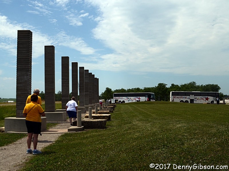
A lot of things about the site have changed over the years but some things begun with that first trip have stuck. The concept of a page for each day with access to the next and previous day has been in place since the beginning as has a cover page with direct access to individual days. The idea of using the daily “Next’ and “Prev” button to (usually) represent the vehicle being used also goes back to that first trip. An animated GIF showing progress has been used on a few subsequent trips but it requires knowing the full route in advance and that’s often not the case. Besides, it’s a fair amount of work.

The organization of trip cover pages and of the site’s home page have changed over the years as features have come and gone and the number of completed trips has increased, but it’s still a clunky 1999 website. At my age and the site’s age, that isn’t likely to change. I’ve done some rework to accommodate things like small screen mobile devices and I’ve incorporated a few third-party tools to support a blog, mailing lists, and RSS feeds but the site is basically good ol’ HTML with the dated appearance and other characteristics that come with it.

Advancements in technology have brought improvements to the site but even more to the road trips documented here. A series of blog articles, My Gear, documents the various hardware used on the trips while another, My Apps, documents the software. The first three My Gear chapters describe the camera, computer, and GPS receiver used on the first trip. Of these, only the camera had a direct effect on the appearance of the website. That camera was a 350 kilopixel Agfa ePhoto 780c. It may be hard to believe there were once digital cameras with sub-megapixel resolution but easy to understand how a camera upgrade could really improve the website. The sluggish (by today’s standards) Toshiba Libretto and dial-up internet left no lasting marks on the website beyond limiting the amount of data uploadable during an overnight stop. The GPS provided some statistics I used on the site but otherwise had nothing to do with it. My Apps – Chapter 1 talks about the website and image editing software used on the first trip. Maybe better image software could have made those 1024×768 (extrapolated) images look better but I have serious doubts. FrontPage Express, the web editing software I initially used, did have lasting impact. The textured beige background that is used on almost all journal pages came from its built-in inventory. My Apps – Chapter 2 is about the software I used to produce printed route instructions which the GPS sort of helped me follow.

The pictures at right aren’t about advances in equipment but a comparison of equipment I had on that first trip. The picture on the left is one of the few unedited pictures I still have from the Agfa. I also carried a 35mm Nikon pocket camera which took the picture on the right. I have no idea what that proves but there it is.

The final cover page for that trip talks about it being temporary. As I said at the time, I expected it to go away because “I’ll need the space or retiring it will just seem right.” Web space became increasingly cheap and apparently retiring it never seemed right. Two decades later that first trip journal is still online and I’ve added 155 more. There is a clickable index of them all as well as a clickable collage. The collage, composed of one image from each of the trips, is a big favorite of mine. Visually skimming over it is a great reminder of what I’ve done with my gas money over the last twenty years. Pausing on any one of those images will always trigger a flood of memories which I can delve into deeper with just a click.

I’m spending this twentieth anniversary at home. I was on the road when the tenth anniversary rolled around. The 1999 trip consisted of following Historic Route 66 to Los Angeles to join a caravan to the Corvette Museum in Kentucky. The 2009 trip was quite similar with the westbound portion being the Lincoln Highway to San Francisco to again caravan to the museum. That was before this blog existed or I might have done a post similar to this one. Instead, I included a brief summary of the day ten years prior in the appropriate daily journals. I began those summaries with the first posting rather than the first day of travel so they begin on the latter trip’s sixth day, August 20, 2009. The summary of the final day of the first trip ended with these words: “It’s really hard for me to imagine a twentieth anniversary for this website but it’s no easier imagining an end. Watch this space.” I’m really happy that some of you are still watching.

Military Vehicle Centennial Convoy

Just months after the end of the First World War, a military convoy of about seventy vehicles spent sixty-two days crossing the United States. Setting out on July 7, 1919, it generally followed the young Lincoln Highway although there were several deviations. One of the most significant was that, rather than starting at the LH’s eastern terminus in New York, it began its westbound journey from a temporary marker near the White House in Washington, DC. A permanent Zero Milestone was erected there in 1923 with the intent that it would be the “POINT FOR THE MEASUREMENT OF DISTANCES FROM WASHINGTON ON HIGHWAYS OF THE UNITED STATES”. It hasn’t quite worked out that way.

For their observation of the 1919 convoy’s centennial, the Military Vehicle Preservation Association (MVPA) had originally planned on departing from that Zero Milestone but later decided to launch directly from their annual convention in York, PA. That happened on Monday, the 12th. On Wednesday, I caught up with them in East Palestine, Ohio, about a mile after they entered the state. East Palestine was a planned overnight stop and I had expected the convoy to already be in town and parked by the time I got there. It was delayed by an accident, however, and we ended up arriving almost simultaneously. Had I realized this and pulled over at the earliest opportunity, I could have photographed essentially the entire convoy. A few vehicles had already passed by the time I got stopped to grab the opening photo and photos of most of the vehicles following which included some pretty big gear.

A nearby park would be the convoy’s home for the night and I headed there to look over the vehicles. The trailered staff car is a 1918 Dodge. The Jeep is a 1943 model built by Ford. I imagine it’s a lot like the one my Dad drove around Belgium, France, and Germany in 1944-45. There’s a front view here and an interior shot here.

Before leaving, I asked one of the participants when they would be leaving in the morning. I was told between 6:30 and 7:00 but really thought that a bit ambitious. When I returned about 6:40 AM, I kind of expected to be killing time until everyone was awake and ready. Not so at all. The last vehicles were pulling into position when I arrived and the first Jeep rolled by at 6:47. The field was empty at 6:52. This is a military convoy.

That was the end of my planned contact with the convoy. I found an independent restaurant in East Palestine for breakfast (Heck’s, recommended) with thoughts of following it with a leisurely drive home. The path that the convoy was following is identified as an “Auxiliary route” on the online LHA map. Apparently, it was part of the 1913 Proclamation Route and the 1919 convoy likely followed it to dinner at Harvey Firestone’s place. I had never driven it before so decided it would be the first leg of that leisurely drive home. By the time I finished eating, I’d learned that the convoy was stopping along the route for breakfast at a place called Firestone Farms.

Their breakfast stop was considerably longer than mine which allowed me to catchup. Firestone Farms is a housing and shopping development on what was once Harvey Firestone’s farm. The original 1828 farmhouse was moved to Greenfield Village in 1983. This facade was built sometime later as part of the commercial development. During today’s stop, the screen on the right showed scenes from a movie of the 1919 convoy while the one on the left showed a movie about wartime manufacturing at Firestone. The tent beyond the clock tower contained displays of local history with an emphasis on Firestone.

The trailered Jeep was one of the vehicles involved in yesterday’s accident. Both drivers were taken to the hospital but are recovering. One of the participants told me that parts are on the way to repair one of the vehicles and the driver, though sore, expects to finish the trip in it. I’m thinking that this is the vehicle in question but do not know that for certain. The second picture shows how some convoy members proudly display Lincoln Highway signage.

When the convoy started getting ready to pull out, I headed to downtown Columbiana for one last encounter. I counted and snapped pictures of thirty-eight vehicles, including the three on trailers, as they passed through the roundabout. Here‘s a rear view of that Packard staff car I captured back at Firestone Farms.

I followed the auxiliary route to Canton and headed home from there. The convoy should be about ready to exit Ohio when this is published. The overnight for today (August 18) is South Bend, IN. A schedule has been posted to their Facebook page but I found it a little tricky to locate so have copied it to share here. Note that this is only a copy and more current information can be obtained through the Facebook page.

The Lincoln Highway Association has a separate centennial tour following the 1919 convoy route. That tour, described here, will be departing from Washington, DC, on August 31.

LHA Conference 2019

This is a big reason why drives involved in the preceding trip were not very leisurely. In the early phases of planning, it seemed like a conference in early June and another in late June would leave plenty of room in between. The devil appeared and the leisure time vanished in the details. The early June conference filled the 5th through 8th. This, the late June conference, filled the 18th through 21st. That left what initially seemed like an ample nine days between the end of one and the start of the other. A two-day drive home from Wisconsin and a five-day drive to Wyoming trimmed all the ampleness from the schedule in a flash. I had time to do laundry and repack and am now on the way to Rock Springs, Wyoming, for the June 18-21 Lincoln Highway Association conference. The first day of the trip is in the books and on the web.

This entry is to let blog only subscribers know about the trip and to provide a place for comments. The journal is here.

My Wheels — Chapter 36
1963 Plymouth Valiant

Among my “road trip cars”, this one holds a very special place. Several special places, in fact. It is the oldest car I ever used on a road trip, and it is the only car acquired specifically for a road trip. It is also the car that participated in the least road trips. I drove it on just one journey other than the one for which it was purchased. It is one of only two “road trip cars” purchased used, and the other one was acquired specifically to replace the Valiant. Despite its limited participation in the activity that is this website’s reason to exist, it’s significance to the site is at least as large as any of the other cars.

The trip for which the Valiant was purchased was a full-length drive of the Lincoln Highway in its centennial year. The model year was chosen so that it would be exactly half the highway’s age at the time of the drive. The picture at the top of this article is of the car in storage where I saw it initially. The pictures at left show the car when I first got it home and in the shop getting a new top.

The big Lincoln Highway drive was centered around the 2013 Lincoln Highway Association Conference in Kearney, Nebraska. The 2012 LHA Conference was held in Canton, Ohio, and I used it for something of a shakedown cruise. The picture at right shows the car at the 2012 trip’s beginning. The journal for the seven-day outing is here.

The Lincoln Highway ran coast to coast connecting New York City with San Francisco. The first picture shows the car in Weehawken, New Jersey, where a ferry from NYC would have delivered Lincoln Highway drivers in 1913. The second picture was taken near the highway’s midpoint in Nebraska and the third at its western terminus in San Francisco, California. The journal for that outing is here. It includes a section, The Ride, which covers finding and preparing the Valiant.

The Valiant also holds the distinction of being owned for the least amount of time of any of the “road trip cars” except for (at the moment) my latest purchase. I bought it December 18, 2010, and sold it April 28, 2014. I sure had fun with the car, and pulling up to that marker in San Francisco was one of the most satisfying things I’ve ever done. But I’m not really the sort of guy to keep a car like that running; The Oklahoman who bought it is.

In addition to appearing in those two trip journals (Lincoln Highway Conference 2012 and Lincoln Highway Centennial Caravan), the bright red convertible was the lead character in a book. I had to both write and publish the book to make that happen but it did happen. That book, By Mopar to the Golden Gate, is available through eBay and Amazon.

My Previous Wheels: Chapter 35 — 2006 Chevrolet Corvette
My Next Wheels: Chapter 37 — 2011 Subaru Forester

Trip Peek #79
Trip #97
Lincoln Highway Conference 2011

This picture is from my 2011 Lincoln Highway Conference trip. It’s a trip that was in doubt almost to the day it started. Dad’s health was not good and I worried about traveling for any length of time. I apparently decided I could probably at least dash to and from the conference and sent in my registration just ahead of the deadline. Dad’s health took a bad turn near the end of May and I cut short a St. Louis trip to hurry back. He improved a bit but never really recovered. He died on June 2. When I eventually returned to thinking about the trip, my initial thoughts were to cancel it. Then I realized there was no reason. There was nothing for me to do after the funeral and long solo drives sounded much more useful than sitting at home.

With no reason to dash, I may have gone overboard. I left home on June 9 and drove the full length of US-36. I camped — in a tent! — in Rocky Mountain NP for a couple of nights.I picked up the Lincoln Highway in Utah and drove the unpaved stretch around Dugway to Ibapah. I met a group in Fallon, NV, for a pre-conference caravan. I hooked up with two groups for two different post-conference outings. One was my first visit to Donner Summit and the second an aborted attempt to drive Kings Canyon. Of course there was the conference in Tahoe with a bus tour west into California and another east into Nevada. When all that was over, I followed the Pioneer Trail alignment of the Lincoln Highway on to San Francisco and a visit with my oldest son. Then it was down the coast on the Pacific Coast Highway to Los Angeles. I’d have gone on to visit my younger son in San Diego but I knew he was at sea with his Navy buddies. I had actually visited him and his family in January. I headed home from LA but took in assorted pieces of Route 66 on the way. I reached home on July 3.

And the picture? It’s from the California conference tour. At our stop in Clarksville, a group of local Ford Model A owners provided rides on the 1914 Lincoln Highway Pavement. The picture was taken from inside a 1928 “leather back”.


Trip Peeks are short articles published when my world is too busy or too boring for a current events piece to be completed in time for the Sunday posting. In addition to a photo thumbnail from a completed road trip, each Peek includes a brief description of that photo plus links to the full sized photo and the associated trip journal.

Book Review
Ford Model T Coast to Coast
Tom Cotter

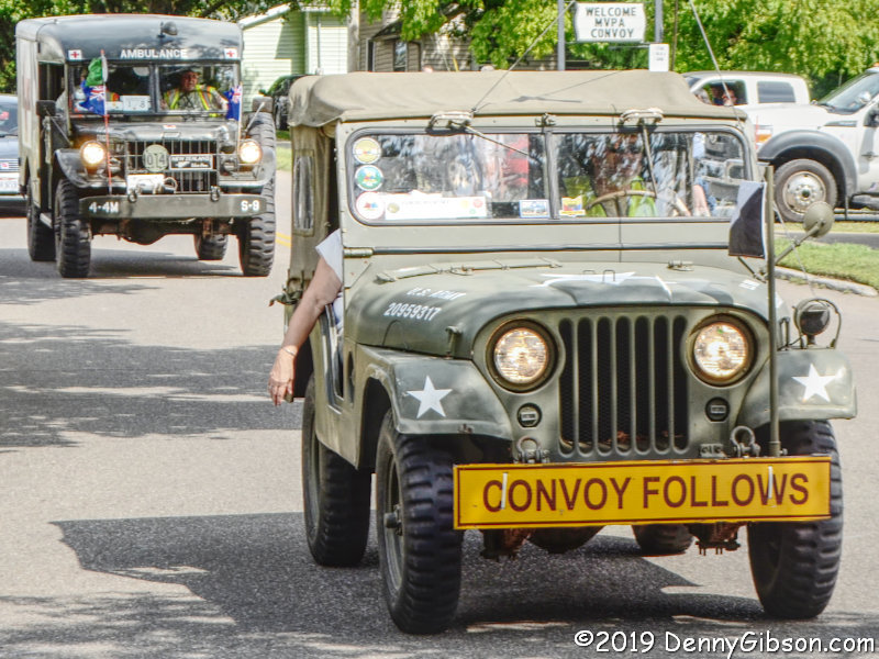
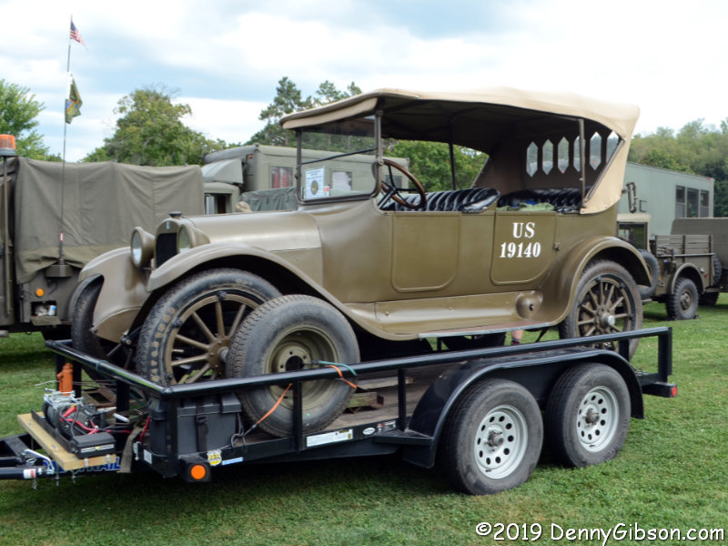
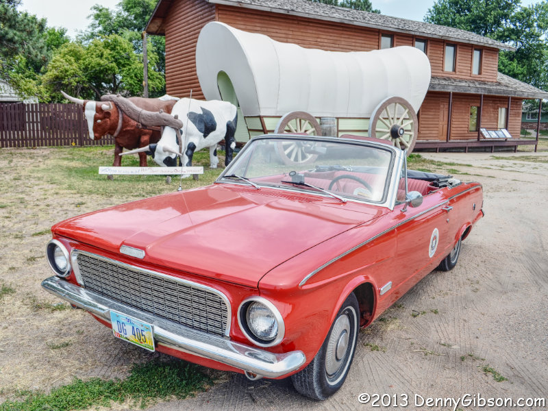
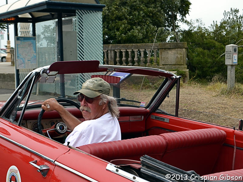
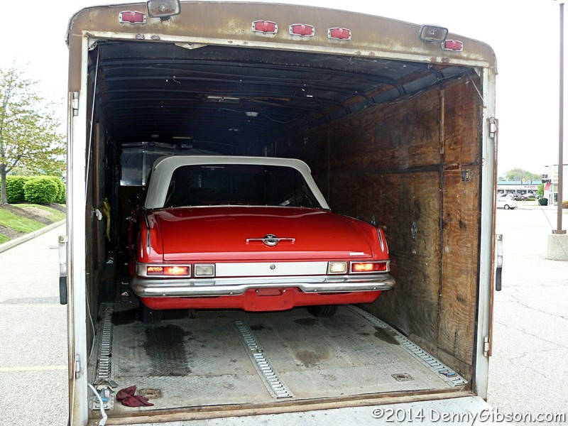
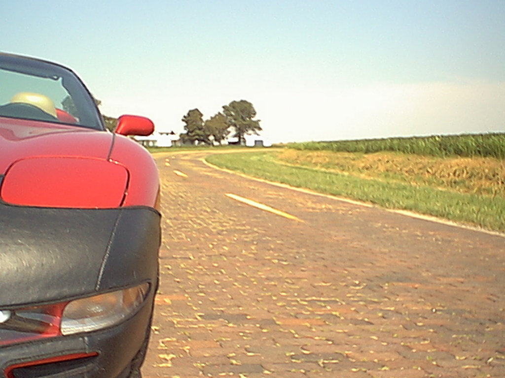
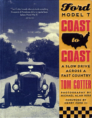
Old-car guys and old-road guys are hardly one and the same although there is definitely a whole bunch of overlap. With this book, Tom Cotter stakes out a position deep in that overlap. Tom is, however, much more of an old-car guy than an old-road guy so it’s not surprising that his position is closer to the car side than the road side. The story of how plans for the trip came together is telling. The idea that Tom started with was driving an old car across the United States. Over the years, the idea had been refined to involve a particular old car. He called it a dream and admitted that it was unlikely to be realized but the car he really wanted to drive across the country country was a Ford Model T. In his dream the road was secondary.
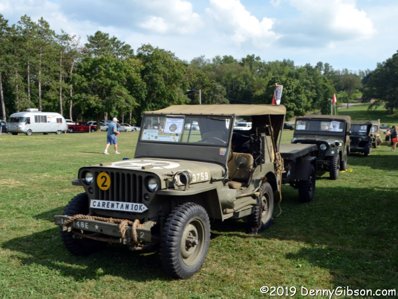
Before getting too deep, let me point out that this is not my great grandfather’s T. My great grandfather once drove a stock Model T to Florida and back. Granddad’s car might have had a theoretical top speed around 40 MPH but the rugged roads of 1920 kept him running in the 20s when he wasn’t stopped fixing a flat tire, worn out brakes, or something else. The car that took Cotter and company to California had a heavily modified engine, lowered suspension, hydraulic brakes, and other improvements that allowed it to cruise at 50+ — safely.

Most of those improvements had been made by Cotter’s traveling companion who was also the car’s former owner. That was Dave Coleman who had sold the car to Nathan Edwards a few years back. Unable to make the trip himself, Edwards loaned the car to Cotter and Coleman. Photographer Michael Alan Ross, following the T in a modern Ford SUV, completed the team.

Only after an authentic but remarkably capable Model T has been lined up for the trip does Cotter look to the route. Calling it a confession, he notes that “I had not heard of the Lincoln Highway until I began planning for this trip.” The trip starts at the Lincoln Highway eastern terminus in New York City, ends at the western terminus in San Francisco, and most of the miles in between were on or near what was once the Lincoln Highway. It was not, however, a particularly strict following of the old highway. There  was occasional streamlining of the route and a few side trips to visit interesting people and places.

So those are the “disclaimers”. The car was not a high-clearance, 20 HP, nearly brakeless, stock Model T. The route did not follow every bend of the Lincoln Highway or even pass by every attraction associated with the historic road. But the car was a very old, extremely basic, and wonderfully historic vehicle, and the route was close enough to the Lincoln Highway to sometimes serve up glimpses of the legendary road and constantly serve up a true view of coast to coast travel. Together they form the foundation for a really cool and extraordinary adventure.

As noted, not every Lincoln Highway icon appears in the book but many do. There’s Dunkle’s Gulf in Bedford, PA, and Lincoln Motor Court in nearby Mann’s Choice. In the midwest, the travelers stopped at the Lincoln Highway Association Headquarters in Illinois and the famous Reed-Niland Corner in Iowa. Farther west they drove through some great scenery and made stops at the Utah’s Bonneville Salt Flats and the historic Hotel Nevada in Ely. Michael Ross snapped great pictures of all these scenes and more.

The Model T that Nathan Edwards generously loaned out for this adventure could be considered a “late model”. It was manufactured in 1926 during the next to last year of T production. It performed flawlessly for the entire 3,707 mile journey. They even had to fake a flat tire to get a “break down” photo. Cotter acknowledges that they were certainly not the first people to cross the United States in a Model T but it seems at least possible that they were the first to do it without something breaking. That’s partly due to the in depth preparation that Edwards and Coleman made before the trip started, but might be due even more to the attention Coleman gave the car during the trip. Daily or more frequent inspections sought out low fluids and loose bolts before they became problems. There’s a lot of work involved in getting a 91 year old car from one coast to the other — but it sure looks like a heap of fun.

Ford Model T Coast to Coast: A Slow Drive Across a Fast Country, Tom Cotter with photography by Michael Alan Ross, Motorbooks, May 15, 2018, 10 x 7.9 inches, 224 pages, ISBN 978-0760359464

Available through Amazon.