A Cosmic Reason for the Season — Reredux

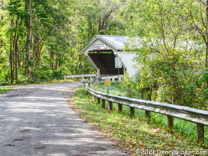
The following article first appeared in 2019 then reappeared in 2020 when the Fort Ancient winter solstice sunrise program was canceled. I have seen nothing specifically about the program this year but know that the site will be open between 7 and 10 AM on December 21, the day of the solstice. That’s a Tuesday which is a day that the site is normally closed this time of year. It is clearly being opened for sunrise and a program of some sort seems possible.

The article’s first publication occurred one day after the solstice. The next year, it was one day before. This year it is two days before. That shifting comes from our efforts to make Sol, Luna, and Earth play nice together. Most of this blog’s posts, and all three posts of this article, occur on Sundays. Days of the week usually shift by one each year because seven does not fit evenly into 365. The two day shift between the article’s first and second appearance was because seven is an even worse fit for 366 and 2020 was a leap year. The seven-day week isn’t quite as arbitrary as it might first appear but neither is it an intuitive unit of measure. The moon circles Earth every 29.5 days. The Egyptians divided that into three ten-day periods. Four eight-day Roman weeks or seven-day Babylonian weeks fit less precisely but could be tied, albeit imperfectly,  to the moon’s four phases. The Babylonian seven-day week was spread far and wide by Alexander the Great, and as Rome moved into Alex’s old stomping grounds, it began to think that way too. The western world’s week became pretty much established in 321 CE when Constantine declared that an official Roman week was comprised of seven days. This Sunday post precedes the winter solstice of 2021 by 2 days; 2 days, 4 hours, and 58 minutes to be precise. 


Calendars come and calendars go and Earth just keeps on turning. And it keeps on orbiting, too. The turning bit creates what we call days. The alternating periods of light and dark impact almost all life on the planet and humans adopted the day as a basic unit of measure pretty early on. What we call years comes from Earth orbiting the Sun. There was plenty of time for early humans to stare at the sky and not a whole lot to keep them from doing it. They couldn’t help but notice that things in the sky moved around. In time, some of the more observant among them realized that not all that movement was random and eventually some patterns were noted. I can’t imagine how exciting it was when some smart guy figured out that the sun popped up at the same point about every 365 days. Of course, that “about” would be very important.

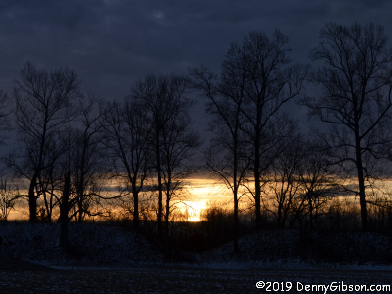
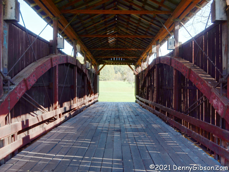
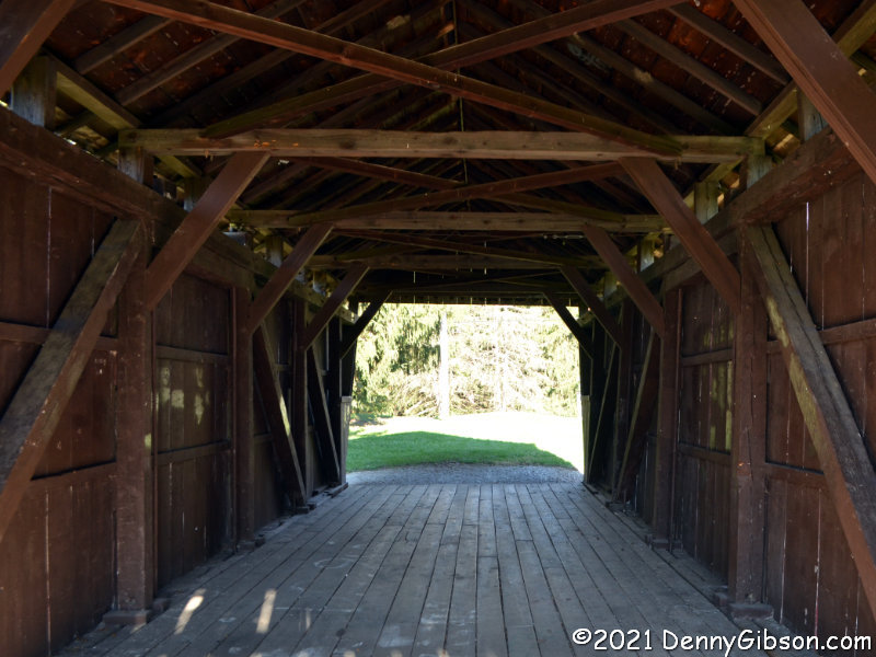
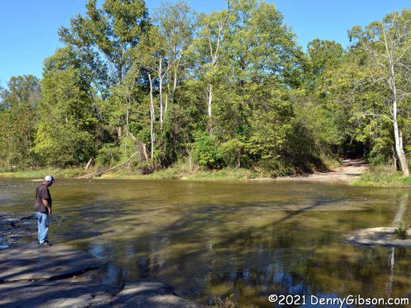
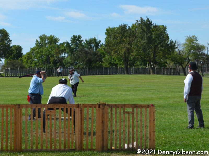
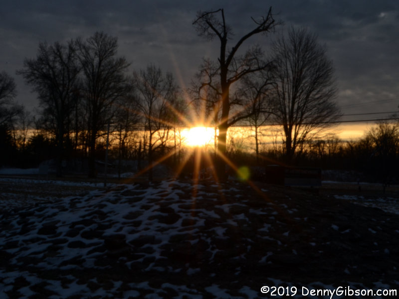
The opening photo shows the sun rising yesterday over a “gateway” in the earthen enclosure at Fort Ancient. The photo at left was taken a bit later and includes a small mound inside the enclosure in the foreground. When the mound, gateway, and sunrise align, sunset will follow sooner than on any other day of the year. This is the northern hemisphere’s Winter Solstice. It is the day when the sun is above the horizon for less time than any other day of the year, and yesterday that amounted to 9 hours, 25 minutes, and 9 seconds. Although we talk about Solstice being a day, it is technically just an instant. It is the moment when the Sun is farthest north or south of Earth’s equator. It happens twice each year and happened yesterday at 23:19 EST.

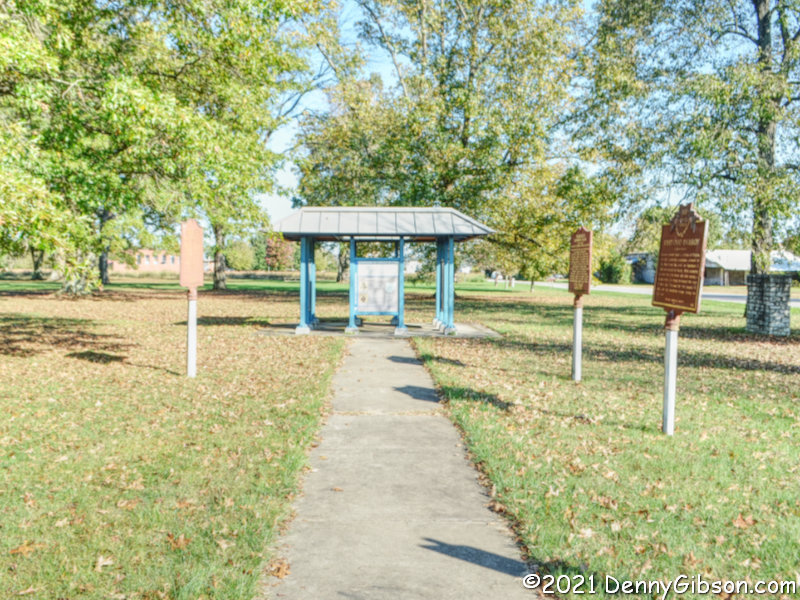
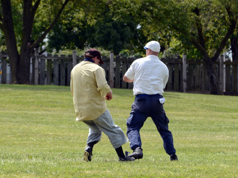
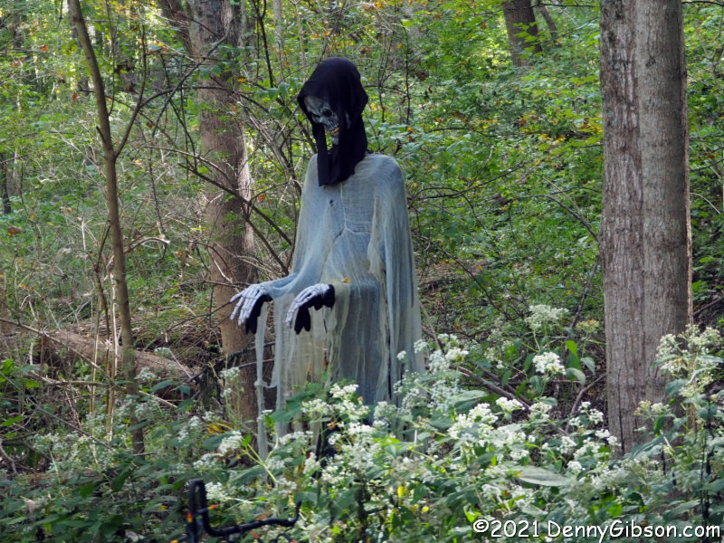
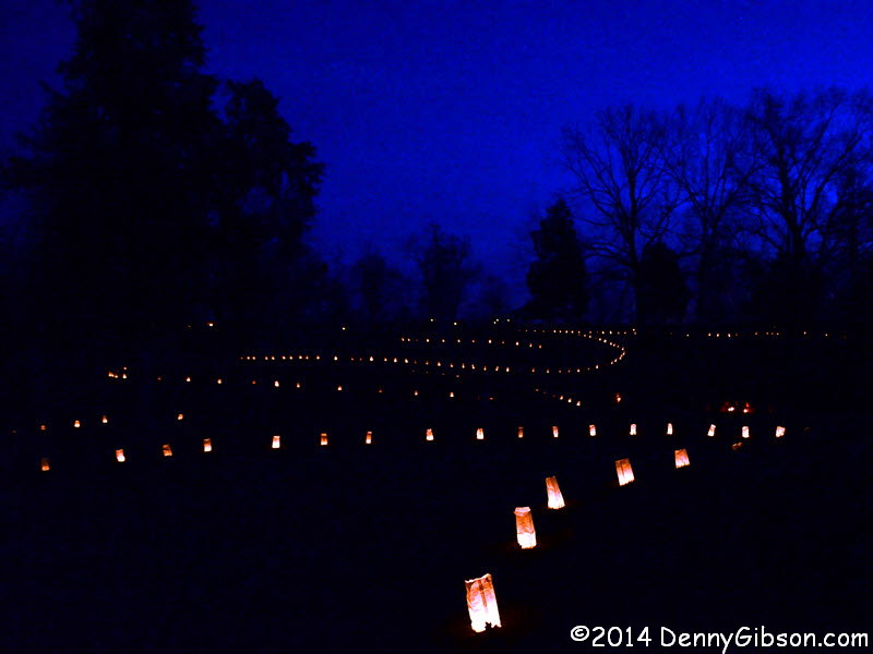
Serpent Mound, another ancient earthen structure containing solar alignments, is a little more than forty miles southeast of Fort Ancient. The serpent’s head is aligned with the Summer Solstice sunset. Body coils align with Summer and Winter Solstice sunrises. For several years, a modern event known as Lighting of the Serpent took place there at Winter Solstice. It was discontinued in 2017. The picture at right is from 2014 which is the only time I attended.

Long before they knew anything about orbits and equators, humans knew the day of Winter Solstice was special. It is the point where each successive day receives more rather than less daylight. It’s the big turnaround that will eventually lead to the warmth of spring and summer. It is clearly a day worth celebrating and it has indeed been celebrated in many different cultures in many different ways.

During their existence, humans have developed a slew of calendar systems. Several actually remain in use today, but the Gregorian calendar is the one most widely accepted. In the late sixteenth century, this started replacing the Julian calendar which had been around for all of those sixteen centuries and then some. The Julian calendar had been created by folks who calculated that a year was 365 and 1/4 days long which was a lot more accurate than an even 365. They came up with the rather clever idea of adding an extra day every four years to balance things out.

We now know that a year is 365.2422 days long. A year is the length of time it takes Earth to orbit the Sun, a day is the length of time it takes Earth to rotate, and neither is adjustable. When the Julian calendar was first adopted, the northern hemisphere’s Winter Solstice fell on December 25 but it slowly drifted away. Someone in authority thought to put an end to this nonsense by declaring December 25 the official solstice. But those non-adjustable orbits and rotations kept doing what they were doing and the official solstice and actual solstice just kept getting farther and farther apart.

The Gregorian calendar, which we have used for roughly 400 years now, put an end to that. Like the Julian calendar, it considers most years to be 365 days long but has a more involved system of “leap years” that add an extra day. The result is that over a long enough period our years will average 365.2422 days in length. Not only did the new calendar eliminate future drift, it tried to correct for some of the previous drift by throwing away ten days. The calendar’s namesake’s full-time job was as Pope of the Catholic Church. Ditching those ten days moved the solstice to December 22 which is where it had been in 325 when the church was founded. Of course, some holidays that had been tied to the official solstice (which hadn’t been anywhere near the actual solstice for some time) would continue to be celebrated on December 25.

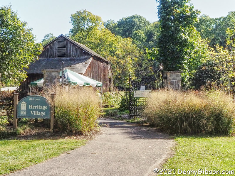
Anyone wanting a more complete discussion of calendars, solstices, and holidays will find one here. Additional information on Fort Ancient is available here.

Holly Days Under Glass

I’d read that Dayton’s Arcade has been the focus of major restoration efforts and that some tenants have moved in and that others were on the way. But I had also read that most of the structure, including the 90-foot rotunda, was not yet open to the general public full time. I had completely missed some opening-related events that had been held in the rotunda but finally got my act together on the second day of Holly Days 2021. It’s an event that the Arcade has hosted in the past. The most recent, however,  was in 1993.

In recent years the Third Street facing side of the building shown in the opening photo is the image assigned to the structure in my mind. Almost all of my memories of the Arcade are, strangely enough, from the outside. My only memory of the inside is of a straight glass-topped walkway that I believe is behind the giant smiling face and was once lined with shops. I vaguely recall stepping into that area in the tow of an aunt on a mission. I have no recollection at all of what she bought but I’m fairly certain that we reversed paths once the purchase was made and I never reached the rotunda. I automatically assumed that access to Holly Days would be through that arch but it was not. My first view of the rotunda was from a normal hallway behind these bland glass doors on Fourth Street.

I had seen plenty of pictures so that first view didn’t shock me but it sure did impress me. I actually think I was more surprised by the bustling crowd than the phenomenal restoration work. I’m pretty sure crowds only bustle during the holidays and possibly only when their focus is gift shopping. About half of the rotunda was filled with potential gifts and this crowd was clearly bustling.

Crowds would have also filled the rotunda in its earliest days and they might have even bustled on occasion. It opened in 1904 as a farmers market which explains the turkeys, ram heads, and fruit decorating the upper walls. Note that cardinal directions, such as east and south, are marked on pillars along with some of the more popular intermediate directions like 159° and 212°.

During Holly Days, a variety of entertainment utilized the rotunda’s north side (i.e., the side opposite the big S). While I was there on Wednesday afternoon, the Miami Valley Dance Company performed selected dances from The Nutcracker.

How something like this could have come as close as it did to vanishing is a question I’ve asked before about other treasures but there is hardly ever an answer. In the end, we just have to be thankful when the wrecking ball is avoided and doubly thankful when something not only dodges the ball but comes back looking like this. If you are unfamiliar with the Arcade’s history, I recommend checking out the information provided here. I also suggest taking a look at Ronny Salerno’s 2016 The Dayton Arcade for a glimpse at what it came back from. Ronny even has a picture of the bit I think I remember.  

Another Covered County Covered

When I took in Preble County Covered Bridges a couple of weeks ago, there was actually another Ohio county in the running for the “honor”. Fairfield County rivals Ashtabula County for the number of covered bridges and is much closer. Of course, Preble County is closer still and I decided to save Fairfield for a day when there was a chance that the trees would be more colorful. Friday was that day but, even though there were some mighty colorful trees here and there, I never did find that picturesque little bridge framed with orange and gold that I envisioned.

Unlike the rather spontaneous Preble County jaunt, I actually did some advance planning for this outing. I started at the Charles Holliday Bridge (#1) on the Millersport Lions Club Sweet Corn Festival grounds. This happens to be bridge #1 in the Fairfield County Covered Bridge Trail Guide but I did not visit the bridges in the sequence they are numbered in the guide. I started with the bridge farthest from my home then hit the rest in a very crude horseshoe pattern. The numbers following each bridge name are from the guide, however.

My second stop was at the R.F. Baker Bridge (#12) behind the Fairfield Union School. It’s not visible from the parking lot but directions from a friendly student got me there. This is the closest thing I found to that bridge framed by autumn colors in my mind’s eye. You have probably figured out that this is the bridge in the opening photograph and you may have also figured out that it is my favorite.

The John Raab Bridge (#8) is on private property and some distance from the road. I think it was possible that I could have gotten permission from the owner for a closer look but I just settled for a shot from the road with a longer lens mounted. That lens was still on the camera when I started to pull away and spotted a fox scurrying across the open field.

I made my Preble County bridge post a member of the My Cabbodles series but not this one. The reason is that two of Fairfield County’s listed bridges are inaccessible inside a park that is temporarily closed. I believe the address I had matches that of the pictured house although I saw nothing that indicated a park. Nonetheless, I think Mae Hummel Bridge (#9) and Shade Bridge (#14) are around here somewhere.

Only four of Fairfield County’s seventeen covered bridges remain at their original locations and three of them are pictured here. At first glance, I thought all three might have had the same builder but that’s not so. The Johnston Bridge (#7) was built by Augustus Borneman while the Mink Hollow Bridge (#11) was built by Jacob Brandt. No builder is identified for the Hanaway Bridge (#3).

Both of these bridges have been moved, but they still cross water and they are still in use although traffic is now pedestrian-only. The George Hutchins Bridge (#2) serves foot traffic in Alley Park while the McCleery Bridge (#10) helps folk cross Fetters Run on the Lancaster Bike Path.

The John Bright #2 Bridge (#6) has also been moved, still crosses water, and serves pedestrians. Like the McCleery Bridge, it is on Fetters Run and the Lancaster Bike Path. Its description states that it is the “gateway to Lancaster Festival concerts at Ohio University”. I’m guessing those concerts take place in the large open field beyond the bridge.

Rock Mill Bridge (#13) is the fourth covered bridge in Fairfield County surviving in its original location. The mill after which it is named also survives right next to it. The Fairfield County Covered Bridge Trail Guide claims that “At one time, every U.S. Embassy in the world displayed a photo of Rock Mill Bridge.” I haven’t yet found anything online to explain or confirm that so I’ve sent a query to the Fairfield County Ohio Visitors and Convention Bureau and will update this with any information I receive.

Here’s a bridge that has been relocated to a spot that once had water but no longer does. The Hartman #2 Bridge (#4) now sits astride what was once the Ohio & Erie Canal between Lock 11 South and Lock 12 South. The stone walls of Lock 12 South can be seen beyond the bridge in the third picture.

The Shryer Bridge (#15) is on private property with no obvious place to pull over so I really did grab a driveby shot of it. Inside Sycamore Creek Park, the relocated Zeller-Smith (#17) serves as the entrance to an arboretum. The Stemen House Bridge (#16) was relocated and shortened from 72 to 36 feet in length. Damaged and decayed parts were discarded during the move but the half that was saved was so good that now stands as the only public covered bridge in the county open to vehicles.

I had to add the word “public” to the previous sentence since this privately owned bridge is open to vehicles driven by the owner or friends. The Hizey Bridge (#5) once crossed Poplar Creek but has been moved to form part of an impressive private driveway.

If that park is ever opened and those two other bridges become accessible, I suppose I might go see them. Then I can republish these pictures as a caboodle. But the truth is that I was a little disappointed in the covered bridges of Fairfield County and it had little to do with the two hidden bridges or not finding the perfect wall of orange and gold leaves. It had to do with there being only two drivable bridges (one if you’re me) in the lot and so many that weren’t actually bridges at all anymore. By that, I mean those sitting in fields that don’t cross over anything that needs crossing. By contrast, six of the eight Preble County bridges were drivable and all nine of the Ashtabula County bridges I visited in 2019 were drivable. There are ten other covered bridges in Ashtabula County that I have not visited and about which I’ll make no claims.

On the other hand, even those that were sitting in someone’s yard, crossing nothing and accessible by no one, had escaped destruction. I’m reminded of something Tod Swormstedt of the American Sign Museum often says. According to Tod, the best way to preserve a sign is in its original setting doing what it was designed to do. Preserving them in museums and private collections isn’t nearly as good but is better than the scrap heap. I guess that applies to bridges, too. I prefer my historic bridges in the wild carrying vehicles over some body of water just like they were designed to do. Parks and private settings aren’t nearly as good — but they’re better than the scrap heap.

Following Morgan

Once upon a time, a hostile military force passed less than four miles from where I live. I wasn’t here at the time. I wasn’t anywhere yet. It was 1863 and Confederate soldiers commanded by General John Hunt Morgan were on their way to reaching as far north as any Confederate soldiers ever would. That would occur on July 26 when Morgan and what was left of his troops were captured near Salineville, Ohio. On Monday, my friend, Terry, and I set out to retrace the Indiana and Ohio portions of Morgan’s three-state raid. Even though it was a slaveholding state, Kentucky did not join the Confederacy so Morgan was technically in enemy territory as soon as he entered the state but things really got interesting when he crossed the Ohio River. That’s where Terry and I started our raid following.

In the opening photograph, which looks across the Ohio River into Indiana from Brandenburg, KY, the raid is the subject of the metal marker and is noted on the stone marker. Both are overshadowed by a seventy-foot Confederate Veterans Monument that was moved here from Louisville, KY, in 2016. Louisville was beginning to think that distancing itself from the Confederacy might be a good idea but not so Brandenburg. Plaques at the monument’s new location tell its original history along with the story of its move. A “Southern Causes for the Civil War” plaque has a noticeable Confederate spin but does present something of a list of perceived causes. A “Northern Causes for the Civil War” plaque properly identifies a cause as “resistance to southern succession” then fills the panel with “things the Yankees did that pissed us off”.

Morgan spent eighteen days traveling through Indiana and Ohio. We spent four. We were traveling faster — and more comfortably — of course, plus we had the advantage of a path marked by signs and documented in guidebooks. The books used were “The John Hunt Morgan Heritage Trail in Indiana” by Lora Schmidt Cahill and “Morgan’s Raid Across Ohio” by Lora Schmidt Cahill and David L. Mowery. The signed route and the route described in the books do occasionally differ. I suspect that the signed route bypasses some of the rougher roads but I’m not certain of that and there may be other reasons for differences. Whatever the reasons, the differences are not many. We stopped at most of the sites marked by interpretive signs or called out in the books but did miss a few — sometimes intentionally, sometimes by accident. Only a few of those stops are covered in this post. It’s a brief recounting of our “raid”, not Morgan’s.

This is the Battle of Corydon Historic Site. I’ve included it to point out that the flag being flown to represent the Confederacy is the first official flag of the Confederate States of America. It is often referred to as the “Stars and Bars”. Artifacts from the steamboat Alice Dean, which Morgan sank after using it in crossing the Ohio River, are displayed here.

In the spirit of cordless phones, unleaded gas, and mirrorless cameras, this is a bridgeless creek. Terry looked over the ford at Big Graham Creek and spoke with a mother and a couple of kids beside the creek before deciding to take the plunge. Just as we started across, a pickup appeared on the opposite bank and entered the water without a pause. He passed us mid-stream on our left as a Jeep pulling a trailer followed us. Indiana may have to post some “congested ford” signs if that level of traffic continues.

Apparently, I grabbed no photos of the trail signs in Indiana. These are in Ohio. The first is at the Harrshaville Covered Bridge which was one of the few bridges crossed but not burned by the raiders. It was renovated in 2013. The U-turn sign is near Rock Springs Park where some of the raiders rested briefly. I’ve included it to show how well the driving tour is marked.

This is Buffington Island Battlefield Memorial Park. This is where things started to unravel for Morgan. Union forces met up with the raiders as they attempted to cross the Ohio River into the recently established (June 20, 1863) West Virginia. Some made it, some were captured, and some, including Morgan, escaped to run around Ohio for another week. “Run” is the appropriate word as Union troops were in close pursuit of the raiders from now on. Read the plaque on that stone marker here.

Here are a few of the more — but not most — interesting roads we traveled in Ohio. The low-water bridge on Hivnor Road over Island Run is as close as we came to a ford in the state.

Morgan’s men were involved in multiple skirmishes with federal troops, local militia, and even civilians. An encounter with Union forces at Old Washington left three of them dead. All three are buried in the town cemetery. In the past, these graves were marked by the X-barred Confederate Battle Flag, which has pretty much been usurped by modern white supremacists. I don’t know when the change was made. Here‘s a photo from 2010. There’s a closer look at one of those flag holders here.

The “Stars and Bars” was replaced as the official Confederate flag on May 1, 1863. It was not the official flag during any part of Morgan’s raid although it was undoubtedly carried by most of his troops. Here‘s a picture, taken at a spot nearer the end of the trail, of the flag, known as the “Stainless Banner”, that replaced the “Stars and Bars”. Of course, it’s unlikely that all flags were replaced in just a couple of months so any official Confederate national flag flown during the raid was probably the “Stars and Bars”. However, the flags at Old Washington and at the Corydon battle site contain just seven stars. That was indeed the way things started, but by November 28, 1861, long before Morgan headed north, the count had grown to thirteen. These flags are a welcome change from the battle flag and are closer to being the national flag at the time these guys died, but they’re still not quite right.

The yellow sign might mark the beginning of the most interesting road we traveled. The sign is itself rather interesting. “GPS route” is not an official designation so neither is “Not a GPS route. This and similar phrases seem to be a way of trying to tell truckers that, if their GPS is sending them down this road, it’s probably wrong. The road is quite steep and winding and neither Terry nor I got any pictures. We did get some shots at the bottom where Gould Road accompanies Long Run underneath the Wheeling & Lake Erie Railroad into Mingo Junction.

ADDENDUM Sep 3, 2022: This trip finally made me do something that I had been threatening. I bought a dashcam. Although I clearly do not have it mastered, I did get a video of this section on my second visit since our Morgan themed outing. Evidence that I’ve not mastered the camera is shown in the lack of sound and GPS and speed information but the “interesting road” can be seen here.

There was still a little daylight when we reached the point where Morgan and his remaining troops were captured. Terry took aim on the surrender marker and so did l. The plaque is here.

We pretty much used all the available daylight on each of the four days we spent covering the trail. The first three days had been completely dry and we even dodged much of the rain that started appearing on the afternoon of the fourth. We attributed our good luck regarding the rain to a black cat that had started to cross our path then stopped and turned around. We didn’t realize just how lucky we were until we got home. Wind and rain picked up as we drove from that “END” sign to our motel in Carrolton, but once we arrived, we temporarily lost all interest in weather. And weather wasn’t much of a factor when we drove home the next day. I was shocked when Terry called to tell me he had learned that several tornados had been sighted in Jefferson County on the day we reached the trail’s end. I was even more shocked to discover that, roughly half an hour before we took our surrender marker photos, a tornado had damaged twenty-three homes, a church, and a business about twenty-five miles away in Wintersville. Apparently, that cat turned around just in time.

ADDENDUM 26-Oct-2021: Even though this outing was not documented with daily posts in this site’s journal section, much of the mechanics behind it were pretty much the same as trips documented there. That includes the routing and tracking that allow locator maps to be made. So, I’m adding a locator map because I can.

My Caboodles — Chapter 5
Preble County Covered Bridges

The Caboodles series was conceived as something to fill in otherwise empty weeks with subjects from completed outings. But, like every other rule connected with this blog, that was far from ironclad, and about halfway through Tuesday’s visits to the eight covered bridges in nearby Preble County, I realized that I would have a legitimate caboodle at day’s end. I decided to use the designation in the weekly post to create the blog’s first-ever real-time caboodle.

Once upon a time, there were approximately 3,500 covered bridges in Ohio. More than 95% of them are gone but that still leaves nearly 150 standing. Eight of those are just to my north in Preble County. On Tuesday, I headed to the county seat of Eaton and had breakfast at the cleverly named and jam-packed Eaton Place where I’m quite certain the waitresses knew everybody’s name but mine. From there I headed to the nearest of the bridges barely a mile away.

1. Roberts Covered Bridge is one of only two Preble County Covered Bridges that are closed to traffic but its claims to celebrity go far beyond that. It is one of only six remaining double-barreled covered bridges in the country and is the oldest of those. The only covered bridge of any sort that is older is the Hyde Hall Covered Bridge in New York, and it is older by a mere four years. Roberts Bridge, obviously the oldest in Ohio, was built in 1929. The Hyde Park Bridge was built in 1825. The bridge was moved here in 1990 from its original location south of Eaton.

2. I’d entered approximate coordinates for each of the bridges into my GPS and proceeded to visit them by heading to whichever was closest. That method next took me to the Christman Bridge a little north of Eaton. Numerous bridges were damaged by a major storm in 1886, and one man, Everett S. Sherman, was contracted to rebuild fifteen of them. That helps explain why the Roberts Bridge is the only pre-1886 bridge standing and also explains why six of the currently standing bridges were built by Sherman. He built this one in 1895

3. The Geeting Covered Bridge was built in 1894 to replace a ford and foot log over Price’s Creek. Floor beams have been broken by overloaded trucks and in 1969 an over-height truck took out some of the roof but the bridge has been repaired every time.

4. It’s fairly obvious that this is the other currently standing bridge not open to traffic. The Dixon’s Branch Covered Bridge does remain quite useful, however, having been moved to the Lewisburg Community Park and put to work as a shelter house. Although there is a parking area right next to the bridge, I initially missed it and ended up walking across much of the park from another lot. That was actually a good thing since I would have otherwise missed this bit of artwork which I’m guessing is from storm-damaged trees.

5. The Warnke Covered Bridge is the northernmost in the county and is the last bridge Everett S. Sherman built. Apparently, it was not one of the jobs resulting from the 1886 flood but was undertaken to repair more localized damage due to an 1895 flood. In this case, repair meant a whole new bridge.

6. The Brubaker Covered Bridge is the only one of Preble County’s older covered bridges to have more than a single small opening in its sides, and even it wasn’t always that way. It is the covered bridge equivalent of stone ‘S’ bridges seen on the National Road and elsewhere. Construction methods of the time placed bridges at right angles to the stream they crossed which sometimes forced the roadway to curve as it approached the bridge. That wasn’t a big deal for pedestrians or horses but became a big deal when automobiles started flying along at tens of miles per hour. The greatly widened openings allowed motorists to see and be seen. There was a rack of Preble County bridge brochures at every one of the covered bridges but the one pictured at the beginning of this post was here.

7. Everett S. Sherman built the Harshman Covered Bridge over Four Mile Creek in 1894. Like most of the Preble County bridges, it’s on a nice straight road that provided a through-the-bridge view in both directions. And, also like most of those bridges, there is a mid-span opening that provides a nice up-the-stream view to anyone traveling slow enough to see it.

8. Had I spent some time working out a full route, I would have probably ended my bridge tour at the northern edge of Preble County then slipped into my birth county (Darke) to do some visiting. As things turned out I’m kind of glad that this was the last bridge of the day because it really is the oddball of the bunch. It looks modern because it is. It was built in 2012. It mimics nineteenth-century bridges in its use of the Burr Arch truss design. It is built of wood so the covering can be justified as protection just as it was in the nineteenth century. There are, of course, other ways of protecting wood today as well as other bridge-building materials. I’m not a fan but neither am I a hardcore opponent of bridges of this sort. It is hardly the only retro-bridge in the country. They are what they are.   

Driving Lessons

During the writing of Tracing A T To Tampa, the fact that I had never driven a Model T Ford began to bother me more and more with every passage that referred to some detail about the car that “put America on wheels”. I had seen plenty of Model Ts and had ridden in a few but every comment that I made about the T’s operation came from observation and “book learning”. I wondered about how accurate I was being.

The T that I traced to Tampa is believed to be the touring car in the first photograph which belonged to my great-grandparents. The coupe is a car they owned many years after the Florida trip. It is currently in the possession of an uncle and I considered bugging him for driving lessons but in the end, I went for the Model T Driving Experience at the AACA museum in Hersey, PA. That gave me access to multiple cars in an environment set up for novice drivers. I combined it with a few other items from my to-do list and made a road trip that is documented here. The driving experience is included in day 4 but not much is said about the actual driving. That’s what prompted me to make this blog post.

This picture is one I used in the trip journal. It shows the four cars that students were to drive. I drove the green, yellow, and red cars but the black car, actually a roadster pickup truck, conked out before my turn came. It was replaced by another black roadster pickup, but the top stayed up on the replacement. That’s it in the b&w photo at the top of the article.

The image at left was taken from the “Ford Model T Instruction Book”. Model Ts were often delivered by train or other means directly to a new owner with nothing resembling today’s dealer prep (and accompanying charge). The 45-page book provided all the information necessary to prepare, operate, and maintain what might be the very first powered vehicle the owner had ever seen.

Our cars had all been prepped, of course, and all were equipped with electric starters. Plus, we would have the advantage of a classroom presentation with visual aids. Against the open doorway, the visual aids weren’t a whole lot easier to see in person than they are in the photograph but we all had copies available in a handout. The use of the spark advance and battery/magneto switch in starting the engine was discussed but today the instructors would take care of those details. Students would be dealing with the hand throttle, the steering wheel, and three pedals.

It seemed everyone was familiar with a hand throttle from a tractor, lawnmower, or something similar. And everyone recognized the steering wheel. It is one of just two controls that have maintained the same function from Model T to Tesla although neither can be operated with modern instincts. Most modern cars have a steering ratio of 12:1 or more; the ratio for Ts is 4:1 or 5:1. It is essentially the only thing on a Model T that can be called quick.

This picture of a Model T’s three pedals appeared in the handout. The bulk of student brain activity would be focused on these. ‘C’, ‘R’, and ‘B’ markings identify them as clutch, reverse, and brake. The brake pedal is the other control that technically retains the same function in modern cars as in the T. However, like the steering wheel, how well it performs that function is dramatically different. Today’s brake pedals are mostly power-assisted and hydraulically connected to large disc brakes at all four wheels that will bring a 3,000-pound 60 MPH vehicle to a halt in forty yards or so. A Model T’s brake pedal is mechanically attached to bands that tighten around a shaft in the transmission that will bring a 1,200-pound 10 MPH vehicle to a halt eventually.

Although there is nothing quite like the reverse pedal in modern cars, its function is simple and easy to understand. With the car stopped and no other pedal pressed, pushing it to the floor causes the car to move backward. The idea of “no other pedal pressed” would really apply to all of the driving we would do on this day. The pedals would be pressed one at a time.

Clutch pedals in modern cars are becoming increasingly rare but they do exist and it’s tempting to think that knowing how to operate a modern manual transmission will help in operating a Model T. Not a chance. Almost every instinct developed by driving manual transmissions will only get in the way when driving a Model T. I will expand on this later but today we would be doing all of our driving in low gear which meant that the clutch was engaged with the pedal pressed and disengaged with the pedal released. Yes, driving in low gear did translate to driving at low speed and I don’t doubt that some readers will think that lame. Pshaw. With 4:1 steering in a fairly primitive car with totally unfamiliar controls, 15 MPH was plenty fast.

A Q&A session followed the presentation then we moved outside where instructors reviewed parts of what we had learned using the real Model Ts as visual aids. Next, an instructor climbed into the driver’s seat of each car and a student joined them for a lap around the course as a passenger. The “course” was an unmarked path around a closed-off portion of the museum grounds with an uphill section on grass and a downhill section on asphalt.

The green roadster was the first car I climbed into but I have no pictures of me as either a passenger or driver. Even though I’d read about it and had ridden with others doing it, the strangeness of holding that clutch pedal down to keep moving didn’t completely register until it was my foot doing the holding. I also was a little surprised at how much the throttle was used. It was positioned for easy fingertip access while holding the wheel and adjustments were required for climbing the small hill and at other points too. I also did a lap as a passenger in the yellow speedster. The instructor thought that prudent because of some play in the steering. I managed to hand off my camera for the speedster drive but only have a picture from that first lap. My drives in both of these cars went well in that I didn’t run into or over anything and I didn’t stall either one. That streak would not continue.

Helpful volunteers did snap pictures of me at the wheel of the other two Ts, both of which I managed to stall. In fact, I stalled the cool-looking furniture van twice. At ages of 94 to 108 years, these vehicles are entitled to some idiosyncrasies and they do indeed have them. For the speedster, it was steering. For the red van, it was a dead spot in the throttle. Twice, when I wanted a little more oomph, I moved the throttle a little when it needed to be moved a lot. I have a different excuse for stalling the black pickup. Model Ts have a parking brake of sorts but using it was not part of the day’s normal procedure. There was no need in the level lot. For some reason, the previous driver had seen fit to set it but that did not keep me from reaching the beginning of the hill before the combination of brakes and incline started to bog things down. The instructor figured that out just as the T’s engine chugged to a halt. With that exception, my drive in the little pickup was understandably the best of the day. Operating that strange clutch and using the hand throttle never became 100% natural but, as it is with most things, the more I did it the better I became.

I said I would expand on clutch operation and I’m going to use a detail from an earlier picture to help with that. I’m also going to take the opportunity to describe briefly what happened when I stalled those cars.

Until it is up and running, a Model T’s engine needs to get its electrical power from a battery. A switch on the dash-mounted wooden box controls that. Following a stall, the instructor would flip that switch to battery and maybe make some adjustments to the throttle and spark advance. They would then tell me to press the starter button. In the picture, it’s on the floor. In other cars, it was on the verticle panel below the seat. Once the engine started, the instructor switched things back to magneto operation and away we’d go.

As I’d recently been thinking of my great-grandfather driving a Model T to Florida and back, at some point I began to think about him with his foot pressed to the floor for the whole trip. That really wasn’t required and that lever that the instructor is holding in the picture above is part of the reason. Pulling it all the way back activates small drum brakes on the read wheels. That’s what was going on when I stalled the pickup. Moving it all the way forward enables high gear. With high gear selected, pressing the clutch pedal to the floor still engages low gear, releasing it partway disengages the transmission, while releasing it all the way engages high gear. So, when driving to Florida, push that lever forward, press and hold the clutch pedal until you’re moving at a decent clip, then slowly release it. Adjust speed with your fingers as necessary and let your feet relax.

The museum does not call what they offer a school. It’s a Model T Driving Experience. The certificate I received simply acknowledges that I “completed” the experience with no indication of how good or bad I did or how badly I frightened the instructors. It does not authorize me to do anything whatsoever and that includes bragging about driving four different Model Ts in low gear without stalling two of them. I’m doing that entirely on my own.

Heritage Village Cincinnati

Friday felt a little odd. It had absolutely nothing scheduled but it was surrounded by days that did. Noting strenuous or even particularly time-consuming, but there were meetings and appointments with specific times that had to be attended to. It would seem logical, I think, to want to just sit around the shanty on that uncommitted day, and that’s probably what I would have done if the day hadn’t promised sunshine and 80 degrees. I know it was my awareness that there would soon be a huge gap between 80 degree days that made me want to avoid wasting this one. I went out to breakfast at a place a little farther away than normal and which I hadn’t been to in a long time. Over a goetta and cheese omelet, I pondered ways to put the day to use. Museums weren’t high on my list because I did not want to spend a lot of time indoors, but I eventually used “museum” as an internet search term and got a near-perfect hit. Heritage Village Museum & Education Center is definitely a museum. It says it right there in the name. But it also says it’s a village which means there is some open space. It really did seem to be exactly what I was looking for.

It wasn’t far from the restaurant where I was eating, so I simply headed directly there when I was done. As I approached the building where admission fees are collected, I passed a sign stating that guided tours were scheduled for 10:00, 12:45, and 3:00. It was about 10:30. Inside the building, I joked that I’d timed my arrival quite badly for a guided tour. The attendant agreed and added something about the last one being yesterday. I eventually figured out that guided tours are given May through September, and that she meant the last one for the year. It was October 1. I somehow felt less foolish missing a tour by a day than by half an hour. I paid my admission. received a self-guided tour brochure, and set off to guide myself.

The first building encountered was also the first building moved into the village. Elk Lick House was from a spot in Clermont County that is now covered by East Fork Lake. The Chester Park Train Station and Crossing Tender’s Booth came from Winton Place across Spring Grove Avenue from Chester Park racetrack and amusement park. The McAlpin’s clock is one of the few things in the village I remember in its original location. It stood in front of the store on Fourth Street from 1992 to 1999. It was actually the fifth clock to stand there with the first four falling to “the elements and traffic mishaps”.

The Fetter Store came from what is now known as Owensville in Clermont County. It was built around 1866. Dr. Langdon’s Office was moved here in 1973 from the Linwood section of Cincinnati. Preparations for Halloween and trick-or-treating were in evidence behind the doctor’s office as well as in that tender’s booth back at the train station.

Myers Schoolhouse is the newest addition to the village and is actually still in the process of being restored. It was moved here in 2008. Its official name was Delhi Township District School #3. It was in use as a school from 1891 until 1926 when Delhi Township consolidated all of its schools.

After reaching the schoolhouse and turning around, the first building encountered is the Somerset Church. The Presbyterian church was built around 1829 and, until it was moved to the village in 1991, stood near Fields Ertel and Montgomery roads less than a mile from where I currently live. Next to the church is the Kemper Log House and a reproduction of its stone kitchen. The house that Rev. James Kemper built in 1804 is the oldest structure in the village. It originally stood near where Cincinnati’s Eden Park is today.

The Hayner House is both the beginning and end of the tour. It was built near South Lebanon in the 1850s. In the village, it faces Sharon Creek as it once faced the little Miami River. The entrance to the museum and gift shop, where tour tickets are purchased, is on the other side of the house. A glance down while walking between the creek and the house can provide a reminder as to just which state you are in.

PA Cars

I pieced together a trip from odds and ends and leftovers then slapped on the name PA Cars because it includes a couple of Pennsylvania car museums. I’m going to learn to drive a Model T at one of them. The first day’s journal has just been posted despite it being the end of the trip’s fourth day in real life.

This entry is to let blog only subscribers know about the trip and to provide a place for comments. The journal is here.

Ohio Cup Vintage Base Ball 2021

I saw my first vintage base ball game right here in Ohio Village back in 2010. It was a July 4th Ohio Muffins intrasquad game. The Muffins might be the oldest vintage base ball team in the country and are definitely the first to play a regular schedule. They are currently celebrating their 40th year of existence. The big end of summer gathering of teams called the Ohio Cup Vintage Base Ball Festival was well established when I saw that 2010 game but this is my first time attending. This is the 29th festival after a COVID19 triggered cancelation last year.

The game is played with the rules, equipment, and courtesy of the 1860s. There are no big padded gloves or other protective equipment. Pitching is underhanded with no calling of strikes or balls. The idea was to put the ball in play, get some exercise, and have some fun. Having fun today includes dressing the part by both players and umpires.

There are 25 teams participating in the festival with games taking place on four diamonds. The teams come from places as far away as Tennessee and Minnesota and their friends, families, and idle players make up a large part of the audience although there are a fair number of pure spectators like me. Note that the event is called a festival rather than a tournament. The goal, remember, is to have fun. There are no trophies and no official winner beyond the individual games

Without the need to call strikes and balls, the (there’s only one) umpire’s main job seems to be identifying foul balls.

Runs and outs can only happen after a ball is hit. Runs have always been scored only by crossing home plate. Then as now, a runner can be retired with a tag or a force-out, and catching a hit ball in flight seems to have always resulted in an out. In 1860 and in Ohio Cup Vintage Base Ball, catching a ball on the first bounce also counts as an out. I’m guessing that went away when padded gloves appeared.

At the end of each game, the teams line up along the base paths and a member of each team gives a short speech that usually has a few jokes and a compliment or two. Then each team gives three huzzahs before they pass each other and shake hands. Yeah, that’s the way it should be done. Huzzah! Huzzah! Huzzah!


I’d heard about an Umbrella Alley in Columbus so decided to take a look while I was there. It was rather nice but, after seeing the Umbrellas in Batesville, also rather underwhelming with a total of thirty-nine umbrellas. I thought the giraffe at the nearby Lego store was cooler.

Music Hall Inside and Out

I recall that at some point during the COVID-19 “shutdown”, outside tours of Cincinnati’s Music Hall became available and I had every intention of joining one. I do not recall why I didn’t. I finally made it on Saturday but by then, inside tours were also available so I did one of those on Friday. I’m no stranger to the 144-year-old building and even posted some 100% layman-type commentary on the place before and after its recent renovation: A Pre-Refurb Peek at Music Hall and A Post-Refurb Peek at Music Hall. But what little I did know about the building came purely from attending events there so I learned plenty from both tours.

Much of Friday’s tour was through public spaces I was fairly familiar with but which I’d never seen without a crowd of concertgoers. The statue of Reuben R. Springer is in the main lobby. Springer donated the majority of the money to construct the Samuel Hannaford designed building that replaced a tin-roofed wooden structure on the site. During the 2016-17 renovation, the solid wood doors across the front of the building were replaced by glass doors that really brightened up the lobby. Two of the original doors now stand behind each of the two bars in the corners of the lobby.

The main performance space is named Springer Auditorium and I’ve been inside it quite a few times. That includes once since the big renovation so I was aware of improvements like the wider seats and overhead acoustic panels. I was not, as a certain cinematic scientist might say, shivering with anticipation when we entered but maybe I should have been. I knew that the 1,500-pound Czechoslovakian chandelier was lowered and cleaned on a regular basis and was even vaguely aware that it happened every two years but I had no idea that one of those cleanings was currently in progress. Seeing all that crystal at eye level with the ceiling images unblocked was probably the day’s personal highlight for me.

We did get into some non-public spaces I’d never seen before. One of these was the huge backstage area with a glimpse of the main stage through a narrow opening. Another was the north hall which was originally built for industrial exhibitions but which became an athletic venue at some point. It was here that Ezzard Charles won many of his fights on the way to becoming World Heavyweight Champion and where the Cincinnati Bearcats played basketball in the 1940s. Cincinnati Gardens effectively took over the job of hosting Cincinnati’s athletic events when it opened in 1949. This is where I took the picture of the handpainted Music Hall that opens this article.

Friday’s last stop was the upper floor of the south hall. The south hall had been built as a place for agricultural exhibits. With its glass roof, it functioned as the city’s horticultural showplace until Krohn  Conservatory opened in 1933. Since then, it has served as a nightclub and dance hall in various forms and today is often rented out for private functions. I have been here a few times but only when it was jam-packed with people.

There were, of course, no non-public spaces on Saturday’s outside tour and I don’t believe I actually saw anything that I had not seen before. I did, however, learn quite a bit and now see some things differently. I know I’ve heard the architectural style described and may have even heard some form of the name our guide used; High Victorian Gothic Revival. But I don’t recall ever hearing the idiom he shared: “stripes and spikes”. He attributed this to an architecture critic of the day and it certainly seems to fit.

The south hall is marked with leaves and flowers to match its agricultural purpose while the north hall’s industrial connection is indicated by gears and mallets. Musical lyres adorn the central building.

The main building displays its year of completion if you can sort the digits into the right sequence. The two side buildings were completed during the following year. The fronts of all three were constructed with glazed bricks brought from Philadelphia and Zanesville. Some of these were then black coated on site. The rear portion of the buildings used less expensive local bricks and some additional money may have been saved by not paying someone to shuffle the build date.


Music Hall is close to downtown Cincinnati and I used the tours as an excuse to eat at a couple of favorites I don’t get to all that often. Friday’s tour was in the afternoon and I stopped by Camp Washington Chili on the way home but took no pictures. Saturday’s tour was in the morning and I headed to the Anchor Grill for breakfast. I did not intend to take pictures there either, but a banner in the parking lot changed my mind. Anchor Grill survived the worst of the pandemic on carryout so I checked before I went, and was happy to see they were now allowing dining-in. Apparently, they’ve been doing it since May, and that’s when the actual 75th anniversary was, too. I really should have been paying attention.

In my experience, the Band Box isn’t played much but almost as soon as I got my order in today, the curtain opened and the music began. It was still going when I left with the animated dance orchestra performing a non-stop medley of brokenhearted country love songs. I thought that was really special. And eating in restaurants older than me two days in a row is pretty special too.