
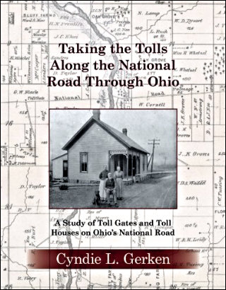
 Cyndie Gerken’s third big helping of National Road knowledge was served up a bit more than a year ago, and I have no good excuse, or even enough bad ones, to account for waiting so long to take a look. Of course, once I did, the same accuracy and thoroughness that marked her earlier books were instantly apparent in this one. In 2015, she documented Ohio’s National Road mile markers with Marking the Miles Along the National Road Through Ohio. In 2018, Taking the Tolls Along the National Road Through Ohio told of the toll gates that operated after the federal government rid itself of the highway by giving it to the states through which it passed. Both books took a deep and wide look at their subjects although that phrase did not occur to me until I was well into the current volume.
Those other books were geographically wide because they involved the whole state of Ohio, and they were also wide in the variety of information they included on their subjects. Depth came from the layers of time and degree of detail covered. Headley… isn’t nearly as wide geographically (The two buildings in the title are barely 300 feet apart.), but it does include the passing road and nearby towns, and the information variety is every bit as wide as in the first two offerings. The detail component of depth is at least equal to that of the earlier books and the time component is considerably greater. The period covered by all three begins at roughly the same time but the story of the two inns has yet to end.
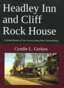
Physically the latest book is much like the others. All are largish paperbacks printed in color. All include a brief overview of the history of the National Road that provides context for the rest of the book. Headley…‘s introduction also includes information on the surrounding area and the role of early roadside inns and taverns.
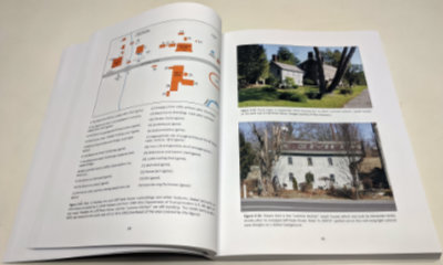 Both of the book’s subjects appeared almost immediately after the National Road passed by the land they would occupy. The first section of the Cliff Rock House was completed in 1830 and the Headley Inn’s first section in 1833. Other dates have appeared in articles and even on signs but Gerken sorts through the various claims and presents a solid case for these dates. Both structures have been enlarged and modified over the years. Despite their nearness to each other, the inns were constructed and operated independently by two separate families. That has not always been the case although it is again today.
 It is generally thought that the Headley Inn initially served as a stagecoach stop while the larger Cliff Rock House catered more to drovers herding sheep and other animals to market. That sort of division was never iron clad, of course, but that kind of thinking does serve to justify the two businesses being so close.
The two periods of glory experienced by the two taverns naturally coincide with the glory days of the passing road. They prospered in the early eighteenth century doing what they were constructed for: serving travelers on the new National Road. Gerken digs deep into public records and family histories to tell the story of this period. Prosperity ended with the coming of the railroad.
Prosperity returned in the early part of the next century when traffic returned to the road out front. This time the customers were carried by automobiles. Alexander Smith, who had built the Cliff Rock House, added the Headley Inn to his holdings in 1857. In 1922, two of his granddaughters opened a restaurant and tearoom in the former stagecoach stop. The old National Road had become part of the National Old Trails Road. Its traffic, and the sisters’ culinary skills, made the tea room a nationally known success. Like they did elsewhere, the interstates of the last half of the twentieth century pulled traffic from the old road and might have ended this second round of glory if the sisters had not already ended it by retiring and closing the restaurant in 1961.
Gerken also uses public records to tell of the tearoom period but they form a much smaller part of the story. There is considerable family documentation available, including photographs, and, more significantly, she has access to quite a bit of living memory of the era. The most important source of that living memory is the son of one of those sisters, Alexander Smith Howard. He not only shared stories that appear throughout the book, he also wrote its foreword.
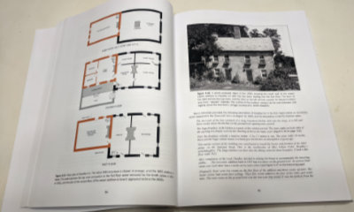
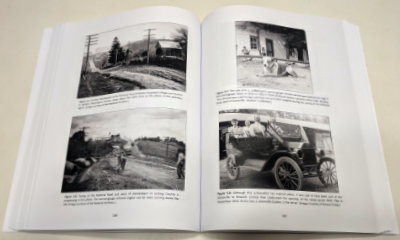 Living memory provides even more input to the post-tearoom era and here the living memory is sometimes Gerken’s own although it is more often her personal interviews with the short series of owners. The book is heavily illustrated with historical photos, maps, diagrams, newspaper clippings, and more. Modern photos include many taken by the author herself.
For the third time, an era of glory early in a new century is a definite possibility. Major restoration of the Headley Inn was accomplished by Stephen and Bernadine Brown during their 1989 to 2006 ownership. It continued under Alan and Patricia Chaffee until 2015. The current owners, Brian and Carrie Adams, along with their daughter Ashley, have added their own historically sensitive improvements and now operate a bed and breakfast with facilities for weddings and other gatherings. In 2018, Cliff Rock House was purchased by Otto and Sally Luburgh and restoration work is now underway there.
I know that this book’s true value lies in its collection of facts, photos, and carefully researched history. It is unequaled in that regard. Much of its readability, however, comes from the stories that fill the background and cluster around the edges. From the story of the Headly Inn’s original owner verbally abusing federal troops early in the Civil War, and tales of tearoom employees drawing straws to determine who had to brave snakes in the attic to retrieve supplies, to reports of elephants appearing — both expected and not — in front of the inn, there are plenty of human interest style anecdotes to balance the solid and valuable historical facts.
Headley Inn and Cliff Rock House: A Storied History of Two Taverns Along Ohio’s National Road, Cyndie L. Gerken, Independently published, March 20, 2019, 11 x 8.5 inches, 378 pages, ISBN 978-1790228089
Available through Amazon.
 The question was never if there would be another book, just when and what. The answers are “now” (actually February) and “toll gates”. In my review of Cyndie L. Gerken’s first book, Marking the Miles Along the National Road Through Ohio, I noted that the huge amount of information presented in that book was only a portion of what Gerken has collected and that we would probably someday see “a Gerken penned treatise on bridges or taverns or toll houses or something else” which shows that taking three or four guesses really improves one’s chances of being right. Nailed it!
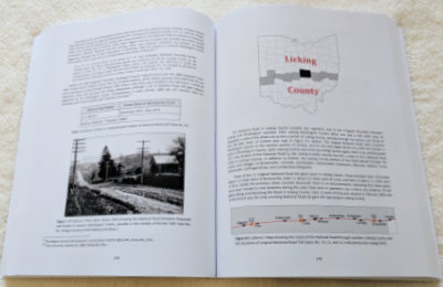 As she did with her first book, Gerken details her subject in a chapter per county moving east to west. However, before that happens, there is an introduction filled with information about the road and toll gates in general, then chapters on vehicles, toll house architecture, and bridges. Each of these, and the county chapters too, contain numerous photos and stories that color in the detailed information and keep things from becoming boring.
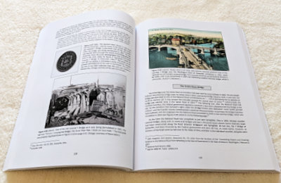 Pictures of gate houses and gate keepers are to be expected, but they are not the only photo subjects presented. This might be the only book available with pictures of the world’s longest bar, grave robbers, a two-headed calf, a Spanish dime, Hopalong Cassidy, and the author’s mother riding in a goat cart. And every one of them belongs.
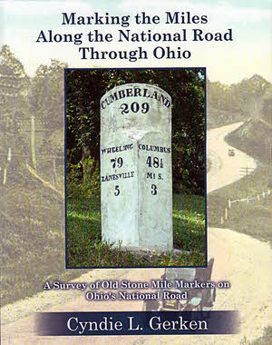 That’s a pretty long book title. There’s a subtitle, too, which makes the whole thing Marking the Miles Along the National Road Through Ohio: A Survey of Old Stone Mile Markers on Ohio’s National Road. It’s long because it, just like the book it identifies, is accurate and precise. The book accurately and precisely locates the 175 mile markers originally set, as accurately and precisely as early nineteenth century technology and local politicians would allow, beside the Ohio portion of the very first federal highway. With all that accuracy and precision you might think this volume would be completely dry and boring but that’s not the case. Stories about the road, the countryside, and even the markers themselves lighten and soften things considerably. Color photos and maps make the book attractive.
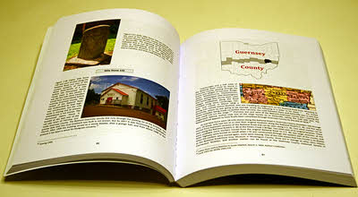 Seven of the ten Ohio counties through which the National Road passed are covered in individual chapters following the introduction. No markers were ever placed in the three westernmost counties on the route as federal funding ended near Springfield in Clark County. Each of these chapters begins with an overview of the county that includes a summary of how many original markers there were, how many remain at their original location, how many exist elsewhere, and how many are lost. Each marker is then addressed individually. With few exceptions there is at least one picture. If a given marker survives, a current photo is included and one or more historical photos are usually presented regardless of whether or not the marker is still around. Understandably, markings on many of the older stones are not exactly legible. Not to worry. Appendix B contains crisp drawings of the inscription of every marker. Markers can often be seen, accidentally perhaps, in old postcards and other photos and many of these appear in the book. Each marker’s history is given and stories about the marker or the area around it frequently add a little fun and background. Placed among the individual marker descriptions are sections of US Geological Survey 7.5 minute topographical maps showing the location of the markers three at a time. Other National Road related landmarks are often shown on the maps as well.
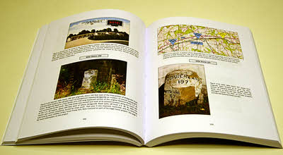 Bringing all of this information together is clearly a major accomplishment but Gerken, a past ONRA president herself, says the information is only a portion of what she has collected on the National Road in Ohio. A well deserved breather follows wrapping up Marking the Miles Along the National Road Through Ohio. Nothing is currently scheduled or promised but the future could see a Gerken penned treatise on bridges or taverns or toll houses or something else. I certainly hope so. I like accuracy and precision and I also like anecdotes and insight. Marking the Miles… provides a pretty good mix.