 I photograph a fair number of signs as I travel, and I know quite a few people who photograph many more than I. Not one, however, is in the same league as Debra Jane Seltzer. If sign hunting was an Olympic sport, the petite Seltzer would be buried under gold medals. Her photo expeditions are legendary. Until recently, when she and her dogs (currently four) headed out in the white Chevy van named Sparkle, they would take along a big stack of notes and marked up map printouts. Today there might still be a printed list of targets but Google maps and a smartphone have reduced the need for paper considerably. The target list is never limited to signs. It’s almost certain to include interesting buildings and other roadside attractions of all sorts.
Seltzer’s website, Roadside Architecture, is the primary beneficiary of these expeditions. It currently contains more than 60,000 searchable photos organized by subject and location. It’s described as “Buildings, signs, statues, and more”. Photos are added and other maintenance is performed between trips. While traveling, Seltzer maintains a blog with stories and pictures from the road and a Flickr account with pictures that didn’t appear in the blog and probably won’t make it to the website. Links to these and more can be found at the Roadside Architecture website.
So why a book? Even though the subject matter of the structured website, the blog, and the Flickr account is essentially the same, they have different uses and different audiences. A book’s audience is different yet. In reading the book, I spotted a couple of signs that could be within range of upcoming travels. As I put them on my own list, I realized that the book could be used as a “shopping list” for travelers. The website, of course, is a super shopping list and both the blog and Flickr can can be sources of things to see, but the printed page is consumed differently and if the book gave me some ideas I’m sure it can do that for others.
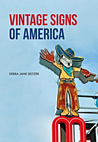
However, before I thought of Vintage Signs of America as a shopping list, I thought of it as a primer. There is a one page introduction which, in addition to providing an overview of the rest of the book, offers a little insight into why Seltzer likes signs and why you might, too. This introduction page and a few near the book’s end where the subject is preservation are the only pictureless pages in the book. The other pages are filled with roughly 175 color photographs divided into five chapters. The first of these, “Types of Signs”, is where I got the idea of the book as a primer. Examples of bulb, opal letter, mechanical, and other types of signs appear with descriptive text. It prepares the reader for recognizing the various types in the wild and also provides a little history of advertising and the sign industry.
The next three chapters form what Selzer refers to as the “theme” section of the book. One chapter focuses on “People” with sub-themes like chefs, women, cowboys, and Indians. I was a little surprised with the statement that “There are far fewer representations of women than men on surviving vintage signs”, and considered why that was so. For starters, most of those chefs, cowboys, and Indians are male. The neon women my male mind first thought of were bathing beauties diving into motel swimming pools. Women are portrayed in other roles but not often. Evidence, I suppose, of women being even more underrepresented in the ’40s , ’50s, and ’60s, when most of these signs were made, than today.
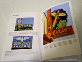 The “Animals” chapter is probably my favorite. Colorful birds, fish, and dogs draw customers to businesses of all sorts. Sequenced neon segments can make birds appear to fly and dogs and horses appear to run. A pig almost always indicates a BBQ restaurant although one sign shows a line of pigs merrily leaping in to a grinder to be made into sausage.
 “Things” is as varied as you might imagine. Bowling balls and pins are popular as are skates, cars, and assorted food items. Donuts and ice cream cones seem to be the most common edibles used to attract customers. Bowling balls lend themselves to animation and when a neon bowling ball rolls, a strike is virtually guaranteed. Together, “Types of Signs” and the three chapters of the “theme” section make up a sort of sampler of the massive Roadside Architecture site. Picking less than 200 images to populate this sampler had to be tough but the choices made were excellent.
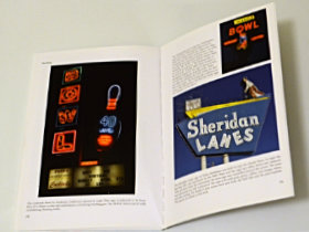
Like the signs themselves, the color photographs snag a reader’s attention. They’re all good eye-candy and some, like those with running animals, flying footballs, or operating machinery, require some amount of study. The pictures are far from alone, however. Every picture has an extended caption that describes the sign, often tells its history, and sometimes includes more general information. As Seltzer tells it, “I snuck facts and history into captions which makes it easier to swallow.” Easy to swallow describes the whole book. Even though it may look like a picture book, it seems quite natural to read it front to back and absorb those “facts and history” along with the images.
The last chapter, “Preserving Vintage Signs”, has those pictureless pages I mentioned earlier. It begins with a couple of pages of text that is sort of a “state of the signs” message. Here Seltzer tells of what has been happening to signs and why. The last page is also all text with some answers to the question “What can I do?” In between are descriptions, with pictures, of the big three sign museums in the country: The American Sign Museum (where I bought my copy of the book) in Cincinnati, OH, the Museum of Neon Art in Glendale, CA, and the Neon Museum in Las Vegas, NV. The whole chapter, and the final page in particular, might just be the inspiration someone needs to get involved is saving or documenting vintage signs.
So I’m thinking that some folks will get inspiration from this book, some will use it as a shopping list for their own sign hunting, for some it will be an introductory primer into the world of signs, and others might see it as a sampler of the full Roadside Architecture web presence. Those are all valid uses for the book and it will satisfy all of them quite nicely. Of course, some might see the book purely as a nice presentation of some very pretty pictures. There’s certainly nothing wrong with that. With the few exceptions noted, there are pretty pictures on every page.
Vintage Signs of America, Debra Jane Seltzer, Amberley Publishing, April 1, 2018, 9.2 x 6.5 inches, 96 pages, ISBN 978-1445669489
Available through Amazon.

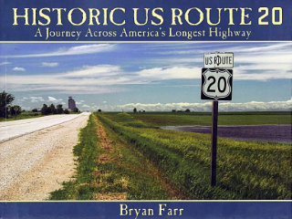 This book didn’t put US-20 on my to‑drive list, that happened long ago, but it did move it up quite a bit. At 3365 miles, Route 20 is currently the longest of the U.S. Numbered Highways so it’s quite naturally a road I’ve thought about driving. I have driven bits of it, of course, and crossed over it many times. It would be pretty hard to completely avoid a road that crosses the entire country as this one does. In Historic US Route 20: A Journey Across America’s Longest Highway, Bryan Farr documents an east to west drive over the entire length of the highway and the entire breadth of the nation with a couple hundred great color photos. There is something I’d like to see in just about every one of those photos.
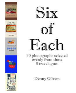 And now for something completely different. Anyone who thought releasing two books within three months might be overdoing it will have no doubts about that being the case when they see another appear a week later. But this is a different kettle of fish. Really. Six of Each is a collection of photographs drawn from the previously published travelogues. Each of those travelogues is available in two forms. There is a black-and-white printed version and a color digital version. Photo-quality color printing is still relatively expensive in the low-volume print-on-demand world. Printing the books in black and white keeps them reasonably priced. On the other hand, color in digital files is free. Offering B&W paperbacks and color ebooks isn’t ideal but it keeps the books affordable and color at least available.
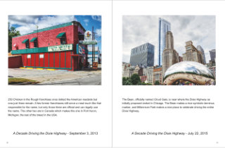 So what I’ve done is pick a half dozen pictures from each of the existing travelogues and combine them in a Blurb magazine. The magazine is only available through Blurb (that’s one of those magazine restrictions) and there is no digital version available (that’s my restriction). It’s also more expensive than it seems a 32-page “magazine” ought to be. But it does let me see what some of my photographs would look like using something besides black ink on stationary paper. And it’s there for anyone else who would like to look.
 Too soon? What had been my most recent travelogue,
  This is my fourth self published book; All are travelogues. This one is a midquel that covers the omitted middle section of a trip that formed part of the previous book,
 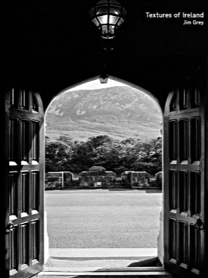 A funny thing happened on the way to this review. Not funny ha ha; Funny peculiar. This is Jim Grey’s second book. I reviewed the first, Exceptional Ordinary, in April, 2017. I figured that this review would reference that one, make some comparisons, make some jokes. It would be fun; Maybe even funny ha ha. But that review has gone missing. I don’t know how or even when. I’ve
 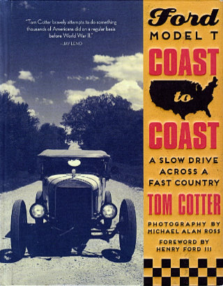 Old-car guys and old-road guys are hardly one and the same although there is definitely a whole bunch of overlap. With this book, Tom Cotter stakes out a position deep in that overlap. Tom is, however, much more of an old-car guy than an old-road guy so it’s not surprising that his position is closer to the car side than the road side. The story of how plans for the trip came together is telling. The idea that Tom started with was driving an old car across the United States. Over the years, the idea had been refined to involve a particular old car. He called it a dream and admitted that it was unlikely to be realized but the car he really wanted to drive across the country country was a Ford Model T. In his dream the road was secondary.
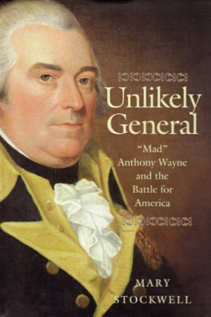 Anthony Wayne gave Fort Greene Ville and Fort Recovery their names. They were significant in both his life and mine although the level of significance is severely tilted toward Wayne. Fort Recovery is where the army led by Arthur St. Clair was nearly annihilated in 1791. It got its name when soldiers under Wayne’s command built a small fort there in 1793. Also built in 1793, Fort Greene Ville stood twenty some miles to the south and was Wayne’s home base during the Northwest Indian War. The treaty ending that war was signed there in 1795. The town that developed on the site of the abandoned fort adopted the shortened name Greenville. I grew up near the midpoint between Greenville and Fort Recovery and adopted Anthony Wayne as a hero at a very early age. I eventually figured out that much of the initial attraction was due the the cool bicorne hat he was commonly shown in, but the fact remains that I’ve known of General “Mad” Anthony Wayne nearly all of my life.
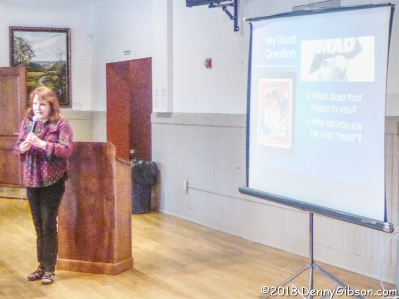
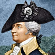 It was probably about sixty-five years ago that I was hooked by that super groovy hat and decided that the dude under it was my hero. It was only a few years later that I saw a painting of a hat-less Wayne and was shocked to learn it was the same person. That painting might even be the same one that appears on the cover of this book. It was at least similar. I recognized that there was more to a man than his hat and Wayne survived as a childhood hero. Inside Unlikely General, Mary Stockwell reveals a lot more than a high forehead. Anthony Wayne was not, as some have interpreted his nickname, insane, but he was a long way from perfect. Perhaps the fact that I’m much older now explains why I was less shocked at learning of the imperfections than I had been at my first sight of Wayne bare-headed.
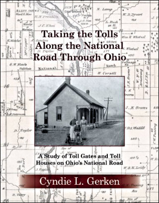 The question was never if there would be another book, just when and what. The answers are “now” (actually February) and “toll gates”. In my review of Cyndie L. Gerken’s first book, Marking the Miles Along the National Road Through Ohio, I noted that the huge amount of information presented in that book was only a portion of what Gerken has collected and that we would probably someday see “a Gerken penned treatise on bridges or taverns or toll houses or something else” which shows that taking three or four guesses really improves one’s chances of being right. Nailed it!
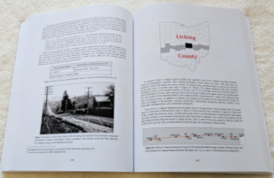 As she did with her first book, Gerken details her subject in a chapter per county moving east to west. However, before that happens, there is an introduction filled with information about the road and toll gates in general, then chapters on vehicles, toll house architecture, and bridges. Each of these, and the county chapters too, contain numerous photos and stories that color in the detailed information and keep things from becoming boring.
 Pictures of gate houses and gate keepers are to be expected, but they are not the only photo subjects presented. This might be the only book available with pictures of the world’s longest bar, grave robbers, a two-headed calf, a Spanish dime, Hopalong Cassidy, and the author’s mother riding in a goat cart. And every one of them belongs.