
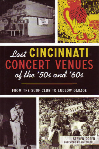
This book brought back some memories, corrected others, and filled in gaps I didn’t even know I had. And I was only here for the last quarter of the covered period. For the years before I moved to Cincinnati, it confirmed some rumors and filled in some blanks. Its author, Steven Rosen, has done an awful lot of writing both as an employee (Cincinnati Enquirer, Denver Post) and as a freelancer (NY Times, LA Times, Cincinnati Magazine, etc.). He is currently serving as Contributing Visual Arts Editor for Cincinnati CityBeat as well as continuing to freelance. With a resume like that, it’s surprising to learn that this is Rosen’s first book.
True to its title, the book is organized by the venues where concerts took place, but venues only matter because of the events they host, and those events are what is really at the heart of Lost Cincinnati Concert Venues of the ’50s and ’60s. The two venues in the subtitle are great examples. The Surf Club operated at the beginning of the 1960s and became known for hosting comedians like Lenny Bruce, Dick Gregory, Henny Youngman, and Phyllis Diller; musicians such as Sarah Vaughan, Peter, Paul, & Mary, and Julius La Rosa; and acts like The Smothers Brothers and Homer & Jethro who were a bit of both. Ludlow Garage rose at the end of the decade with performances by Alice Cooper, the Allman Brothers, Santana, the Kinks, and a whole bunch more. People may or may not remember that the Surf Club had taxidermied swordfish on the walls or that the Ludlow Garage had some really big chairs, but remembering where you saw Phyllis Diller or the Allman Brothers is a certainty.
Cincinnati is a border town with some Kentucky venues as accessible to residents as many in Cincinnati itself. Rosen’s first chapter is, in fact, titled “Northern Kentucky”. He acknowledges the Beverly Hills and Lookout House showrooms but seems to feel that their notoriety has brought them enough attention. He focuses on some lesser-known places like the Sportsman’s Club (where the Drifters once performed), the Copa Club (Miles Davis, Sam Cooke, and more), and Stagman’s Flamingo Dance Club (Jerry Lee Lewis, Chuck Berry, et. al.).
Rosen describes and locates the venues then fleshes them out with tales of the acts that played there and the people who owned and managed them. In the case of the northern Kentucky clubs, ownership might have a little organized crime involved and Rosen discusses that too.
There is also a chapter on “Downtown Cincinnati” (Living Room, Albee Theater) and one called “Neighborhoods and Beyond”. There are lots of neighborhoods in Cincinnati and Rosen doesn’t get to all of them but here’s a sampling of the neighborhood-venue-performer combinations he does get to: Walnut Hills, New Cotton Club, Aretha Franklin; Eastern Avenue, Vet’s Inn, Albert Washington; Western Hills, Hawaiian Gardens, Lonnie Mack.
Some venues get their own chapters. In addition to the subtitle’s Surf Club and Ludlow Garage, there’s Cincinnati Gardens, Seven Cities, Babe Bakers, Hyde Park-Mount Lookout Teen Center, and Black Dome. Gene Autry played the Gardens long before that Everly Brothers headlined show with Rodgers, Holly, Anka, Cochran, et.al., and in the years that followed, the Stones, Beatles, James Brown, Bob Dylan, and just about everybody else played there.
One act and one event also get their own chapters. The act, not surprisingly, is the Beatles who played Cincinnati twice; once at Cincinnati Gardens and once at Crosley Field. The event is the Cincinnati Summer Pop Festival of June 13, 1970. It was also held at Crosley Field and Rosen uses the chapter to mention that the Ohio Valley Jazz Festival took place there from 1964 to 1970. With acts like Traffic, Mountain, Grand Funk Railroad, and Bob Seger, the Pop Festival was a major event and Rosen can certainly be forgiven for stretching the ’50s and ’60s by a few months. Back in those days, people apparently sometimes brought pineapple upside-down cake and peanut butter to concerts giving fans something to remember Alice Cooper (cake) and Iggy Pop (peanut butter) by.
Rosen used some of his own memories in this book and combed through a lot of local papers and other publications. He also contacted many of the others who were actually there. Jim Tarbell, of Hyde Park Center and Ludlow Garage fame, provided the forward. He also provides a telling comment about loss at the end of the ’60s. Reflecting on rock becoming big business, he says, “It was baptism by fire to realize how quickly the whole scene changed from peace and love to money.”
Even though it’s not exactly about peace and love and money, the book’s final sentence does make a thoughtful observation on the loss of a major Cincinnati concert venue. “Crosley Field is now lost but is still dearly missed by fans of both Cincinnati baseball and Iggy Pop.”
Lost Cincinnati Concert Venues of the ’50s and ’60s: From the Surf Club to Ludlow Garage, Steven Rosen, The History Press (Jan 10, 2022), 6 x 9 inches, 176 pages, ISBN 978-1467147217
Available multiple places including Arcadia Publishing (History Press) but I suggest going straight to the guy who wrote it: StevenRosen.net.
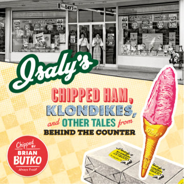 It’s been said you should write what you know. Brian Butko may or may not believe that but there is reason to think he might believe even more in the corollary: Write what you want to know. I frequently get the impression that Butko enjoys the hunt as much as the kill, research as much as publishing, learning as much as teaching. Isaly’s Chipped Ham, Klondikes, and Other Tales from Behind the Counter gives me that impression in spades. This is Butko’s second run at the subject having published Klondikes, Chipped Ham, & Skyscraper Cones: The Story of Isaly’s in 2001. I’m not familiar with the earlier book but know that there is some unavoidable overlap. No surprise there. There is no doubt a multitude of reasons for the redo but I’ll suggest — and this is pure conjecture — that not only was it tackled in order to improve the story with knowledge learned in the intervening twenty years but as an excuse to learn even more.
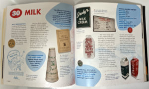 In the middle half of the twentieth century, Isaly’s was a major regional presence whose farms, factories, and stores helped feed a whole lot of people in northeast Ohio and northwest Pennsylvania. The arc of that presence is not unique. It was a family business that saw the success and growth of the first few generations eventually fade away in corporate buyouts. I’ve lived in Ohio my entire life but we missed each other. My neighborhood has been the state’s southwest corner, and the closest Isaly’s ever came to my home was Columbus. Although a few Columbus stores remained in the late 1960s and it’s possible that I saw one, I have no memory of it. The company entered Columbus in 1935, peaked there in the 1940s, and officially began its exit in 1954. Everything I know about Isaly’s I learned from Brian Butko. Brian Butko learned from family members, former employees, company records, newspapers, and libraries.
 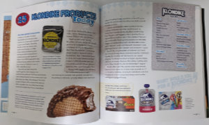 There were other innovations such as Skyscraper Cones, Party Slices, and Klondike Bars. Klondike Bars were the biggie. The only Isaly’s product to have success nationally, they are still available today although they are made by Unilever and no longer bear the Isaly’s name. They do, however, still bear the Isaly’s bear.
 Unlike me, Brian has plenty of personal Isaly’s memories. He says that his earliest was of their macaroni and cheese. His excitement is evident when given access to a 3-ring binder of company recipes. He finds the sought-after Baked Macroni then writes, “I have yet to try the official recipe…”. The fact that the recipe yields 60 servings might be one deterrent but I think I also detect a little fear that today’s result might not live up to yesterday’s memories. I, for one, encourage Brian to face his fear and look that macaroni right in the elbow. Finding 59 mac & cheese eaters should be easy.
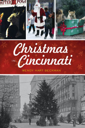 This History Press publication, as is their standard formula, is built around lots of photos both old and new. In this case, a few of those photos are mine. I won’t pretend that isn’t what made me aware of the book and triggered this review but will point out that the book does fit handily into the local-author-local-subject category that I’m fond of talking about. The local author, Wendy Hart Beckman, isn’t a native Cincinnatian but has spent much of her adult life here. I’m thinking that her New England background might actually help in recognizing what is unique or even just a little different about Christmas in Cincinnati.
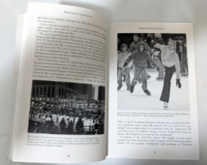 “Things to Do” in Cincinnati around Christmas time include skiing, sledding, and ice skating on Fountain Square. Shopping and visiting Santa in the numerous downtown stores was once a major draw in the days leading up to the holiday but the stores and the shoppers slipped away to the suburbs some time back. In 2020, COVID-19 nearly put a stop to in-person shopping anywhere and only time will tell if it ever fully returns. The same is true of sitting on jolly men’s laps. Beckman includes “Donating” among things to do and writes about several Cincinnati signature campaigns like the Ruth Lyons Children’s Fund and Neediest Kids of All.
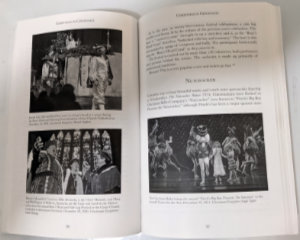 There are indeed plenty of things to do and hear in Cincinnati but there are even more “Things to See”. Beckman lists many Nativity scenes and light displays including some at private residences that have become must-sees over the years. The Cincinnati Zoo’s “Festival of Lights” and the tree on Fountain Square are in that must-see category. What might be considered the big three of Cincinnati Christmas events are on Beckman’s “Things to See” list. The oldest is Boar’s Head and Yuletide Festival which has been celebrated in Cincinnati since 1939. That’s clearly long enough ago to qualify as a true tradition but the festival’s history goes back another 600 years in England. Number two is The Nutcracker which the Cincinnati Ballet Company has been doing since 1974. The newest of the three is Playhouse in the Park’s production of A Christmas Carol which dates to 1991.
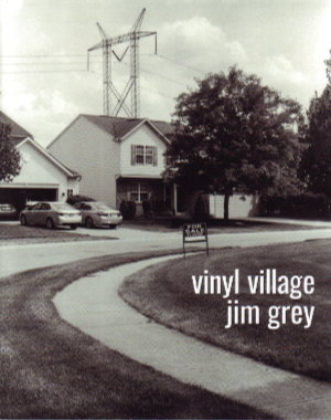 Jim Grey blogs, collects film cameras, uses those cameras, develops the film himself, walks, bikes, and observes. Put them together and what have you got? This book.
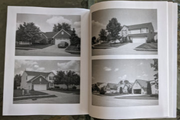 It is a story about the neighborhood in which he lives, and where he interspersed COVID-triggered working-at-home with some calorie-burning walking-near-home. We are introduced to the neighborhood as a collection of modestly priced homes in an area of pricier residences. A big attraction is access to very good schools at somewhat bargain prices. Although the location makes them bargains, they are hardly shabby and actually look quite attractive — from the front.
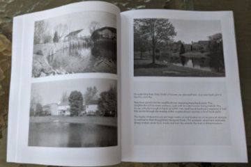 Construction is wood frame with vinyl siding and brick accents. Those accents, however, are almost entirely on the front of the houses. The other three sides are the focus of the story. Part of Grey’s story is about these sides being exposed by the curving streets, numerous retention ponds, and open spaces created by electric and gas lines.
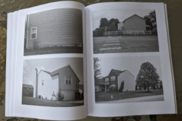 The rest of the story is about those exposed surfaces and areas being a long way from handsome. The story’s name comes from the large expanses of vinyl siding exposed by those curves and ponds. Windows are few and from the outside often appear to be placed rather randomly and often awkwardly. Many side walls are unbroken by any windows at all.
 There are few words but lots of pictures. The pictures are black and white and large. The most common arrangement is two 4×6 inch photos to a page. Where words do appear, they typically share a page with one of those 4×6 photos. Occasionally a photo gets a page all to itself which lets it grow to approximately 5 1/2 by 8 1/4 inches. Grey has changed publishing platforms (from Blurb to Amazon) for this project which results in some physical differences from the previous essays. The pages are slightly smaller (8×10 vs 8.5×11) and the paper used is uncoated rather than semi-gloss. Photo quality does suffer but again it is the subject of the picture that is important. The pictures are here to document the subject and illustrate Grey’s story, not to be admired in and of themselves. It’s an assignment they handle quite well.
 Just like all but one of my previous books, Tracing a T to Tampa is a travelogue. Unlike any of those books, it is not about following a specific road or reaching specific destinations. It is about following a single specific trip. That trip is one made by my great-grandparents in 1920 in a Model T Ford. Throughout the 1920 journey, my great-grandmother sent a series of letters to her daughter in which town names were often included in her reports of what they were seeing and doing. Those town names allowed me to roughly reproduce their route. There are multiple reasons why my reproduction is a rough one. One is that roads have changed in the intervening years and another is that I usually had to guess at the path they took between the towns my great-grandmother mentioned. Some of those guesses are almost certainly wrong but proving it, should you be so inclined, would not be easy. Parts of the 1920 trip were clearly on the Dixie Highway and National Old Trails Road although neither is identified by name in the letters.
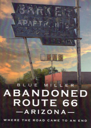 If I maintained a list of questions I frequently ask myself, “Why another Route 66 book?”, would be high on the list. I have never arrived at a reason that another one is actually needed; only justifications for ones at hand. Those justifications generally take the form of answers to two questions. They are, “What makes this book different from all others?”, and “Why should I buy it?” In practice, I ask them in the reverse order which means that, if I don’t have a good reason to buy a book, I’ll probably never get around to discovering what, if anything, makes it different.
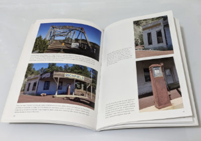 Although not of the coffee table variety, this is first and foremost a photo book. It contains upward of a hundred photographs, in color, printed on good quality semi-gloss paper. They are primarily documentary photos. That does not mean that they are boring, but it does mean that properly recording each subject is the main goal. The book is certainly not without its share of creative composition, but there are no abstract-light-patterns-on-pavement style pictures. There are usually two or more photos on a page for a max size somewhere around 5.5 by 3.5 inches. That might keep you from displaying it on your coffee table, but it is plenty big enough to show off bridges, buildings, and signs.
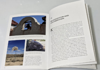 Yes, the pictures are cool and those of some fairly obscure places enlightening, but it is the words that made me happy with my purchase. The histories of most of the pictured buildings are told. Some are reasonably well known and available elsewhere, but Miller’s telling is both complete and concise. Others are not so well known, and I’ve little doubt that Miller’s aforementioned sleuthing ability brought out some details and possibly some entire stories. Maybe others knew all those details about the schools of Valentine, but I sure didn’t, and the story of the Ostermans and Peach Springs was all new to me. There are other examples of what I take to be sleuthing in the book, and all of them add to my appreciation of it.
 I knew nothing of this book or its author until just before it was reviewed in the Jefferson Highway Association newsletter, The Declaration. The only reason I learned of it that early was because the reviewer, Wayne Shannon, is a friend whom I happened to chat with by phone while he was putting his review together. He was quite positive in talking about the book but, like me, unfamiliar with the name Stephen H. Provost.
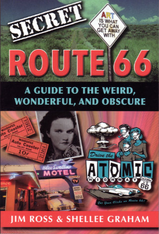 At first glance, this probably looks like a perfect fit for my bookshelf. Like many of the other books there, its subject is a historic highway and its authors are people I know. In this case, the highway is Route 66 and the people are the husband-and-wife team of Jim Ross and Shellee Graham. Both are accomplished historians, photographers, and writers with Jim probably having a bit of an edge in the history department, Shellee having an equally small lead on the photography side, and their writing skills being too close to call. A second glance, however, just might turn up something about this book that is different from most of the others with which it now shares shelf space. It is the word “secret”.
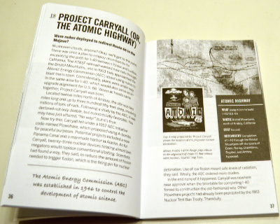 So how is this book I didn’t exactly want? Surprisingly good. I’m not really all that surprised, of course. To my relief, the idea of revealing secrets doesn’t get much further than the title. I doubted that a pair of respected authorities would suddenly become conspiratorial sounding characters sharing dark secrets from the shadows but it was good to have that verified. To some extent, the subtitle also does that. Weird, wonderful, and obscure accurately describe the book’s contents.
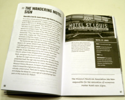 Almost everything in Secret Route 66: A Guide to the Weird, Wonderful, and Obscure is something that, while not actually a secret, is not likely to be found in mainstream guides. Even when the subject is something commonly known, Ross and Graham provide some detail or backstory not commonly known at all. Sometimes the subject isn’t a place or a thing but simply that uncommon detail or story. Among the things that struck me as weird is the true tale of a proposal to use atomic bombs for roadway excavation. Everyone has their own definition of wonderful but my definition is matched by the story of the Motel St. Louis sign that wandered off to help people find another motel (Finn’s in St. James) and then a church (New Hope) before being rescued and returned home. I thought learning about the annual reunion for the ghost town of Alanreed was kind of wonderful, too. Topping my personal list of obscure things is the chapter on several abandoned bridge abutments on the original route through Santa Fe.
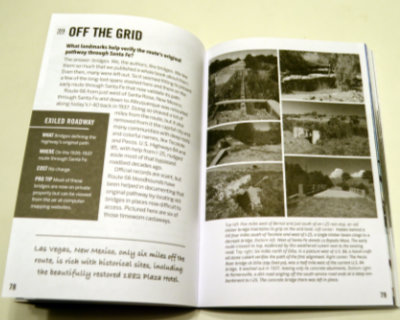 A pair of facing pages make up each of the ninety chapters so that everything about an item can be studied without flipping back and forth. A sidebar contains appropriate information, such as location. These pages are printed in black and white, but they are augmented by sixteen pages of color photographs (plus 2 b&w to make the positioning work) in the middle of the book. Some page flipping here is appropriate but the subject and associated page number are shown for each photo to make it easy. Images in the book are a mixture of historic and modern. Most of the modern photos are the work of the authors but not all. Other researchers and photographers are always credited with images provided.
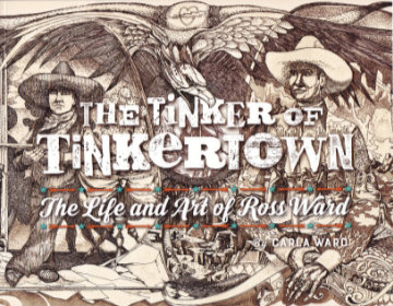 I guess my purchase of this book fits the technical description of an impulse buy, but I sure don’t think of it that way. Yes, I bought it without a hint of hesitation the instant I learned of its existence and there was certainly a lot more emotion than logic involved in the decision. But I sincerely believe that the logical part of my brain had long ago decided that acquiring this book was something I needed to do as soon as it existed. If it ever did.
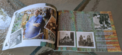 Sometime between the book being ordered and its arrival, I revisited its description and noticed its length of thirty-six pages. I wasn’t worried but I did wonder how Carla could tell Ross’ story in just three dozen pages. The answer, as I think I already knew, is “Just fine.” She tells it with pictures and just enough well-chosen words to properly place those pictures in Ross Ward’s life and to tell some details of that life that the pictures do not.
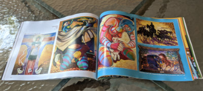 There are several delightful photos of Ward, but the bulk are of his art and the bulk of those are in a section of “2D Work”. It’s a section I found quite interesting as most of its contents are things not displayed at Tinkertown. Items range from posters to etchings to fine art paintings representing nearly every period in Ward’s life. A personal favorite is a circus parade that he drew on thirty feet of adding machine paper at the age of eight.
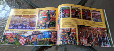 A “Tinkertown” section follows. The pictures in it are of things I’ve seen but that doesn’t make me enjoy it any less. The well-done photos provide an excellent look at the exhibits that got me interested in Ross Ward to begin with. A timeline of Ross Ward’s life appears on the final page.