Science Behind Pixar

The Science Behind Pixar exhibit at the Cincinnati Museum Center opened last October meaning I’ve had plenty of time to see it. There are two reasons that I waited until it had barely three weeks remaining before checking it out. The first is that I believe 2006’s Cars is the only Pixar movie I’ve actually seen in its entirety. The second is that I thought the exhibit was for kids only. Reason one is undeniable fact; reason two is pure nonsense.

The picture at left is of a divider in the exhibit. Some of the figures on it do look familiar to me because I’ve seen them in commercials or maybe in a movie that was playing somewhere I walked past. But I can’t connect any of them with movies or commercials they are in, and I sure don’t know their names. Characters are used to demonstrate different pieces of Pixar science, and I don’t doubt that knowing who they are would make things more fun — watching kids experiencing the exhibit proved that — but it’s not required.

The idea of a creative pipeline is central to Pixar’s operation. The steps that go from story and modeling to lighting and rendering are identified in an introductory movie and panels explaining them are arranged in a circle near the center of the exhibit.

The bulk of the exhibit space is filled with hands-on stations where kids and old men can pretend to participate in each of those pipeline steps in a variety of ways. I don’t know how many job openings Pixar expects over the next few years but I’m sure that, with this sort of recruitment tool, they will all be easily filled.

There are also a number of these smaller kiosks around with Pixar employees describing their jobs or how certain problems were solved. If neither the hands-on stuff nor the technical descriptions make you want a job at Pixar, maybe seeing the enthusiasm these employees have will do it.

Heck, after playing with some animation, lighting, and other pipeline steps, I was almost ready to ask about job openings myself. And I have no intention of ever working anywhere ever again. I am, of course, joking about this whole thing being a recruitment tool for Pixar — mostly. I am not joking at all about the exhibit showing how much fun and satisfaction there can be in science.

I attended The Science Behind Pixar on Friday, April 1. It is open through April 24.

Leo da Vinci and the Forty Machines

I’ve read that, once upon a time, ordinary people rarely needed to count past forty and that forty became another way of saying “a whole bunch”. That implies that Noah and family might not have watched it rain for precisely forty days and nights and that Ali Baba may not have encountered exactly forty bad guys. We have outgrown that, of course, and today use numbers like gazillion when we are tired of counting even though that probably occurs long before we reach forty. That is not, however, the case with this post. The Leonardo da Vinci: Machines in Motion exhibit currently at the National Museum of the Air Force in Dayton contains exactly forty of Leo’s “machines”.

I took in the exhibit on Friday. It is set against the wall farthest from the entrance which means there is some walking involved. Not only does this provide an opportunity for a little exercise, but there are also plenty of opportunities for getting distracted on the way by the many other, mostly permanent, displays in this wonderful museum. I skipped my favorite gallery, Early Years, and focused on the da Vinci exhibit and still spent at least as much time getting to and from it as I did experiencing it. It’s simply impossible to ignore all those unusual planes and their engaging stories.

A fair number of the displayed machines have to do with flight. That is certainly appropriate for the Air Force Museum although the exhibit’s makeup was not tuned for the location. In fact, this appearance seems to be a recent addition that is not yet listed on the schedule at the Machines in Motion website.

The high ceiling at the museum allows some of da Vinci’s concepts to be suspended overhead as if in flight although they sometimes have to share space with flying things of more recent vintage. The overhead displays include the “parachute” in the opening photograph. The version here is not quite full size. A full-sized version and a description of a real-world use of the design were part of the Da Vinci the Genius exhibit I saw in Cincinnati in 2016.

Leonardo’s flying machines may not have been practical but many of his other ideas certainly were. I don’t believe it is a proven fact that he invented ball bearings but his design of a revolving stage using them might have been their first practical application. His designs for converting one form of motion to another (e.g., rotary to linear) were definitely practical. Check out the kid getting a real hands on education in the background of the second picture. The third picture shows a machine combining several devices to raise heavy pillars.

Seeing this machine for grinding concave mirrors was a real learning experience for me. The sign next to it talks about burning mirrors and mentions that one of their uses was welding. Believing that welding was at best an eighteenth-century concept, I had to look into that and discovered that the welding of soft metals like gold and copper goes back much further and was rather common in da Vinci’s day.

The exhibit runs through May 8 and, like the museum itself, is free.

Went to the Chapel

I don’t know if we are entering an era of fine art circuses or if they are merely a passing fad. Apparently Michelangelo’s Sistine Chapel: The Exhibition has been in circulation since 2015. My impression is that the various immersive Van Gogh shows (I recently saw this one.) date to 2020 or so but I’m not certain. Those dates make me think that the current popularity of the Sistine Chapel thing might be fallout from the popularity of the Van Gogh things but I am not, of course, certain of that either. What I am certain of is that I didn’t hear of either before late 2021 and the hoopla surrounding one made me receptive to the hoopla surrounding the other.

One characteristic the two exhibitions have in common is physical size. Lots of space is needed to either immerse people in wall-sized projections or surround them with ceiling-sized prints. The Sistine Chapel exhibition in Dayton occupies one floor of a former Elder-Beerman department store. Not knowing the location of the now unmarked store within the mall meant driving around until I spotted a sign-covered entrance.

It was a bit before the stated opening time and that entrance was locked. Several people moved on when they discovered this but I and a few others waited. Timed tickets came with instructions to arrive at least ten minutes ahead of the scheduled entrance, and the doors were unlocked with almost enough time to make good on that. Three women entered ahead of me. As we got our tickets scanned, a group approached from inside the building. I’m guessing these were people familiar with the mall and aware of another entrance to the store that may or may not have been open earlier but which clearly required a walk to the exhibition entrance. One of the ladies in front of me opted to watch a video before entering and the others paused at the gift shop. I entered the exhibit first and alone.

I have seen photos taken of Sistine Chapel exhibits in other cities where some of the prints are displayed overhead to simulate, I presume, the ceiling of the real chapel. Thankfully that wasn’t the case here as that would at least partially nullify the “up close” claim of exhibit promotions.

There’s no question that the most familiar image from the chapel frescoes is of God’s finger bestowing life to Adam. That detail is from The Creation of Adam which is placed very near the entrance. I’ve seen plenty of reproductions of this scene but I guess I have always focused on the hands or maybe the faces of God and Adam. Before today I’d never noticed the young lady on the right with wide-open eyes aimed directly at Adam.

I was completely unfamiliar with the majority of images displayed and that includes, perhaps surprisingly, The Creation of Eve. I don’t recall ever seeing a reproduction of this image before. I may have missed one here or there but it certainly hasn’t been given a whole lot of attention by the world at large. Michelangelo thought it was important enough to put it in the very center of the Sistine Chapel ceiling. There is a placard by each print that gives some information about the image and shows its position at the chapel. The one for The Creation of Eve is here. A clearer view of the ceiling, taken from a poster in a window at the entrance, is here.

The Creation of Adam and The Creation of Eve are visible from the main room but are set back a bit. I had actually viewed every picture in that entire room, with very little company, between viewing Adam and then Eve. Behind me, the steadily increasing crowd was doing the same.

Almost nothing in the main room was familiar to me. The same was true of the prints in the area beyond Eve — with one exception. This image of God with arms extended is one I’ve seen several times. In fact, it and the almost touching hands from The Creation of Adam were both used in promotional materials for this exhibit. However, I really knew nothing about it and my previous interpretation was completely wrong. I’d thought God looked pretty angry in the painting and assumed he was telling someone to get off his lawn or out of his garden. The Creation of the Sun, Moon, and Plants contains two images of God. His expression in the righthand image is not one of anger but an indication of the force being used. The lefthand image is of a true “dark side of the moon” moment with God turned away from the viewer as he creates Earth’s vegetation.

Once I’d passed by all the prints, I sat down to watch that video I’d skipped on the way in. It was not tied directly to the exhibit but was primarily comprised of PBS programming on Michelangelo. One of the things I learned from the video was that, in exchange for carving a crucifix for the Church of Santo Spirito, he was allowed to study corpses awaiting burial at the church. The Deluge and The Drunkenness of Noah are just two examples of how he made use of the knowledge of anatomy gained there.

A fair-sized line existed when I started watching the video but it was pretty much gone by the time it had cycled through. The video mentioned The Last Judgement and reminded me that I had seen it mentioned in exhibition ads but had not seen it at the exhibition itself. Michelangelo painted The Last Judgement at the Sistine Chapel altar twenty-five years after he had painted the ceiling. Thinking I might have somehow missed it, I stepped back inside to take another look. No luck, and I was eventually told that it was “lost at the airport”. The exhibition images are described as “life-sized” and a picture on the exhibition website makes it look like that includes The Last Judgement. As we’re often reminded, “Many Bags Look Alike” so maybe someone accidentally walked off with the wrong 40′ by 45′ suitcase.

I have seen comments online about the exhibit being unrefined and knocking the lighting in particular. Those comments are, in my opinion, accurate. The prints are not displayed and lighted as would be expected in a good art museum. There are actually some similarities, starting with the fact that it’s set up in an abandoned store, between the exhibit and those “starving artists” sales that used to pop up in furniture outlets and such. The process that accurately transferred the images from the curved ceiling to large flat panels is remarkable and the prints are quite impressive but, at the end of the day, they really are just printed versions of paintings.

There is certainly no possibility that the defunct Ohio department store will be mistaken for a five-century old Italian chapel. But there is a very real possibility that attendees will get a sense of the magnitude of Michelangelo’s accomplishment that just isn’t there when looking at normal-sized reproductions of the artwork. The images are big and there’s a lot of them. Yes, the exhibition is a circus and its staging leaves plenty to be desired but I came away with a pretty good appreciation for the six thousand square foot (plus 1800 sq. ft. Last Lost Judgement) masterpiece without crossing the Atlantic. And I got a much better look at the details than I could ever get craning my neck to peer at images nearly forty feet above my head.

Voice of America Museum

I attended Airwaves Kite Fest in 2006 and 2010. 2006 was the second of eight; 2010 was the sixth. It was a cool way to greet springtime and I wish it was still around. It was held at the Voice of America Bethany Station site where a huge array of antennas once broadcast news and more to Europe, Africa, and South America. I believe that parts of the building were open in 2006 and I took some photos inside but the entire month of April 2006 has gone missing from my photo archives. The building held the beginnings of a museum in 2006 and in 2010 it was being renovated to improve the museum operation. Since then, it has gone from being open sporadically to being open every Saturday and Sunday. I’ve driven by it countless times since 2010 but Saturday was the first time I actually did what I told myself I should do on most of those drive-bys. I made it inside where those 2006 beginnings have turned into the impressive VOA museum.

I arrived just as a volunteer was wrapping up his introduction to a sizable group which turned out to be all one family. I accompanied them past a beautifully restored Crosley Hot Shot to watch a short orientation movie.

Then it was a stop at the “Ham Shack” operated by the West Chester Amateur Radio Association. Several members were present (and behind me in the photos) and we were given an overview of the operation. We also got to listen in on a conversation with a fellow in Finland while we were there.

The claimed purpose of the Volksempfänger (people’s receiver) was to make radio reception affordable to the general public but its real purpose was to make the general public accessible to Nazi propaganda. Of course, it could also be used to listen to the BBC and VOA although that was quite illegal. Knowing that Hitler sometimes referred to the VOA broadcasts as “the Cincinnati liars” was and is a source of pride for the locals.

Hitler was completely wrong. For one thing, from its beginning, VOA realized that broadcasting reliable and truthful news would have more impact than broadcasting false propaganda. Secondly, although transmission was from near Cincinnati, the content was not. It came from New York and Washington on telephone lines which were routed to one of six 200-kilowatt transmitters. There were no liars involved and definitely none in Cincinnati. Before it was shut down in 1994, Bethany Relay Station saw several upgrades in transmitters and antennas. People living nearby often reported receiving the station on the plumbing in their bathrooms and the fillings in their teeth.

There were multiple reasons for locating the station here including it being a safe distance from the coasts. But a possibly bigger reason was the existence of Powell Crosley and Crosley Broadcasting. After starting elsewhere at 50 watts, Crosley’s WLW (World’s Largest Wireless) was broadcasting AM from just down the road at 50,000 watts. Between May of 1934 and February of 1939, it had transmitted at an incredible 500,000 watts. Here’s a closeup and description of that pictured metal ball. Across the road from the AM station, a Crosley shortwave station was retransmitting its programming. This became WLWO (Overseas), increased power to 75,000 watts, and, as told here, begat VOA.

Crosley begat a lot of other stuff too. There were cars like the previously pictured Hot Shot. Radios, though, were the money makers. Some products were invented in-house and some were purchased patents. The purchased category included the Icyball and Shelvador. Although refrigerators with door-mounted shelves are commonplace these days, hardly anyone makes a fridge with a good built-in radio anymore. The Reado could deliver and print the news overnight but was done in by the Great Depression.

Crosley was the pioneer and long-time leader but Cincinnati’s TV and radio story goes far beyond that. The museum includes lots of memorabilia from others who spent some time living on the air in Cincinnati.  

Went to Gogh

I drove to Columbus on Wednesday to immerse myself in Vincent Van Gogh. You might be aware that Van Gogh: The Immersive Experience will be opening in Cincinnati in June. If so, I’d expect you to ask, “Why not wait? It’s the same thing isn’t it?” Well, no. No, it’s not.

There are currently five different digital Van Gogh exhibits touring the United States and triggering a flurry of bad puns. The one I saw in Columbus is Immersive Van Gogh. It is also currently in Cleveland. The one in Indianapolis at present is called Van Gogh Alive. Beyond Indianapolis, Beyond Van Gogh: An Immersive Experience is playing in St. Louis. All four of these have appeared or will appear in several cities other than the ones I’ve mentioned. The fifth exhibit, Imagine Van Gogh: The Immersive Exhibition just opened in Boston and will open in Seattle in March. Those two cities are the only stops currently planned for that exhibit. AFAR has a rundown on all five here.

So which is best? Having seen only one, I have no idea. I went to Columbus for a couple of reasons. One is that I didn’t want to wait. Another is that I’d read a very positive report from a friend I haven’t met. It’s here. She immediately followed her Immersive Van Gogh experience by taking in a related display at the Columbus Museum of Art. That’s described here. I decided I should do that too although, because of ticket availability, I visited the two exhibits in the opposite order.

The picture at the top of this article is of the big ART sculpture near the Columbus Museum of Art. The picture at left is at the entrance to the Through Vincent’s Eyes: Van Gogh and His Sources exhibit inside the museum. The title comes from the more than 100 works from artists that Van Gogh admired and was influenced by. These include Paul Gauguin, Claude Monet, and many others. For me, however, the real draw of the exhibit was the seventeen pieces by Van Gogh himself.

I am neither an art connoisseur nor an art historian. I don’t doubt that there are several pieces in the exhibit that are more significant, but these three caught my eye for one reason or another. Bridge across the Seine at Asnieres caught my eye at least partially because it was both different from images I’d previously associated with Van Gogh and similar to images I’ve frequently captured myself with a camera. The bright gold of Wheat Field seemed even more different from the admittedly limited set of Van Gogh images that set my expectations. Neither of these paintings contains people and I think I’d really come to expect people in Van Gogh’s work. Undergrowth with Two Figures, which obviously does contain people, caught my eye through its reproduction in a jigsaw puzzle that passing visitors worked on now and then.

From the museum, I headed a few miles north to the Immersive Van Gogh Experience at Lighthouse ArtSpace. The exhibit opened on October 28 and was originally scheduled to close on January 2. It was sufficiently popular, however, to trigger an extension to February 27.

The 60,000 frames of video appear primarily on the walls but sometimes spill onto the floor and other horizontal surfaces. The giant images are far from static. For example, the purple irises slowly pop onto the green grass background until it is nearly covered and they are almost always in motion.

Neither proof of COVID vaccination nor a negative test is required for admission but a mask must be worn at all times. Circles are projected onto the floor to aid in social distancing. I had expected all of these to be “unfurnished” and many were but more than half contained a simple bench. I had anticipated sitting on the floor but was happy to see the benches. For those of us of a certain age, rising from a bench is much much easier than rising from a floor. Cushions, with a Van Gogh sunflower, are included in VIP ticket packages, and I believe they can be rented. I made do with self cushioning.

The space is basically open but it is large and there are a few pillars. They are covered with a mirror-like surface that avoids blank spots while adding some interesting variations of its own. I doubt you would have guessed and may not find it even after being told it’s there, but one of these pictures contains a funhouse-mirror-style selfie.

I suppose these are the sorts of images my mind tended to associate with Van Gogh in the past. I enjoyed seeing them but probably benefited more from being reminded that he produced some bright and pleasant images too.

These photos were taken with an exposure that makes the exhibit area look quite a bit brighter than it ever really appeared in person. Hopefully, they provide an idea of just how big the area was and how it was laid out.

Wow! The immersive exhibit was wild and entertaining. The original music was splendid and added considerably to the experience. At the end of the day, however, I think I liked the Van Gogh and His Sources exhibit more. The sequence that I saw them in could have something to do with that but I don’t think so. At Lighthouse ArtSpace, it was the presentation and the machinery behind it that held my attention. At the museum, my attention was pulled in by Van Gogh’s actual product and, on occasion, the stories behind it. Both exhibits were well worthwhile, and they do complement each other. It even kind of makes sense, perhaps, to end the day’s doubleheader looking at the eyes that I started the day by trying to look through.

A Hanukkah Drive-Thru

I’m not really sure what to think about Rockwern Academy’s drive-through Hanukkah display. On one hand, this new addition to Cincinnati’s holiday attractions is clearly making a lot of people happy. On the other, it is a little sad to see what seems to be one religion feeling compelled to compete with another. Of course, it could just be an example of a religion making a small concession to the modern world. Let’s go with that. It’s way too easy to overthink the whole thing. 

As I pulled into the display on Monday, a greeter offered some guidance and tips such as turning off headlights. She also held up a big QR code to help connect a smartphone to the school’s website and a soundtrack. The connection can also be made by manually entering the site’s address. The soundtrack is a brief introduction followed by recordings of students singing a number of Hanukkah songs. I scanned the QR code, connected my phone to the car’s sound system, and entered the display surrounded by happy young (the school is K-6) voices. I’m sure the owners of some of those voices appear in the slideshow of school scenes projected on a large screen near the beginning of the display.

The display is believed to be a first for Cincinnati. There is online evidence that something similar existed in nearby Dayton, Ohio, last year but that seems to have been a one-time pandemic-inspired thing. The folks at Rockwern say theirs will be back bigger and better next year.

I’ve never been Jewish although I once claimed to be 1/8 Jewish because my wife was 1/4 Jewish. I really don’t know much about Jewish traditions. I did know that Hanukkah celebrates a lamp’s one-day supply of oil lasting for eight days back in 3622 (139 B.C.E.). And I did know that the celebration lasts for eight days with a candle being lighted on each of those days. I even knew that those candles were held by something called a menorah but I did not know that menorahs come in two configurations. A Hanukkah menorah holds nine candles. The center candle is used to light the others, which represent the eight days of miraculous lamplight.

As I poked around the internet while writing this, I was seriously confused by the seven candle menorahs I saw. I’ve certainly seen plenty of them in the past but they just hadn’t registered. The seven candle menorah predates the miracle of the oil. If there was ever a single universally accepted explanation for its seven branches, it seems to have been lost to history. I’ve found references to the seven days of creation, the seven days of mourning associated with a death, and (from pre-telescope days) the five planets plus the earth and moon.

I also noticed what I thought was a significant number of bears in Hanukkah-related images. Almost all are the cuddly Teddy Bear type like in the opening photo. The internet was of no help in explaining then so I asked a Jewish friend. She knew of no official connection and theorized that their popularity might be due to being able to dress them like humans in displays such as this. It’s possible, we decided, that the whole thing just might be a Build-A-Bear scheme to increase the holiday market for their product.

Even though today, December 5, is the final day of Hanukkah 2021, the last chance to experience the display was last night. The first was last Sunday meaning that not one of this blog’s regular Sunday morning posts occurred during the event. If you missed it because you’re depending on me for Jewish holiday alerts, you are clearly meshuggah.

Another Covered County Covered

When I took in Preble County Covered Bridges a couple of weeks ago, there was actually another Ohio county in the running for the “honor”. Fairfield County rivals Ashtabula County for the number of covered bridges and is much closer. Of course, Preble County is closer still and I decided to save Fairfield for a day when there was a chance that the trees would be more colorful. Friday was that day but, even though there were some mighty colorful trees here and there, I never did find that picturesque little bridge framed with orange and gold that I envisioned.

Unlike the rather spontaneous Preble County jaunt, I actually did some advance planning for this outing. I started at the Charles Holliday Bridge (#1) on the Millersport Lions Club Sweet Corn Festival grounds. This happens to be bridge #1 in the Fairfield County Covered Bridge Trail Guide but I did not visit the bridges in the sequence they are numbered in the guide. I started with the bridge farthest from my home then hit the rest in a very crude horseshoe pattern. The numbers following each bridge name are from the guide, however.

My second stop was at the R.F. Baker Bridge (#12) behind the Fairfield Union School. It’s not visible from the parking lot but directions from a friendly student got me there. This is the closest thing I found to that bridge framed by autumn colors in my mind’s eye. You have probably figured out that this is the bridge in the opening photograph and you may have also figured out that it is my favorite.

The John Raab Bridge (#8) is on private property and some distance from the road. I think it was possible that I could have gotten permission from the owner for a closer look but I just settled for a shot from the road with a longer lens mounted. That lens was still on the camera when I started to pull away and spotted a fox scurrying across the open field.

I made my Preble County bridge post a member of the My Cabbodles series but not this one. The reason is that two of Fairfield County’s listed bridges are inaccessible inside a park that is temporarily closed. I believe the address I had matches that of the pictured house although I saw nothing that indicated a park. Nonetheless, I think Mae Hummel Bridge (#9) and Shade Bridge (#14) are around here somewhere.

Only four of Fairfield County’s seventeen covered bridges remain at their original locations and three of them are pictured here. At first glance, I thought all three might have had the same builder but that’s not so. The Johnston Bridge (#7) was built by Augustus Borneman while the Mink Hollow Bridge (#11) was built by Jacob Brandt. No builder is identified for the Hanaway Bridge (#3).

Both of these bridges have been moved, but they still cross water and they are still in use although traffic is now pedestrian-only. The George Hutchins Bridge (#2) serves foot traffic in Alley Park while the McCleery Bridge (#10) helps folk cross Fetters Run on the Lancaster Bike Path.

The John Bright #2 Bridge (#6) has also been moved, still crosses water, and serves pedestrians. Like the McCleery Bridge, it is on Fetters Run and the Lancaster Bike Path. Its description states that it is the “gateway to Lancaster Festival concerts at Ohio University”. I’m guessing those concerts take place in the large open field beyond the bridge.

Rock Mill Bridge (#13) is the fourth covered bridge in Fairfield County surviving in its original location. The mill after which it is named also survives right next to it. The Fairfield County Covered Bridge Trail Guide claims that “At one time, every U.S. Embassy in the world displayed a photo of Rock Mill Bridge.” I haven’t yet found anything online to explain or confirm that so I’ve sent a query to the Fairfield County Ohio Visitors and Convention Bureau and will update this with any information I receive.

Here’s a bridge that has been relocated to a spot that once had water but no longer does. The Hartman #2 Bridge (#4) now sits astride what was once the Ohio & Erie Canal between Lock 11 South and Lock 12 South. The stone walls of Lock 12 South can be seen beyond the bridge in the third picture.

The Shryer Bridge (#15) is on private property with no obvious place to pull over so I really did grab a driveby shot of it. Inside Sycamore Creek Park, the relocated Zeller-Smith (#17) serves as the entrance to an arboretum. The Stemen House Bridge (#16) was relocated and shortened from 72 to 36 feet in length. Damaged and decayed parts were discarded during the move but the half that was saved was so good that now stands as the only public covered bridge in the county open to vehicles.

I had to add the word “public” to the previous sentence since this privately owned bridge is open to vehicles driven by the owner or friends. The Hizey Bridge (#5) once crossed Poplar Creek but has been moved to form part of an impressive private driveway.

If that park is ever opened and those two other bridges become accessible, I suppose I might go see them. Then I can republish these pictures as a caboodle. But the truth is that I was a little disappointed in the covered bridges of Fairfield County and it had little to do with the two hidden bridges or not finding the perfect wall of orange and gold leaves. It had to do with there being only two drivable bridges (one if you’re me) in the lot and so many that weren’t actually bridges at all anymore. By that, I mean those sitting in fields that don’t cross over anything that needs crossing. By contrast, six of the eight Preble County bridges were drivable and all nine of the Ashtabula County bridges I visited in 2019 were drivable. There are ten other covered bridges in Ashtabula County that I have not visited and about which I’ll make no claims.

On the other hand, even those that were sitting in someone’s yard, crossing nothing and accessible by no one, had escaped destruction. I’m reminded of something Tod Swormstedt of the American Sign Museum often says. According to Tod, the best way to preserve a sign is in its original setting doing what it was designed to do. Preserving them in museums and private collections isn’t nearly as good but is better than the scrap heap. I guess that applies to bridges, too. I prefer my historic bridges in the wild carrying vehicles over some body of water just like they were designed to do. Parks and private settings aren’t nearly as good — but they’re better than the scrap heap.

Following Morgan

Once upon a time, a hostile military force passed less than four miles from where I live. I wasn’t here at the time. I wasn’t anywhere yet. It was 1863 and Confederate soldiers commanded by General John Hunt Morgan were on their way to reaching as far north as any Confederate soldiers ever would. That would occur on July 26 when Morgan and what was left of his troops were captured near Salineville, Ohio. On Monday, my friend, Terry, and I set out to retrace the Indiana and Ohio portions of Morgan’s three-state raid. Even though it was a slaveholding state, Kentucky did not join the Confederacy so Morgan was technically in enemy territory as soon as he entered the state but things really got interesting when he crossed the Ohio River. That’s where Terry and I started our raid following.
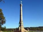
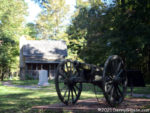
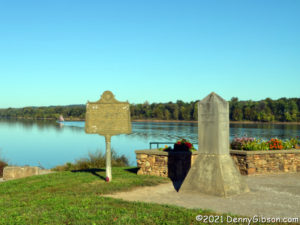
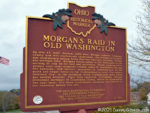
In the opening photograph, which looks across the Ohio River into Indiana from Brandenburg, KY, the raid is the subject of the metal marker and is noted on the stone marker. Both are overshadowed by a seventy-foot Confederate Veterans Monument that was moved here from Louisville, KY, in 2016. Louisville was beginning to think that distancing itself from the Confederacy might be a good idea but not so Brandenburg. Plaques at the monument’s new location tell its original history along with the story of its move. A “Southern Causes for the Civil War” plaque has a noticeable Confederate spin but does present something of a list of perceived causes. A “Northern Causes for the Civil War” plaque properly identifies a cause as “resistance to southern succession” then fills the panel with “things the Yankees did that pissed us off”.

Morgan spent eighteen days traveling through Indiana and Ohio. We spent four. We were traveling faster — and more comfortably — of course, plus we had the advantage of a path marked by signs and documented in guidebooks. The books used were “The John Hunt Morgan Heritage Trail in Indiana” by Lora Schmidt Cahill and “Morgan’s Raid Across Ohio” by Lora Schmidt Cahill and David L. Mowery. The signed route and the route described in the books do occasionally differ. I suspect that the signed route bypasses some of the rougher roads but I’m not certain of that and there may be other reasons for differences. Whatever the reasons, the differences are not many. We stopped at most of the sites marked by interpretive signs or called out in the books but did miss a few — sometimes intentionally, sometimes by accident. Only a few of those stops are covered in this post. It’s a brief recounting of our “raid”, not Morgan’s.
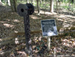
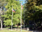
This is the Battle of Corydon Historic Site. I’ve included it to point out that the flag being flown to represent the Confederacy is the first official flag of the Confederate States of America. It is often referred to as the “Stars and Bars”. Artifacts from the steamboat Alice Dean, which Morgan sank after using it in crossing the Ohio River, are displayed here.
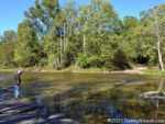

In the spirit of cordless phones, unleaded gas, and mirrorless cameras, this is a bridgeless creek. Terry looked over the ford at Big Graham Creek and spoke with a mother and a couple of kids beside the creek before deciding to take the plunge. Just as we started across, a pickup appeared on the opposite bank and entered the water without a pause. He passed us mid-stream on our left as a Jeep pulling a trailer followed us. Indiana may have to post some “congested ford” signs if that level of traffic continues.
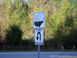
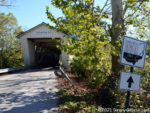
Apparently, I grabbed no photos of the trail signs in Indiana. These are in Ohio. The first is at the Harrshaville Covered Bridge which was one of the few bridges crossed but not burned by the raiders. It was renovated in 2013. The U-turn sign is near Rock Springs Park where some of the raiders rested briefly. I’ve included it to show how well the driving tour is marked.
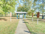
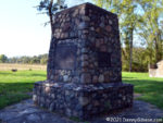
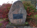
This is Buffington Island Battlefield Memorial Park. This is where things started to unravel for Morgan. Union forces met up with the raiders as they attempted to cross the Ohio River into the recently established (June 20, 1863) West Virginia. Some made it, some were captured, and some, including Morgan, escaped to run around Ohio for another week. “Run” is the appropriate word as Union troops were in close pursuit of the raiders from now on. Read the plaque on that stone marker here.

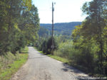
Here are a few of the more — but not most — interesting roads we traveled in Ohio. The low-water bridge on Hivnor Road over Island Run is as close as we came to a ford in the state.
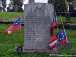
Morgan’s men were involved in multiple skirmishes with federal troops, local militia, and even civilians. An encounter with Union forces at Old Washington left three of them dead. All three are buried in the town cemetery. In the past, these graves were marked by the X-barred Confederate Battle Flag, which has pretty much been usurped by modern white supremacists. I don’t know when the change was made. Here‘s a photo from 2010. There’s a closer look at one of those flag holders here.

The “Stars and Bars” was replaced as the official Confederate flag on May 1, 1863. It was not the official flag during any part of Morgan’s raid although it was undoubtedly carried by most of his troops. Here‘s a picture, taken at a spot nearer the end of the trail, of the flag, known as the “Stainless Banner”, that replaced the “Stars and Bars”. Of course, it’s unlikely that all flags were replaced in just a couple of months so any official Confederate national flag flown during the raid was probably the “Stars and Bars”. However, the flags at Old Washington and at the Corydon battle site contain just seven stars. That was indeed the way things started, but by November 28, 1861, long before Morgan headed north, the count had grown to thirteen. These flags are a welcome change from the battle flag and are closer to being the national flag at the time these guys died, but they’re still not quite right.
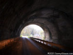
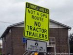
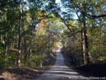
The yellow sign might mark the beginning of the most interesting road we traveled. The sign is itself rather interesting. “GPS route” is not an official designation so neither is “Not a GPS route. This and similar phrases seem to be a way of trying to tell truckers that, if their GPS is sending them down this road, it’s probably wrong. The road is quite steep and winding and neither Terry nor I got any pictures. We did get some shots at the bottom where Gould Road accompanies Long Run underneath the Wheeling & Lake Erie Railroad into Mingo Junction.

ADDENDUM Sep 3, 2022: This trip finally made me do something that I had been threatening. I bought a dashcam. Although I clearly do not have it mastered, I did get a video of this section on my second visit since our Morgan themed outing. Evidence that I’ve not mastered the camera is shown in the lack of sound and GPS and speed information but the “interesting road” can be seen here.
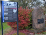
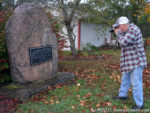
There was still a little daylight when we reached the point where Morgan and his remaining troops were captured. Terry took aim on the surrender marker and so did l. The plaque is here.
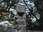
We pretty much used all the available daylight on each of the four days we spent covering the trail. The first three days had been completely dry and we even dodged much of the rain that started appearing on the afternoon of the fourth. We attributed our good luck regarding the rain to a black cat that had started to cross our path then stopped and turned around. We didn’t realize just how lucky we were until we got home. Wind and rain picked up as we drove from that “END” sign to our motel in Carrolton, but once we arrived, we temporarily lost all interest in weather. And weather wasn’t much of a factor when we drove home the next day. I was shocked when Terry called to tell me he had learned that several tornados had been sighted in Jefferson County on the day we reached the trail’s end. I was even more shocked to discover that, roughly half an hour before we took our surrender marker photos, a tornado had damaged twenty-three homes, a church, and a business about twenty-five miles away in Wintersville. Apparently, that cat turned around just in time.
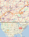
ADDENDUM 26-Oct-2021: Even though this outing was not documented with daily posts in this site’s journal section, much of the mechanics behind it were pretty much the same as trips documented there. That includes the routing and tracking that allow locator maps to be made. So, I’m adding a locator map because I can.

Heritage Village Cincinnati

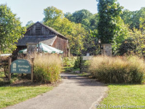
Friday felt a little odd. It had absolutely nothing scheduled but it was surrounded by days that did. Noting strenuous or even particularly time-consuming, but there were meetings and appointments with specific times that had to be attended to. It would seem logical, I think, to want to just sit around the shanty on that uncommitted day, and that’s probably what I would have done if the day hadn’t promised sunshine and 80 degrees. I know it was my awareness that there would soon be a huge gap between 80 degree days that made me want to avoid wasting this one. I went out to breakfast at a place a little farther away than normal and which I hadn’t been to in a long time. Over a goetta and cheese omelet, I pondered ways to put the day to use. Museums weren’t high on my list because I did not want to spend a lot of time indoors, but I eventually used “museum” as an internet search term and got a near-perfect hit. Heritage Village Museum & Education Center is definitely a museum. It says it right there in the name. But it also says it’s a village which means there is some open space. It really did seem to be exactly what I was looking for.

It wasn’t far from the restaurant where I was eating, so I simply headed directly there when I was done. As I approached the building where admission fees are collected, I passed a sign stating that guided tours were scheduled for 10:00, 12:45, and 3:00. It was about 10:30. Inside the building, I joked that I’d timed my arrival quite badly for a guided tour. The attendant agreed and added something about the last one being yesterday. I eventually figured out that guided tours are given May through September, and that she meant the last one for the year. It was October 1. I somehow felt less foolish missing a tour by a day than by half an hour. I paid my admission. received a self-guided tour brochure, and set off to guide myself.

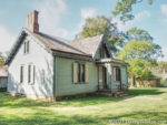
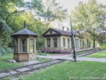
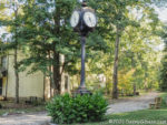
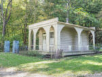
The first building encountered was also the first building moved into the village. Elk Lick House was from a spot in Clermont County that is now covered by East Fork Lake. The Chester Park Train Station and Crossing Tender’s Booth came from Winton Place across Spring Grove Avenue from Chester Park racetrack and amusement park. The McAlpin’s clock is one of the few things in the village I remember in its original location. It stood in front of the store on Fourth Street from 1992 to 1999. It was actually the fifth clock to stand there with the first four falling to “the elements and traffic mishaps”.

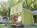
The Fetter Store came from what is now known as Owensville in Clermont County. It was built around 1866. Dr. Langdon’s Office was moved here in 1973 from the Linwood section of Cincinnati. Preparations for Halloween and trick-or-treating were in evidence behind the doctor’s office as well as in that tender’s booth back at the train station.

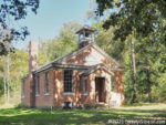
Myers Schoolhouse is the newest addition to the village and is actually still in the process of being restored. It was moved here in 2008. Its official name was Delhi Township District School #3. It was in use as a school from 1891 until 1926 when Delhi Township consolidated all of its schools.

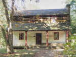
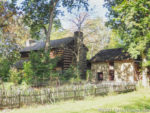
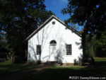
After reaching the schoolhouse and turning around, the first building encountered is the Somerset Church. The Presbyterian church was built around 1829 and, until it was moved to the village in 1991, stood near Fields Ertel and Montgomery roads less than a mile from where I currently live. Next to the church is the Kemper Log House and a reproduction of its stone kitchen. The house that Rev. James Kemper built in 1804 is the oldest structure in the village. It originally stood near where Cincinnati’s Eden Park is today.

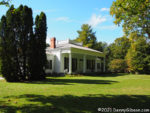
The Hayner House is both the beginning and end of the tour. It was built near South Lebanon in the 1850s. In the village, it faces Sharon Creek as it once faced the little Miami River. The entrance to the museum and gift shop, where tour tickets are purchased, is on the other side of the house. A glance down while walking between the creek and the house can provide a reminder as to just which state you are in.

Kim’s (Is) Back

Not only is Kim’s Classic Diner back in operation, owner Kim Starr is back at the helm. After years of wanting to own a diner, a few more years shopping for the right one, and another year moving and rehabbing a 1946 Silk City, Kim seemed to be living her dream. That dream, however, was put on hold about a dozen years ago so that Kim could devote all of her energy to helping her daughter deal with life-threatening heart and lung issues. Now it is those threats that have been put on hold — hopefully forever — as daughter helps mom bring her diner back to life.

There were attempts to keep things going without Kim’s involvement. Over the years, the diner was leased to three different operators but all three failed as a business, a responsible leasee, or both. I remember two of them but must have missed the third one entirely. I know it can’t be easy to make a classic diner go in a town of well under 3,000, but every time I drove through Sabina and past the closed business, I thought to myself that this place would be hopping if Kim was still here.

Well, Kim is here now, and while the place may not yet be hopping all the time, it apparently is some of the time. Employees spoke of being “swamped” on occasion and a scan of the diner’s Facebook page shows that the daily specials have “SOLD OUT” more than once since the August 20 reopening. I was there on Friday for breakfast. It wasn’t swamped but I sure was not alone. I did my normal dawdling while other customers came and went and I think there were always between five and ten people eating with me.

My Friday visit was just one day shy of the eighteenth anniversary of the original opening. One of the reasons Kim had picked the second anniversary of the 2001 terrorist attacks for her opening date was the diner’s New York history. I was happy to see articles about that history back on the walls and especially happy to see that three mugs from those days (delivered to Kim by a visiting waitress) were back on the shelf. These were among the items that had gone home with Kim for safekeeping during her absence from the diner.

In addition to being one of the coolest diners within my extended neighborhood (It’s about 40 miles straight up US-22), Kim’s is special to me for another reason. It was the subject of the first of four Diner Days articles I wrote for American Road Magazine between 2006 and 2008. It was, in fact, the very first thing of mine published to the general public. In that article, I spoke of the use of car names for breakfast selections, and I am happy to report that that is once more the case. This time I had a Mercury.