To the Circle
Comment via blog
Prev
Next


|
Day 15: June 30, 2016 To the Circle Comment via blog |
Prev Next |
|
|
|
 In the early planning for this trip I saw the Arctic Circle seemingly not
far from Fairbanks on maps and briefly looked into it. I only had to read
a little about the road involved to decide I'd pass. Then, on the day
before departure, I was discussing my route with a friend who asked if I
had any side trips, such as to the Arctic Circle, planned. When I said no,
he quickly pointed out that I'd probably never be closer. I remembered
that when I reached Fairbanks and, although there was still no chance of
me driving it, I poked around some outfits offering excursions there and
found one I liked with an opening on Friday. Terry Wolf, this is your
doing.
In the early planning for this trip I saw the Arctic Circle seemingly not
far from Fairbanks on maps and briefly looked into it. I only had to read
a little about the road involved to decide I'd pass. Then, on the day
before departure, I was discussing my route with a friend who asked if I
had any side trips, such as to the Arctic Circle, planned. When I said no,
he quickly pointed out that I'd probably never be closer. I remembered
that when I reached Fairbanks and, although there was still no chance of
me driving it, I poked around some outfits offering excursions there and
found one I liked with an opening on Friday. Terry Wolf, this is your
doing.
At 1st Alaska Outdoor School I was the beneficiary of two couples from south-west Indiana being enough to get the tour scheduled. Our party of six meshed well. As I had visited our first stop, the pipeline park, yesterday, it wasn't a particularly exciting beginning and the rain lowered the excitement level even more. But Cassie, our driver/guide, did convey some useful info about the pipeline during the stop. We would see a lot more pipeline before the day was over. |
|
|
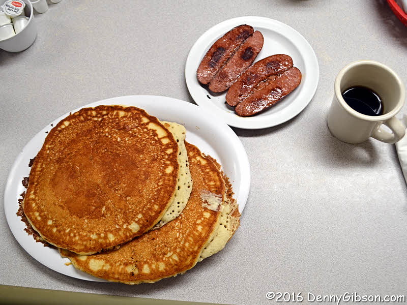 The second stop wasn't exactly exciting either, but it sure was tasty.
When my breakfast arrived, I was reminded that, when the menu offers the
option of a single pancake, there's a reason. I ate about half of my short
(but very wide) stack and about half of my reindeer sausage. The other
half of the sausage went home with Cassie along with half of her own
order.
The second stop wasn't exactly exciting either, but it sure was tasty.
When my breakfast arrived, I was reminded that, when the menu offers the
option of a single pancake, there's a reason. I ate about half of my short
(but very wide) stack and about half of my reindeer sausage. The other
half of the sausage went home with Cassie along with half of her own
order.
|
|
|
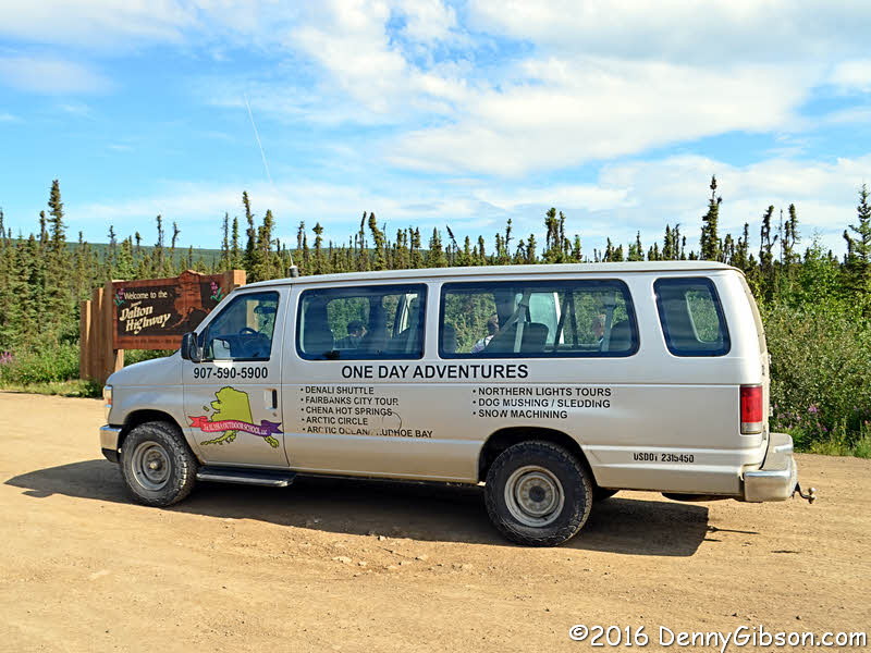
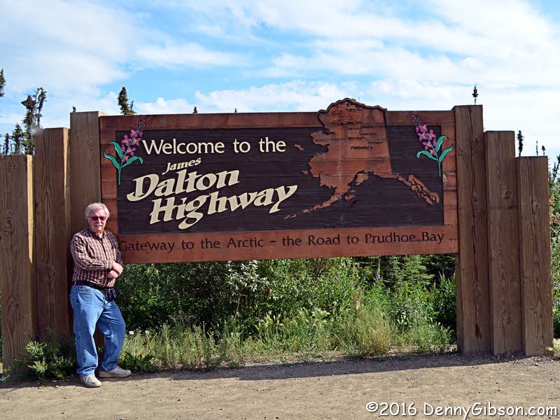 We took "before" pictures of ourselves and the van at the start
of the Dalton Highway. The fun is about to begin.
We took "before" pictures of ourselves and the van at the start
of the Dalton Highway. The fun is about to begin.
|
|
|
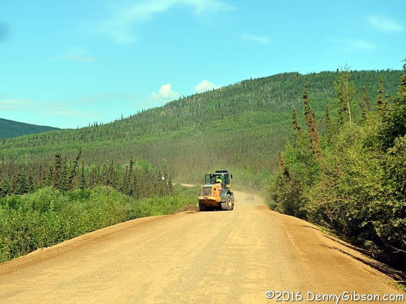
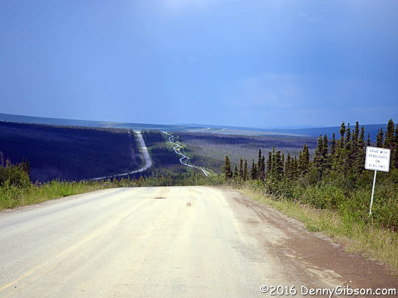
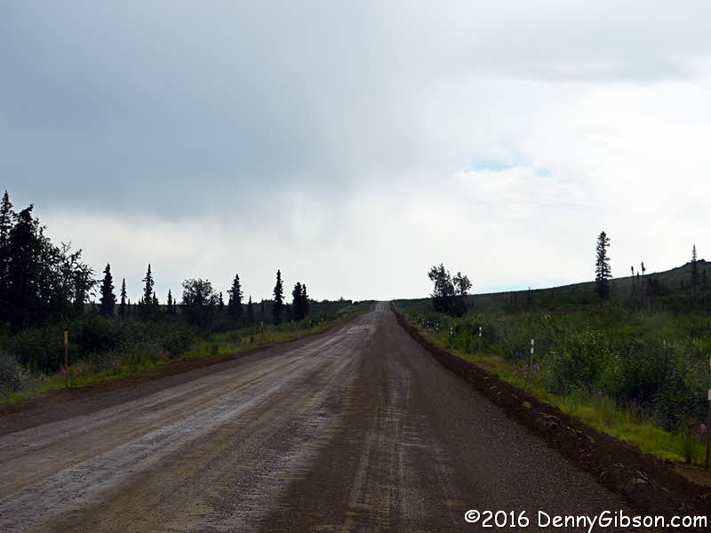
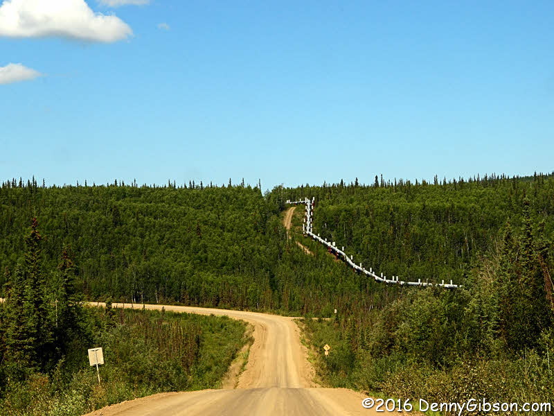 What is now the Dalton Highway was known as the North Slope Haul Road when
it was built in 1974 to support pipeline construction. It has been under
construction and under repair ever since. There are no flaggers or stop
lights out here. Drivers must spot the equipment themselves and make sure
the operator is aware of them before trying to pass. The Dalton Highway
has been featured on a reality show called Ice Road Truckers. Big
rigs are a common sight and so is the pipeline. The pipeline, in fact, is
almost constantly in view.
What is now the Dalton Highway was known as the North Slope Haul Road when
it was built in 1974 to support pipeline construction. It has been under
construction and under repair ever since. There are no flaggers or stop
lights out here. Drivers must spot the equipment themselves and make sure
the operator is aware of them before trying to pass. The Dalton Highway
has been featured on a reality show called Ice Road Truckers. Big
rigs are a common sight and so is the pipeline. The pipeline, in fact, is
almost constantly in view.
|
|
|
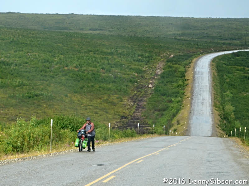
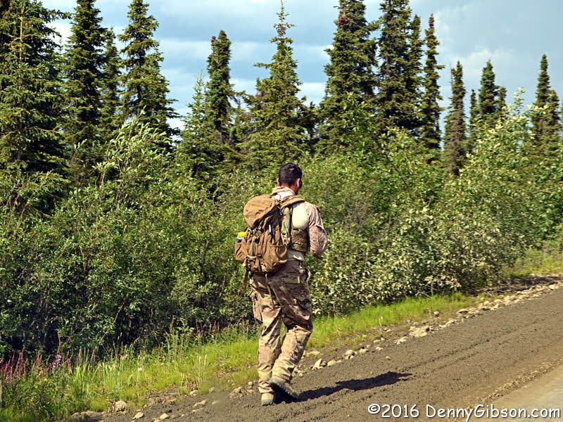
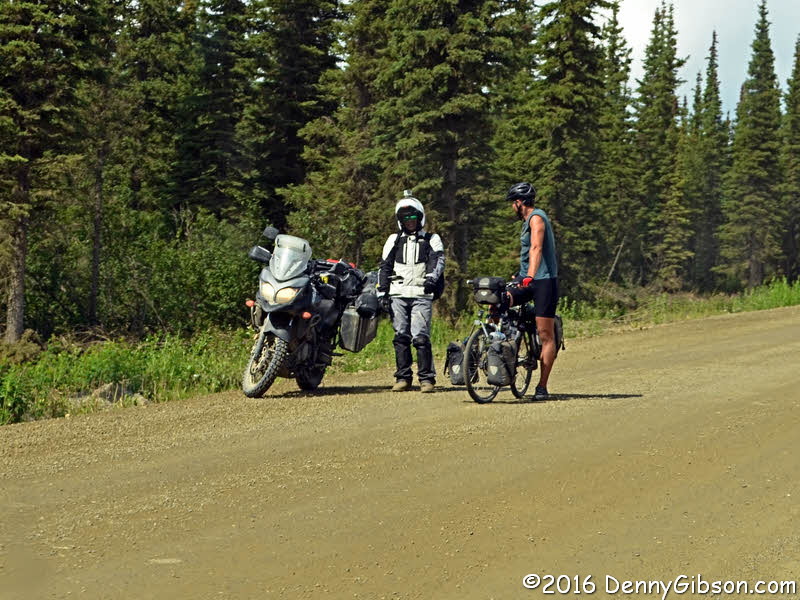
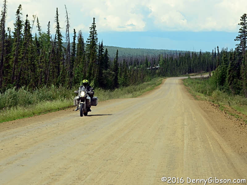
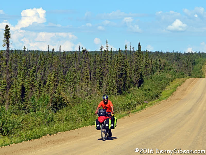
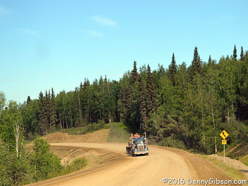
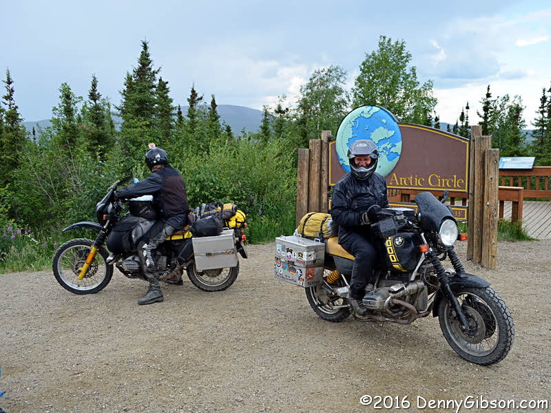
 Trucks and construction gear are hardly the only things on the highway. We
saw a couple of other tour vans and a few private vehicles along with a
variety of two wheeled conveyances. This panel contains some out of
sequence photos of people traveling on two -- or less -- wheels. We
monitored the CB all the way and sometimes picked up information from
truckers. We knew the walker was up ahead when we heard "Look out for
Forest Gump.". Although the rain had stopped by the time we passed
him, we were pretty sure it was the fellow in the last picture who
prompted a truckers sarcastic "Just the vacation I wanted. Riding the
Dalton south in a rain storm by myself."
Trucks and construction gear are hardly the only things on the highway. We
saw a couple of other tour vans and a few private vehicles along with a
variety of two wheeled conveyances. This panel contains some out of
sequence photos of people traveling on two -- or less -- wheels. We
monitored the CB all the way and sometimes picked up information from
truckers. We knew the walker was up ahead when we heard "Look out for
Forest Gump.". Although the rain had stopped by the time we passed
him, we were pretty sure it was the fellow in the last picture who
prompted a truckers sarcastic "Just the vacation I wanted. Riding the
Dalton south in a rain storm by myself."
|
|
|

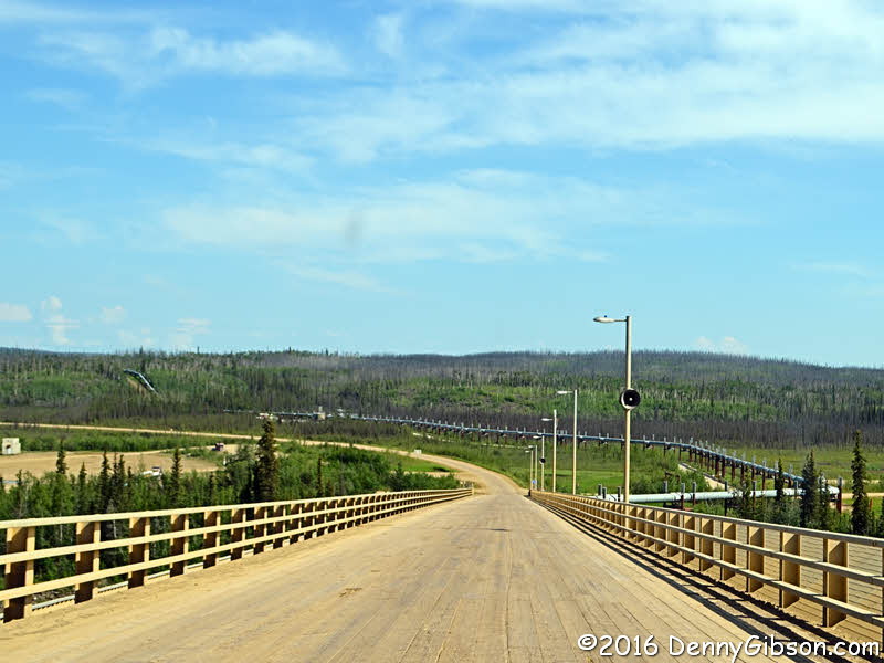
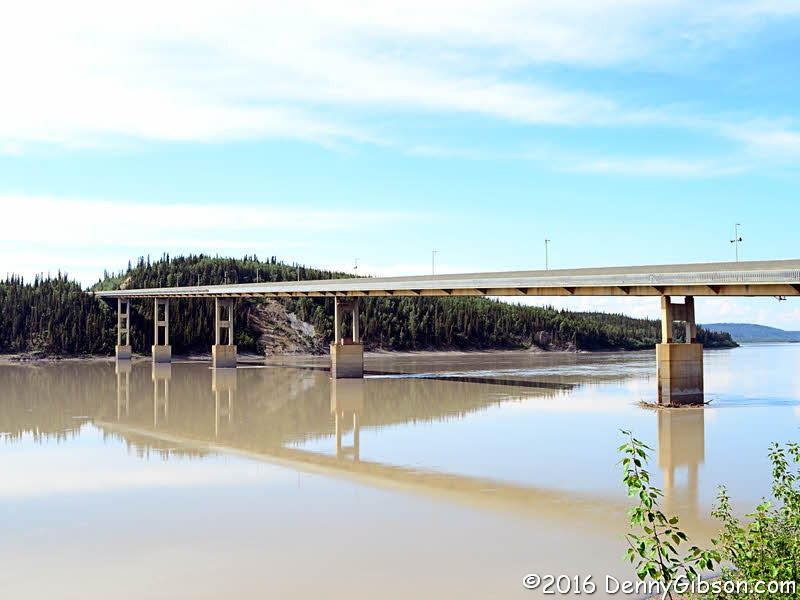 Here we are heading down to the Yukon River and over the only bridge to
cross it in Alaska. The deck was originally steel but wood turns out to be
better material in dealing with the temperature extremes experienced here.
The Bureau of Land Management has an office near the bridge and a path
leads from there to the riverside.
Here we are heading down to the Yukon River and over the only bridge to
cross it in Alaska. The deck was originally steel but wood turns out to be
better material in dealing with the temperature extremes experienced here.
The Bureau of Land Management has an office near the bridge and a path
leads from there to the riverside.
|
|
|
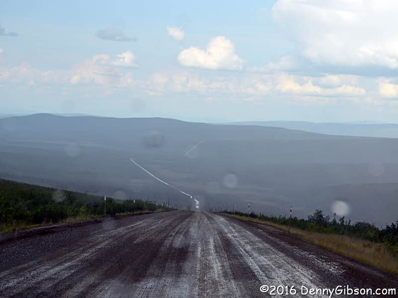
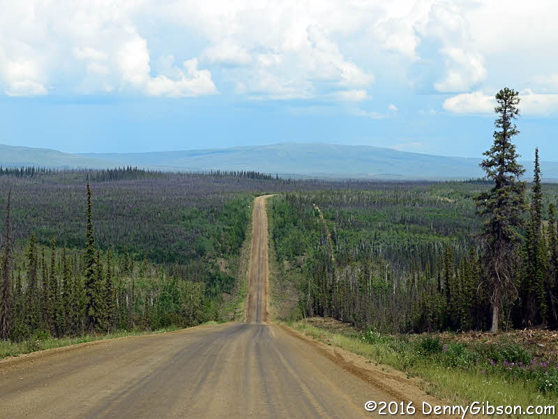
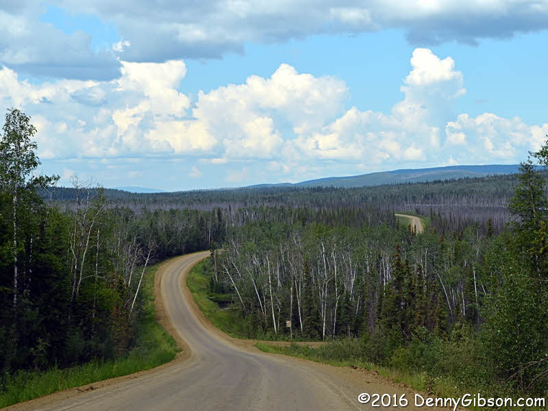
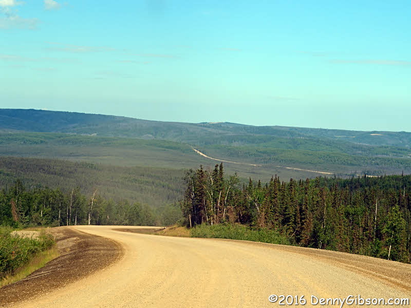
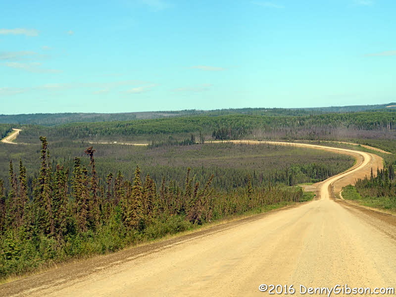
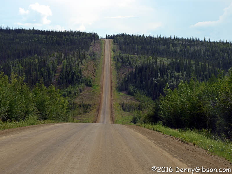
 An assortment of Dalton Highway views. The third picture may or may not be
the section known as Roller Coaster. The fifth picture may or may not be
the section known as Beaver Slide.
An assortment of Dalton Highway views. The third picture may or may not be
the section known as Roller Coaster. The fifth picture may or may not be
the section known as Beaver Slide.
|
|
|
 This is by far the funniest thing I've seen in a long time. Placing a
"ROUGH ROAD" sign where it can only be seen by someone who has
just covered more than 100 miles of the Dalton Highway proves that
Alaskans have a superb sense of humor.
This is by far the funniest thing I've seen in a long time. Placing a
"ROUGH ROAD" sign where it can only be seen by someone who has
just covered more than 100 miles of the Dalton Highway proves that
Alaskans have a superb sense of humor.
|
|
|
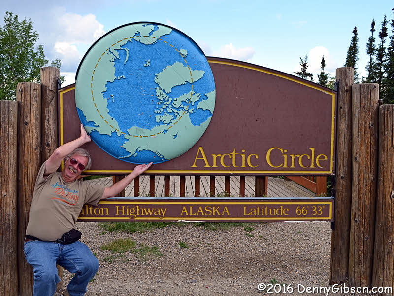

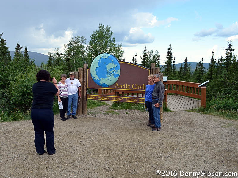

 The first picture was taken from the van which Cassie has parked so that
half its occupants are above the Arctic Circle and half are below. I'm
above. There were a few drops of rain as Cassie hurried through handing
out certificates and taking pictures. That's Ida, Tim, Oopsiforgothername,
and Gene in the third picture. Not only did Cassie suggest the shrugging
Atlas pose, she positioned it so well I had to post it. The couple in the
last picture pulled up just before we left. They are from New Zealand and
have been traveling for over two years. Now that's a road trip.
The first picture was taken from the van which Cassie has parked so that
half its occupants are above the Arctic Circle and half are below. I'm
above. There were a few drops of rain as Cassie hurried through handing
out certificates and taking pictures. That's Ida, Tim, Oopsiforgothername,
and Gene in the third picture. Not only did Cassie suggest the shrugging
Atlas pose, she positioned it so well I had to post it. The couple in the
last picture pulled up just before we left. They are from New Zealand and
have been traveling for over two years. Now that's a road trip.
|
|
|
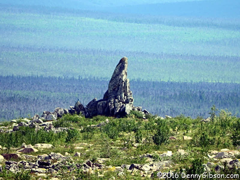
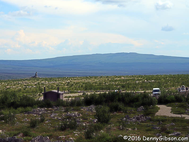
 I'm fairly confident that the first two southbound pictures are of Beaver
Slide and Roller Coaster. The others were taken at the Finger Mountain
rest area. While there we scoured the landscape looking for caribou known
to frequent the area but saw none. This as actually something of a setback
for me. I was thinking that, of the big animals I expected to see on this
trip, only moose remained unseen. I simply hadn't thought of caribou. Now
I had two big critters on the unseen list.
I'm fairly confident that the first two southbound pictures are of Beaver
Slide and Roller Coaster. The others were taken at the Finger Mountain
rest area. While there we scoured the landscape looking for caribou known
to frequent the area but saw none. This as actually something of a setback
for me. I was thinking that, of the big animals I expected to see on this
trip, only moose remained unseen. I simply hadn't thought of caribou. Now
I had two big critters on the unseen list.
|
|
|
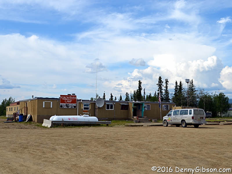

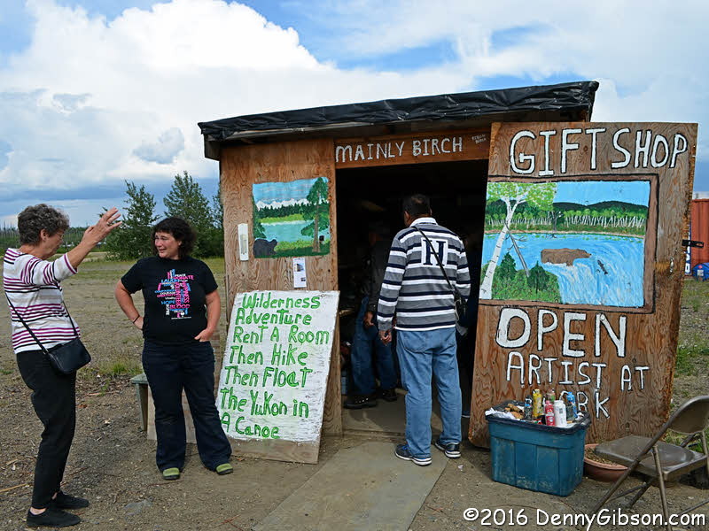
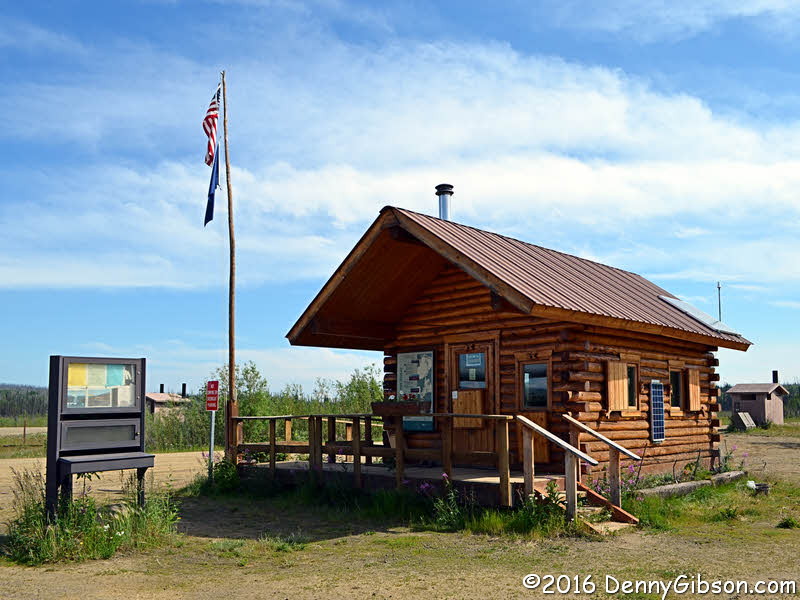
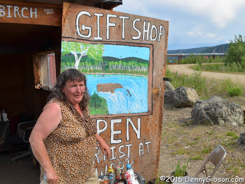 That's Margaret in the first picture. She makes everything offered in her
gift shop just across the road from the BLM office where we'd stopped on
the way north. She lives nearby in a house that she and her son built.
While Ida and Cassie have an animated discussion, folks from another tour
go shopping in the tiny shop. I visited the riverside before walking to
the Yukon River Camp main building for dinner.
That's Margaret in the first picture. She makes everything offered in her
gift shop just across the road from the BLM office where we'd stopped on
the way north. She lives nearby in a house that she and her son built.
While Ida and Cassie have an animated discussion, folks from another tour
go shopping in the tiny shop. I visited the riverside before walking to
the Yukon River Camp main building for dinner.
|
|
|
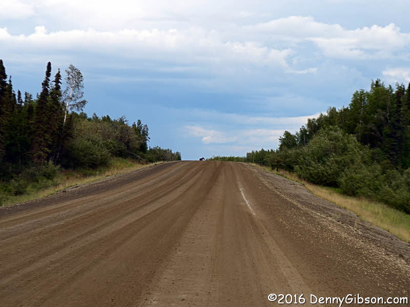
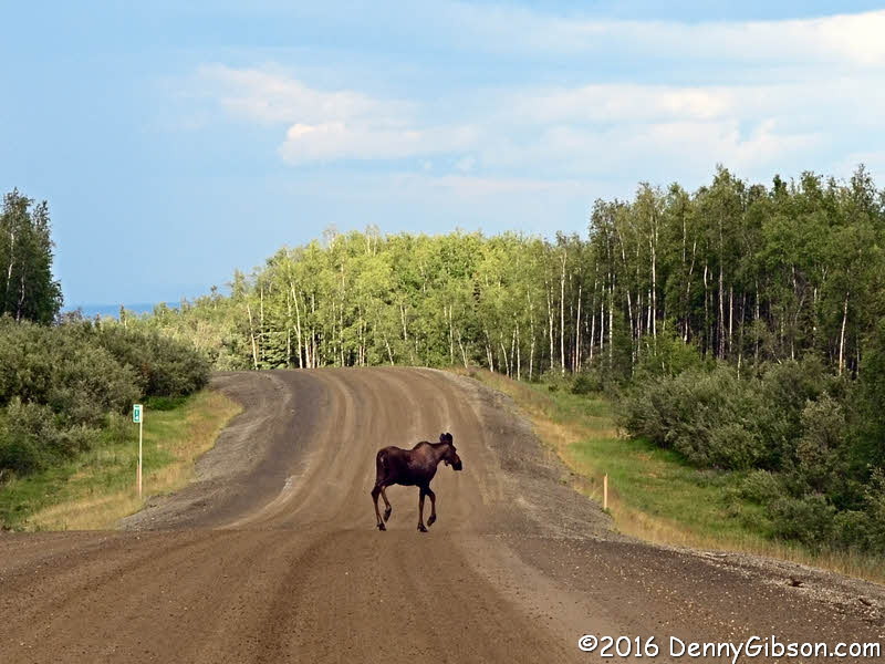 We were getting used to dark spots on the road turning into cyclists of
one sort or another but this dark spot didn't look quite right. That was
because it was not a cyclist but a moose and my unseen list was back to
one. Today I broke even.
We were getting used to dark spots on the road turning into cyclists of
one sort or another but this dark spot didn't look quite right. That was
because it was not a cyclist but a moose and my unseen list was back to
one. Today I broke even.
|
|
|
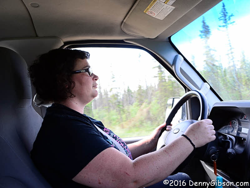
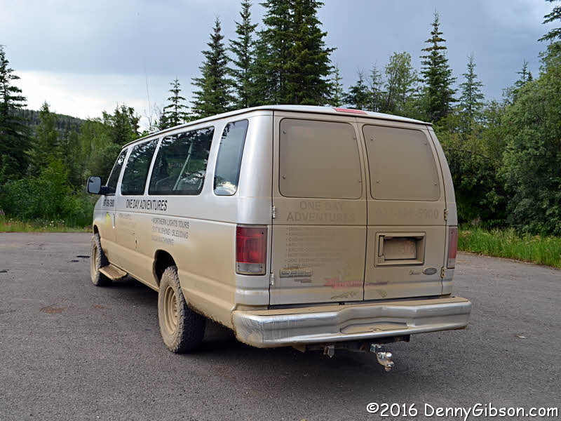 At the end of the day the van didn't have quite as much dirt on it as I
expected but it was enough. The picture of Cassie at work in her office
was taken earlier. Cassie is from Australia and worked as a guide on
similar tours there. She gave us instant confidence in her driving and her
knowledge of the area and its plants and wildlife was just as impressive.
Having her as a guide was another bit of luck.
At the end of the day the van didn't have quite as much dirt on it as I
expected but it was enough. The picture of Cassie at work in her office
was taken earlier. Cassie is from Australia and worked as a guide on
similar tours there. She gave us instant confidence in her driving and her
knowledge of the area and its plants and wildlife was just as impressive.
Having her as a guide was another bit of luck.
|
|
|
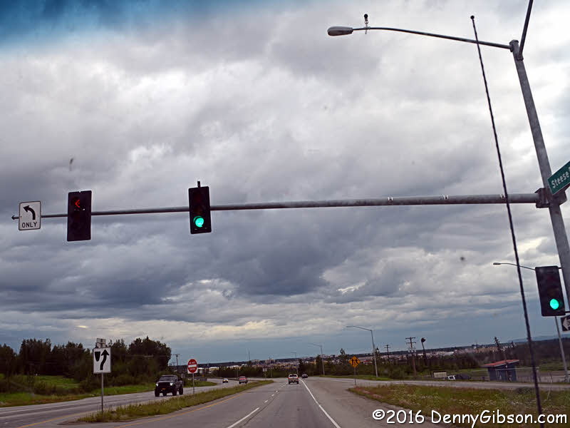 Cassie says this stop light, which I think is at the intersection of
Steese Highay and Farmers Loop Road, is the northernmost in the US. Bonus!
Cassie says this stop light, which I think is at the intersection of
Steese Highay and Farmers Loop Road, is the northernmost in the US. Bonus!
|
|
|
| [Prev] [Site Home] [Trip Home] [Contact] [Next] |