|
July, 29, 2011: South from the Crossroads
|
|
July, 29, 2011: South from the Crossroads
|
|
|
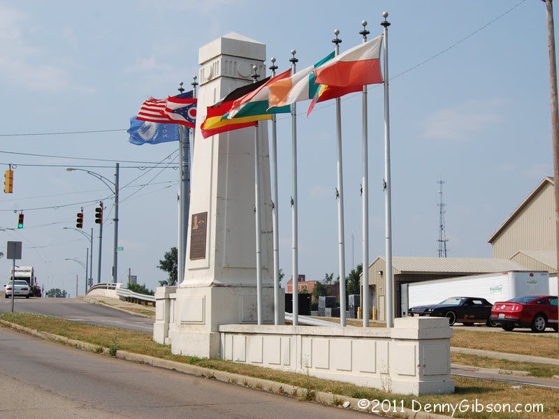
 Even though, unlike religion, the constitution doesn't specifically
prohibit establishment of a national crossroads, the US government has
refrained from doing so. That's certainly wise since preventing people
from believing in the Crossroads of America of their choice could easily
lead to another revolution. My own choice is where the eastern trunk of
the Dixie Highway once crossed the National Road. On Friday, an
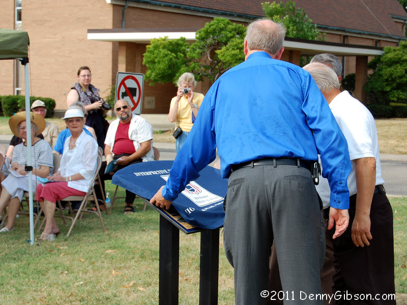
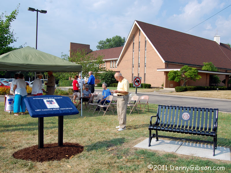
interpretive sign supporting my choice was unveiled very near that
intersection. This is the fifteenth of a total of sixty signs the
Ohio National
Road Association has planned. It's in front of a church just west of
actual intersection. The
Historical Society of Vandalia-Butler also played a
large role in placing this sign and a new bench, dedicated to the memory
of member Carl Karns, stands beside it. The bench is positioned to provide
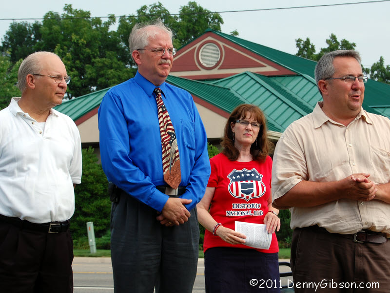
a good view of traffic passing through the actual intersection. That's
HSVB President Joe Dranschak at the left of the second picture with ONRA
President Dean Ringle next to him. Former ONRA President Cyndie Gerkin,
who acted as MC today, stands in the back while Vandalia Mayor Bill Loy
speaks.
Even though, unlike religion, the constitution doesn't specifically
prohibit establishment of a national crossroads, the US government has
refrained from doing so. That's certainly wise since preventing people
from believing in the Crossroads of America of their choice could easily
lead to another revolution. My own choice is where the eastern trunk of
the Dixie Highway once crossed the National Road. On Friday, an
interpretive sign supporting my choice was unveiled very near that
intersection. This is the fifteenth of a total of sixty signs the
Ohio National
Road Association has planned. It's in front of a church just west of
actual intersection. The
Historical Society of Vandalia-Butler also played a
large role in placing this sign and a new bench, dedicated to the memory
of member Carl Karns, stands beside it. The bench is positioned to provide
a good view of traffic passing through the actual intersection. That's
HSVB President Joe Dranschak at the left of the second picture with ONRA
President Dean Ringle next to him. Former ONRA President Cyndie Gerkin,
who acted as MC today, stands in the back while Vandalia Mayor Bill Loy
speaks.
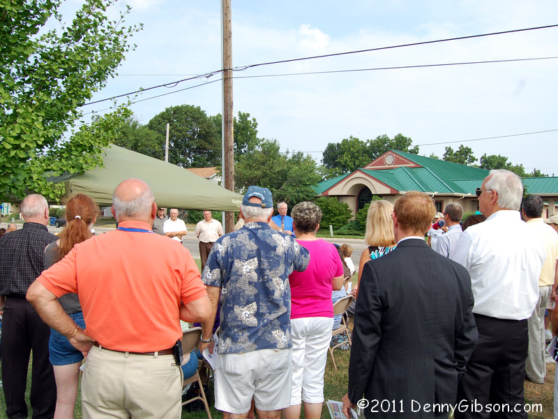
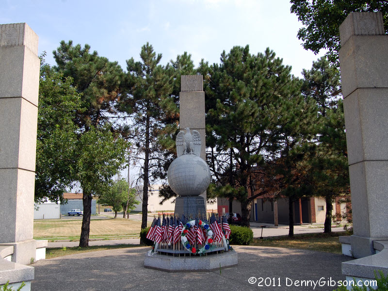
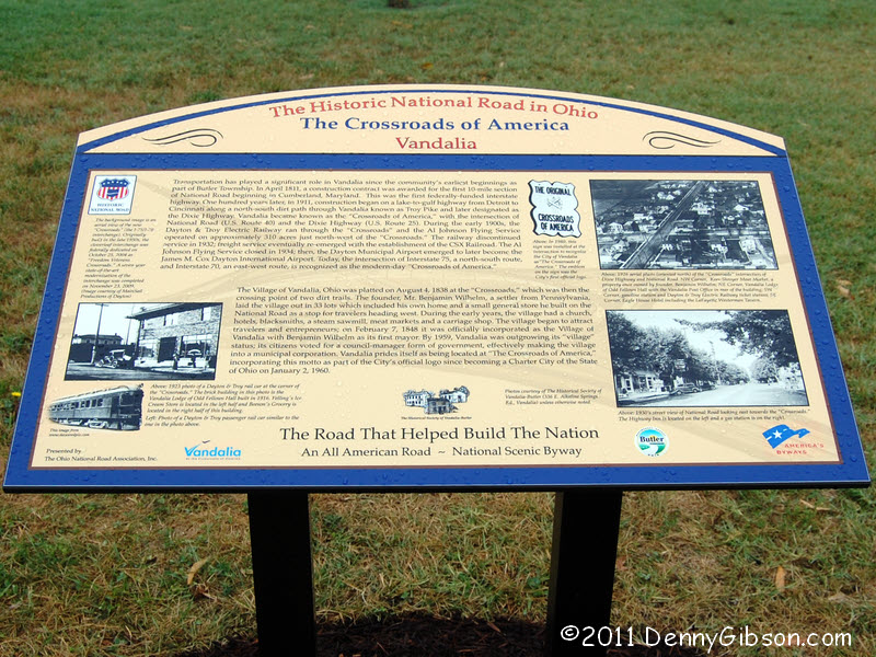
The weather was perfect for the well attended event. I failed to get an actual count but am guessing that there were upwards of fifty people on hand and a crew from WDTN-TV, too. The good looking and informative sign includes some historic photographs one of which is a 1926 aerial photo of the Dixie Highway - National Road intersection. It is possibly the first and last aerial photo taken of those two roads since that's the year they became US 25 and US 40. The east Dixie Highway route is now covered by I-75 and I-70 has taken over US 40's job. Their intersection, less than two miles away, is a legitimate contender for the current "Crossroads of America". When a complete modernization of the interchange was completed in 2004, it was given the name "Freedom Veteran's Crossroads". |
|
|

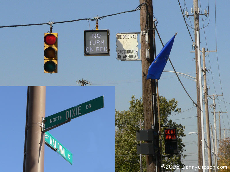
 I had already decided that I would use the unveiling as an excuse to drive
the Dixie Highway between Vandalia and Cincinnati. I've probably driven it
all at some time but never in a single pass and never intentionally. The
1980 signs declaring this "The Original Crossroads of America"
are still there but they are mounted quite high and newer lights and
crossbars make them hard to see. There used to be colored flags displayed
at all four corners of the intersection which at least made it stand out a
little and might draw someone's attention to the signs. The names are now
separated so the Dixie Highway and National Road connection is less
apparent. Here's a glimpse of
the intersection a few years ago. Hopefully Mayor Loy heard enough whining
about the absent flags to at least think about some additional marking for
the intersection. The second picture looks south along the path I am about
to take.
I had already decided that I would use the unveiling as an excuse to drive
the Dixie Highway between Vandalia and Cincinnati. I've probably driven it
all at some time but never in a single pass and never intentionally. The
1980 signs declaring this "The Original Crossroads of America"
are still there but they are mounted quite high and newer lights and
crossbars make them hard to see. There used to be colored flags displayed
at all four corners of the intersection which at least made it stand out a
little and might draw someone's attention to the signs. The names are now
separated so the Dixie Highway and National Road connection is less
apparent. Here's a glimpse of
the intersection a few years ago. Hopefully Mayor Loy heard enough whining
about the absent flags to at least think about some additional marking for
the intersection. The second picture looks south along the path I am about
to take.
|
|
|
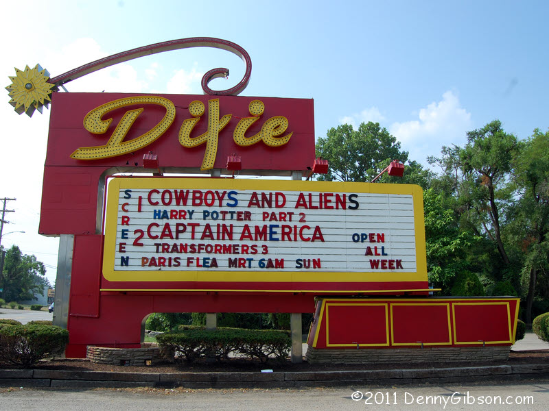
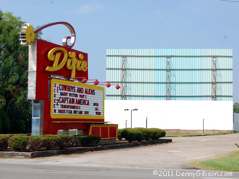 The Dixie Drive In is
still operating and still looking good. And it's not just operating, it's
showing top-notch first-run stuff. I don't go out for many movies but an
ad for "Cowboys and Aliens" caught my eye a few weeks ago and I
think I'd really like to see it. This would be the perfect place.
The Dixie Drive In is
still operating and still looking good. And it's not just operating, it's
showing top-notch first-run stuff. I don't go out for many movies but an
ad for "Cowboys and Aliens" caught my eye a few weeks ago and I
think I'd really like to see it. This would be the perfect place.
|
|
|

 This intersection would be a strong "Crossroads of America"
candidate if roads actually crossed here. The route from the left once
carried the National Old Trails Road and the NOTR and the DH crossed the
Mad River together. Since the National Old Trails Road (a.k.a.,
Dayton Cutoff) was the preferred east-west route during the heyday of
named auto trails, it seems likely that more "National Road"
travelers met the Dixie here than in Vandalia. If it didn't sound so
funny, we might call this "The Junction of America".
This intersection would be a strong "Crossroads of America"
candidate if roads actually crossed here. The route from the left once
carried the National Old Trails Road and the NOTR and the DH crossed the
Mad River together. Since the National Old Trails Road (a.k.a.,
Dayton Cutoff) was the preferred east-west route during the heyday of
named auto trails, it seems likely that more "National Road"
travelers met the Dixie here than in Vandalia. If it didn't sound so
funny, we might call this "The Junction of America".
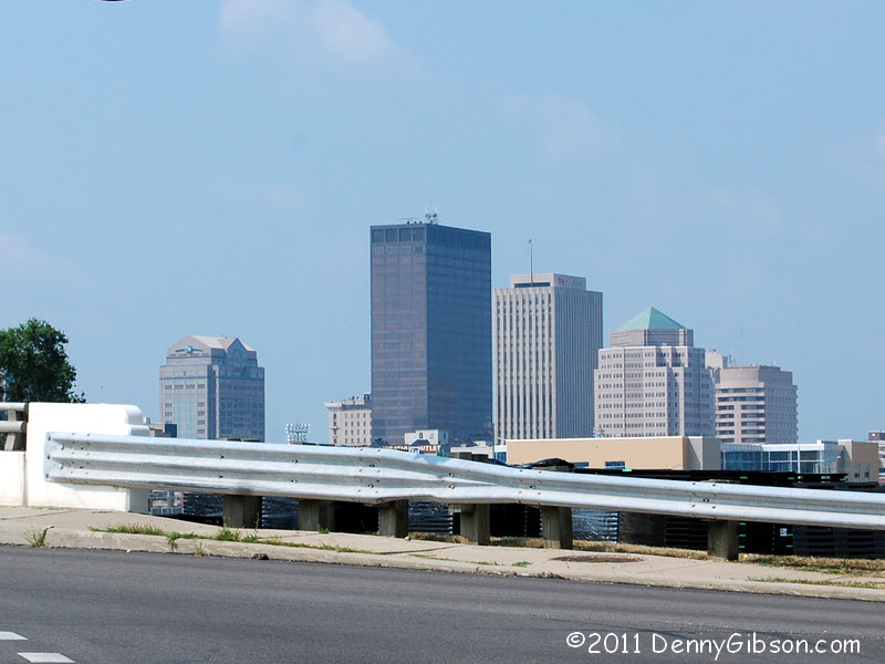
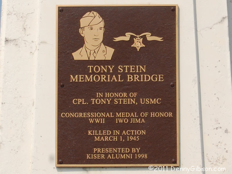
I've been unable to learn if this actual bridge was in place when the two auto trails were in use. It was named the "Tony Stein Memorial Bridge" in 1998. Plaques naming the Medal of Honor winner are on towers along both north side approaches that are obviously much older. A nice veteran's park sets in the 'V' of the junction with a view of the eastern face of downtown Dayton. |
|
|
 The National Old Trails Road followed 1st Street at this point and there
seems a good chance that the Dixie Highway did, too. But 1st is now one
way east bound with Monument Avenue carrying westbound traffic. Today I
couldn't even take Monument very far as it was blocked off for some
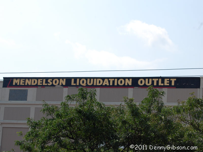
riverfront activity. Mendelson's ("The First Place to Look for Every
Last Thing") is actually on 1st Street but the picture, like the
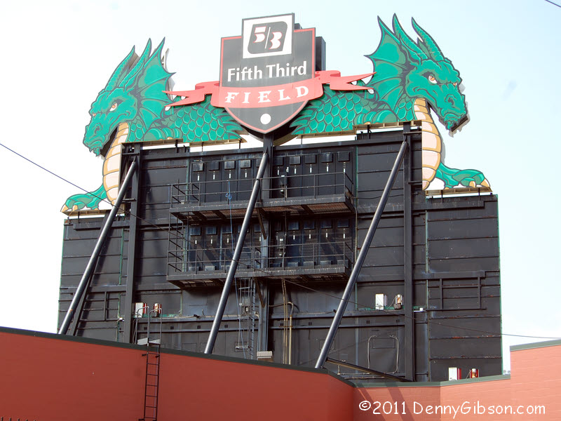
others in this panel, was taken on Monument. 5/3 Field fills the block
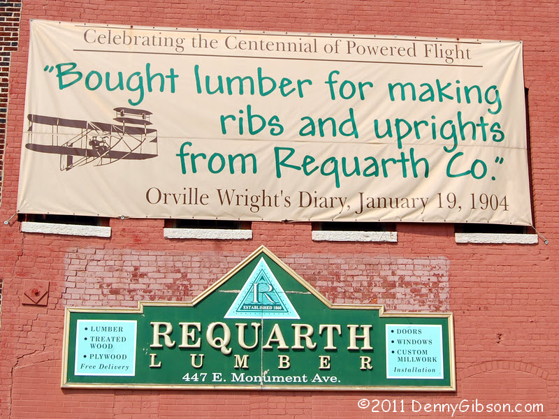
between Memorial and 1st. My photo shows the back side of the scoreboard.
With their 815th consecutive sellout on July 9, the
Dayton
Dragons set a new record for professional sports and the streak is
still going strong. Even if the Dixie Highway ran down 1st Street and not
right by Requarth
Lumber, drivers on the Dixie might have shopped there. They have been
in business since 1860 and operating on Monument since 1895 and it's still
a good place to buy lumber for making ribs and uprights.
The National Old Trails Road followed 1st Street at this point and there
seems a good chance that the Dixie Highway did, too. But 1st is now one
way east bound with Monument Avenue carrying westbound traffic. Today I
couldn't even take Monument very far as it was blocked off for some
riverfront activity. Mendelson's ("The First Place to Look for Every
Last Thing") is actually on 1st Street but the picture, like the
others in this panel, was taken on Monument. 5/3 Field fills the block
between Memorial and 1st. My photo shows the back side of the scoreboard.
With their 815th consecutive sellout on July 9, the
Dayton
Dragons set a new record for professional sports and the streak is
still going strong. Even if the Dixie Highway ran down 1st Street and not
right by Requarth
Lumber, drivers on the Dixie might have shopped there. They have been
in business since 1860 and operating on Monument since 1895 and it's still
a good place to buy lumber for making ribs and uprights.
|
|
|
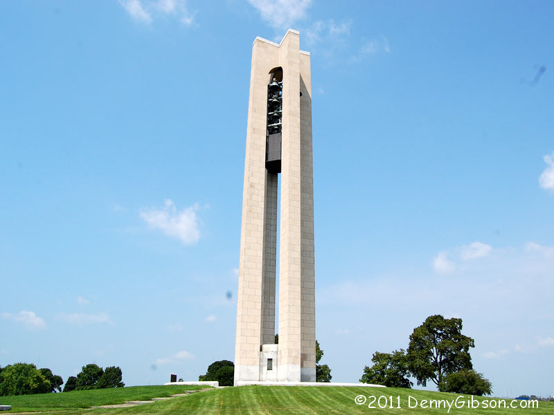
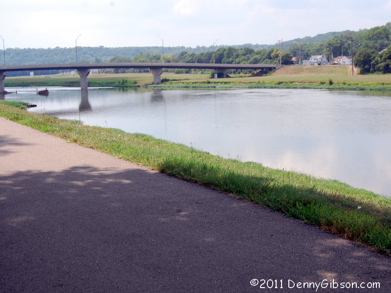
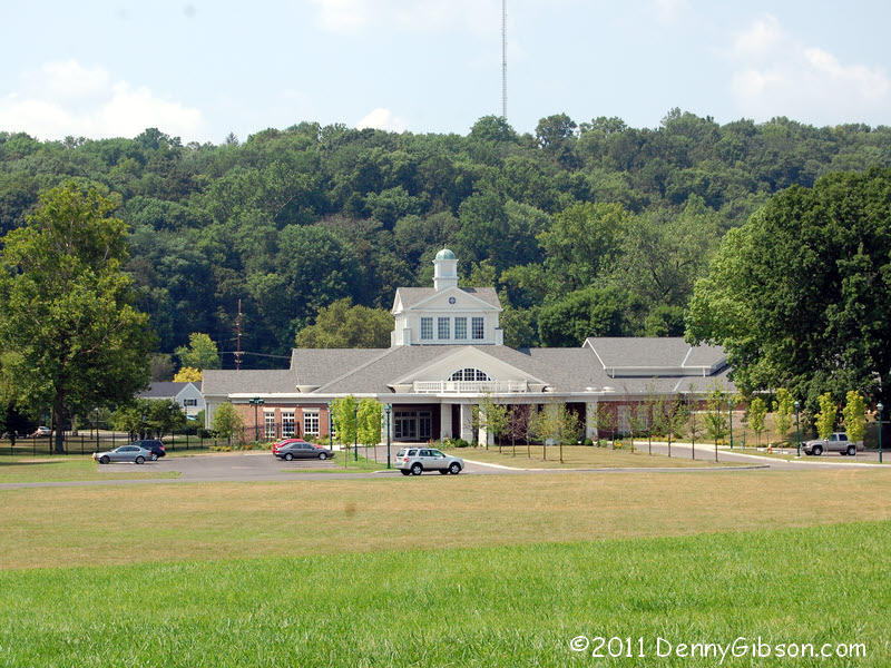 Even though it is now divided four-lane, once it gets through the center
of Dayton, what was once the Dixie Highway gets kind of pretty as it runs
beside the Great Miami River with the Deed's Carillon in the distance. The
last picture is of the entrance to
Carillon Historical Park taken from near the carillon.
This is a wonderful "full size" museum with 25 historic
structures on 65 acres.
Even though it is now divided four-lane, once it gets through the center
of Dayton, what was once the Dixie Highway gets kind of pretty as it runs
beside the Great Miami River with the Deed's Carillon in the distance. The
last picture is of the entrance to
Carillon Historical Park taken from near the carillon.
This is a wonderful "full size" museum with 25 historic
structures on 65 acres.
|
|
|

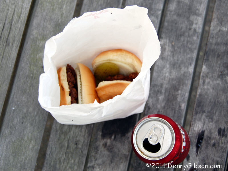
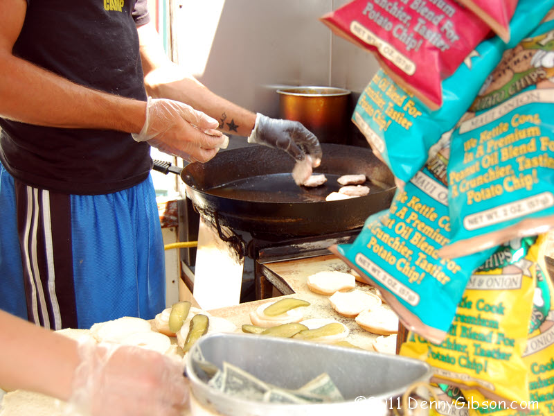
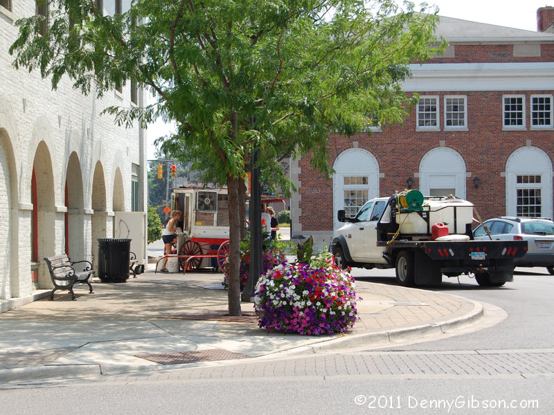
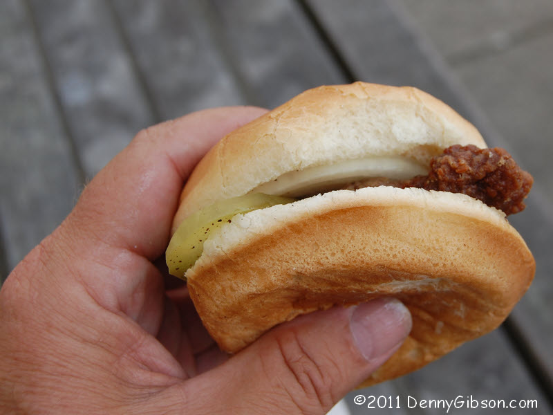
 As the Dixie Highway go through Miamisburg, Ohio, it passes right in front of the 1851
Market Square building which the historical society now calls home. Turn
left and there, at the building's southeast corner, is the world famous
Miamisburg
Hamburger Wagon. I usually get by the 'Wagon once or twice a year but
this was my second visit in less than a week. I often walk down to the
river with my purchase as I did last Sunday but
today I just walked across the street and parked myself on a bench. A line
often forms at the 'Wagon and double parking can become the norm but today's
crowd was very nicely paced. Though I saw the window empty but once, and
that was only for a few seconds, the crowd rarely exceeded a half dozen
while I munched and watched.
As the Dixie Highway go through Miamisburg, Ohio, it passes right in front of the 1851
Market Square building which the historical society now calls home. Turn
left and there, at the building's southeast corner, is the world famous
Miamisburg
Hamburger Wagon. I usually get by the 'Wagon once or twice a year but
this was my second visit in less than a week. I often walk down to the
river with my purchase as I did last Sunday but
today I just walked across the street and parked myself on a bench. A line
often forms at the 'Wagon and double parking can become the norm but today's
crowd was very nicely paced. Though I saw the window empty but once, and
that was only for a few seconds, the crowd rarely exceeded a half dozen
while I munched and watched.
|
|
|
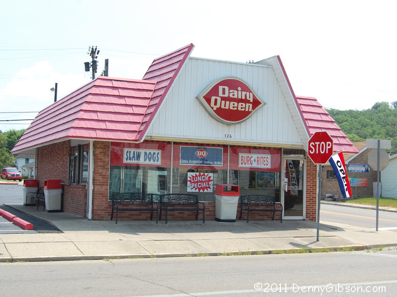
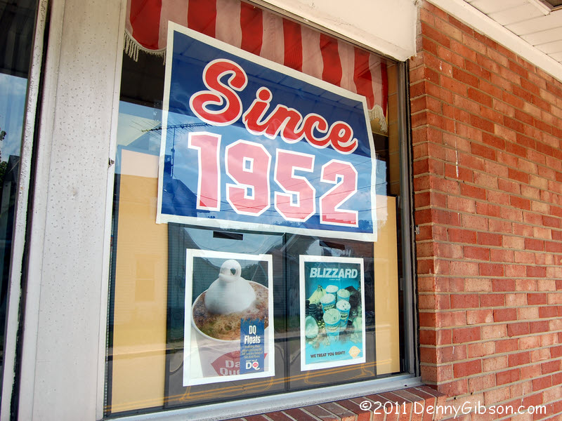
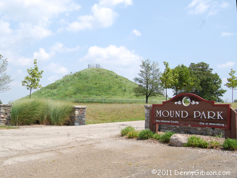
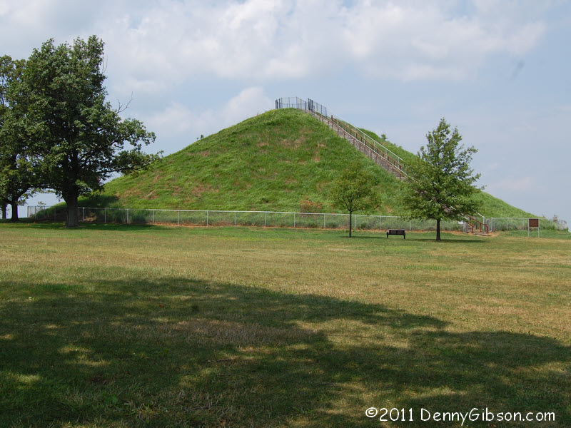 Dessert can be had about a half mile further south at a nearly 60 year old
Dairy Queen. Turning left at the DQ will take you to the
Miamisburg Mound State Memorial just over a mile off
the Dixie. I have climbed the 116 steps to the top in the past but didn't
even consider it today. Note that this is "the largest conical burial
mound in the state of Ohio". That means there are larger conical
mounds around and there may be larger burial mounds in other shapes but,
if you're in Ohio and looking for something cone shaped with dead people
inside, you just can't do any better than this.
Dessert can be had about a half mile further south at a nearly 60 year old
Dairy Queen. Turning left at the DQ will take you to the
Miamisburg Mound State Memorial just over a mile off
the Dixie. I have climbed the 116 steps to the top in the past but didn't
even consider it today. Note that this is "the largest conical burial
mound in the state of Ohio". That means there are larger conical
mounds around and there may be larger burial mounds in other shapes but,
if you're in Ohio and looking for something cone shaped with dead people
inside, you just can't do any better than this.
|
|
|
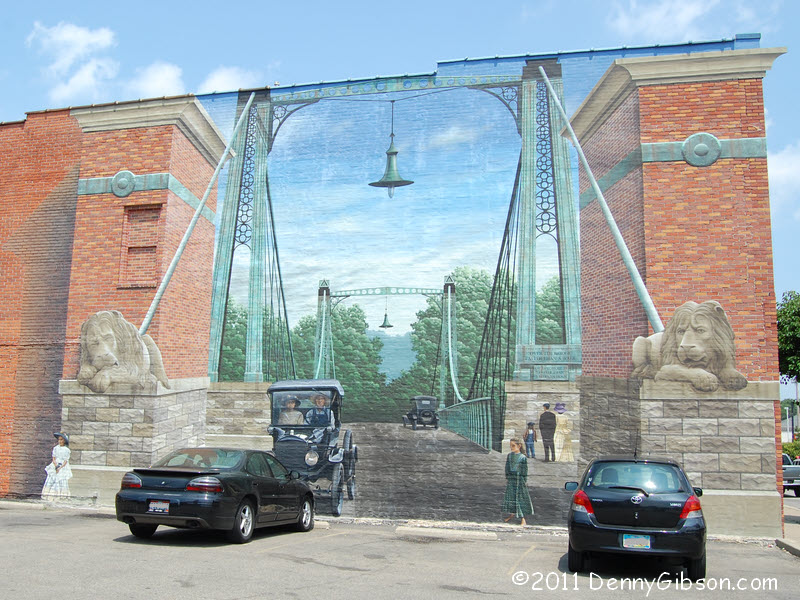
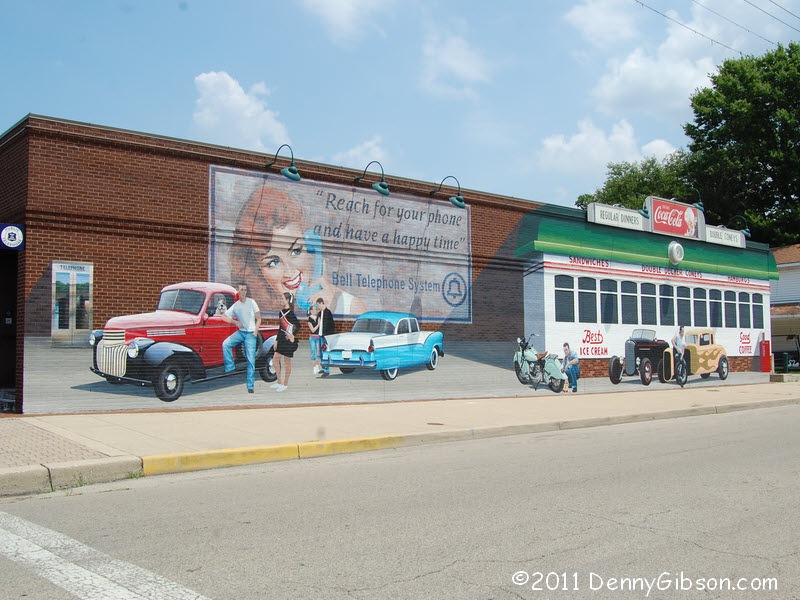

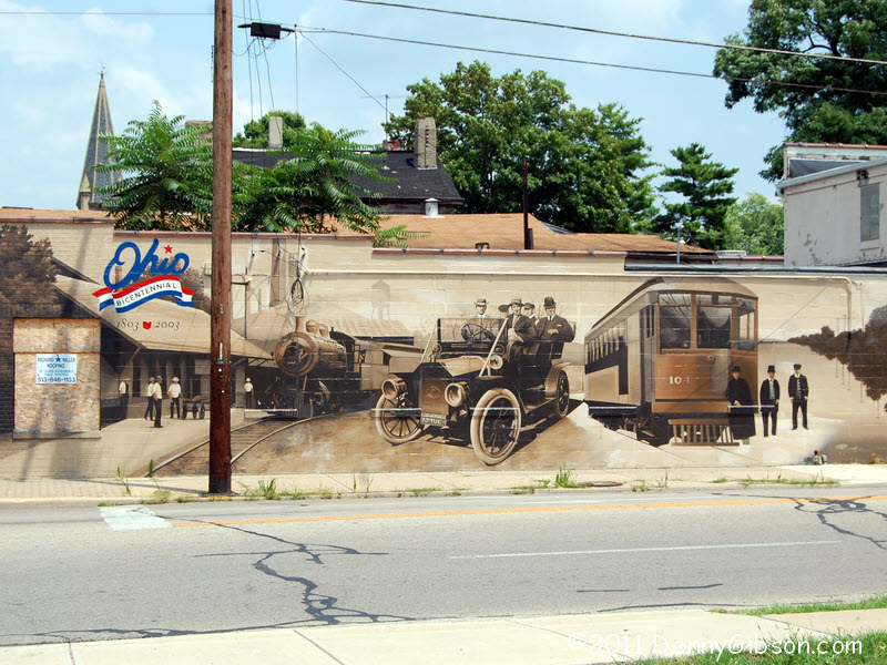 This panel is going to require some reverse thinking. Franklin, Ohio, is
one of those places where the main flow of traffic is split along two
one-way streets. Northbound traffic gets the original Dixie Highway
alignment while us southbound folks get something else. More importantly,
northbound travelers get to see the wonderful murals that Franklin put up
for Ohio's bicentennial in 2003. So I drove south through town without
taking a picture then turned north on the real Dixie Highway to produce
this panel. Photos never do this kind of murals justice. In the diner
scene, the normal 3-D tricks are augmented with some
real world attachments including a working clock.
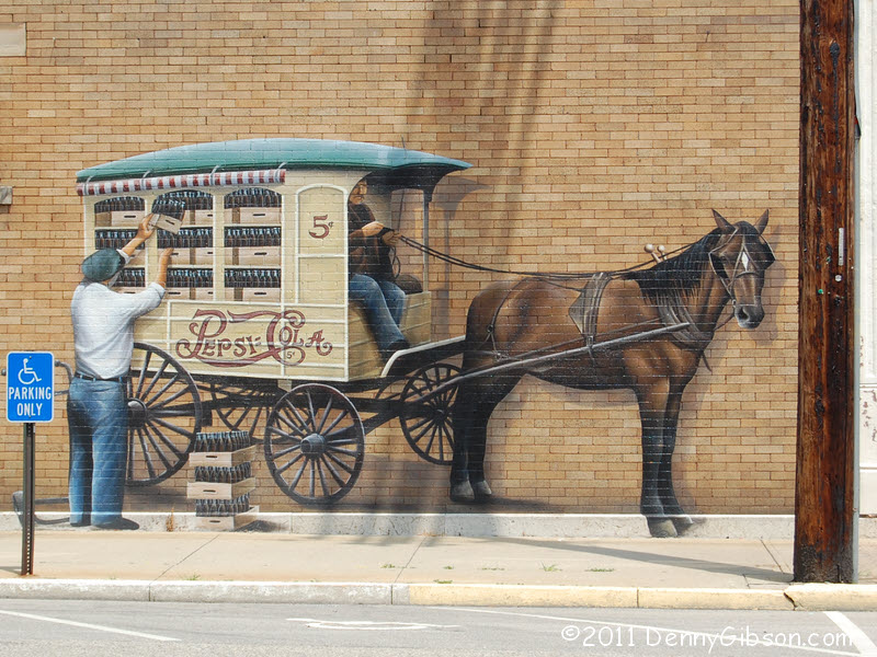
The bridge depicted in the last mural once spanned the nearby Great Miami
River. The bridge is long gone but the lions survive and today guard the
bridge at 2nd Street.
This panel is going to require some reverse thinking. Franklin, Ohio, is
one of those places where the main flow of traffic is split along two
one-way streets. Northbound traffic gets the original Dixie Highway
alignment while us southbound folks get something else. More importantly,
northbound travelers get to see the wonderful murals that Franklin put up
for Ohio's bicentennial in 2003. So I drove south through town without
taking a picture then turned north on the real Dixie Highway to produce
this panel. Photos never do this kind of murals justice. In the diner
scene, the normal 3-D tricks are augmented with some
real world attachments including a working clock.
The bridge depicted in the last mural once spanned the nearby Great Miami
River. The bridge is long gone but the lions survive and today guard the
bridge at 2nd Street.
|
|
|
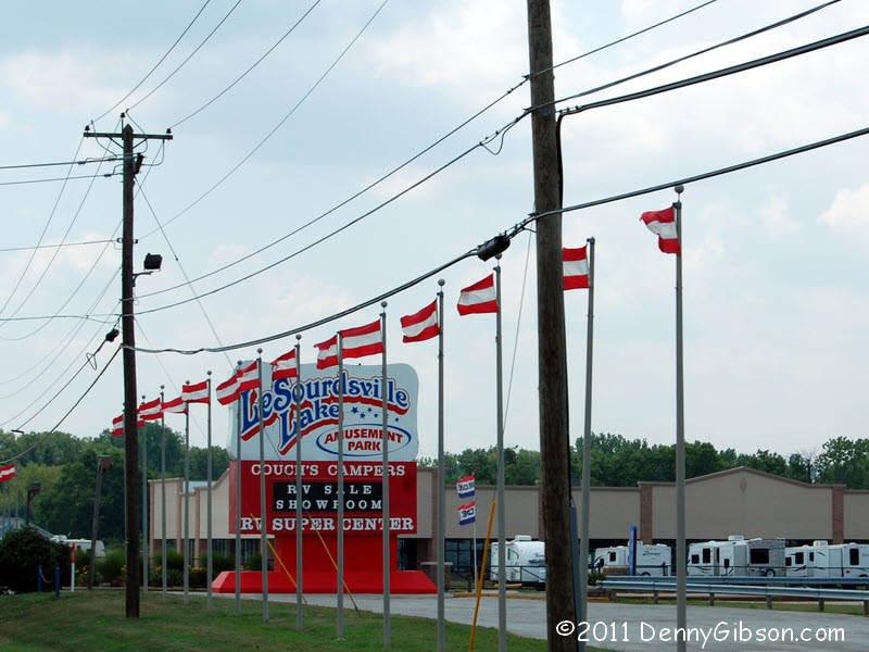

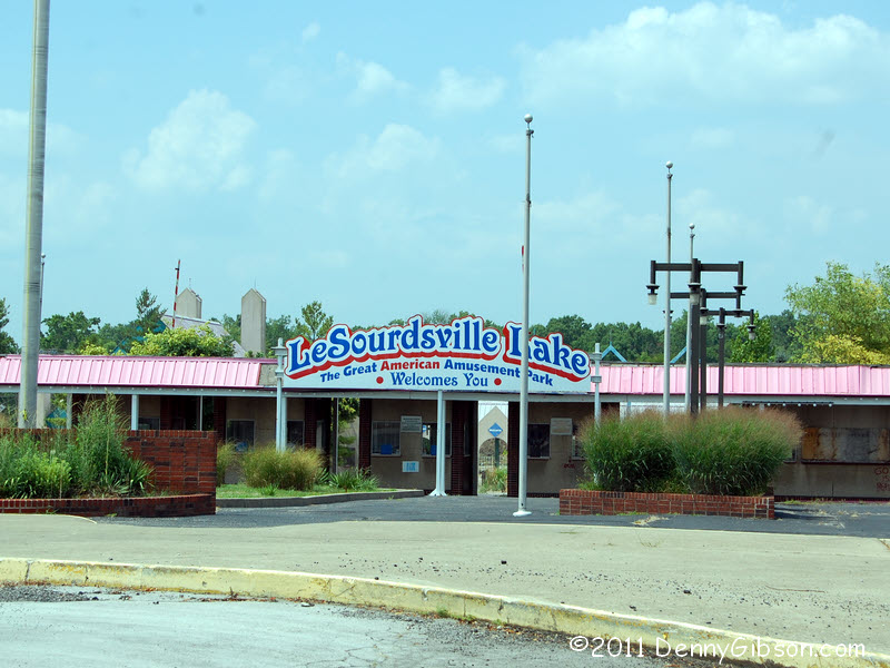 This was pretty much the only amusement park I knew of as a child. It was
a major 50-plus mile trip and we didn't get there often which, on top of
it simply being an AMUSEMENT PARK, made it pretty special. It
started in 1922 (No, I don't remember the grand opening!), struggled
through the last part of the twentieth century, then closed down for good
in 2002. Until today I'd never connected
LeSourdsville
Lake and the Dixie Highway in any manner at all. Now I'm guessing that
the occasional Michiganer in a Model T must have paused here for a swim on
the way to Miami Beach.
This was pretty much the only amusement park I knew of as a child. It was
a major 50-plus mile trip and we didn't get there often which, on top of
it simply being an AMUSEMENT PARK, made it pretty special. It
started in 1922 (No, I don't remember the grand opening!), struggled
through the last part of the twentieth century, then closed down for good
in 2002. Until today I'd never connected
LeSourdsville
Lake and the Dixie Highway in any manner at all. Now I'm guessing that
the occasional Michiganer in a Model T must have paused here for a swim on
the way to Miami Beach.
|
|
|

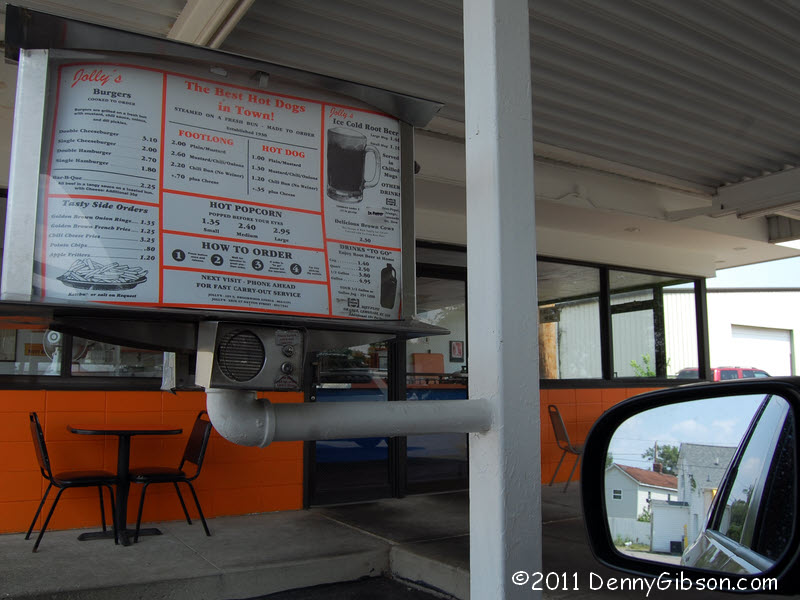
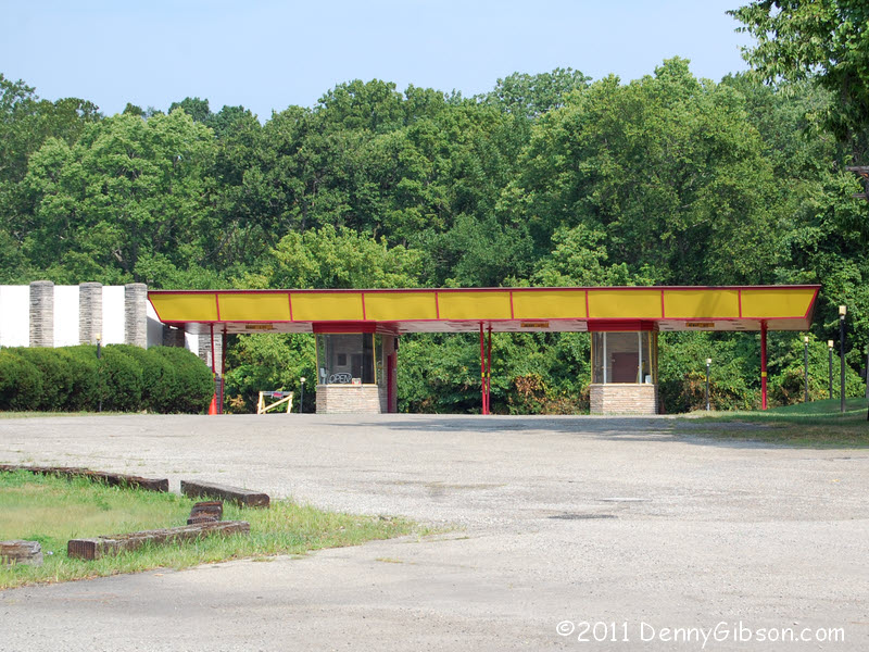
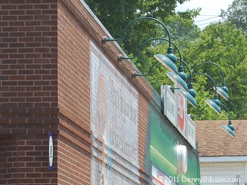
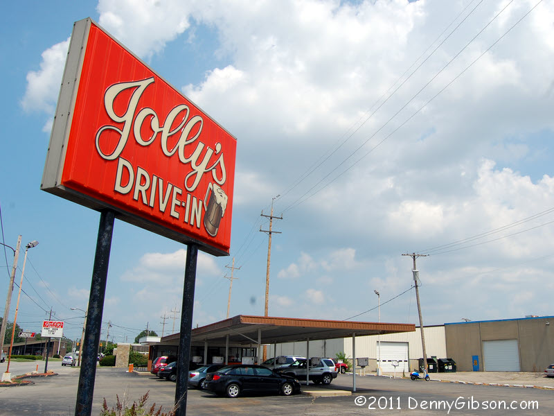 Jolly's Drive-In is on the Dixie in Hamilton. They no longer make their
own root beer but it's still quite good and it's still served in frosted
mugs with car-side service "at the speed of sound". A fellow
inside told me that the Jolly's on Brookwood Avenue still makes root beer.
That's something I need to check out.
Jolly's Drive-In is on the Dixie in Hamilton. They no longer make their
own root beer but it's still quite good and it's still served in frosted
mugs with car-side service "at the speed of sound". A fellow
inside told me that the Jolly's on Brookwood Avenue still makes root beer.
That's something I need to check out.
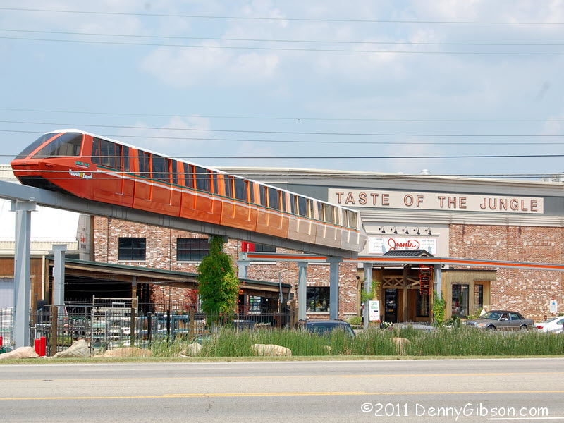
Jungle Jim's International Market is just a few miles down the road in Fairfield. There is nothing else like it on any highway and it's right there on the Dixie. ADDENDUM: May 17, 2012 - With a little more checking, I've learned that the road that passes Jolly's Drive-In was never the Dixie Highway. About a half mile north of the drive-in, the DH veered west and ran along what is now Heaton Street. Making that correction is the real reason for the addendum but I'll take further advantage of it and share that I've made it to the Jolly's on Brookwood and they do indeed continue to make their own root beer. |
|
|
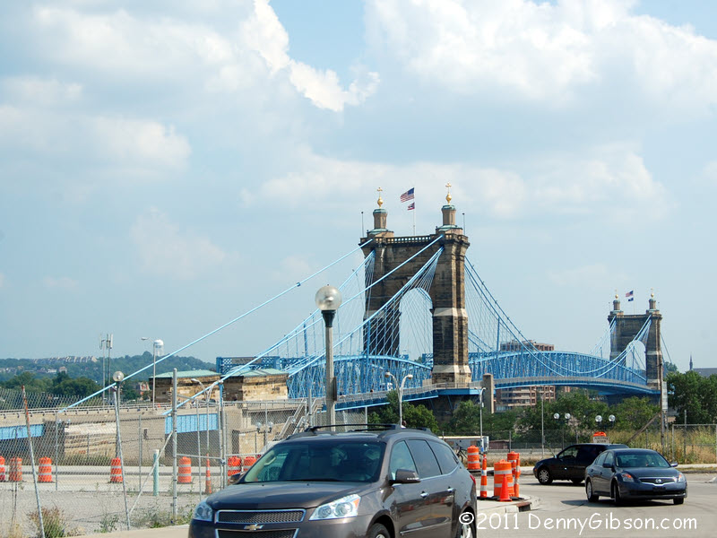
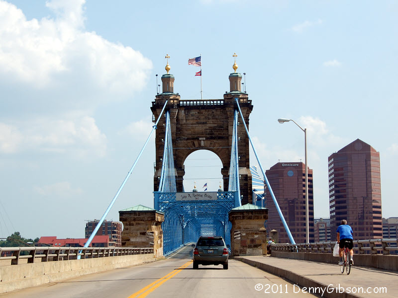 Last year they repainted the Roebling Suspension Bridge and this year
they're working over the approaches. I've started at least one
southbound Dixie Highway drive here so I'm
just crossing the river then turning back. The trip's not quite over,
however.
Last year they repainted the Roebling Suspension Bridge and this year
they're working over the approaches. I've started at least one
southbound Dixie Highway drive here so I'm
just crossing the river then turning back. The trip's not quite over,
however.
|
|
|
 I know there was a later Dixie Highway alignment that headed more
directly south as it left Franklin. I wanted to include it in today's
trip by driving it northbound but I haven't yet learned where it
rejoined the older alignment. I'm fairly certain that it connected with
Reading Road near the Hamilton-Butler county line and a reasonable guess
is that it followed Reading to downtown Cincinnati. But it's only a guess
and I opted to jump to the Dixie's "last known location" at the
county line. These pictures are from Cincinnati-Dayton Road as it runs
from the Hamilton-Butler county line north to Franklin, Ohio.
I know there was a later Dixie Highway alignment that headed more
directly south as it left Franklin. I wanted to include it in today's
trip by driving it northbound but I haven't yet learned where it
rejoined the older alignment. I'm fairly certain that it connected with
Reading Road near the Hamilton-Butler county line and a reasonable guess
is that it followed Reading to downtown Cincinnati. But it's only a guess
and I opted to jump to the Dixie's "last known location" at the
county line. These pictures are from Cincinnati-Dayton Road as it runs
from the Hamilton-Butler county line north to Franklin, Ohio.
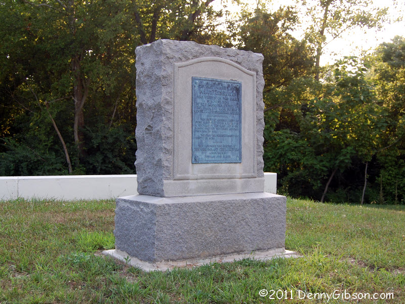
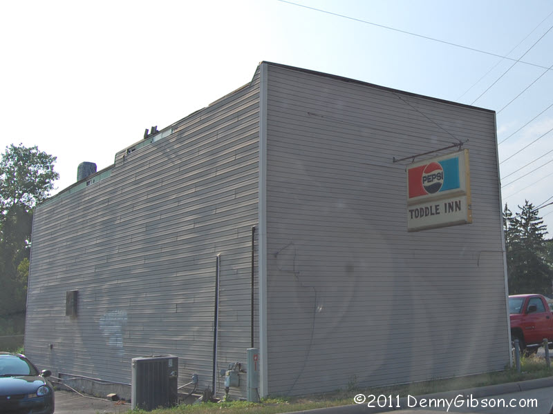
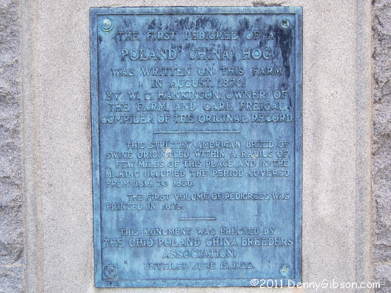
There once was a town named Guilford that stagecoach drivers called blue ball because of a marker that hung there, possibly for their benefit. In 1862, Guiford changed its name to Blue Ball and, in 1993, Blue Ball was annexed by Middletown. This unadorned sphere and a sign at the used car lot just beyond it are about the only indications left that Blue Ball, Ohio, ever existed. Back when Blue Ball was a real place, a waitress at a restaurant I frequented, lived there. She moved there from Horneytown, North Carolina. I haven't seen her in years. Wonder where she lives now. The Toddle Inn is just north of the pictured blue ball at the intersection where the original is said to have hung. I've seen the word "historic" associated with the name and thought it might be really interesting. I stopped for a beer but didn't learn much. Yeah, it's old. From the '30s, maybe. I was there about 6:00 and several patrons were well into that shout-every-word-'cause-beer-makes-me-deaf mode. They start fairly early, I'm guessing. Then just north of the Toddle House is this revealing marker. It turns out that the first Poland China Pig was not, as I assumed, the result of some eastern European porker forcing himself on some petite Asian porkee. Nope, it was the result of some very careful breeding right here in the Blue Ball community. The breeding occurred in the late 1800s but the monument was erected by the side of the thriving Dixie Highway in 1922. A genuine tourist attraction at the time I'm certain. |
|
|
| [Site Home] [Contact] |