|
September 6, 2004: Pair of Madonnas
|
|
September 6, 2004: Pair of Madonnas
|
|
|
 Some seventy-plus years ago, the Daughters of the American Revolution
placed a monument in each of the twelve states through which the National
Old Trails Road passed. Two of these monuments, which became known as the
Madonnas
of the Trail, are about fifty miles from my home and about fifty miles
from each other. The first statue to be dedicated is in Springfield, Ohio,
and another, the ninth, is in Richmond, Indiana. I've had the idea of a
day trip incorporating both of these nearby monuments for awhile and it
seemed just the ticket for today. Blue skies, 80 degrees, and the
unofficial end of summer (Labor Day). A short and simple road trip seemed
almost a necessity. A quick glance at the map told me that US-42 would be
a sensible way of getting to US-40 on the east side of Springfield.
Another glance at the Ohio Byways web site revealed two byways along the
route. Ready.
Some seventy-plus years ago, the Daughters of the American Revolution
placed a monument in each of the twelve states through which the National
Old Trails Road passed. Two of these monuments, which became known as the
Madonnas
of the Trail, are about fifty miles from my home and about fifty miles
from each other. The first statue to be dedicated is in Springfield, Ohio,
and another, the ninth, is in Richmond, Indiana. I've had the idea of a
day trip incorporating both of these nearby monuments for awhile and it
seemed just the ticket for today. Blue skies, 80 degrees, and the
unofficial end of summer (Labor Day). A short and simple road trip seemed
almost a necessity. A quick glance at the map told me that US-42 would be
a sensible way of getting to US-40 on the east side of Springfield.
Another glance at the Ohio Byways web site revealed two byways along the
route. Ready.
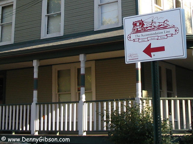
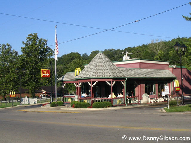
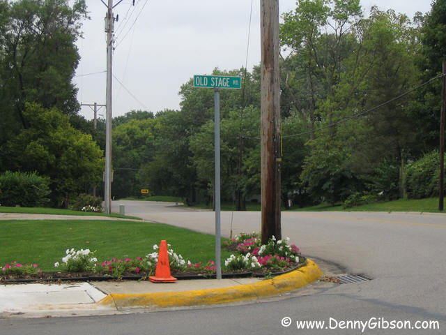
I picked up US-42 in Lebanon and was soon in Waynesville. Waynesville was founded in 1797 and calls itself "The Antiques Capital of the Midwest". The wood covered McDonalds is in keeping with that image. It sets at the intersection of OH-73 and Waynesville's Main Street which is just where the Accommodation Line Byway begins. The Accommodation Stage Line operated in these parts during the 1820s and '30s and the byway supposedly follows part of its route. I say "supposedly" because I'm not exactly sure just where that byway goes. The web site says it "follows Main Street through the Village of Waynesville, returning to US 42" That sounds pretty simple and that's part of what I did. But, at the corner of Main & Chapman, I saw this sign pointing up the hill to the northwest. I followed it. I'll spare you the details of my meandering but I will say that at no point after that turn did I feel confident about where I was. In the end, I returned to Main and followed it to US-42. I've subsequently learned that Delorme's Street Atlas labels Fourth Street as Old Stage Road. So does Mapquest. Maybe there should have been a sign at Chapman & Fourth. Maybe there was and I missed it. I guess I just had too many instructions and no horses to follow. ADDENDUM: By fortuitous coincidence, my job had me driving up US-42 just a few days after this trip. I used the opportunity to check out that Fourth Street/Old Stage Road theory. I wasn't too surprised to find a Old Stage Road sign just one block from Chapman and diagonally across from a Fourth Street sign at the same intersection. That prompted me to check the Fourth & Chapman intersection and see an empty pole in a similar location at that intersection. It seems reasonable to think that an Old Stage Road sign belonged there. I followed Old Stage Road to US-42 through some fairly scenic sections. When I later returned home on south bound US-42, I saw a sign, like the one at Waynesville's Main & Chapman, pointing up Mount Holly Road from US-42. These signs are labeled Warren County and the one at Mount Holy Road may be there, rather than at US-42 and Old Stage Road, because Mount Holly Road is just within the Warren County border. |
|
|

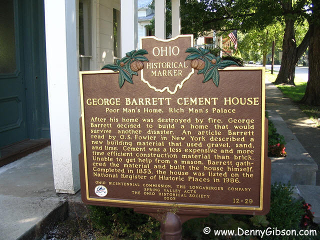 I eventually headed on up US-42 to the town of Spring Valley. The town is
just a bit off of Forty-Two and probably was not on the original stage
route - didn't exist until 1844. It might or might not be on the
"Accommodation Line Byway". I made a point of getting into
Spring Valley to see the oldest cement house in Ohio. George Barrett built
the house himself. In 1853!
I eventually headed on up US-42 to the town of Spring Valley. The town is
just a bit off of Forty-Two and probably was not on the original stage
route - didn't exist until 1844. It might or might not be on the
"Accommodation Line Byway". I made a point of getting into
Spring Valley to see the oldest cement house in Ohio. George Barrett built
the house himself. In 1853!
|
|
|
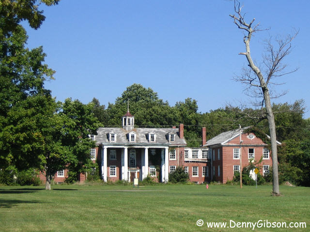
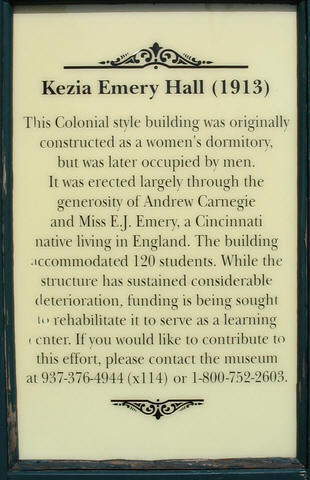
 Through Xenia and onto Wilberforce. The
National African American Museum Cultural Center is on
the campus of Wilberforce University and I thought that today would be a
good day to see it. However, it isn't open on holidays so I'll see it
another day. In the midst of more modern buildings, the neglected
Kezia Emory Hall definitely attracts the eye.
Through Xenia and onto Wilberforce. The
National African American Museum Cultural Center is on
the campus of Wilberforce University and I thought that today would be a
good day to see it. However, it isn't open on holidays so I'll see it
another day. In the midst of more modern buildings, the neglected
Kezia Emory Hall definitely attracts the eye.
|
|
|
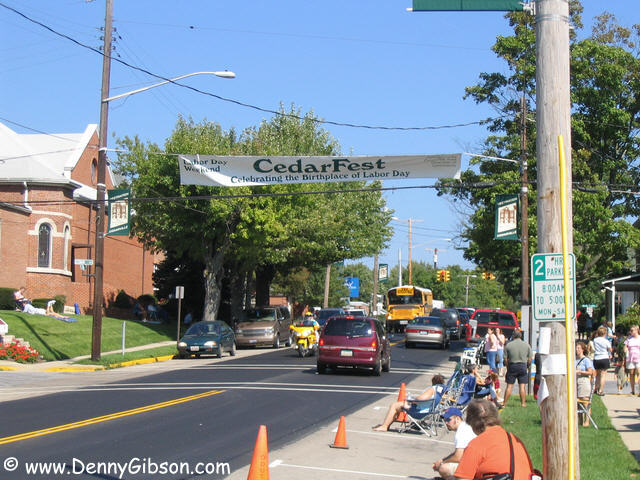
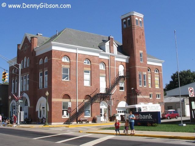
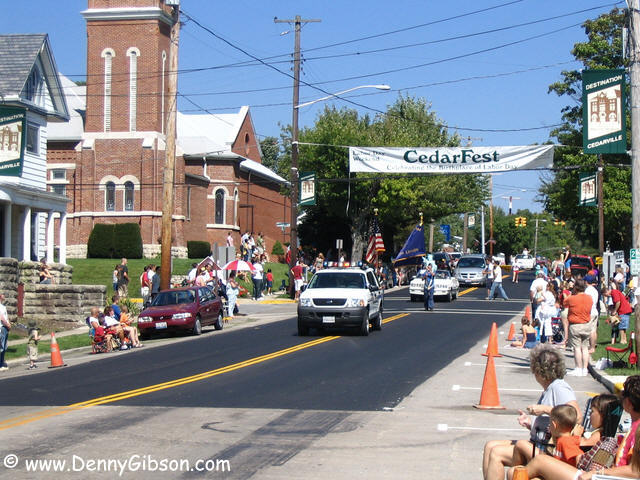
 Next came the major serendipity of the day. It was easy to see that the
folks in Cedarville were getting ready for a parade and, when I noticed
the phrase "Birthplace of Labor Day", I just had to stop. The
parade, I learned, was about 45 minutes away. I walked along the street
and bought bottled water from a friendly vendor in front of the
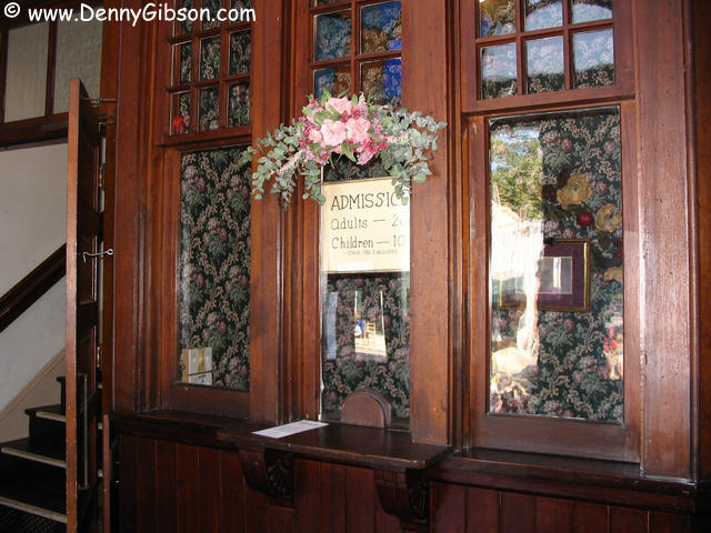
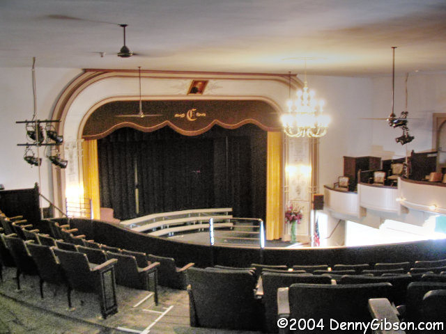
Opera House. What a treasure. As the circle high on the front states,
this was built as the town hall in 1888. It filled that role but was also
the place for college and high school graduations, rallies, orators, and a
variety of entertainments. Retired in 1956, the wonderful building was
saved from possible demolition in the early 1980s and is now back to
providing a stage for Cedarville. Thanks to Dean & Paul for an inside
view and some great history.
Next came the major serendipity of the day. It was easy to see that the
folks in Cedarville were getting ready for a parade and, when I noticed
the phrase "Birthplace of Labor Day", I just had to stop. The
parade, I learned, was about 45 minutes away. I walked along the street
and bought bottled water from a friendly vendor in front of the
Opera House. What a treasure. As the circle high on the front states,
this was built as the town hall in 1888. It filled that role but was also
the place for college and high school graduations, rallies, orators, and a
variety of entertainments. Retired in 1956, the wonderful building was
saved from possible demolition in the early 1980s and is now back to
providing a stage for Cedarville. Thanks to Dean & Paul for an inside
view and some great history.
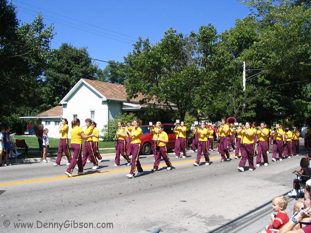
The parade started rolling only a couple of minutes after I stepped outside. Thirty minutes long with tractors, convertibles, fire trucks and all the rest mixed with marching bands. Four or five, I think, but no Colonel Bogey March. Instead, Louie Louie & Alice Cooper's School's Out. That "Birthplace of Labor Day" banner? As the city limit sign proclaims, Cedarville is the 'Birthplace of U.S. Senator James H. Kyle, "Father" of Labor Day'. Matthew Maguire is widely accepted as deserving that title based on accomplishments like organizing the first labor day parade in 1882, in New York City. Kyle's claim is legitimate, though. He introduced the bill that gave the holiday national recognition in 1894. |
|
|
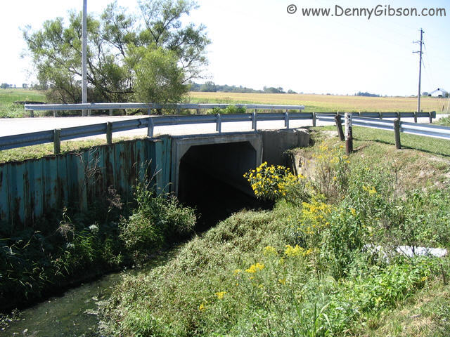

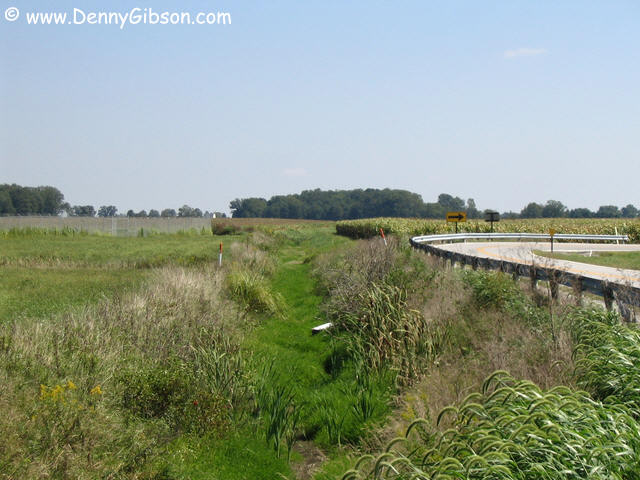 I have long accepted that the beginning of the Little Miami River was near
Clifton Gorge near John Bryant State Park. Much of my early experience
with the Little Miami involved canoes and that's probably the earliest
reasonable launch point. But maps actually show the river's source more
than ten miles east of there. A mile or so along the gully in the first
picture. Within half a mile, the dry gully has a respectable amount of
water as it flows under the bridge where I stood to take the picture. That
bridge is the Little Miami's first bridge but it carries a driveway
leading to a huge feed lot. The water is barely past that driveway when it
turns and passes under the bridge in the third picture. That bridge is on
Huntington Road just east of South Charleston.
I have long accepted that the beginning of the Little Miami River was near
Clifton Gorge near John Bryant State Park. Much of my early experience
with the Little Miami involved canoes and that's probably the earliest
reasonable launch point. But maps actually show the river's source more
than ten miles east of there. A mile or so along the gully in the first
picture. Within half a mile, the dry gully has a respectable amount of
water as it flows under the bridge where I stood to take the picture. That
bridge is the Little Miami's first bridge but it carries a driveway
leading to a huge feed lot. The water is barely past that driveway when it
turns and passes under the bridge in the third picture. That bridge is on
Huntington Road just east of South Charleston.
|
|
|
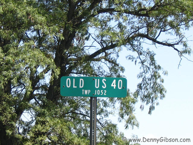
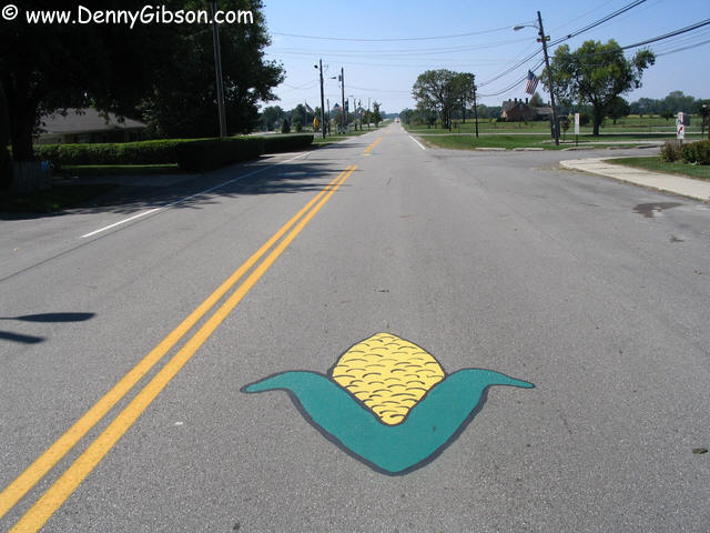
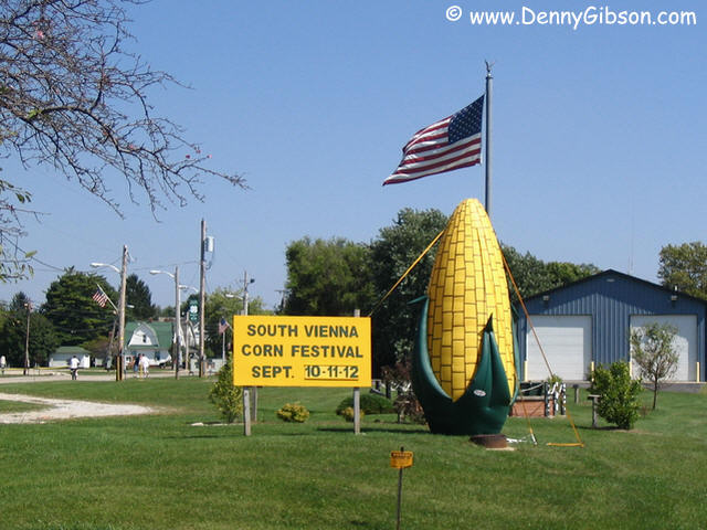 From the Little Miami's first bridge, it was only a few miles before I
turned west on US-40. On the way to Springfield, there are a couple of
chances to drive through small towns on short sections of Old US-40. One
of those sections passes through South Vienna where the road surface is
put to use promoting next week's Corn Festival. When I pulled over to get
a picture of the sign and giant ear of corn, I had two state troopers
behind me almost immediately. Turns out the station is just a few miles up
the road and they were probably heading in at the end of a shift. They
assumed I must have car problems and were clearly amused by the thought
that someone would stop to photograph some fake corn. Even better than the
troopers was the boy on a bicycle who pedaled up to the patrol cars to ask
"What'd he do?"
From the Little Miami's first bridge, it was only a few miles before I
turned west on US-40. On the way to Springfield, there are a couple of
chances to drive through small towns on short sections of Old US-40. One
of those sections passes through South Vienna where the road surface is
put to use promoting next week's Corn Festival. When I pulled over to get
a picture of the sign and giant ear of corn, I had two state troopers
behind me almost immediately. Turns out the station is just a few miles up
the road and they were probably heading in at the end of a shift. They
assumed I must have car problems and were clearly amused by the thought
that someone would stop to photograph some fake corn. Even better than the
troopers was the boy on a bicycle who pedaled up to the patrol cars to ask
"What'd he do?"
Jimmy Buffet: "Nothing this exciting since the fertilizer truck blew a front tire and landed in the creek." |
|
|

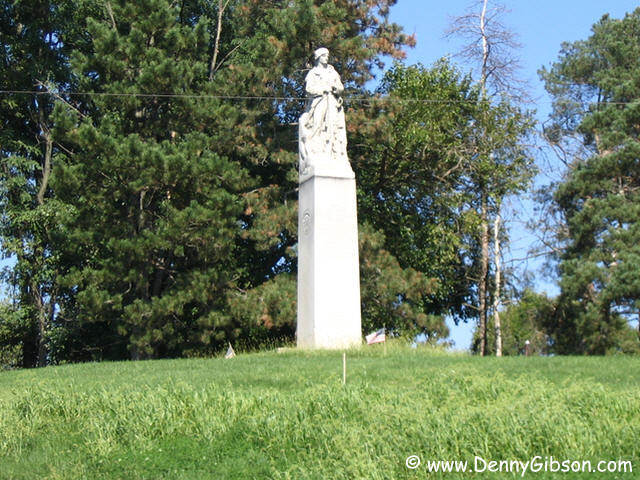
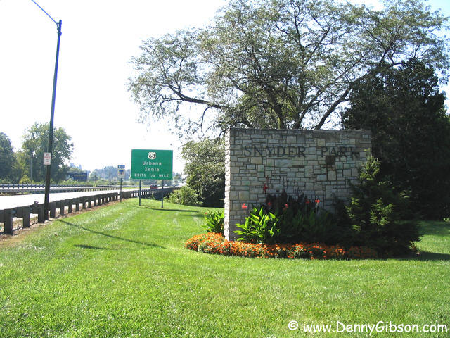 Snyder Park is just about as close as you can get to the Madonna of the
Trail Monument on the west edge of Springfield. The monument is just at
the other edge of the bridge. There is not enough room to pull completely
off of the road in front of the monument although tracks indicate that
some have stopped there. The second picture is from the west side of the
monument and shows an opening in the wall on the east side. That may be
where folks enter to tend to the landscaping but there is no convenient
way for "civilians" to get there. This Madonna sits right on the
edge of a golf course and the third picture taken from one of the course's
tees.
Snyder Park is just about as close as you can get to the Madonna of the
Trail Monument on the west edge of Springfield. The monument is just at
the other edge of the bridge. There is not enough room to pull completely
off of the road in front of the monument although tracks indicate that
some have stopped there. The second picture is from the west side of the
monument and shows an opening in the wall on the east side. That may be
where folks enter to tend to the landscaping but there is no convenient
way for "civilians" to get there. This Madonna sits right on the
edge of a golf course and the third picture taken from one of the course's
tees.
|
|
|


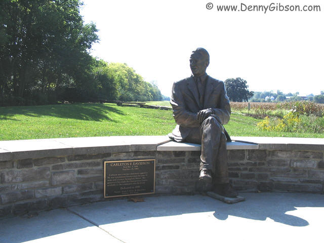 The
Lower Valley Pike Scenic Byway begins where Tecumseh
Road crosses US-40. Fort Tecumseh Olde Fashion Store sits at the corner
but was not open today. Just before the byway heads west on Lower Valley
Pike, a statue of George Rogers Clark sits high on a hill with no access
immediately apparent. Even the statue itself is hardly apparent to
southbound travelers. I stopped at the Davidson Interpretive Center but
it, too, was closed. There are points of interest, such as the site of the
1780 Battle of Pekuwe, along the byway and maybe the interpretive center
would have helped me appreciate them. Without it, the byway was a little
disappointing. Especially when it ended as an entrance ramp to I-70.
The
Lower Valley Pike Scenic Byway begins where Tecumseh
Road crosses US-40. Fort Tecumseh Olde Fashion Store sits at the corner
but was not open today. Just before the byway heads west on Lower Valley
Pike, a statue of George Rogers Clark sits high on a hill with no access
immediately apparent. Even the statue itself is hardly apparent to
southbound travelers. I stopped at the Davidson Interpretive Center but
it, too, was closed. There are points of interest, such as the site of the
1780 Battle of Pekuwe, along the byway and maybe the interpretive center
would have helped me appreciate them. Without it, the byway was a little
disappointing. Especially when it ended as an entrance ramp to I-70.
|
|
|
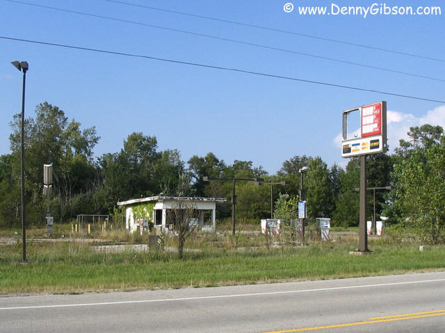
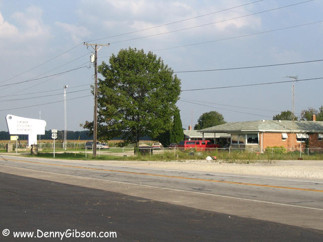

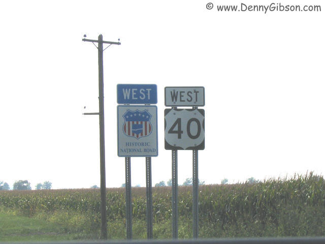 The Historic National Road is not the same as US-40 although they often
share pavement. This spot, somewhere in the vicinity of Lewisburg, is
actually one of the few places where the signs appear together. At US-127,
I stopped for gas and snapped a picture of the defunct truck stop on the
opposite corner. In the late '60s and early '70s I often traveled US-127
between Cincinnati and Greenville. The truck stop was quite active and was
an occasional stopping point. While refueling, I also grabbed a shot of
the motel adjacent to the old truck stop. That sign, unreadable in the
photograph, says "SANDMAN EFFICIENCY APARTMENTS". Many of the
old motels on this section of US-40 have become private homes, storage
buildings, or just disappeared so the Sandman is closer to its original
use than most. A few miles beyond, a long dead Citgo station offers a
camera target. With nearly a dozen pumps still standing, this was
obviously once a pretty major operation.
The Historic National Road is not the same as US-40 although they often
share pavement. This spot, somewhere in the vicinity of Lewisburg, is
actually one of the few places where the signs appear together. At US-127,
I stopped for gas and snapped a picture of the defunct truck stop on the
opposite corner. In the late '60s and early '70s I often traveled US-127
between Cincinnati and Greenville. The truck stop was quite active and was
an occasional stopping point. While refueling, I also grabbed a shot of
the motel adjacent to the old truck stop. That sign, unreadable in the
photograph, says "SANDMAN EFFICIENCY APARTMENTS". Many of the
old motels on this section of US-40 have become private homes, storage
buildings, or just disappeared so the Sandman is closer to its original
use than most. A few miles beyond, a long dead Citgo station offers a
camera target. With nearly a dozen pumps still standing, this was
obviously once a pretty major operation.
|
|
|
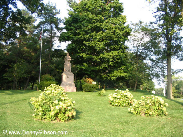
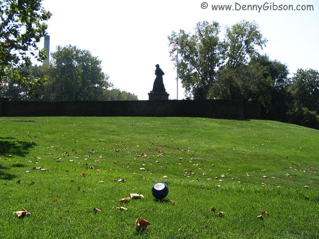
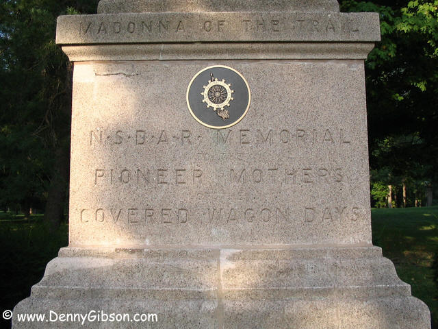 The Madonna of the Trails Monument in Richmond is a lot easier to get to
than the one in Springfield. In Glen Miller park on the east side of town,
it is both visible and accessible. It doesn't sit right on a golf course
but the Glen Miller Golf course is right next to the park. Maybe there is
some secret connection between D.A.R. monuments and golf. I'll be
vigilant.
The Madonna of the Trails Monument in Richmond is a lot easier to get to
than the one in Springfield. In Glen Miller park on the east side of town,
it is both visible and accessible. It doesn't sit right on a golf course
but the Glen Miller Golf course is right next to the park. Maybe there is
some secret connection between D.A.R. monuments and golf. I'll be
vigilant.
|
|
|
 Once I had crossed the Whitewater River, I turned back and headed home.
US-40 is split through Richmond and the mural is on the east bound route.
I get through here once in awhile and have previously noticed the
painting. This time I looked into it a little deeper and found out that
the artists shown are Bix Beiderbecke, Tommy Dorsey, Don Murray, Howdy
Quicksell, Tommy Gargano and Paul Mertz. Learn more about Richmond's
Gennett studios and Starr pianos
here.
Once I had crossed the Whitewater River, I turned back and headed home.
US-40 is split through Richmond and the mural is on the east bound route.
I get through here once in awhile and have previously noticed the
painting. This time I looked into it a little deeper and found out that
the artists shown are Bix Beiderbecke, Tommy Dorsey, Don Murray, Howdy
Quicksell, Tommy Gargano and Paul Mertz. Learn more about Richmond's
Gennett studios and Starr pianos
here.
|
|
|